Tuesday 31 May 2011

Freshwater and Yarmouth Railway Path

Yarmouth Station
The Isle of Wight is a haven for railway path walking and cycling, partly as a sad result of the wholesale closures of the 1950s and 1960s, but also the thinking of local authorities who managed to preserve at least some of each of the closed lines for recreational use. Since most of the sections of line are relatively short, I had considered a day of exploration covering several lines for a long time.
Yarmouth Wharf
The first of the lines that I visited on the day was the former Freshwater and Yarmouth line. This independently built railway was eventually closed in 1953, having been run on a shoestring since it was first constructed through the sparsely populated western part of the Island. Given the time that has passed since its closure, it is something of a miracle that any of it has survived but the 3 mile section of trackbed between Yarmouth and Freshwater stations has been a popular cycle path for a good many years. Fortunately this is perhaps also the most scenic part of the railway following the banks of the tidal estuary of the River Yar for much of its length.
Railway Carriage Home
The original railway was a 12 mile branch line from Newport, the main town on the island, and was opened for traffic in 1889. Histories of the line and pictures are available at http://www.shalfleet.net/steve/fyn.htm and http://www.disused-stations.org.uk/graphics/wight/iow_station_index.htm .
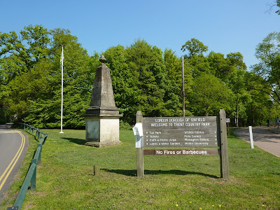
Yarmouth Countryside
The line always had a chequered history, mostly associated with sparse traffic and sailed close to bankruptcy until British Rail finally gave up on it in 1953. After closure and perhaps because of its rural nature, most of the line became absorbed into the countryside as part of farmers fields, while several of the station buildings were recycled into new uses. Between Newport and Yarmouth, very little of the line can be traced although determined relic hunters can still find the odd bridge intact. There are a couple of short walkable sections of the old trackbed at Wellow and Watchingwell but these are disconnected and could not be construed as forming any reasonable railway path.
Yarmouth Harbour
The part of the railway path that is available for use begins on the B3401 just outside Bouldnor. There is a parking area alongside the road, although spaces are limited and I suspect very popular during the summer. I parked around the corner in the public car park, which is free. The rail line begins abruptly just north of Thorley Bridge. Any trace of the line eastwards has been completely absorbed within the garden of a large property on the opposite side of the road. I assume that there would once have been a road bridge here due to the height differential between road and rail, but any trace of this has also disappeared entirely.
Heading South
Heading westwards though the story is different, with their being a well maintained path through the reeds of Rofford Marsh. The railway origins of the path are not at all obvious to begin with, but that all changes after half a mile or so when the former Yarmouth station is reached. Against the odds the old station has survived and is currently used as a youth centre. It is well maintained and is in remarkably original condition. It would be easy to imagine waiting on the platform for a train to arrive, although none have actually stopped for passengers for nearly sixty years (almost as long as the station was open for traffic!).
Freshwater Church
The line now changes direction as it reaches the formidable obstacle of the River Yar, heading alongside this very attractive tidal estuary. As the line swings away from the small town of Yarmouth, the station’s inconvenience at the edge of town can be appreciated although it was probably still the station generating the most traffic. It is hard to believe, but the railway company had originally had ambitious plans to connect the line via a 2.5 mile tunnel to the mainland at Lymington from here.These plans obviously came to nought and passengers had to rely instead on the ferry service across to the Hampshire port instead (as they still do!). Looking across to the estuary just past the station a large tidal mill building is still intact although inevitably now private housing rather than any industrial use. Just across from the mill is an old railway carriage now serving as a home. Its vintage isn’t known but is almost certainly from one of the three original railway companies that ran the network on the island. I suspect that the carriage dates from Victorian times, judging by its appearance.
Tidal Limit
Initially on the route south the old line runs through open estuary fringe with extensive views across the water, albeit through the reedbeds. It is a section of line remarkably similar to the Hayling Billy, although the surface is much smoother and more cycle friendly. After a short stretch the line then enters some very pretty woodland and it was easy to see why the closure of the line was fiercely opposed.Sadly, in these early days of railway closures very few protests were listened to. If the line were running now it would undoubtedly be a very popular tourist attraction, for it is very scenic.In the early spring sunshine the woodland was beginning to wake from its winter slumber and many of the leaves and blossom were out in full force. In a couple of places it was possible to head down to the water’s edge and look out across the estuary and to the attractive church of Freshwater beyond.
Crossing Keeper's Cottage
Once I had passed by the woodland, I passed another surviving railway building, the crossing keepers cottage at Freshwater. Once there would have been a level crossing across the road known as the Causeway controlled by the crossing keeper. Now the cottage is just another attractive house with its origins almost forgotten. At the adjacent bridge across the River Yar, its flow lessens considerably and is almost lost entirely within the reeds.
Tree Lined Track
The path continues on for approximately half a mile until coming to an abrupt left hand turn. This is the point at which the railway line path stops; the line would once have continued onward into Freshwater station just beyond the fence. The site is now occupied by a garden centre and Co-op store. The only clue of its existence is the aptly named ‘End of the Line’ café, which even has some station awning as decoration to the outside of the building. As a station, the location of Freshwater was very inconvenient for any of the local attractions being too far from the beach at Freshwater Bay or The Needles, almost two miles distant. Considering these were the markets that the railway company had hoped to tap into it was probably no wonder that the line was doomed to failure.
Site of Freshwater Station
For me this was the point at which I retraced my ride back to Bouldnor, but walkers could make a circular route by heading by road to Freshwater Church and then continue along the other side of the estuary via the waymarked Freshwater Bay and thence by coast path through Yarmouth back to the start point. As an introduction to railway cycling on the Isle of Wight this section of line whetted my appetite for the longest of the routes, the Perowne Trail which follows the former Newport to Sandown route. It was here that I headed next!

Monday 23 May 2011

London LOOP Section 12 Cockfosters - Chingford


Spring Blossom
Considering that I am now trying to complete the sections of the London LOOP furthest from home I reckoned that the next official section from Cockfosters to Enfield Lock was rather too short at only 8.5 miles and looked therefore for another finishing point. I reckoned that extending to Chingford would be a better bet, making for a 13 mile walk instead. The spring weather was continuing to hold steady and it seemed necessary to take advantage while I could!
Entrance to Trent Park
The outward journey was far from easy, taking a considerable time to get from Worthing to Chingford due to the early morning traffic in East London. I found a convenient place to park just across the way from the train station at a point that I expected to finish the walk later on the common. When I made enquiries at the station on the best fare available to get to Cockfosters I was encouraged to buy an Oyster Card, a useful little facility I had never thought about before. This I did for the rather convoluted trip changing twice at Walthamstow Central and then again at Finsbury Park. It took about an hour to get to Cockfosters.
Trent Park Pond
I had been looking forward to this section of the walk, courtesy of a work colleague who had waxed lyrical about Trent Park, the first notable place I would visit today. When I emerged at Cockfosters I immediately noticed how different the stages of spring were here in North London compared to my time in Cornwall. All the horse chestnut trees seemed to be out in full bloom, seemingly about three weeks ahead of schedule. They provided a beautiful avenue of trees alongside a largish cemetery, a rather auspicious start to the walk I thought…
Obelisk
The path then wound around some woodland before getting to Trent Park properly. The park was busy with Easter holiday families enjoying the warm spring sunshine but the café was too good to miss. I picked up some sandwiches and headed on through the park, making my way through woodlands dotted with bluebells (no carpets here such as the woods near where I live). Eventually I came upon the lakes at the centre of the park and decided that this was as good a place as any to have my lunch. While I ate my sandwiches I was amused by the industry of a local coot, swimming backwards and forwards across the lake fetching and carrying good bedding materials for its nest.
Botany Bay View
Eventually I summoned up the energy to get going and wandered up through the parkland away from the main house that the park was once associated with. This is now a campus of Middlesex University, but today there were only glimpses of the architecture as the leaves were starting to come in on all the trees in front. The rest of the park was lovely and fresh looking, with leaves all starting to react to the warmth of the sun. I think that virtually all of them came out during the day!
Apple Blossom

The end of the park was fairly obvious, when I reached a rather unwelcome busy road. Fortunately I only had to cross and not walk along. As I crossed I became aware of a very large obelisk on the edge of the woods. I later found out that it was brought here by the former owner of Trent Park, Sir Philip Sassoon, in 1934 from another park to impress the Duke and Duchess of Kent who were staying at the time. The obelisk has also featured in an episode of Dr Who, although one from 1982 rather than the more recent incarnation of the programme.
Rape Fields
Once across the road I really felt like I had left London behind completely as the path continued around some fields full of crops. All unremarkable stuff but pleasant nonetheless, especially as the waft of spring flowers and blossom helped complete the scene. Rather better than the smell of exhaust fumes and industry! At the foot of the slope down from the road I met the small stream of Salmon’s Brook. This was barely a trickle and yet had had enough energy to carve itself something of a valley, which the LOOP used to get along to Gordon Hill. Away on the horizon was the curiously named Botany Bay, named after the Australian outpost rather than the other way around. Apparently it was remote enough from London to acquire the name, which has stuck ever since! They were the only houses I could see; a remarkable feat considering I was still firmly in the London Borough of Enfield.
LOOP this way
Eventually I came upon yet another main road at Cuckolds Hill. Initially the path did its best not to dump me on the pavement and tracked the road, but eventually I was required to walk alongside the traffic until reaching the Royal Chase Hotel, a rather sumptuous looking place and not the type that walkers would normally frequent. I escaped from the traffic down a very rutted concrete road to Rectory Farm. The farm looked like it had fallen on hard times for many of the outbuildings were derelict and the yard was a dumping ground for old machinery and assorted junk. It was a farm that looked like it probably would a developers dream, although its inclusion in the green belt may have been partly responsible for its dereliction.
Cricket Soon
By now I was starting to get a bit hot and bothered in the afternoon sun and was pleased when at Clay Hill I got some respite when the path dived down into some more woodland. I rounded a very attractive looking cricket pitch that will surely have been in business within days of my passing and then back down into the valley of Turkey Brook that I had met briefly at Rectory Farm. The character of the walk had completely changed in less than half a mile from open agricultural countryside to tended parkland for I had now entered Hilly Fields Park. My ears pricked up as I wandered through the park, for it was here that I heard the first cuckoo of spring, always an exciting moment. Strangely I have never seen one of these birds after all these years of listening out for them!
Bandstand
The path through Hilly Fields Park was slightly annoying in that it did not follow the course of the stream all the way, choosing at one point to climb away from it before returning down towards the Rose and Crown pub. I wasn’t sure of the reason for this, but it could have had something to do with the superior views gathered of the picturesque pub and also a rather out of place looking bandstand stood by the stream in the valley below.
Rose and Crown
Once past the Rose and Crown the path continued alongside the Turkey Brook although its surroundings were no longer parkland but less manicured countryside. I passed the rather odd cut of the ‘New River’ a watercourse originally designed to carry drinking water into London, but now just a forgotten relic. The path continued along through woodland until it came to some very attractive fishing lakes that were apparently once the fishponds for Elsynge Hall, a fashionable house for Elizabethan gentry and allegedly the setting for the famous moment when Sir Walter Raleigh put his cape down over a puddle so that Queen Elizabeth wouldn’t have to get her feet wet. The house has long since disappeared, having been demolished as long ago as 1660.
Elsynge Hall Lakes
Once past the lake I headed up towards a more modern house of note, that of Forty Hall built by Inigo Jones in 1636. This is an architectural gem, but alas my detour today was rather in vain as the whole house was encased in scaffolding and I was very disappointed. All the facilities boasted here were also closed including the café and toilets, although the grounds were thronged with people still having a good time. I headed back to the path and met with the Turkey Brook once again at Maidens Bridge, a rather attractive brick built bridge. The path crossed and re-crossed the Turkey Brook at this point in order to move forward.
Forty Hall
After all my countryside walking today I had to contend with urban walking for the next three miles or so as I had now reached Enfield Lock. After crossing the new course of the New River which passed unseen through some pretty large looking tunnels I then crossed the very busy A10 a little further on by means of a footbridge. This looked over yet another cemetery, this time full of cherry trees now sporting their big puffy looking pink blossoms. This would be the last greenery I would see for awhile as I headed through the built up area of Enfield Lock. This wasn’t a particularly pleasant part of the walk – Enfield Lock is hardly the most salubrious part of London although to be fair it wasn’t the worst section either and it did give me the chance to top up with refreshment.
Enfield Lock
The main problem with Enfield Lock was the rubbish. The poor old Turkey Brook, which had been my companion for some time now was choked with rubbish and one delivery agent had decided that the best place for his pizza flyers were in the stream, which defaced a significant length beside the recreation grounds on the other side. A lonely looking mandarin duck, complete with its colourful and regal looking plumage looked like it was really slumming it in such surroundings!
Lea Navigation
After passing the second of the stations in this area things began to perk up when I reached Enfield Lock on the Lea Navigation, after which this area was named. Any thoughts of the delightful section of canal that I had walked along near Uxbridge were soon dashed. The lock keepers house was derelict looking and a rather nasty looking nightclub type establishment alongside was in a very sorry state indeed. Its name, Rifles, was obviously in recognition of the former works here which produced the famous Lee Enfield Rifle. There is little trace of the works visible from the LOOP and any thoughts of following the canal were quickly squashed when the path changed direction a few hundred metres further on.
Feeder Channel
My route followed the River Lea feeder channel, part of an extensively engineered section of this river. It wasn’t unpleasant but didn’t have anything like the same interest level that a canal would have with its narrow boats and beautiful engineering. Soon I was to leave the waterway behind entirely and cross the Sewardstone Nature Reserve, a rather dull place only notable for the many mileage signs and expensive looking all-weather walking surface.
The Onward Path
As I reached another road the guide book told me to look out for a path leaving to cross fields opposite a pub known as the Royal Oak. Well the pub sign was there, but the pub had long gone! It had now been replaced by a housing estate, so watch out if you are using the official directions! After the built up area it felt good to be out in proper countryside once again and the path headed uphill for the first time in seemingly ages! By now the miles under my feet were beginning to tell and I felt proper tired when I reached the top (more than 100 in a week!). I was compensated though by the view behind me across the Lea Valley and the drinking water reservoirs that dominate the scene. Away in the distance I could once again see Canary Wharf, suggesting that I was once again heading back towards the Thames.
Looking back to Lea Reservoirs
The onward piece of countryside was delightful with rolling hills dominating this particular part of the green belt. I passed by a recently restored Carrols Farm, which I didn’t recognise as the rickety sounding farm described in the guide book. Shortly after I came upon Gilwell Park, the centre of Scouting in the UK. Strangely, although growing up as a Scout and even doing some time as a leader, I had never been here before. Of course now that I have no links with the movement I guess I had no business looking anywhere beyond the front gate, although it was tempting!
Carrols Farm
The last stretch of walk was probably the most enjoyable for scenery as the path found its way through some delightful woodland, remnants of the once more extensive Epping Forest. Truth be told though it was all rather wasted on me as it had been a long day and I was a bit hot and bothered. My feet were also yelling at me to stop – they were sore after carrying me so many miles in such a short space of time. I was relieved to get back to the car park and even more relieved when I saw the ice cream van that had been there when I left in the morning! I had a lemon sorbet cone, which I didn’t expect a lot from but was absolutely heavenly!
Gilwell Park
This is a section of LOOP that is pleasant but doesn’t reach the heights of other sections earlier. The trip from one end to the other by public transport is fairly convoluted but despite the two changes didn’t seem too lengthy. There are various refreshment stops on the way, but it was hard to beat the one in Trent Park for its setting, although it was rather less middle class than I expected! At 13 miles it weighs in a bit further than previous sections, but isn’t too onerous. Only 26 miles left from here…
Entering Waltham Forest

Wednesday 18 May 2011

South West Coast Path Section 20 Portreath - Hayle

Godrevy Lighthouse
Choosing my last walk of my week away was quite tricky as I was conscious that I would have a 300 mile+ drive after I had finished for the day. It was imperative therefore that I didn’t wear myself out too much! I also had the tricky prospect of finding a walk with good transport links as some had awkward services on a Saturday. In the event I settled on the 12 mile section from Portreath to Hayle as the guide book promised easy walking. As connections looked awkward I parked at Redruth Station to save myself a potentially long wait between connecting bus and train. I caught the bus for the short trip over to Portreath, biding my time until the right stop. Portreath reminded me of Combe Martin in North Devon as the town straggles its way along a steep sided valley, with only a short stretch of coast at its head. Getting off before the beach would have left me with a lengthy and unnecessary walk so I was glad I paid attention!
Portreath
Portreath was originally one of the centres of exporting metal ore to Swansea for smelting (along with Devoran on the south coast). Evidence of the various tramways that were constructed can still be seen in the valley and there is also a cycle path that connects the two ports using the route of one of the tramways. I had hoped that I might explore during the week but it wasn’t to be and will have to wait for another trip. Evidence of this former industrialisation is fairly scant now though and the town seems far more geared up for tourist traffic, just like so many other Cornish towns.
Rocky Coast
Having been dropped at the beach front there wasn’t much opportunity to look around the town, the heart of which was some way behind me. Knowing that I wanted to get back to Hayle before 3pm to catch my onward train to Redruth (I would have a couple of hours wait otherwise!), I was keen to press on. It looked like the perfect day for a beach trip although at this early hour it was still quite deserted and even the café was only just beginning to stir into life.
West Hill View
While the guide book describes this as an easy walk, they do not mention the steep hills at the beginning. The first of these is West Hill overlooking the cove of Portreath. My heart sank when I saw the path heading straight up the side – no zig-zags here! The view at the top was well worth it though with a huge sweep of the coast to the north offering a tantalising glimpse of sections I haven’t yet completed. These sadly will have to wait for another trip…
Zig Zag Path
As I rounded West Hill the view of the first part of today’s walk emerged. Far away in the distance was the lighthouse of Godrevy, a milestone that rather reminded me of my walk yesterday to Pendeen. The similarity ended there though as the weather was rather better today! My immediate view was of high cliffs rather unlike those that I had got used to on the Lands End peninsula in that they were sheer and not rocky slopes with odd steeper spots. One of the cliffs below was known as The Horse and when I looked I could see why it was, using my imagination in a kind of ‘magic eye’ kind of way! On the other side of this was an extremely steep sided ravine, intriguingly named ‘Ralph’s Cupboard’. A feature of Western Cornwall are the plethora of interesting names given to the various coastal features I have come agross.
Hairy Blighter

No sooner had I got settled into walking along the ridge of the cliffs when I had a nasty shock at Porth-cadjack Cove. Here the path plunged almost down to sea level before heading straight back up the equally steep valley side to resume the walk no more than about 400 metres ahead of me at the same height! I was beginning to think that the writer of the guide book was having a laugh at my expense. On the way back up the other side, I then almost tripped over the biggest and hairiest caterpillar I have seen in a long time! Once at the top I thought that might be the end of climbing, only to find another valley drop just ahead. This third one though was nothing like the previous two climbs and thankfully after that the path did finally level out.
Looking Ahead to Godrevy
The way ahead now proved to be a very quick and delightful walk. Unlike so many cliff walks this was almost entirely flat, if not slightly downhill all the way to Hells Mouth, a local beauty spot. Almost all the way the landmark of Godrevy Lighthouse beckoned to me. As I glanced at my watch I was pleased to see that I was making excellent progress and could probably fit in a lunch stop at the café I had heard a lot about at Gwithian Beach. Just before reaching Hell’s Mouth I took yet another look over the cliff edge (difficult to resist on this kind of walk!) to find an unannounced shipwreck! Not much was left of the stricken vessel and I haven’t managed to find any information about it since although it may be wreckage from the Escurial, a steamship that sank hereabouts in 1895.
Escurial Shipwreck
Away from the coast I was also rather fascinated by a large gymkhana that was being set up in a field across the way. Many horseboxes were arriving and the whole event looked like it was going to be pretty large. I was surprised that more preparation hadn’t already been done for the time was now cracking on towards late morning and the event looked far from being ready to start. Still once underway, the setting for the event was cracking as by now the sweep of St Ives Bay on the other side of Godrevy Point had come into view.
Godrevy Point
I had Godrevy Point and the Knavocks to negotiate before I would get to Hayle Bay, but first I lingered awhile at Hell’s Mouth, a very aptly named cove cut deep into the cliffs by the relentless sea. Inland from here is a very popular looking café, with many punters already sitting outside eating their all day breakfasts and supping coffee. I resisted, promising myself that Gwithian was a better place to stop as it marked the end of the cliff top walking for the day.
Knavocks
At Hell’s Mouth the direction of the path changed to head north, which meant that I swung round and had a view to my right of the coastline already negotiated today. It was amazing how far I had travelled in a fairly short space of time! The cliffs looked like a wall of rock and not the indented and angular coast I had actually seen as I walked along it. Ahead of me now the Knavocks were covered in bright yellow gorse, so vivid that I was glad of my sunglasses. The smell of the blossom was almost overpowering and I guess that there are probably some people that don’t appreciate the sickly and coconutty smell. If that is you, come to this part of the world in the autumn as there is no avoiding it otherwise!
Gorse View
As I crossed the Knavocks at the far end the most amazing view from the trig point at the top. Godrevy Lighthouse was now far below me and I just had Mutton Cove to negotiate. As I reached the side of the cliffs again I looked down and was delighted to see grey seals bobbing about in the sea far below. Their antics amused me, although there were a few heartstopping moments as these creatures got rather close to the cliffs and I felt sure that would be bashed against the rocks.
Looking Back to Godrevy
As I got to Godrevy Point a crowd had developed on the cliff top with afternoon strollers clocking the presence of the seals. However, the action they were watching was only one seal, rather than the small group I had had all to myself further back along the path.
Hayle Sands
At Godrevy Point I paused to look at the lighthouse on Godrevy Island just opposite. This is the lighthouse that features in the Virginia Woolf story To The Lighthouse. It was built in 1858-9 after the SS Nile was shipwrecked on the reef offshore with the loss of all hands. As with all other lighthouses, this is now automated and no keeper has to negotiate the short water crossing from the mainland.
Dune View
At Godrevy it was a short walk down to the crossing of the Red River. The beach was busy with visitors although most were hiding out of the wind in the shelter of the rocks. The Red River is so called after the discharge of iron oxide into the sea here from waste material produced by the many mines inland. Now the waters flowing into the sea are pristyine and only the name of the small river gives any hint to its previous nature. I found the café here and was very pleased to get myself a sandwich and cuppa. It was all very nice and worth a stop, although I couldn’t help thinking that the food came out rather slow (30 minutes after the order). Although reasonably busy, the place could hardly be said to be packed out as there were several empty tables around. Be warned! (food was lovely though).
Abandoned Buildings
From Gwithian the coast path negotiates its way through some very large sand dunes. It swings around through the dunes and although mostly well signposted there were some annoying looking sections where the path headed away from the coast. I was tempted a couple of times to take what I took to be short cuts through this section to make sure I got back to Hayle in plenty of time. However, this was definitely a bad move as on both occasions I ended up getting myself in a bit of a pickle as the initially promising path soon ended up negotiating some very steep looking sand dunes, leaving me to curse and rejoin the coast path anyway. In the dunes were some abandoned buildings, suggesting perhaps that there were some attempts to colonise the area with housing. The sand probably put paid to that on account of the maintenance required to keep the sand out!
Beach Football
As I got closer to Hayle activity on the beach increased once again and I was amused to see a couple of lads playing football. They had spent a long time marking their pitch out on the sand using a stick! Ahead of me was the familiar sight of St Ives, albeit from a different angle. The guide book suggested this as the final destination for today, but I think Hayle is a rather better staging point as the coast along the other side of the Hayle River I think deserves a bit more attention than would be given if at the end of a very long section of walking (St Ives is almost 18 miles from Portreath). By the time I turned from the open coast into the Hayle River, I had had enough of sand dunes and was relieved that I didn’t have too much of the day left.
Looking Ahead to St Ives
Away from the breeze of the coast I also became aware of how warm the day had become. Cloud had bubbled up from the west though, which suggested that I might have had the best of the weather for the day. Apart from another sculpture made out of buoys and the view across to Lelant Church the way into Hayle wasn’t the most pleasant. The harbourside is in the early stages of redevelopment and as a result I was marshalled through fencing, which rather cut off the views across the river. I suspect originally that mineral and fishing traffic would have made Hayle a busy port, but there was little evidence of this now.
Buoy Collection
At the end of the harbour wall I crossed the old swing bridge, which is reputedly the oldest in the country and followed the old harbour branch line which used to run down from the main line. Sadly, although much effort had been made to open this path up for the public to use, it is already being badly mistreated with flytipping and dog mess everywhere. A sad sight to end my day. The good news though was that I made it to Hayle station with 20 minutes to spare!
Hayle
This was a lovely end to my week away and I brought up the 90 mile mark for the eight walks I completed (a leisurely average of 11.25 miles per day). This was perfect for a day with so much driving ahead of me, although the dunes section was far from easy at the end. As with so many of these walks, there were two parts of very different character and yet both were equally enjoyable. Pick a day with good visibility though – it deserves that for the views!