Tuesday 22 September 2015

Shaun in the City

The Shauns I Found
Two years ago Bristol hosted Gromits and the unbelievable success of that charity fundraising event prompted the organisers to turn to Shaun the Sheep as the next character from the Aardman stable to repeat the exercise.  This time there were 70 Shauns put out in Bristol, to follow the 50 that were placed out in London earlier in the year.  Sadly I had missed them so I did not want to lose the opportunity to revisit Bristol.  Hence on my way to the south west I detoured to Bristol and did the trail around the city.  No children with me this time so I had high hopes of seeing all the ones in the city centre and perhaps even time to check out some of those placed in outlying districts.

Jarsberry Ram
It was a rather grey morning; perfect for this kind of exercise.  The organisers had set the Shauns out on 9 different trails this time and I started out with the Harbourside one.  I parked at the western end of the old docks and walked down to The Pump House, once an important building for the docks but now a popular pub.  Being early in the morning I was able to check out the first Shaun of the day without worrying too much about customers.  Last time the Gromit here was Gromberry - Gromite dressed up as a strawberry.  There was a pleasing parallel then when I encountered Jarsberry Ram - Shaun dressed as a raspberry!

Bristol Docks
I crossed to the south side of the docks and attempted to take the route that we had used last time around by the boatyards.  Unfortunately for me it was too early and the path had not yet been opened and so I had to retrace my steps and take the rather less interesting route along the road.  I did get to have a close look at a very large catamaran being painted so the trip wasn't entirely wasted. Luckily on the other side of the boatyard I was able to regain the dockside path and passed by the early morning sweeping crew doing their best to make the area spick and span before the visitors started arriving for the day.

Pirate Captain
The walk along the dockside is one of the best urban walks I know and even on a gloomy day like this the colours of the houses on the opposite side of the dock really made up for the greyness.  I soon passed the second Shaun, Sgt. Shepherd, a play on the Beatles character and looking a bit like Paul McCartney!  This was probably the last Shaun that I was able to inspect without being hindered by other vistors.  By the time I got to the next one, Lotus, outside the Aardman HQ behind the SS Great Britain I had to wait my turn before I could get a photo.

Tug
I didn't pause too long to look at SS Great Britain as no Shaun outside and I have already visited a couple of times.  It is a fascinating place to look around though.  Onward I went past all the former sidings of the docklands railway to the M Shed.  Outside the museum was Pirate Captain and he definitely had the air of Jack Sparrow about him.  The detail was really good, with a big bushy beard and a small bird taking shelter in his hat.  This was the first Shaun I came across that had significant interest and this set the tone for the rest of the day.  In fact I was really surprised at how huge the interet was in all the Shauns.  Whole families were out on the hunt for Shauns and most were doing the App that went with it.  At each Shaun you could scan a QR code and it would bleat at you to confirm that you had found it. Someone had some imagination - it certainly made me smile!

On The Waterfront
While on the dockside I took some time to look at some of the non-Shaun stuff.  The old steam crane was being started up for demonstrations later in the day, the black smoke suggesting that the fire wasn't very hot yet.  On the opposite side of the dock there were screams every so often as mad people were bungee jumping from a crane.

St Mary at Redcliffe
The next Shaun was probably the one I had the hardest time finding.  Baahbershop was not in the location suggested on the map but a couple of hundred metres away.  I really had to tour round the neighbourhood to find it but eventually found it outside some hoardings advertising the latest regeneration project for the docks area.  I rather suspect that the docks will look even more different in a couple years time when this area is redeveloped.

Bristol Express
I crossed the swing bridge at the eastern end of the dock.  Lucky for me that I missed work that was about to start on the bridge for it is to close for a good long time for refurbishment.  I picked up six more Shauns on the opposite side of the dock in quick succession including a couple of particularly good ones - Beach Boy and On The Waterfront.  All were thronged with people and this slowed me up considerably.  Yet, the rest at each one was fairly welcome as pounding the paved streets can be quite tiring very quickly.  Beach Boy was the last of the Shauns on the Harbourside Trail and my next one was the Temple Trail.

Temple Church
I found myself in Queen Square - a very upmarket little oasis with King William III at the centre sitting astride his horse.  This statue is a grade 1 listed building apparently - an accolade not likely to ever be afforded to the temporary art installations on the Shaun trail.  The Shaun by his side was a green and yellow affair which was far less interesting than the one tucked away in the corner which showed Shaun dressed in the robes of the judiciary.  It rather suited him!

Bagpuss Shaun
The rest of this trail was through the district of Redcliffe and took in the enormous church of St Mary, Temple Meads station and the regenerated area to the west of the station.  Of particular note were three Shauns near to the station - the very imaginative Bristol Express dressed like a railway scene and celebrating the old ways of getting to Bristol. Great West Shaun also celebrated the railway but this time he was dressed as an engine.  The final celebration of transport was Rosie where Shaun was dressed like a canal narrowboat.  The navigation from London finally ends here and there were a few narrowboats around that had obviously completed the journey via the Kennet and Avon Canal.

Lamb Chop
Before leaving the Temple Trail I got to look at a sight in Bristol that I had not previously seen; the rather amazing Temple Church.  This bombed out church has been left as a poignant relic in its ruined state - not unique by any means and in fact not even unique in Bristol but somehow more haunting than some of the other churches that I have seen in a similar state.  The flush of brightly coloured flowers alongside the bright pink Sheepish added some much needed colour to proceedings.

Shaun on the Cob
I crossed the river to walk the Old City Trail - this was based around Castle Park and the nearby shopping areas. This part of the walk took me into Cabot Circus - a modern shopping centre housing Bagpuss Shaun (a rather strange combination of children's characters it has to be said).  Outside this shopping centre  was the main shopping area for Bristol and even though it was a Sunday it was thronged with people.  There were a few Shauns scattered around this area including one at the bus station that amused me because it was Shaun jointed into Bristol portions.  Outside the bus station was an old time busker playing the accordian - a sight I hadn't seen in a good many years.  He didn't seem to be doing it for money either - just the love of the music.

St Nicholas Church Gardens
Some of the best Shauns on the trail were on this section of walk - the colourful Maisie and Friends stiing outside the children's hospital, the Test Card and perhaps the best one of all - Shaun on the Cob.  Just along from here I finally stopped for lunch at a rather wonderful little stall that sold falafels and other middle eastern type food. From the shopping area I headed back into Castle Park and the gardens of yet another bombed out church.  This was a good moment to pause and take breath.  There was a good array of flowers and I really enjoyed this little oasis before moving on to St Nicholas Market across the road.  The stalls here were largely closed as it was a Sunday but the atmosphere of the place seemed timeless.  The Shaun that was perhaps the most work to put together was inside here - Woolly Wonderland, which seemed to be entirely knitted.

St Nicholas Market
I briefly found myself back at the head of the docks as I transferred from the Old City Trail to the Heritage Trail which headed up towards Clifton and the older part of the city.  There was less emphasis on the cathedral this time around as the only Shaun was outside the frontage and the first that was in two pieces.  As Shaun Arthur trying to get to grips with Excalibaar could really only be in two pieces!

Woolly Wonderland
I headed up Park Street and dived out into Brandon Hill Park where I expected to find From Dusk until Shaun at the top near to the Cabot Tower but was caught out as when I climbed to the top I found myself looking down on it - feeling highly irritated I got to the bottom on the other side and was confronted with the slowest family yet who seemed to want the piece all to themselves.  All of us waiting were getting rather annoyed by their slowness but they never seemed to get the hint.  I managed a couple of quick snaps before heading up to the Cabot Tower.  I was pleasantly surprised to see that the tower was free to access and so I climbed to the top.  Even though it was rather a grey and overcast day the views from the top were amazing.  There were plenty of other people having the same idea and it was a bit of a squash at times.  The tower was built in the 1890s to celebrate 400 years since the sailing of John Cabot from Bristol to the New World where he discovered what was to become Canada.

Park Street
Having puffed my way up and down the tower I headed over to the museum to visit the next two Shauns hosted inside.  The museum once again had one designed by Nick Park, the creator of Shaun the Sheep.  This had some of the original drawings from the early cartoons on it and was fascinating to look at.  With 70 Shauns to decorate some of the designs were really innovative and the one in the Foyer was mesmerising as it had colour changing LEDs inside it.  This trail was a particularly short one as I quickly picked off Thunderbird Shaun, Rex and Flock n' Roll before heading over to Clifton.
View From Clifton Bridge

By the time I got to Clifton I was feeling weary and I took the pragmatic view that there were a couple of the Shauns on this trail that were just too far to walk to.  With the combination of the trails that I have been on I had walked more than 10 miles and on hard pavements I was beginning to feel it.  Nevertheless the thrill of crossing the Clifton Suspension Bridge was too much to miss.  Leaving it to the end was probably a good move on my part for it made for a really good finale to the walk.  I popped up to the Observatory first, passing a natural rock slide on the way that seemed to be extremely popular.  The view out over the gorge was spectacular although the river in the bottom was a rather strange sight as the tide was out.  At low tide the river barely has any water in it and it is rather astonishing to think that a major port could have built up around a waterway that is unavailable for such a long time.
Clifton Bridge View

The walk across the bridge to find Isembaard was a bit of a procession.  The bridge is pretty narrow and there isn't a lot of room for a walkway either side.  Nevertheless the number of people on the bridge did not detract from this engineering marvel.  The view is astonishing and more than makes up for the fact that there is only a relatively thin deck of metal holding you up so high above the gorge.  Having walked over and back I dropped down to the Avon Gorge Hotel.  On the way I passed the bride and groom from an Indian Wedding up here to have their pictures taken.  They looked so lovely and  colourful in the wedding outfits and I hope that the pictures taken did them justice.  I also wandered past the former cliff railway that enthusiasts are trying to reopen.  I wish them well in that endeavour as it looks like a very long term project indeed.  I had to walk through the hotel out into the beer garden to catch the next Shaun, which was rather an odd experience and one I didn't care for.  Outside the hotel was a lion from an old trail.  Thankfully the lion and Shaun were kept at a safe distance from each other :)

Clifton Railway
After the hotel there was only one more Shaun to get - they helter skelter one in the middle of Clifton.  As with so many of the others on the trail it had a healthy number of visitors to come and look.  In fact I would say that the numbers out on the trails massively exceeded what we remembered from Gromit a couple of years ago.  By now it was the middle of the afternoon and I had seen 46 of the Shauns.  Not content with that I picked off a few in the outer part of the city that were too far to walk to - hunting mascots is pretty addictive!  The auction comes up soon and I think there is every likelihood that the organisers will exceed the £2m they raised from the sale of the Gromits.  I wish them every success as I thoroughly enjoyed hunting them down in the Bristol streets.

Sunday 13 September 2015

Derwent Valley Heritage Way Section 2 Grindleford to Rowsley


Grindleford Station
After our promising start on the Derwent Valley Heritage Way we were eager to do another day.  Being a Sunday it would usually have been a bit of a problem with public transport but here in the Peak District there are perhaps more buses available than any other day due to the demand from hikers and other day trippers.  Thus we managed to find a fairly easy connection from Rowsley to Grindleford but only changing buses at Bakewell and having a layover of about 10 minutes.  The second part of the journey was a particular treat as we got to sit upstairs at the front on a double decker bus.  The journey took about 50 minutes altogether and we were able to get going reasonably early in the day.
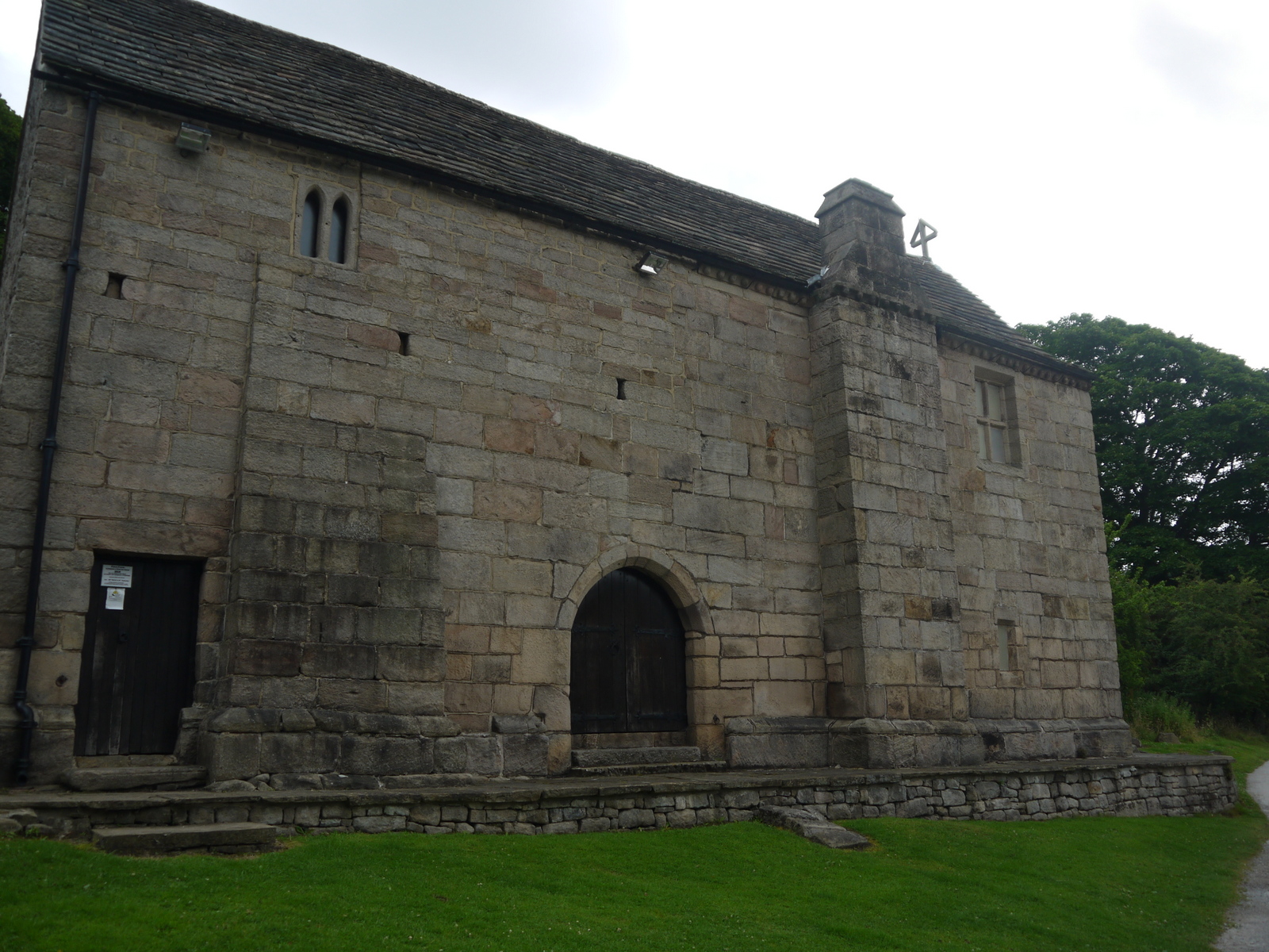
Grindleford Church
We wandered past Grindleford station cafe once again and it was already busy.  We weren't tempted though as we had already had a big breakfast at our hotel.  We retraced our steps back down into the valley and were soon alongside the river once again.  It was like saying good morning to a friend!  The first part of our walk resumed its course through the woodland we had entered yesterday and although overcast the breaks in the cloud suggested that we might be in for a better day and the opposite of day 1 when we started good and went grey.

Horse Hay Coppice
After a few minutes we left the wood behind and our onward path crossed several fields before reaching the village of Grindleford, which is about a mile from the station of the same name.  On our way through the fields the children had rather an amusing encounter with the sheep we passed.  A couple of them wanted to make friends and followed us for some distance.  Overhead we heard the call of a pair of buzzards that were whirling around - not sure if this was a mating ritual or they were hunting in tandem?  Anyhow their call pierced the morning sky and was pretty much the only sound we could hear in the very peaceful countryside.

Froggatt Tepees
At Grindleford we crossed the main road and I took a brief look at the church there before we carried on.  Almost immediately the character of the path changed once again.  The path was proudly announced at the beginning by one of the signs that were put out by the Peak District and N C (Northern Counties) Footpaths Association.  This one dated from 1908.  What followed was a delightful woodland walk through Horse Hay Coppice at the foot of Froggat Edge.  I have walked along the top many times but don't really remember walking along the foot of the Gritstone Edges.  Although nothing like as dramatic as the cliff top walk this route was perhaps just as enjoyable and I could see that a circular walk incorporating both elements would be fantastic to do.

Froggatt Bridge
The woodland was quite short lived and we soon came upon the picturesque village of Froggatt after crossing a few fields.  Here we spotted a rather unusual looking tent over in the distance - it looked like it probably belonged to scouts or guides but was a pretty retro design.  Along the short stretch of road we had to walk along the houses all sported extremely well kept gardens and these were being lit nicely by the emergence of the sun.  At Froggatt we changed banks on the Derwent, crossing via a wonderful old arched bridge.  On the far side as I went to look at the bridge more closely I spotted a grey wagtail right in front of me on the bank.  It hung around long enough to tempt me into getting my camera out and ready then promptly flew off – what a tease!

New Bridge
Our path headed alongside the river until the next bridge at Calver.  It was very noticeable how much wider and less full of energy the river was now but this was explained in part by a large weir ahead just in front of the latest bridge.  This powered an old mill, long since retired from service.  The bridge looked as if it had once been a toll bridge and now carries the redirected A625 road.  This was once the ill-fated Mam Tor road but has been rerouted along here to join another trans-Pennine route.  The old workers cottages alongside the bridge were very beautiful – I wonder if the workers realised how sought-after their homes would have been when they lived in them?

Water Board House
Our onward route took us through some very shady woodland and into a field of not just cows but a very large and healthy looking bull.  We gave all of them a very wide berth, especially when initially they looked like they were coming towards us with a certain amount of intent.  Luckily there was no problem with the herd but it did cause a moment of hesitation – you hear stories of other hikers having problems so always best to be wary I think.  We passed a small caravan site in Curbar before passing the very large mill, which was open for approximately 150 years to spin cotton.  The impressive old mill is 7 stories and must make for an impressive place to live in.  Sadly it isn’t possible to get a particularly good view of it as the old place is surrounded by quite a lot of trees.

Calver Mill
We crossed underneath another main road at this point via a rather gloomy subway that seemed a little out of place here in the countryside.  We passed alongside a housing estate and then it was back to the same pattern of crossing fields and passing through small wooded areas alongside the river until we got to Baslow.  Always pleasant walking we were surrounded by the noises of sheep and overhead birds – mostly crows and the odd buzzard rather than singing birds.  The views across to the Gritstone edges were splendid too now that we were a bit further back from them.

Calver Gardens
After a couple of miles we reached Baslow and crossed the river once more when we got to the main part of the village.  On the far side of the little arched bridge was a rather curious little turret – perhaps an ancient sheltering point?  Baslow itself seems a well-heeled village with some good looking shops and houses especially by the church which was just the other side of the bridge.  We dog-legged through the village avoiding the main roads, which do rather spoil the place a bit.  At the green at the far end of the village we stopped at the café for a cup of tea and a bit of a rest.  This was very welcome for all of us for the overcast day that we had started out on was pretty warm now.

Heading Into Baslow
Having refreshed ourselves we checked with the girls that they still had the energy to complete the remaining 3-4 miles to Rowsley.  They were in uncharted territory to a certain extent from here as up to now we had been mostly limiting walks to 8 miles and we were already at that point.  Nevertheless they were keen to carry on and so we proceeded into Chatsworth Park via a most unusual turnstile type gate.  This was designed to keep the deer from have free right of access beyond the park.

Baslow
Once inside the park we could quickly see that a major event was in the process of being packed away.  There were still large numbers of tents erected and a few refreshment vehicles and stalls being packed away.  I don’t know why but I rather suspected that this may have been a religious gathering as the people were all better dressed than you might have expected from a campsite.  They were tucked down one end of the park quite away from the main house, which we could now see in the distance.  The park was busy as you might expect, not only from the crowd in the tents but also associated with a cricket match taking place a little further on and day trippers eager to take in the magnificent scenery of this iconic place.

Chartwell Tents
Our path crossed the Derwent once again outside the main house, which still belongs to the Duke of Devonshire.  It is probably the main tourist attraction in all of Derbyshire and a mecca for many an overseas tourist.  We went ourselves a few years back and it is definitely an amazing place well worthy of the attention it gets.  By now the big puffy clouds that had been around for much of the day were replaced by wispy ones which seemed to suit the landscape rather better.  The river was rather a different kind of watercourse as it passed through the estate – somehow tamer and definitely factored into the overall look of the park.  Away in the distance we could see a herd of the deer that famously roam about the place.  I can remember being held up by these as I negotiated the road through the estate a few years ago.

Cricket at Chartwell
As we moved south through the park we gradually climbed up and away from the river.  The crowd soon thinned out until we reached a car park at the south end of the park, which was enormously busy.  Luckily most of the people parking there were interested more in the farm shop than walking our route and so we soon left them behind.  We headed through a beautiful little hamlet that I suspect is owned by the Chatsworth Estate.  The gardens were exquisite in the few houses were there and they seemed to be having a competition to see who could grow the tallest sunflower.  With all the flowers in the gardens and a few wildflowers in the fields beyond the houses were attracting a lot of attention from the local insect life.  There were plenty of bees and butterflies servicing the flora in this area.

Chartwell House
Our onward route took us across a very large and rutted field that wasn’t the easiest to walk across.  The miles had now caught up with the girls and they needed a lot of sweet bribery to keep them going for the last mile or so into Rowsley.  The weather had gone full circle by now as the wispy clouds that we had seen earlier had now formed a blanket layer across the sky and we were once again in overcast conditions.  As we entered the village we crossed underneath the former Manchester to Derby railway line.  This is one of the few sections that isn’t in active use as a transport link as this part is not cycle route as further north nor preserved railway as further south.  The viaduct over the Derwent still looks in pretty good condition and I suppose could carry trains again with minimal refurbishment.  To their credit Derbyshire County Council have preserved the route of the railway in case it gets the go ahead to re-open.  It certainly looks like one of the dafter decisions of the Beeching era.

Chartwell Estate
Rowsley seems quite an agreeable place but sadly, as with so many villages in the Peak District, it is rather spoiled by the extremely busy main road passing through it (in this case the A6).  For us it was journey’s end and the prospect of the long drive back to Sussex.  The girls were justifiably proud of their day’s work as we completed 11 miles on this section.  The variety of the route was quite amazing too given that we followed the same river for only a few miles.  I think all of us left wanting more and very soon!

Rowsley Viaduct

Wednesday 9 September 2015

Derwent Valley Heritage Way Section 1 Ladybower to Grindleford

Ladybower Reservoir
Following the completion of our walk along the Kennet and Avon Canal earlier in the year we cast around for another walk we could all do as a family and settled on the Derwent Valley Heritage Trail as a contender.  I had bought an out of print book on the trail a number of years ago but never got around to doing any of the walk.  With a modest total distance of 55 miles and relatively easy transport connections for its entire length it seemed like a good candidate.  Given that we had been in Wales earlier in the week it seemed like a good opportunity to make a start on it before we headed home.
Preparing to Cross the Dam
Our starting point was Heatherdene Car Park adjacent to Ladybower Reservoir; the largest reservoir actually in the Peak District National Park.  Ladybower Reservoir completely fills the Derwent Valley, as do the reservoirs further up the valley.  No doubt the valley looks completely different than it did 100 years ago when there was only a small river running through it.  The reservoir was built in the war years and completed in 1945, taking two years to completely fill.  The former village of Ashopton was completely submerged during the construction phase and signboards further up the valley show the rather haunting picture of the church spire sticking out of the water.  It was later demolished as a hazard.  All was quiet today as it was still fairly early in the morning.  Swirling clouds and bright sunny conditions greeted us on the early stages of the walk, which was very welcome.
Former Railway Line
We walked down from the car park through a section of woodland to the end of the dam.  We crossed the earth dam along a path that was permitted only after the opening of the Heritage Way.  The view from the dam certainly gives a visual idea of the scale of the project - the earth dam itself is absolutely enormous, while the water body held behind it is also huge.  In fact from the dam it is only possible to see a fraction of the overall lake, which extends right up the valley beyond the Snake Pass bridge visible in the distance and off to the left behind the mass of Win Hill.

Bamford Moor
At the end of the dam we turned left and headed slowly downhill along the track bed of the railway that was built for the construction trains that brought in all the materials.  Although there were minimal traces of this being a railway somehow it was easy to envisage its original use for it was not nearly so haphazard as a normal farm track.  Sadly as we proceeded down the track the sunshine conditions that we had enjoyed for the first half hour or so of our walk gave way to black clouds and before long we were putting our wet weather gear on.  Fortunately the rain didn't last very long and we were soon bathed in sunshine for a short period of time again.
Water Board HQ
The track encountered a road and dog legged around it before resuming its course.  I suspect that there was originally a level crossing or even perhaps a bridge here, although no trace of either now remains.  The onward path became ever more hemmed into a cutting as we headed south but eventually we emerged by a large house that catered for family holidays.  Apparently this was once the headquarters of the Water Authority but I am guessing that it has not been for a good many years.  The former railway line would have continued onward to form a junction with the Hope Valley railway line a little further on.  Our route took us across fields to reach the still active railway that links Sheffield and Manchester.  This was our first look at the valley since we had left Ladybower, some three miles up the line.  The scenery all around us was quite different now - already we had left the brooding moorlands of the Dark Peak and were heading to the more pastoral White Peak area.
Wildflowers
Just the other side of the railway and we passed by a garden centre that look rather devoid of stock.  Being August though I suppose most of the main planting has been completed by most people.  We then crossed the very busy main road to Castleton.  Years ago this road would have taken traffic over Mam Tor Pass but it has been cut off as a through route following a serious landslip in the late 1970s which necessitated abandonment of the route.  Nevertheless with Castleton being quite a tourist honeypot the traffic along the road is still very busy and we crossed with extreme care.
Old Barn
On the other side of the road we took up a path that closely followed the River Derwent.  The course of the path would remain close by for the remaining part of the day and was always delightful.  The river was full of energy, boosted by in input of water from the River Hope, and it bubbled its way down the valley.  Our path sometimes followed at level with the river and sometimes we rose high above on small cliff like features that the river had eroded on its journey downstream.  About a mile into this section of the walk we got pretty excited when we spotted a kingfisher, its azure blue colour really showing up in the now gloomy conditions.
Stepping Stones
As we headed downstream it is fair to say that in spite of the wonderful scenery there were few other notable features.  We did pass one of the old stone barns for which the Peak District is famous and I was quite surprised that it hadn't been converted into anything else.  Many of the barns are now used for camping purposes or even converted into holiday homes.  This one was still in its tumbledown state & had a good deal of rustic character about it.  We also passed some stepping stones across the river and the girls were a little disappointed that we weren't going to use them for our route!  Otherwise the main sight along this stretch was the large swathes of wildflowers all along the banks.
Gatekeeper
Away to the north of us was the village of Hathersage, for my money one of the most attractive in all of the Peak District and perhaps one I would consider living in if the opportunity ever arose.  This could be a good staging point for the walk especially if time is limited.  We had decided to push on a little to Grindleford, the next station down the line.  This meant that we had to cross the river via a wonderful old stone bridge and resume our course on the eastern side of the river.  By now we were starting to see more walkers on our route although strangely all of them seemed to be going in the opposite direction.  We wandered along a road that formed an access to a works unit and then across some fields to a pine forest.  There seemed to be a number of different species in here and it was a lovely section of path.  Too soon though we were leaving the river behind and wandering up on the link path to Grindleford station.
Padley Chapel
The path took us up through the forest and across the railway line.  Although the weather was very overcast it was still quite humid and we really noticed this on the climb away from the river.  A little way after we crossed the railway we came to the cluster of houses around Grindleford station and passed Padley Chapel.  This old chapel was once attached to Padley Manor and has a rather grisly history as two Catholic priests were found holed up in here by the authorities during the reign of Elizabeth I.  Practising the Catholic religion was a pretty dangerous pastime in those days and these two priests were dragged off to Derby where they were hanged, drawn and quartered.  Their remains were stuck on spikes as a warning to others not to follow the same religious road.  Sadly the chapel was shut so we were unable to go inside, but the fact that it acts in this capacity still is something of a miracle as the building served as a barn for many decades and the old manor house has long since gone.
Grindleford Station Cafe
When we arrived at Grindleford Station we had some very welcome refreshments in the station café.  This place is justifiably popular - people come here just to have their lunch without necessarily going on the train or venturing forth into the surrounding countryside.  The breakfasts in particular looked both welcome and generous.  Maybe another time?

Wednesday 2 September 2015

Llangollen, Castell Dinas Bran and Valle Crucis Abbey

Canal Wharf
When we had booked our trip to Llangollen one of the walks that we were eager to do was number 24 in the Pathfinder Guide volume 32 North Wales, Snowdon and Offa's Dyke.  What we couldn't be sure of though was whether our girls could cope with the climbing and the distance of eight and a half miles.  They themselves were a bit unsure too, especially when they saw that the beginning of the walk entailed a slog up to the top of the large hill overlooking the town with the ruined Castell Dinas Brann at the top.
Castell Dinas Brann
We had selected the best weather day of the week so far on the basis that we did not want that to sabotage our plans.  Also the girls had a few miles under their belts now and on that basis were more willing to give it a go than if we had tried a few days earlier.  Our route was clear from the outset - first objective was the ruined castle.  We had no public transport to worry about today as we were able to undertake this walk directly from the holiday cottage. 

View North from Castle
We wandered down through the bustling town and past the railway station that was gearing up for another day of steam running.  This must surely be one of the best located steam railways in the country with the wonderfully restored station right in the heart of the town.  What a shame that the railway doesn't still extend from Ruabon down to Barmouth as it originally did as it would surely attract a lot of custom now.  As with so many of the Beeching closures it all seems so short-sighted now.  Sadly the re-opening of the whole railway now seems to be highly unlikely as the trackbed to the east of the station is underneath some relatively recent redevelopment.  Passengers therefore have to satisfy themselves with a trip to Corwen about ten miles away.
Camping Spot
Across the road from the railway station and we started to climb the hill out of town.  This headed across the canal where we had walked only the day before.  We followed a narrow path between houses and past a sports centre and we were suddenly out of town already.  This perhaps demonstrates how confined Llangollen is to the Dee Valley.  The first part of the climb wasn't too bad and we managed pretty comfortably.  After a short while the path flattened out for a bit before we passed through a gate into the land surrounding the castle, which I assume is all owned by the same organisation?  The last part of the climb was through a bracken clad path up to the summit, with views opening up all around us.  When we got to the top we were almost blown away by the wind!

Fields Below Escarpment
There isn't a huge amount left of Castell Dinas Brann - just a few walls and fragments of the former castle.  Yet, considering how short its active life was it is a miracle that any exists at all.  The castle was built in the middle of the 13th Century but was burned by the brothers of Llewellyn,  Prince of Wales and although subsequently garrisoned by English invading forces it soon fell into disrepair and was abandoned.  Given how awkward it was to reach it I am not surprised that no-one wanted to take it on as a residence! 
Eglwyseg Rocks
Despite the little remaining of the castle it was a fascinating place to wander around.  There were parts that were sheltered from the wind and they were especially welcome.  The views from here though were magnificent as you might expect.  It was possible to see right down the Dee Valley as far as Pontcysyllte where we were yesterday.  Upriver we could see almost to Corwen, while below us was the spread of Llangollen and to the north the rather grand looking Eglwyseg Rocks, which is the name for the prominent limestone escarpment that you cannot fail to miss if you come by this area.

Ripening Fields
After satisfying our curiosity with the view and the ruins we headed onward, dropping down almost immediately on the other side.  Luckily we did not lose all the height we had gained immediately as our path ran alongside a road underneath the scarp slope.  The weather was by now relenting and the heavy cloud was starting to shift.  Below us were some fairly hardened looking campers - they had a lovely looking spot for waking up in the morning but not too many mod cons!  Our only other company along this stretch of road were sheep grazing on the scree slope of the limestone escarpment.
Valle Crucis Abbey
After wandering along the road with only the odd bleating sound in the air we almost jumped out of our skins when a couple of sheep went scarpering past us at a rate of knots from the yard of a holiday cottage that we passed.  We couldn't understand what the problem was initially but it soon became clear when a Land Rover came bombing along the road too complete with very excited sheep dog in the back riding in the flat bed part with tongue hanging out.  It amused all of us as the farmer and his do pursued the renegade sheep.

Abbey Ruins
Not long past here and we left the road to pass through a number of fields.  The distance that we now put between us and the limestone cliff enabled us to have a much better look at the rock formation.  Standing back a bit really showed off its impressive beauty.  Apparently it is home to some very rare plants although time did not permit us to go and check out these claims.

Looking Across to Castell Dinas Brann
After a few fields we came back out on to the road we had left minutes before as it wound round to meet our position.  A little past here and we turned left down another road for a short distance.  As we walked along this stretch we could hear the unmistakable sound of buzzards calling.  We were lucky too as they swooped down in the valley below us giving us a good view of them hunting.  Sadly I wasn't quick enough with my camera though so no shots.  Seeing them up so close was a massive treat for all of us though.

Llantysilio Church
We were glad to finally leave the road as our path took a left turn just before the road headed down a very steep looking hill.  We carried on at level for a little while before dropping down ourselves into the valley below the famous Horseshoe Pass.  The path continued through some pine forest and then alongside some ripening fields before we eventually reached Valle Crucis Abbey, our second ancient monument of the day.  This ruined abbey was built in 1201 and was the last Cistercian Abbey to be built in Wales.  Inevitably it did not survive the dissolution of the monasteries by King Henry VIII and was largely destroyed although unusually you can go upstairs in the dormitory part of the former monastery and see where the living quarters would once have been.  As members of English Heritage we were able to visit for free but you can also do so by paying a small fee.
Horseshoe Falls
We lingered at the Abbey for quite a  while trying to imagine what life would have been like here back in its heyday.  Sadly though the atmosphere of the place is rather impaired by the presence of a rather large caravan site next door.  It is a slightly bizarre arrangement with the two very different operations sitting side by side.  There are no cafe facilities at the abbey so we had to make do with wandering up the road to the farm shop at the top where there is a restaurant/ bistro/ tea shop (apparently all of those things!)  We had some welcome refreshments before pushing on.

Berwyn Bridges
We crossed another field and the main road into Llangollen before we had the rather unpleasant shock of another climb, this time through bracken covered country.  Luckily the climb, although tricky because of keeping our balance on slippery surfaces, did not amount to as much as we thought and the path soon levelled out.  As we walked along this stretch we could hear the sound of the latest steam train to leave Llangollen and travel along the Dee Valley.  It was great to hear the hard work of the locomotive although sadly we could not see anything of it through the trees even though it wasn't actually that far from our position.

Canal Reflections
We dropped down on to a road and then found a path along the valley to a small chapel.  The guide book suggests walking along the road to hear but the path seems a newer and safer option so it is wise to look out for it.  We dropped down to the side of the River Dee just below Llantysilio Church and soon found ourselves at the Horseshoe Falls.  These are signposted from some considerable distance away and you might be forgiven for thinking that the falls are an impressive feature.  Sadly not, although it is what they were used for that is more impressive than what they look like.  The falls are purely man-made and the weir was a means by which water from the River Dee could be pooled enough to supply the Llangollen Canal which begins at this point.  There is a surprising amount of flow along the canal and it was this that ensured the survival of the canal after its commercial use had stopped in the 1940s.  The flow of the water ensured that it remained an important water source for the faraway towns of Crewe and Nantwich.

Llangollen Railway
We paused at the falls briefly before commencing the last couple of miles of the walk along the canal towpath.  The canal itself is too fast flowing and narrow along here for use by boat traffic but nevertheless it makes for a very pleasant walk indeed and I think we were all glad of this gentle finale to the walk.  We soon passed the rather splendid hotel at Berwyn although were directed along the back of it so didn't see it at its best.

Eisteddfod Building
The route back along the canal was full of fascination and we got to see many of the tourist attractions that make Llangollen such a popular place to visit along the way.  We passed by the small motor museum, the sidings of the Llangollen Railway and the rather astonishing Eisteddfod building that hosts the world famous music and cultural event each year.  We also passed by the horse drawn canal boat that uses this section of canal.  It was delightful to see but the passengers all looked rather bored - perhaps it is better to watch the boat than travel on it?

Horse Drawn Barge
Soon enough we came back to the tea shop where the horse drawn boats begin their journey.  We knew that we had reached the operational part of the canal now because we were passed by a powered boat.  It seemed a fitting end to the walk where we had seen so many layers of history of this corner of Wales from mediaeval to the Industrial Revolution to the modern day.  It really is a smashing walk - easy to see why it is called one of the classics of Wales.  As for my girls they were thrilled to have completed it as they felt that it was a big challenge when we started and yet they felt comfortable with the distance by the end.  Perhaps we are ready to try more challenging stuff?