Showing posts with label Canal Journeys. Show all posts

Thursday, 25 May 2017

Worcstershire and Staffordshire Canal - Kinver to Kidderminster

Kinver Lock
For the first time ever we transferred our attention from canal walking to canal cruising and tried out a section of this canal for a couple of days.  We hired the boat from Worcester and headed up the Severn before transferring on to the canal at Stourport.  It was only by going by boat that we realised how slow this form of transport actually is.  By the time we got to Kidderminster we realised that would have to be the limit of our ambitions.  Yet we also wanted to explore more of the canal than we could by boat and so we hit on the idea of doing our usual thing and walk the section we had originally intended to cruise.

Reflection
Fortunately for us there are a couple of buses per day from Kidderminster to Kinver and we made sure to get the one on the morning.  Perhaps surprisingly we were the only ones on board and it was a fairly bumpy ride the few miles that we had to go.  We got out in the rather attractive looking village of Kinver and headed away from the centre to find the canal about a quarter of a mile away.  On the way we passed a very grand looking water pumping station.  The Victorian architecture was very eye-catching and I couldn't help thinking that the old place would make for a good looking block of flats someday.
Housing Stock
At the canal bridge we passed by a pub that looked rather inviting.  It was a bit early for lunch though so we turned right along the canal and headed towards Kidderminster.  Almost immediately we plunged into the most delightful countryside and not how you might expect Staffordshire to look. (we crossed the county boundary on the bus).  Large scale maps of this area suggest that it is a lot more built up than it actually is.  Initially the canal bank was nose to tail with moored boats.  I suspect that many of them were here to make the most of the pub and/ or the facilities of the village.  Most looked pretty sleepy although there was the smell of bacon as we passed by some of them. 

Approaching Whittington Lock
Mostly the route was free of boats after this although a couple passed by us in the next couple of miles. We left the first boat that passed us behind when it got stuck in a lock and all was quiet for some time after that.  It wasn't long before we crossed the county boundary between Staffordshire and Worcestershire, handily marked by a proper signpost (never seen one of these on a canal before).  It was about this point we started to see the surrounding countryside and not just the canal corridor.  Beyond were the bright yellow fields of rapeseed and in others merely red/ brown soil reminiscent of Devon.  We were now hitting our stride with the walk and the combination of early spring fragrances and singing birds were enough to gladden the hardest of hearts.

Whittington Lock
Up until Caunsell Bridge (number 26) the route had largely been straight sections with the odd curve.  Now the route changed to a lot more wiggly as we found a small range of hills.  This was a very interesting section as we passed by a pretty good looking building that I suspect is now a conference centre/ hotel.  This overlooked a large field in which a heron stood motionless poised for action, although he seemed quite far away from the water and presumably what he was looking for.

Flotilla
A little further ound the canal and we went past a mobile home site.  This was rather larger than I thought for when it looked like we had passed it some more seemed to reappear around the next corner.  Perhaps I was rather more focused on trying to find out where the woodpecker I could hear was actually hiding out.  I never did see it although it sounded like it was really close.

Starting Out
The next part of the mobile home site sported an unusual sight - a signal gantry that looked like it was of Great Western Railway vintage.  No doubt that the residents of this particular park took the appearance of their site very seriously - most seemed to have well tended small garden plots outside their homes.  I would like to say that my nose was filled with teh fragrance from their flowers but sadly that was not the case - instead I got a sudden waft of death smell and this soon turned into a stench.  It was pretty apparent why when I passed by a dead badger.  It looked like the carrion eaters had been at it already for it wasn't a pretty sight either - looked a bit CSI.

Border Post
After we had passed by the mobile home site we came upon a short tunnel and unusually we had to walk though.  Personally I always like these opportunities, as long as no-one is coming the other way!  There really isn't much room to pass by then...  Just the other side of the tunnel and we passed by a factory that still had its canal connection.  I imagine in days gone by this was a wharf but now any notion of goods coming this way must be a very long time ago!

Guard Duty
Another aspect of this canal which we found very attractive was the rocky outcrops that showed themselves when we went around some of the corners.  These were particularly evident at Debdale Lock, where I stopped to help out some boaters get through. This must have taken some digging out by the navvies and probably wasn't too attractive when first built but now it has blended in it really adds a lot of character to the waterway..  We went around a large loop with a large rocky outcrop in the middle while on the other side the woods were resplendent with bluebells - made for a lovely scene.  Further on and the bluebells were replaced by Ramsens, adding some extra fragrance to the walk.
Gantry

At the next lock we were briefly tempted by a coffee shop in the garden centre next door to the canal but moved on when we saw how busy it was.  Across the valley we could see the village of Wolverley and the church looked particularly attractive.  The sunny start we had had to the day was disappearing though under a layer of cloud, which was a great shame. 

Cookley Tunnel
The last part of the walk was completed a lot more quickly as I took rather less pictures with the increasing gloom.  It wasn't too long before we came to the outskirts of Kidderminster and although the housing estates were clearly growing out into the surrounding countryside the canal successfully managed to cut a swathe through all of them and retain a rural feel for quite some distance.  Even the estate that did surround the canal towards the end nicely dovetailed with the route.  Having the canal as the centrepiece rather than a nuisance was a nice touch by the developers and the residents appeared to embrace it running through the middle.
Boat Park

Not long past here and we were back to our boat.  It was a good little work out for the morning - although we only walked a modest length (6 miles) we did enough to suggest tht this canal might be worthy of further exploration.  I'll wager it will be by foot rather than boat as it is a lot quicker!


Orange Tip

Sunday, 30 April 2017

Wey Navigation Godalming to Guildford

Godalming Church
Walks this year seem to be more sporadic as the time available seems to be ever more at a premium.  This particular Saturday walk was a welcome one especially as it coincided with one of the first good weather days of the spring.  We had actually completed this walk a year before but dunderhead that I am I managed to delete all the pictures from my camera.  We discovered that not only was the weather remarkably similar to that day, but it was also the corresponding day in the calendar - how spooky!

Park and Bandstand
This is far from a challenging walk - it is only just over four miles long and largely flat as it heads along this branch canal.  Some of the walk was completed during the wander along the Wey-South Path some years ago.  This section is still used and may provide the link from the Wey and Arun to the River Thames in years to come.

End of the Navigation
We started at Godalming; the very end of the canal section.  Godalming is a pleasant place, clearly with some wealth behind it.  In that respect it isn't a lot different to many other towns in Surrey.  We parked at the station, which was fairly inexpensive on a weekend day (beware bank holidays - they are inexplicably more expensive).  The rail service between Guildford and Godalming is roughly half hourly so getting back isn't too much of a problem. 

Boat Hire
From the station it is best to aim for the very large church as the river is almost right next door.  We passed by the Phillips Memorial Cloister.  This curious feature commemorates the life and death of the chief wireless operator on the RMS Titanic, Jack Phillips who was responsible for sending out the distress calls from the ship on that fateful night.  The gardens inside were designed by Gertrude Jekyll, famed designer of the early 20th Century.

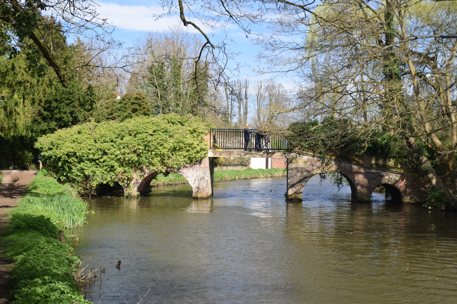
Trowers Footbridge
We stopped for a bit of lunch in the park and watched with amusement as the ducks, geese and swans were all engaged in various courtship rituals.  There was no boat traffic here as the river is not navigable past the Town Bridge.  That seemed to help the birds as they were largely undisturbed.  The park was properly waking up from its winter slumber.  Flowers were brightening up the whole scene and the weeping willows overhanging the river were bedecked in their early spring foliage.  Coupled with the powder blue sky the whole scene looked very fresh and young.

Blossom
Just beyond the park and we emerged onto the main road through the town which was a bit of a shock to the system after the tranquil surroundings that we had come from.  Thankfully it was short lived as we resumed our course along the River Wey on the other side.  Just around the corner and we reached the town basin at end of the navigable section of river.  There were quite a few boats moored along this stretch of river, most of which looked like they were still on their winter break.  In fact we all noted how little activity there was on the river - to be fair the temperatures were still a bit chill.  I suppose it needs to warm up a bit more before people properly get going.

Pillbox
After a lengthy straight stretch of river we came to our first lock at Catteshall.  We coincidentally found a boat coming through it - the only activity we saw for several miles.  The lock had a boathouse just the other side although there was little sign of anyone wanted to hire one of the boats on offer.  The river took a meandering route from here winding through small trees just showing signs of sprouting foliage.  We went under the unusual Trowers Footbridge, which was apparently built to access the nearby Unstead Park.  It was a rather grander affair than would be provided now but probably befits the importance of its destination.

Exclusive Parking Spot
The route was characterised by a number of pillboxes along its length and the first of these was shortly after.  These ones are unusual in that they are perfectly round, unlike the square ones that we see in Sussex.  The River Wey was clearly felt to be an important strategic route for any invaders as they are still pretty prominent even after all these years.  After a meandering route we lost the river over a weir and the navigation became a proper canal, complete with lengthy straight section.  We passed by the picturesque Unstead Lock.  Just off to the left was a picturesque garden with what looked like a berthing basin for boats - indeed there was one in position as we passed by.

Half Pint
Two former railways crossed the canal just north of here - the first is now occupied by the Downs Link footpath that links Guildford with Shoreham using the trackbed of the former lines that crossed Surrey and West Sussex via Horsham.  The bridge across the canal has been replaced with a more modern span that is cycle friendly - I imagine that the original one was removed some time after closeure in the mid 1960s.  Further on is a slightly more dubious railway - certainly the earthworks are all in place but whether it ever carried trains seems to have been lost in history.  Certainly it must have been an early closure for the middle of the trackbed now sports a World War II pillbox.

Mighty Bridges
In between the two erstwhile railways is the stub of the Wey and Arun Canal, walked a few years ago on the Wey South Path.  There is a move to restore this and significant progress has been made in the past few years.  It will probably be longer than my lifetime to see this little stub of the canal becoming part of the through route though.  We also had to cross the busy A248 road - not an easy task.  I rather wished that the towpath went uder the road bridge but alas there is insufficent room.

Guildford Castle
The onward walk from here is very familiar as I have done it a number of times in combination with other routes.  For my money the approach to Guildford is up there with some of the most scenic canal walks in all of England, certainly the ones I have visited.  It starts at the rail bridge taking the North Downs railway across the canal and passes by the shallow lock of St Catherine's (it only brings the water up a couple of feet).  After meandering through some woods and passing the base of sandy cliffs Guildford comes into view overseen by its castle.

Negotiating the Locks
As we approached the edge of the built up area the canal boat that we had helped through the lock finally caught us up - it would only be ahead of us for a short period of time though as the lock in town soon held it up again.  By now we had also caught up with the hoards of people all enjoying one of the first genuinely warm days of spring.  Sadly my lot weren't particularly interested in a trip to Guildford Castle so I had to go with the flow.  I think perhaps it was the hill up to the top that put them off - maybe next time I come this way I shall make sure of a trip to the top.  For now though we made our way through the town to the station and returned by train to Godalming.  On the way we passed by a memorial to Lewis Carroll, who died in Guildford in 1898.  Rather fittingly it was of Alice watching the white hare running away alongside the canal.  I think this must be a recent installation as I don't remember seeing it before.

Last Crossing
As short walks go this is a particularly good one with plenty to see along the way.  I think perhaps we might try and complete this walk going north although it doesn't look as if transport links will be easy - maybe some out and back walks would work?

Lewis Carroll Monument

Monday, 24 August 2015

Llangollen Canal

Chirk Tunnel
After finishing our walk on the Kennet and Avon Canal a few weeks ago we were really please to have another opportunity for a canal walk.  The day didn't start too promisingly though - the early part of the day was wet and miserable.  By early afternoon though the weather had relented enough for us to consider this as a definite possibility especially with light evenings helping our cause.  We took the bus from our base in Llangollen to Chirk, where we had visited the day before.  The bus journey was pretty short and dropped us off at Chirk station before it would wend its way up the Ceiriog Valley where we had walked the day before.

Purple Loosestrife
We crossed the railway line and headed down into the dark tree lined cutting of the canal just north of Chirk Tunnel.  This tunnel of more than 450 yards was luckily not on our route for otherwise we would have had to either pick our way through holding the handrail or bring a torch.  The tunnel appears to be something of a bottleneck on the canal for there were a large number of boats waiting to enter.  I'm not sure what the protocol is for entering the tunnel but a number of boats were waiting to pass through.  I suspect that this is a popular mooring spot for the town of Chirk also.

Chirk Marina
The cutting was rather damp from the earlier rainfall and we had to pick our way past some of the muddier spots as we headed along the first section of canal.  It was difficult to get a feel for the outside world along this stretch as the cutting is surprisingly deep.  When we couldn't hear the chatter of the crews on the boats though we were aware of the hum of factories that are just outside the woods on our right hand side.  One of them is a chocolate factory although sadly there was no giveaway smell to confirm that.
Whitehouse Tunnel

Eventually we left the cutting and the trees on either side of the canal relented a bit.  The view each side was still rather obscured though from tall flowering plants this time.  Rosebay and Greater Willowherbs dominated but Purple Loosestrife also got involved too.  This made for very pleasant walking and for a time at least the number of boats passing calmed down giving us some peace and quiet.  This is apparently the most popular section of canal in the whole of the country and I guess with aqueducts, great views and no locks between here and Whitchurch (a popular point for starting cruises) it was easy to understand why.

Dee Viaduct
Soon we came upon Chirk Marina.  I am guessing from the number of boats moored here that this is an extremely popular place to stop along the way.  Getting in and out of the narrow entrance did not seem to be that easy for some of the crews though - we saw at least two craft really struggling to negotiate the entrance.  A little further past and around the next corner was another tunnel - the rather shorter Whitehouse Tunnel.  This was dead straight and so we were able to negotiate without too much of a problem.  It added a bit of spice for the girls, who loved the adventure of passing through the darkness hanging onto the handrail as we did so.  That was the little bit of security we all wanted for the tunnel itself is unlit.

First Glimpse of Pontcysyllte
Once through the tunnel the canal opened out quite a bit and was easily wide enough for two boats to pass each other easily although strangely we saw most boats heading southwards and almost none heading in our direction.  I twigged that it was a Wednesday and for most boaters on a week's cruise they would be heading back to Whitchurch today to ensure they got back in time.  Some of the boaters abilities seemed a bit varied; some still hadn't got the hang of steering straight.  Perhaps it was good that they didn't need to negotiate flights of locks as well!
Crossing the Aqueduct
At Irish Bridge there was a sharp turn to the left as we reached the Dee Valley.  Here, the railway line that we had been following since Chirk headed off across the valley on a large and impressive looking viaduct as it headed north towards Chester and Wrexham.  For us though the canal took a course on a shelf high on the valley side to the village of Froncysyllte.  Although our side of the valley was very rural (perhaps because it is in shade a lot of the time) the other side was pretty built up.  The trees flanking the side of the canal largely blocked our views across the Dee Valley however, with only glimpses to be had from time to time.  It was just after we had turned to head westwards briefly that we got the first glimpse of one of the reasons for taking this walk - the Pontcysyllte Aqueduct.
Trevor Basin
In Froncysyllte we passed a couple of tea houses that we perhaps should have made use of.  In our excitement to get across the upcoming aqueduct we by-passed them in favour of a refreshment stop the other side.  If you decide to take this walk I would suggest you don't wait - what is available here looks far more promising than what we found on the other side.  I cannot say that the walk to the aqueduct was particularly enjoyable either as we had to put up with a couple of young girls talking inanely on the phone as they wandered along the towpath.  It rather spoiled the ambience!

Completing the Crossing
When we got to the aqueduct we paused and let them continue on their way while we inspected the way forward.  This aqueduct took 10 years to build and was essentially a white elephant straight away for the canal stops on the other side of the valley.  By the time the aqueduct was completed the costs for continuing the canal to Chester had spiralled and it was no longer considered to be cost-effective to continue.  Yet, Thomas Telford and William Jessop constructed the tallest and longest aqueduct in Britain and did such a brilliant job that the structure is still almost exactly as it was back in those days.  Apart from routine maintenance no major reconstruction has been needed in the intervening time.  It is an awe-inspiring sight even in the 21st Century - goodness only knows what the Georgian public made of it.  Back then railways were unheard of and roads were very rudimentary.
Heading Along Llangollen Branch

Crossing the aqueduct was rather scarier than I imagined.  None of my girls are particularly good with heights but I don't normally struggle.  Yet the narrowness of the path and the fact that there was just a thin metal railing between us and oblivion was definitely something more than my comfort zone.  I cannot begin to imagine what it is like to take a boat across for on the non-towpath side of the canal there isn't even so much as a fence but a sheer drop!  Definitely not for the faint-hearted and yet there was something very exhilarating about the whole experience!  My girls were on for an ice-cream on the other side so for them it was just about reaching the destination - I'm not even sure they looked at the view!

Dee Valley
It was quite a relief to reach the Trevor side of the aqueduct and the boatyard there is a good place for boats to moor and there are enough facilities to keep most boat owners happy.  There is a public loo, a pub and a little shop.  Sadly for us no tea room - the little shop sells machine made hot drinks only which was a disappointment.  Luckily there was enough sun around to make an ice cream a good alternative.  We sat looking at the strip of water that seemingly flies through the air as we ate our ice-creams.  Just our luck that a flurry of boats went through where none had done during our crossing.

Meeting
Behind us the boatyard seemed a bit incongruous.  This was what should have been the main line of the canal to Chester but was abandoned shortly after the completion of the aqueduct.  Where there should have been a water source near Wrexham the canal builders had a slightly interesting problem.  They needed a new water source and so a decision was taken to drive a branch line of the canal through to Llangollen and slightly beyond to reach the River Dee.  Considering that we had just crossed the Dee 126 feet above it seemed almost impossible that in a few short miles the canal and river would meet a confluence at level.  The branch line is of course now the main line and it seem especially ironic that the whole canal is named after this five mile afterthought. 

Former Railway Bridge
It certainly isn't easy for boats to deal with the immediate right hand turn after the aqueduct - many struggled as we watched, having to do 3, 4 and even 5 point turns to get around.  We eventually decided to follow one as we finished our ice-creams.  It soon became clear that we could walk faster than most of the narrow boats.  What was particularly striking about this section of canal was how narrow it was - it was certainly not a stretch of water for those not all that good at steering!  As we went along the first part of the towpath we passed by a panic stricken dog owner who seemed to have lost one of his dogs.  This caused some alarm with my girls but they were happy once again when they saw dog and owner reunited in field nearby.  The dog had obviously got lost after chasing something he shouldn't.  Still a scolding from the owner probably made both feel better.

Dinas Bran Castle
The onward walk was a lot less busy - there were fewer boats now and walkers seemed to be fewer on the ground too.  The character of the canal rather changed too as we headed along teh Dee Valley.  Every now and again we had wonderful views open up of the valley but there were also more intimate sections too as the surrounding woodland would occasionally wrap us up in its green lushness.  We started to open out into a procession rather than walking as a group.  Walking along a canal allows this as there are no problems with getting lost along the way. 
Clouds

Soon we came upon the railway bridge across the canal.  Sadly this section of railway between Ruabon and Llangollen is no more - it closed with the Beeching cuts.  I suspect it will never reopen either since the trackbed in Llangollen itself has sadly been built over.  This stretch has really returned to nature - the trackbed is seriously overgrown and would take an awful lot to clear.  The track follows the canal for some distance but not that you would know it unless you looked really carefully!

Cliff Section
Soon the view ahead of us opened up again and we could see Dinas Bran Castle high up on its lofty perch above Lllangollen.  It looks such a mysterious place - we had already planned another walk that would explore it on another occasion.  The view from the canal just served to whet our appetites.

Castle House
As we got close into Llangollen the canal seemed to get ever narrower and the engineers had clearly had a bit of a task as the opposite bank to us was just a sheer cliff!  I suspect this was engineered rather than a natural feature though to be fair it was quite difficult to tell.  Navigating a boat through here must be tricky though - it was barely wide enough for a standard canal boat and if you met someone coming in the other direction that would be a nightmare for there were no passing places.

Tea Room
We soon came into the town of Llangollen high above the main part of the town centre.  The canal takes a route that is almost surreptitious in its arrival.  Yet in a way it is all the better for doing so for we could get a decent view over the town centre.  Just before leaving the canal for good we went by a rather curious castle shaped house - for my money it was probably the best one in the entire town and certainly had the best garden.  Just beyond here was a delightful looking tea shop.  By now it was early evening and not only did we have no appetite for tea but the place was shut for the day anyway.  Now in town we wandered back to our holiday cottage - the whole walk had taken about an hour less than expected and was a delight pretty much the whole way.  The canal itself continues onward to its water source at the Horseshoe Falls about two miles away.  More about that on the next walk though! 

Monday, 25 June 2012

Chichester Ship Canal

The Richmond Arms

For my latest outing it was Father’s Day and so it seemed highly appropriate to design a walk that we could all do as a family rather than a solo outing as I normally do.  With my daughter’s little legs in mind (they are 8 and 5), I thought that the perfect outing would be to explore the Chichester Ship Canal, a short walk of four miles.  We parked in the small village of Birdham and caught the bus to Chichester, getting off at the canal basin just to the south of the City Centre.

Chichester Canal Basin
Although for the most part the weather this summer has been pretty dire, it was a much better day and spirits were high as we embarked on our outing.  The tow path was pretty good too, not suffering too much with the amounts of mud I have had to endure elsewhere on my recent walks.

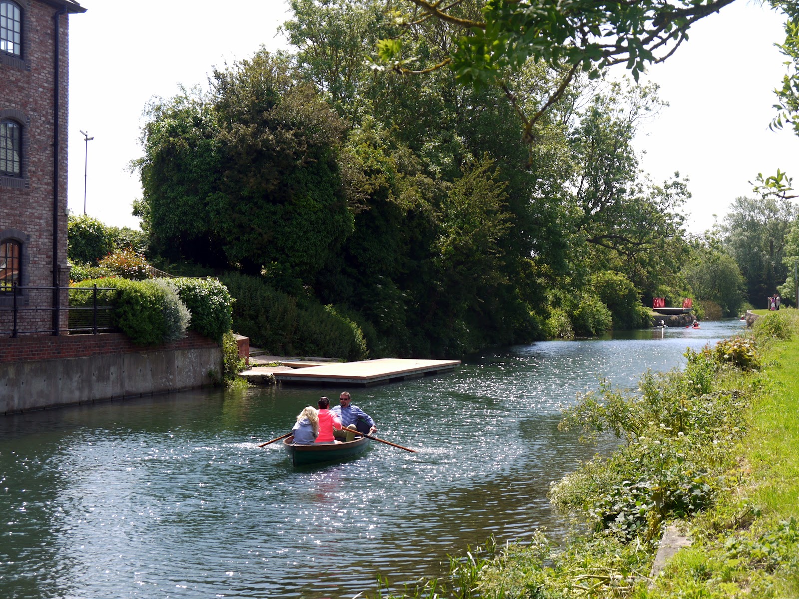
Rowing Near Poyntz Bridge
The Chichester Ship Canal was a short arm of a much bigger canal network designed to link London with the south coast of England, allowing for the distribution of materials to Portsmouth without using the open sea.  This network was conceived during one of the wars with France, but was built far too late to get any decent business.  

A Quick Breather
This part of the canal left the river Arun at Ford and cut across the open countryside to the north of Bognor Regis, coming out into open water at Chichester Habour where an inside passage route could be used as far a Portsea Island.  The branch into Chichester led off from Hunston to access the city centre itself (for more information please also see my walk at Portsmouth and Arun Canal).  The last shipping to use the ship canal was in 1906 when the canal basin was sold initially to Chichester City Council, who then passed in to West Sussex County Council in 1957.

Peaceful Canal Near Stockbridge
The basin was full of activity, with a group of sea scouts kayaking and messing about in various boats.  More building had taken place in the area since my last visit in 2010 and a new group of swish looking flats had been completed overlooking the south west corner of the canal basin.  With a route like this there was almost no chance of the children getting lost and they were thrilled to be let off the leash and explore further by themselves.  My older daughter was put in charge of her own camera so that she could take pictures of stuff that interested her along the way.  It soon became clear that she took this very seriously indeed and practically every blade of grass was recorded for awhile!

Coot Chicks
Just to the south of the basin is the old Poyntz swing bridge.  This is no longer in its original position but has been lovingly restored and looks to be in great shape in its new location.  It looks to be mostly for decoration these days as it seems to be stuck in the open position all the time.  The next bridge is a much more modern affair, carrying the bulky weight of the A27 Chichester by-pass across the canal.  The tow path takes a route underneath and for about 50 metres the path takes on a dark and dingy course.  This really is the only modern interruption to the sedate course of the canal though.  The onward fairly straight course down to Hunston is a delightful and peaceful route.

Egremont
The tow path is shared by National Cycle Route 2, the coastal route that connects many of the seaside towns in Sussex.  It proved to be very popular with cyclists and every few minutes we had to stand aside to let them by.  The canal sides were alive with life with irises, blackberries and large clumps of cow parsley among the many flowers in full bloom.  These in turn attracted quite a lot of butterflies, particularly Red Admirals, which seemed to be particularly abundant.

Punting By
About halfway to Hunston we were passed by the small narrowboat that conducts pleasure cruises along the canal.  The crew gave us a cheery wave, which was much appreciated by my girls.  We were also treated to an aerial display by a common tern, which showed some surprising manoeuvres in the air.  It was one of a number of birds that seemed to show interest in us, with sparrows, robins, black headed gulls and pigeons also joining us at various intervals along the way.

Return of Egremont
A couple of less conventional craft passed us as we approached the bridge at Hunston.  These were a couple of surf boards, being punted along the canal by a couple of very enthusiastic looking rowers.  They gave us a wave as they proceeded very quickly towards Chichester.  We took the opportunity of a refreshment stop here to mark the fact that we had walked the first mile of our route.  The path crosses the bridge at Hunston to provide a good view back towards Chichester.  By walking round the house being redeveloped on the other side we were able to regain the towpath.


Rosebay Willowherb
At Hunston, the canal does a sharp right turn. This betrays the fact that this was once a junction of canals, although the onward route towards Ford is now completely filled in and lost to history. Fortunately the Ship Canal is still in good shape and so we continued on towards the sea enjoying the plethora of flowers as we did so.


End of Navigable Section
About half a mile on from the former canal junction is another transport relic – the old bridge from the Selsey Tramway.  Only the bridge abutments remain but it doesn’t take too much imagination to work out where the route would have gone as on the towpath side a long straight, if rather overgrown, path heads off into Hunston Village and would once have gone on to the small town of Selsey.  The old railway was a short-lived and troublesome affair, being built on the cheap and not very passenger friendly.  It succumbed to road competition fairly quickly and had a service life of only about twenty years.  Flooding and breakdowns were a constant problem and the number of wayside halts on the journey probably made for very slow journeys.
Racing Along the Towpath

Not far past here was the end of the navigable section of the canal and we passed the narrow boat heading back in the opposite direction around here.  The numbers of walkers and cyclists had also dropped off, which made life easier as far as monitoring the children.  The picture taking from older daughter had lost its novelty by now too and I seemed to be carrying camera and younger daughter’s rucksack in a bid to keep the speed going!  Eventually we came to a road, where the canal had been filled in with the road foundations, presumably a good many years ago.  It wasn’t an easy road to cross as it was strangely busy for a ‘B’ road.
Extra Large Dandelion Clock

On the other side, the canal seemed to be at a lower level, suggesting perhaps that the road had originally marked a lock that no longer exists.  A little further on and we had a lengthy encounter with a cormorant, which fascinated the children no end as they watched it preen and clean its feathers.  Eventually it flew off with a languid kind of flight along the route of the canal.  This part of the canal proved to be a very hot section as the sun was fully out now and there was little shade.  As soon as we could we stopped again for a snack to perk up the kids and continued on our way through a delightful section full of trees sporting blossom still.
Chichester Marina

The next road that we reached was the one that we had used to get back to Chichester on the bus.  Again this was super busy and not so pleasant to cross.  However, we were by now reaching the ¾ mark of our walk and in the home straight.  We crossed over and headed along the side of the road into the large marina at Birdham.  This was perhaps the least pleasant part of the walk, although walkers were catered for and the traffic into the marina was quite light.  On the way we saw the biggest dandelion clock we had ever seen (although to be fair I think it might have been another plant with a similar seed head).  The canal here looked quite sorry for itself, with weed choked sides and looking a long way from being navigable.  Yet as a wildlife corridor it is probably invaluable since much of the surrounding countryside is now given over to arable farming.
Houseboat Norana

At Chichester Marina, the character of the walk completely changed.  Gone was the quiet and peaceful countryside and with it came the buzz of yachting folk.  The marina itself is a sea of masts of some very large looking craft.  I suspect many millions of pounds of boat traffic is tied up in the marina, although strangely given the type of day it was, the numbers left in port were a little surprising.  More interesting perhaps than the lines of yachts were the flotilla of houseboats moored along the last part of the canal route.  Most were moored on the south side of the canal, with some curious little moving platforms used by the boat dwellers to reach the parking area on the other side.  We were rather tempted by one houseboat that was for sale, but the price rather put us off!  Although no doubt a wonderful place to live in summer, I suspect that it would be pretty awful during the winter months.
Birdham Pool

At the end of the canal was Saltern’s Lock, which allegedly still works although looking at it I have my doubts.  We crossed over the lock and wandered down towards Birdham Pool, where another huge collection of sailing craft are stored.  The sea of masts just proved to me what a popular pastime yachting is, especially in this part of the world.  We had finished our route along the canal though and so all that was left was to walk the half a mile or so back to Birdham Church, where we had parked earlier in the day.  The girls had a wonderful time on the walk and it proved to be a good little project for both of them, enabling them to feel as if they had achieved something without being too much for them to handle.

Birdham Church