Showing posts with label Isle of Wight Coast Path. Show all posts

Saturday, 10 January 2009

A Wight Winter Wander Day 4 Ventnor - Ryde


Ventnor High Street
Today I took the train all the way from home as it allowed me to buy a through ticket to Shanklin, the southern extent of the last rail line left on the island. It was an easy trip from home as the passenger ferry from Portsmouth Harbour station connected easily with trains at both end of the crossing. The Island Line is a little surreal and badly in need of some investment, with old London Underground trains plying the 10 mile route from Ryde Pier Head to Shanklin. The stations are mostly dilapidated and the trains painfully slow but it did make a change from using the number 7 bus. The line onwards to Ventnor is long since closed, but a connecting bus does take you the last few miles to the southern-most town on the Island.
Ventnor Church

The weather was very unpromising, with prolonged snow showers from the very outset and when I arrived at Ventnor I was pretty unsure whether I could complete the day. However, the sun did come out when I arrived so I decided to chance it. The first section out of Ventnor is along the sea wall and this was a little hairy as the sea was very angry and waves crashed up over the front. I was please when after a short while I was able to climb up onto the small cliff and away from the sea. At this end of the island there is very little land area beyond the huge mass of St Boniface Down and the path weaves around an area called the Landslip (so-called for obvious reasons).

View from Luccombe Chine
Luckily the path stays at a relatively low level and there is no major climb around this section of coast. The landslip is characterised by some very attractive woodland and was a haven for smugglers in years gone by. There are few clues to this activity now, but there is a ‘wishing seat’ half way round that looks like a natural stone formation.

Shanklin Clock Tower
Eventually you reach Luccombe Chine and here there are some very attractive houses, where the owners are clearly keen gardeners. There was even the chance to walk through one of the gardens as the path cut across it. Shortly after the path turns into a road and this leads down into Shanklin. At the beach you can see the exit of Shanklin Chine, a tourist attraction that was heavily fenced to make sure that no-one could see its charms without paying for a ticket! At this point I decided to walk along the foot of the cliffs along the promenade as there was a choice of routes. Shanklin and Sandown seafronts were perhaps a sadder sight than anywhere else along the Isle of Wight coast at this time of year. There were no businesses open and some had clearly fallen by the wayside some years before. Indeed it was difficult to imagine this being a hive of activity during the summer months.
Shanklin Beach Huts

After a fairly long walk along the promenade I eventually reached Sandown Pier, which claimed to be the best day out you could have. As the only fully functioning pleasure pier left on the island there may have been a grain of truth to that boast, but I was unconvinced as it looked tatty and seriously in need of bringing into the modern world since its last refurbishment was probably some time in the 1970’s or early 1980’s.

Sandown Pier
I took the opportunity of stopping in Sandown for a bite to eat. In the high street there was fortunately no shortage of choices of places to eat and after some fish and chips I felt fortified enough to carry on. By now the weather had improved considerably and I continued along the last part of the promenade in brilliant sunshine, passing the leaping tiger atop the entrance to Sandown Zoo before heading out on to Culver Down. This had dominated the horizon for most of the morning since I turned the corner at Luccombe Chine, but I was pleased that it wasn’t as far as it had seemed earlier in the day.

Coast Path at Sandown
The climb up Culver Down wasn’t nearly as daunting as it seemed from a distance and as I approached the top I could clearly see the line of the chalk ridge that extends the length of the island. At the top of the ridge was Bembridge Fort, another defence installation that was built in 1860. A little further along was a monument to the Earl of Yarborough, who was the founder of the Royal Yacht Squadron. By the time I got to the top of Culver Down, another snowstorm had arrived although this was thankfully short-lived.

Sandown Zoo
The view from the top of the Down was pretty spectacular with the sweep of Sandown Bay on one side and a view of Portsmouth, the Spinnaker Tower and Spithead on the other. Surprisingly there was still some way to go today, and the trek around Bembridge took quite a long time. Due to cliff erosion much of the official route has been closed in this area, with re-routing mostly along roads. However, I again struck lucky with the tides and was able to divert along the beach. This made for an interesting walk, although hard going as I had to skip between sandy parts of the beach so as not to come to grief in the many rock pools. The path passed Bembridge lifeboat station, a very impressive affair that was built out on stilts above the low water area to ensure that the lifeboat didn’t come to grief when launched.


View From Culver Down
At the end of the beach was the mouth of the River Yar and I soon had a sinking feeling when I realised that I would have to make a huge detour in order to reach the lowest bridging point at St Helens, nearly a mile away. The road was a bit of a shock to the system, but the houseboats moored alongside proved distracting enough to make it less of a problem than I expected. One of the boats was for sale, a tempting prospect although it didn’t look like it was in great shape. When I reached the far end of the estuary I turned back along the other side and across a long causeway that had been built across the northern side of the harbour.

Yarborough Monument
A section of sand dunes follows before the path heads inland for a short time around the Priory Hotel, a large country house hotel that probably costs a small fortune to stay there. Soon I found Seaview, a small and very attractive town that is well off the usual tourist trail. The path wound through the streets before coming to the promenade, which would lead all the way into Ryde. The views across Spithead were constantly changing with ships going to and from the ports of Portsmouth and Southampton. Some were big ocean going container vessels, while at least three cross-channel ferries also passed by. This stretch of water is also notable for the forts which have been built in the gateway to the important naval port of Portsmouth.

Bembridge Lifeboat Station
The last little bit of the walk went through Puckpool Park and by now the daylight was fading fast and my energy levels had been sapped. I did enjoy looking out across the considerable sands off Ryde, but I was not tempted to see how far they went out, even though it was very low tide by now. Ryde Esplanade station could not come quickly enough and I was very pleased to finish my Wight expedition.

St Helens Causeway
This stage of the hike is relatively easy, although for me the weather was the worst of the days with many snow showers and there were a couple of points on the walk where this could present a safety issue. However, this part of the island is fairly well developed and there are numerous shops, pubs and bus services that should get you out of trouble if you should need them.


Puckpool Tower
On the whole the walk around the Isle of Wight is a very enjoyable experience, even in the depths of winter when (apart from a couple of notable areas) mud is not a serious issue. If four days seems too ambitious, or the thought of commuting or carrying loads of gear seems too much the walk can easily be split into different, shorter sections. There are a number of holiday companies offering luggage carrying and accommodation booking services. This is a really good walk for the beginner as there is lots of variety of scenery, has a couple of challenging sections, and there are plenty of refreshment stops and places to stay. You can even have tasters by doing circular walks based on the coastal path. If you would like to have a go at this challenge, I would be pleased to offer any practical advice before you go. It is a thoroughly recommended expedition.

Friday, 9 January 2009

A Wight Winter Wander Day 3 Freshwater Bay - Ventnor


Freshwater Bay
There is no doubt about it, this was the hardest of the days on the island due to the distance and terrain. The south west coastline of the Isle of Wight is pretty wild, with few villages and little development. Its wildness is reminiscent of the Dorset coast and the weather can be very unpredictable. The reason I chose to follow the route around the island in an anti-clockwise direction was because I had this section in mind. I really wanted the prevailing wind at my back rather than have to face into it. What I didn’t bank on was that on the day in question the wind would actually be from the north, meaning that I would cop it no matter which direction I walked along the coast!

Freshwater Bay
Another impediment to my day was the length of time that it took to get to Freshwater Bay from Ryde on the bus. With all the stops and detours around housing estates this took nearly two hours and I didn’t arrive until noon, which meant that I would need to get my skates on to complete the walk within daylight hours. Luckily the weather was absolutely fabulous, easily the best of the days that I had on the island and so I really wanted to make the most of it.

Climbing out of Freshwater
Freshwater Bay is a small settlement dominated by a large hotel and the surrounding chalky cliffs. From the small promenade the view down the coast was spectacular but also a bit daunting as I knew I would have to cover this entire length, with a few extra miles round the corner at the end. Luckily once the first chalk cliff had been safely negotiated the next eight miles of cliff were mostly level, which made for fairly easy walking to begin with. At Compton Bay the underlying geology changes dramatically from chalk to sandstone, giving the coastline a completely different character.


Whale Chine Beach
There are almost no settlements between Freshwater Bay and Chale, some ten miles down the coast. Luckily the path runs parallel with the old military road and this is also the route for the number 7 bus, so if I had a problem I always knew that I could catch the bus if I needed to.

Coastal Erosion
The coastline, while spectacular, was also a bit monotonous compared with the rest of the island’s coast. Blackgang Chine and St Catherine’s Cliff, which could be seen in the distance from the off never seemed to get any closer. However, this was a most enjoyable section, with the sun shining relentlessly and the sea at low tide exposing great swathes of sandy beach below. Every now and again a small stream cut a deep gorge into the sandstone to find its way into the sea. These land features are known locally as chines. The other main feature of this stretch of coastline was the dramatic erosion, which had claimed stretches of car park, beach huts and even some of the buildings at the few holiday camps in this part of the island. There were several buildings that had been abandoned and left to their fate, since there was no coastal protection on this stretch of protected coast.

Sandy Cliffs

Eventually after about four hours I reached the village of Chale, where I briefly contemplated getting the last bus into Ventnor (it was only 4pm!). I decided against it as I was enjoying the walk so much, but knew that it would be a tall order to reach Ventnor before it got dark. The climb out of Chale up onto St Catherine’s Cliff wasn’t nearly as hard as I expected and once again I was high up on a chalk cliff rather than the fairly low sandstone ones that had been my companion for the last 7 miles. Strangely though I was no longer at the coast but a mile or so inland, with what looked like a landslip between this cliff and the much smaller one below. As I rounded the corner and finally left the view of Freshwater Bay behind me, I got a good view of St Catherine’s lighthouse below, which marked the southernmost point on the island.
Church and Oratory


The path skirted the village of Niton and continued along a wooded clifftop for a mile of so before a very steep descent to the actual coastline below by the village of St Lawrence. The path continued along the low cliffs all the way into Ventnor and after a mile or so it the coastal strip was actually a park that stretched all the way into Ventnor. Once at St Lawrence I wrongly assumed I was almost there, which proved to be a mistake as it was actually still quite a long way along the front. By the time I got to the outskirts of Ventnor I had to take a detour away from the coast path and follow the main road into town as it was too dark to see where I was going.

St Catharine's Cliffs
This section of the walk is very long and could be split at Chale by using the bus service. This would allow more time to explore the coast near Ventnor, which is a completely different character. I would suggest that if you were to finish at Chale, the next section should be as far as Sandown, making for a 9 mile section. Overall the walking wasn’t too difficult although it’s a good idea to ensure that you are fully equipped as this is the only section without major settlements en route. Keep a close eye on the weather in particular.

Thursday, 8 January 2009

A Wight Winter Wander Day 2 Shalfleet - Freshwater Bay

Newtown River Mouth
When I decided to walk round the Isle of Wight I soon realised that I would have to become acquainted with the number 7 bus route. This appears to be the main service to just about anywhere on the island and can even take you completely around the coast if you so wish. Unfortunately, I discovered that although West Wight is served, direct links between Freshwater Bay and Shalfleet were few and far between. This was the only day where I actually had to take my car onto the island in order to help me complete the section.

Boardwalks
The bus journey was actually pretty short from Freshwater Bay and I got going from Shalfleet just before 11am. The weather was sunny but a bit fresh, with a few puffy white clouds skating across the sky, hinting perhaps at a change in the weather later in the day. From Shalfleet, the path continues around the inlets and salt marshes of the Newtown River. The path negotiates causeways and bridges, making for a very interesting stretch. In between the waterways were fingers of woodland, now in the early stages of bud hinting at the arrival of spring.
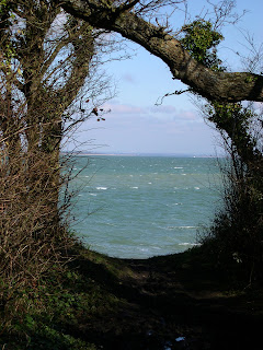
The Solent
On the way down to Hamstead Farm I had a close encounter with a fox, which stood no more than thirty yards away. Its fearlessness seemed appropriate on the day after the foxhunting ban became live. It soon caught a scent of me and was away in the blink of an eye across the fields and into the distant woods.


Hemmed In
Beyond Hamstead Farm the path has a reunion with the coast and there is a short stretch along a shingle beach. The path then climbed a small cliff and through another farm where there was a field full of goats wearing woolly jumpers! The view back across the Newtown River estuary and the Solent towards Southampton was quite spectacular from this point. The path then disappeared into Bouldnor Woods, which was allegedly a good place to spot red squirrels. Unfortunately try as I might I never did see any, presumably they were being sensible and hibernating still on such a cold day.

Yarmouth
Eventually the path reached the small town of Yarmouth and by now the weather was showing signs of deteriorating considerably. The few puffy white clouds that had been a feature of the sky up to now were now gathering together and threatening rain or snow. When I got to Yarmouth it was lunchtime and my initial thought was to disappear into a café. However being a ferry port and a Sunday, all the cafes were heaving so I thought better of it and bought a pasty and continued on my way. Yarmouth itself was an attractive little town, quite different from the sprawling towns on the eastern end of the island. The town was dominated by a castle that overlooked the harbour and the ferry that was being loaded in readiness for the 30 minute crossing to Lymington.

Looking Back to Yarmouth
The path crossed the estuary of the River Yar, a large yachting marina and turned along the sea wall. This leads into Fort Victoria, one of the only tourist attractions locally that was still functioning in the dead of winter. Once through the woods that hug this stretch of coastline, the path comes out into yet another deserted holiday camp at Cliff End Battery. At this point I got my first glimpse of the Needles, which still seemed a long way distant. Across the other side of the Solent, I got a good view of Hurst Castle, which seemed almost close enough to touch. This structure was built at the end of a long spit and was clearly designed to protect the narrow channel from attack.

Fort Albert
I did have a stroke of luck at Colwell Bay, as because the tide was out I managed to take a short cut along the beach, obviating the need to take the official route down to the main road. This was Colwell Chine, a very nice stretch of sandy beach that is completely covered at high tide making this was impassable. As well as another view of Hurst Castle, Fort Albert came into view, the Isle of Wight equivalent. Beach huts appeared to be the order of the day along the next mile of coast to Totland and there were a couple of cafes that were catering to the few adventurous people that had ventured out. How busy they were I couldn’t tell since the windows were completely steamed up.

Totland Bay
Totland was obviously popular enough in Victorian times to warrant the building of a pier. Unfortunately on closer inspection the pier had clearly seen better days and much of it was now fenced off. Just beyond Totland I left the sea wall and climbed up onto Headon Warren. This was a completely different landscape to what had gone before. It was an area of heathland characterised by heather, bracken and gorse bushes and looked more like a piece of the New Forest that had got lost. It was a stiff climb to the top and once at the summit there was an extremely strong wind which instantly made my eyes water. The view back across the Solent was quite spectacular with the twin sentinels of Hurst Castle and Fort Albert dominating the scene.

The Needles
At the western end of the Warren the Needles came into view, suddenly much closer than the last time I saw them. The Warren ended abruptly at Alum Bay, famous for its coloured sand for which the only use appears to be as filling for nasty glass ornaments sold by the shed load in the shops at the top of the cliff. The path passed this shopping extravaganza, which was still busy even on a late February afternoon.

Alum Bay
For motorised traffic, the Alum Bay experience is the end of the road at this end of the island. The road does continue to the Needles Battery, at the very end of the peninsula but is barred to traffic. It was a good job since there were a lot of walkers on this stretch going up to see the Needles. Just before the end of the peninsula, the path turned up on to the chalk ridge and then again to head eastwards at the coastguard cottages at the top. When I got to the very top, the wind was unbelievable and I felt like I was almost walking horizontally. Life in the coastguard cottages must be really bleak during the winter months.

Tennyson Monument
I didn’t linger long to admire the view of the Dorset coast some miles distant but pressed on as quickly as possible. At the top of the chalk ridge was a monument to the poet Tennyson, the most famous resident of this part of the island in Victorian times. Just past there I was thankful that the path dropped down into Freshwater Bay, my destination for the day. Ahead I could see Blackgang Chine in the very distance and the cliff line that would form the bulk of the next section of the hike. For now I was very relieved to be reunited with my car so that I could get out of the wind and thaw out.


West Hill Down
This section of the walk is far more varied than the first day and was my personal favourite, with a dramatic end section from the Needles across Tennyson Down. If you only manage one section of the walk then in my opinion this should be it! You could also try a circular walk from Freshwater Bay using the Freshwater Trail (another waymarked path) to Yarmouth and then use the coastal path to complete the circuit.


Wednesday, 7 January 2009

A Wight Winter Wander Day 1 Ryde - Shalfleet


Arrival on the Island
When deciding upon a walk I like to think about what I want to achieve. A rare opportunity arose a couple of years ago in February when my wife went to visit her parents; four free days to get out on the hills. Where to go? February is a funny month for walking. The weather has usually improved from the darkest days of January and December and there is sufficient daylight to get a lot of mileage in. However, conditions on the hills can be dicey to say the least, with mud the biggest enemy. I settled on a project that I felt able to complete in four days, where mud shouldn’t be too much of a problem. This would be the time I walked around the coastline of the Isle of Wight, a 65 mile trek along clifftops, seaside resort promenades and river estuaries. It was something I had wanted to do for ages, and here was the perfect opportunity.
Ryde Tunnels
As a lot of hotels were closed at this time of year, I decided that I wouldn’t stay on the island but would make a series of day trips. This had the distinct advantage of being a lot cheaper and there were no cumbersome backpacks to carry but the days were quite long and required a good deal of planning in advance.
Ryde High Street
When the week arrived we had a cold snap, where snow showers were quite frequent. This was the main hazard I had to contend with, although I also experienced a couple of occasions where I was very tight for time meeting public transport.
Cottages at Binstead
Ryde is an appropriate place to start the walk. It is the town where many tourists first experience the Island. The tall church at the top of the hill in Ryde town centre almost acts like a beacon to welcome visitors. On this particular cold February day I decided that Spithead was calm enough for me to take the hovercraft across. The crossing was only 10 minutes, the shortest of any to the Island although the departure point in Portsmouth is not particularly convenient as it is a fair distance from the train station.

Binstead Churchyard
As soon as I reached Ryde, I got going on the path out of town. The day started promisingly, with sunny skies and puffy while clouds bobbing along. There was a stiff breeze however, and wrapping up warm was the order of the day. On the edge of Ryde, the path took the old road towards Cowes initially through a golf course and then into small sections of the forest that once dominated the landscape before agriculture and then tourism completely changed the environment.
Binstead Church
After a mile or so, you come to Quarr Abbey. Originally a Cistercian Abbey, this was one of those dissolved by Henry VIII in 1536 and is now a ruin, being demolished quite quickly after the dissolution. One part is now a house, and the abbey ruins were inhabited by a couple of small Shetland ponies when I passed. A little further up the road is the new Benedictine monastery called Quarr Abbey, built in 1901 and quite a contrast to the old building.
Old Quarr Abbey
A little beyond Quarr Abbey I came across the ferry port at Fishbourne, which was enlarged to take car traffic back in the 1930’s. Even on a Tuesday in February the port was still a hive of activity, being one of the main gateways to the Island. Just by the port is the Fishbourne Inn, a good stop for lunch if you reach it at the right time (I didn’t today but the food is rather good).
Old Quarr Abbey
Unfortunately the next stretch of the walk to Cowes is not particularly pleasant, with a lot of road walking and not much coast. This is presumably because of the Osborne House estate, which extends along this stretch of coast. Queen Victoria obviously didn’t like the idea of her subjects getting too close to the house so no public footpaths exist along this stretch of coastline. You would certainly be forgiven for catching a bus from Wootton Bridge to East Cowes, as I wished I had done about half way along the three mile road.

New Quarr Abbey
By the time I got to East Cowes the weather had completely changed and I had experienced a couple of heavy winter showers on the way. I took refuge in the little cabin on East Cowes harbour front and waited for the chain ferry to the other side of the River Medina. Cowes is a bit of an anomaly, a small harbour with a fair amount of industry. Most of these types of port have almost disappeared from the mainland, but in keeping with other aspects of the Isle of Wight, the port has a feeling of England thirty years ago.


Butterfly House

The crossing took only five minutes, giving me just enough time to enjoy the pictures drawn and painted by local children in the passenger cabin. The crossing for foot passengers was free, which was a bit of a bonus. West Cowes feels like a completely different town, with more of a history about it and a lot more care taken over the town centre. Presumably this is because it is the location of the start of Cowes Week, the famous yachting regatta that takes place each summer. The path continues past the Royal Yacht Squadron, where the race is started from and there are warning notices about the sound of the starting cannon. However, the cannon itself resembles a pea-shooter rather than the nice big chunky ones that are more familiar.

Cowes Chain Ferry
Unfortunately the road walking didn’t stop at Cowes but continued on to Gurnard the next town along the coast. On the way I encountered an enormous snow storm, which made visibility incredibly difficult for a short while. Unfortunately I was by now on a stretch of the Esplanade that was not frequented by so many pedestrians presumably, since there were no shelters and I had to brave the worst of the weather. Luckily for me the storm passed very quickly and within minutes the sun was out once again.

Fast Cat
Just outside Gurnard I cheered as the path finally left the road and went out across the cliffs towards Thorness Bay. The path weaved its way through gorse bushes that had thankfully been kept at bay by the number of walkers passing this way. Eventually, the path descended down into the bay which was quite remote feeling and gave a clue to the character of the west of the island, which is quite different from the east. Overlooking the bay were a number of holiday homes that were made from converted railway coaches. These must have been sold off cheaply during the wholesale closure of the island’s railways in the 1950’s and 1960’s. At the other end of the bay was another desolate holiday camp consisting of large caravans and at this point the path again left the coast and headed inland.


Gurnard
This time the diversion was not for Queen but for country since this part of the coast has been requisitioned by Her Majesty’s forces for military training. The path crossed some fields to a road, which should have been straightforward but was far from it. I managed to find the biggest bog on the island and spent about twenty minutes crossing one field using tussocks of grass as stepping stones. By the time I reached the road, I was about three inches taller because of the amount of mud that had stuck to the bottom of my boots.
 
Royal Yacht Squadron

The next couple of miles were a pretty unattractive trudge along a busy road until I reached Newtown. This was clearly a misnomer, since it was neither new and not really a town either. It did however possess a town hall, built around 1700 when the town was much more important. Originally Newtown was called Francheville but gained its new name when the town was rebuilt following French raids in 1377. At one time Newtown actually returned two members of parliament but when declared a ‘rotten borough’ in 1832 its importance declined.


Thorness Carriage
The last stretch to Shalfleet continued by road around the spider like inlet of the Newtown River. This is a huge nature reserve, which was a constant companion for the next few miles. I decided not to linger too long as I had a bus to catch and so made my way to Shalfleet church quickly to ensure that I didn’t miss it, for the next one wouldn’t be for another two hours.

Newtown Town Hall
All in all the day was an interesting mixture of landscapes and history, although there was far too much road walking for my liking. This is less of a problem on a winter weekday, but I wouldn’t like to tackle some stretches on a summer Sunday because of the traffic.