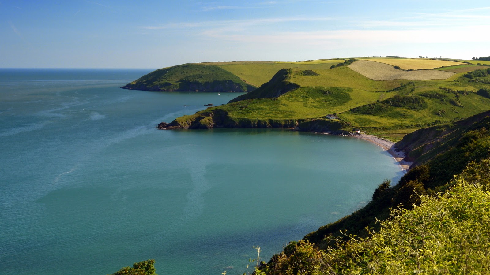
Wednesday, 16 July 2014

South West Coast Path Section 45 Brixham - Torquay


Brixham Harbour
After a lengthy and hot day on my first day in the south west I was rather pleased that I had planned to be less ambitious on my second day.  It enabled me to have a slightly later start as I only had a fairly modest eight mile section to Torquay to complete.  One of the reasons why I had planned such a short section was partly to do with the vagaries of public transport but also to enable enough time for me to visit the Dartmouth Steam Railway.

Brixham Coast
Getting the bus over to Brixham for the start of the walk was pretty easy although I would have preferred to go by train.  Sadly for me the last train ran to Brixham more than 50 years ago so I was a little late for that!  I did however enjoy my ride at the front of the top deck of the bus – that is always a treat!  I got to Brixham in mid morning and provisioned myself up before heading north along the coast.
Brixham Wall Art

It was a slightly different day today with more cloud around, more breeze and yet a more intense sun.  Before leaving Brixham I decided to hang around the harbour for a short while to watch the morning’s activities.  Some of the please boats were gearing up to go including the ferry that heads all the way into Torquay.  I cursed myself as that probably would have been a more memorable way to do the return journey than the bus.  After watching the departure of some rather empty looking pleasure cruisers I headed on my way towards Goodrington.

Brixham Battery
To the north of Brixham Harbour were a good number of former World War II defences and I imagine that back in those days the structures left behind would have stationed some pretty powerful guns to ward off enemy ships.  Now all was peaceful and it made for a very attractive park full of families rather than watchful soldiers.  The path climbed up to a higher level away from the path and passed alongside a golf course through some woods briefly.  I came out to an area by a small museum dedicated to World War II and a new development site that looked as if some old houses were being bulldozed for a holiday park.  Lucky holidaymakers – the view from here looked lovely.  The signage was a little confusing here but I soon figured out that I was actually supposed to drop down to sea level and happened upon the most glorious cove complete with sandy beach. I was surprised at how few people were using the beach given the proximity to the local population centres of Churston and Brixham.  A couple of people had pitched their tent at the back of the beach and looked to have found an idyllic spot to camp.

Churston Cove
I started climbing up the rocky side of the cove on the other side of the beach and waited my turn half way up for a couple of people to come down.  I almost wished I hadn’t made this gesture as what I thought were a couple of people turned out to be a steady stream and I stood there like a lemon for some time before finally plunging into more woods on the other side along a surprisingly straight section of path.  This was a quiet section and was probably the only time in the whole day that I had the path completely to myself.  It was something of a relief to be walking through the woods as although I didn’t get much of a view I did at least enjoy some cooler temperatures in the shade.

Churston Point
The next beach was rather larger and as before I wound my way back down to sea level in order to cross the back of it.  This time there a lot more people enjoying the beach as I suppose it was a lot more accessible.  As I crossed I could see a young Council worker who had possibly the most enviable cleansing job of all as he pottered along litter picking the beach wearing his council issue shorts, t-shirt and baseball cap.

Broadsands Clouds
The character of my walk changed from this point too – gone were the woods and the next stretch of path between coves was through a clover filled meadow with views of Goodrington ahead of me.  This was pleasant strolling territory and the rugged coastline of yesterday (and the next day if my memory serves me correctly) seemed a distant memory.  There were lots of families out enjoying the sunshine, although ahead I could see some fairly menacing clouds beginning to develop.  As I rounded the headland the beach called Broadsands came into view and this was perhaps one of the most scenic beaches I have ever seen.  I paused on a bench to enjoy the view and take on some water and as I did so I was lucky enough to see one of the steam trains from the Dartmouth Railway puff past on its way to Paignton.

Lively Getaway
Feeling fortified I headed along the crescent shaped beach front enjoying the people at play as I passed by and admiring the cheerful looking beach huts.  As I passed I realised how different the path looks in high summer, for this is the first time I have done any of the path during the main summer season.  I have to confess that I really enjoyed it and vowed that I would do some more of the path in the summer.
Goodrington Sands

I walked almost the length of the beach before climbing up and away from the cove along a path at the back of the beach.  I ended up crossing underneath the railway as it soared overhead on a huge stone viaduct.  On the other side I then climbed to the top of a long flight of steps that took me above the level of the railway line.  It was pretty hot work and I had to make another drinks stop at the top.  It was at this point that I was passed by a female hiker who probably wondered what she encountered when she saw my red sweaty self.
Roundham Head

For awhile now the path followed alongside the railway.  Realising that a train had not long before passed me I was anxious to try and ensure I had a close encounter.  Evetually I reached a good vantage point and when I heard the whistle of the train as it left Paignton I stayed put for a short period of time so that I could watch its approach.  It soon came into view and slowed and stopped at Goodrington Sands station.  It was when it pulled away from the station that I got the best show though.  The line climbs slightly out of the station and the engine really blasted its way up the slope belching out huge plumes of smoke as it did so.  It was a quite magnificent sight as it worked its way up the hill and I was glad that I had paused to watch it.
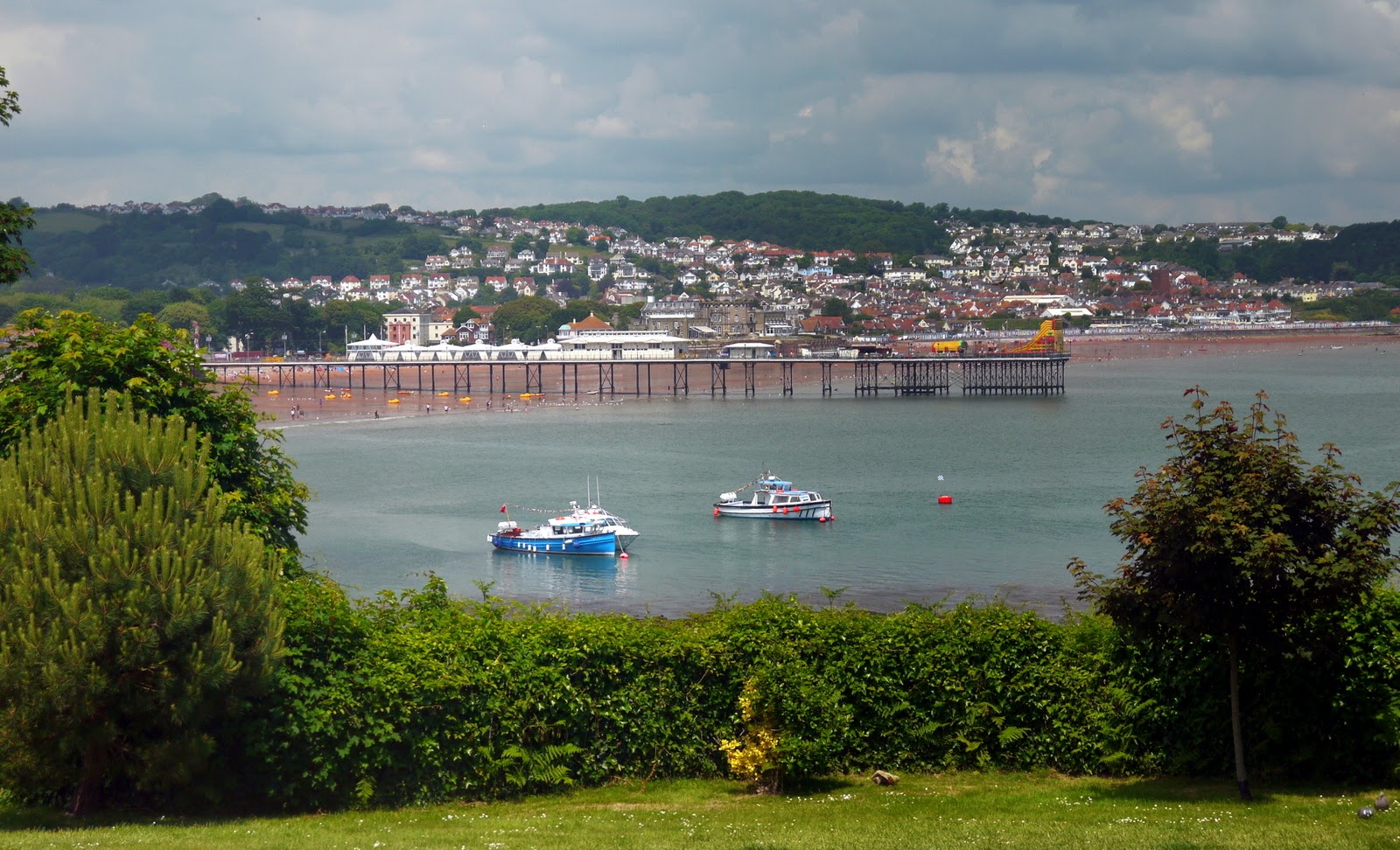
Paignton Pier
At Goodrington Sands I met the proper holiday crowds as the beach was packed with people all making the most of the good weather.  I felt quite out of place with my hiking gear on walking along the promenade.  I imagine that the beach gets only busier during the school holidays and with good reason – it is one of the nicest I have seen for quite a while and with plenty of facilities on hand for young families.  There was a big water park and restaurants/ pubs all catering for the holiday traffic and perhaps Weymouth aside this was the first time that I had really seen facilities on this scale along the SWCP.  Yet, in its way it was every bit as enjoyable as the lighthouses and rugged sections of coast.
Paignton Harbour

At the far end of Goodrington Sands I climbed up the cliff and into Roundham Gardens.  This section reminded me rather of Bournemouth in the way it was laid out.  At the top of the cliff I was surprised to see that some of the facilities, including the pitch and putt course were closed and I am guessing that these would not be open for the season.  It was also obvious that the beautiful weather I had had up to now would not likely last for the remaining part of the day.  At the far side of Roundham Head I entered Paignton.  At first this didn’t seem like a big deal as the path took me through some residential streets but then I came upon the harbour, which was a little gem.

Candy Coloured Hotels in Paignton
I passed by the harbour and saw a house that the emergency services were trying to break into. I am not sure what the back story was here but I do hope the occupant was alright.  Just beyond that and the sweep of the beach at Paignton was quite superb.  There was a funny little pier about half way along the beach – not as grand as others that I am used to but it was good to see one anyway. It rather reminded me of the one further along the coast at Teignmouth.  When I reached it I took the opportunity to have an ice cream and paused to try and gauge what was going on at Paignton Green, the park just behind the beach. Evidently there was a large open air concert planned for later in the day and the stars of the show would be UB40.  Things were obviously some way from being completed but I imagine that anyone who wasn’t lucky enough to be a ticket holder could still hang out on the beach and enjoy the music.

Paignton Beach
At the far end of the beach I had to briefly walk along the road to get around a folly like hotel before regaining the promenade.  The beach had become less intensely busy by this time and surprisingly few of the long line of beach huts were actually in use.  Perhaps the thing that caught my eye most of all along this stretch though was the tidal pool at the far end of the beach, which I took to be some kind of paddling pool.
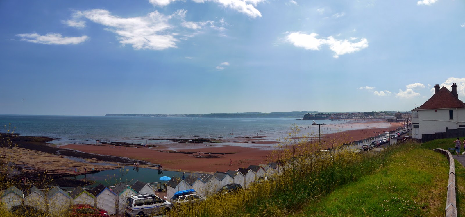
Looking Back to Paignton
In truth most of the remaining part of the walk into Torquay was most disappointing.  Apart from crossing a rather forlorn and neglected park most of the remaining walk was along the very busy seafront road connecting Paignton and Torquay.  The clouds that had threatened to cover the sky did so too, so even the views out towards Torquay Harbour were rather more ordinary than they could have been.  I crossed the road just before Torquay station to take advantage of the one viewpoint there was but in truth I was disappointed with the lighting for my picture.  Shortly after I caught the bus back to Paignton and from there had my ride on the steam train, which was fabulous!

Arrival at Torquay
Originally I had intended to walk these two days as a single day but in truth I am glad I split them as the first day was rather harder than I thought and I don’t think I would have got anything like the enjoyment from this section as I did.  True, it isn’t very challenging but it is far from being the easiest section I have completed for the weather was hot and there were a few steep if modest climbs.  Overall I was very pleased with my couple of days away and hope that I can sneak another of these short trips again before the end of the year.

Saturday, 12 July 2014

South West Coast Path Section 44 Kingswear to Brixham


Berry Head View
I had one of those extremely rare days for my next outing; a full day of walking with no time limits except for when it got dark.  Being that it was almost midsummer’s day that would be a very long time indeed J.  In fact I had managed to sneak a cheeky trip to the South West in to get a couple of days of walking the coast path in.  As I only had a couple of days to spare I decided that it would be good to walk the English Riviera section from Dartmouth to Torquay. 

Berry Head Lighthouse
I didn’t have the luxury of travelling down the night before so it was an early start from Worthing but I managed to avoid the worst of the traffic and arrived in Brixham around 10am.  I really struggled to find a long term parking spot in the town and so I thought it best to park up on Berry Head, which was near the end of my scheduled walk for the day and just outside the town.
Catch of the Day

The top of Berry Head also had a few facilities including a toilet and a place to buy drinks in the shape of a café at the adjacent Napoleonic Fort.  This was a huge structure built on an earlier Iron Age hillfort and it was easy to see why it should have been built here for the view all around Brixham and Torbay was astonishing.  Ahead I could see Hope’s Nose, a section I walked around in 2011 (scary to think it was 3 years ago!), and even further away the mass of Portland Bill could just be made out.  Apparently it is 42 miles away as the crow flies, but I know all too well how far it is to walk!

Brixham Lido
I lingered on Berry Head for quite a while enjoying the views as knowing that I would be staying overnight, I had all the time in the world.  Eventually after taking in all the views and inspecting the lighthouse (which apparently is the shortest one in England), I headed off down through the woods into Brixham.  The little fishing town of Brixham is surely one of the most picturesque of all the coastal settlements in Devon and certainly rivals some of the other fishing ports in Cornwall.  Even from the end of the coastal road I could tell that I was going to like it and fortunately there was some time to explore before my onward bus to Kingswear arrived.

Brixham Outer Harbour
The path skirted past the lido, a seawater filled swimming pool that was largely empty except for a couple of brave souls but which had the most increadible blue hue to the water and a very attentive lifeguard; attentive to me that was – he seemed to be ignoring the swimmer in the pool!  As I got nearer to town the activity increased considerably and the docksides seemed to be mostly populated by the older generation and all of them seemed to have northern accents!  Not exactly what I was expecting but then I suppose that a lot of people come here on coach trips and stay in the nearby resorts of Torquay or Paignton.

Brixham Inner Harbour
The harbour was full of activity with fishing boats being repaired and scrubbed down ready for the next trip.  I imagine though that the activity here now is minimal compared to what it would have been when the harbour was full of trawlers 40 or 50 years ago.  Like so many fishing ports the fleet in Brixham is a shadow of what it once was.  Still I was fascinated by the colours and activity of the port – for me these are some of the most magical scenes all along the coast path.

William III
A couple of notable pieces of history are commemorated in Brixham harbour.  The first is a replica of the Golden Hind ship, famously sailed by Sir Francis Drake during the Battle against the Spanish Armada.  I’m not clear on why the Golden Hind is here but it looks like a faithful replica and has been here since the mid 1960s since when hundreds of thousands of visitors have come to see what life must have been like for the sailors of this surprisingly modest sized ship.  The other reminder of our history is the statue to William III, formerly the Prince of Orange.  Brixham was the place that he landed rather bizarrely when he launched his ‘Glorious Revolution’.  Although the spin on this event was that he was welcomed into the country with open arms I can’t help thinking that he was nothing more than a usurper and opportunist with a rather weak claim to the throne.  Still, the victors write history and I cannot profess to be an expert on such things.  Brixham clearly celebrates their part in this slice of English History by providing a very fine looking statue near the spot where he is said to have landed.
Golden Hind

Having scouted around Brixham I headed for the bus.  It turned out to be one of those slightly larger than a mini bus and it was pretty full.  I did feel decidedly young though and the chap next to me seemed to belong to a completely different era as he described his latest meals to the lady sat next to him. Most appeared to contain offal, which seemed very weird.  The bus journey was about half and hour and we rattled  around the narrow country lanes until finally getting to my destination of Kingswear.  I have only been to this part of the Dart Valley once before and had completely forgotten how beautiful it was.  The view across to the famous Naval College of Dartmouth was quite phenomenal.  Below me was the steam railway that comes down here from Paignton.  Sadly no trains to look at and I wasn’t in the mood to wait a couple of hours for it to arrive.

Kingswear Harbour
I walked down past the station to the car ferry quay.  A queue of cars was waiting for the ferry to return from Dartmouth and I watched its progress before looking around for refreshments.  I soon realised that facilities on the Kingswear side of the river were quite limited and I settled for buying stuff from the steam railway café.  Supplied up I finally got myself going on the walk proper and by now it was lunchtime!

Dartmouth Ferry
I soon realised it was going to be a hot one and was pleased that a large part of the early part of the walk was through trees as the shade was very welcome.  Before the trees though and it was various steep streets that I had to negotiate through Kingswear.  Most of the housing here has been deliberately built to exploit the views out across the River Dart, but perhaps the one that did this most of all was the house known as Inverdart.  This was built for one of the Legal Director of the Great Western Railway and it certainly befitted his status as one of the bigwigs of the company.  Eventually the road ran out and I passed by the memorial of Lt Col Herbert Jones, who died during the Falklands Conflict.  The onward stretch of path around Newfoundland Cove has been dedicated to his honour and it starts with a knee crunching zig zag path back down to sea level followed by a huge climb of equal magnitude straight back up the other side.

Kingswear Station
I took the opportunity of a breather at the top and had my lunch in the cool woods that I found there.  After the shock of this rapid descent and ascent I was pleased that for awhile at least the path levelled out through the trees and every so often I was afforded the most amazing views across to Dartmouth Castle and the mouth of the Dart but also across to Start Point, an as yet unexplored part of the coast.  For this section though this was probably my favourite part of the day. I had the path completely to myself and the combination of the wooded coast and occasional views were quite spectacular.

Inverdart
Eventually I reached Inner Froward Point and came upon the coastguard lookout, now run by the voluntary organisation the Coastwatch Institute.  The occupants looked pretty intense about their business so I took the opportunity instead to look over the gun encasements and other defences for this very strategic lookout.  I decided to take the long route around the headland and this was a good move for I found lots of remnants of the old defence battery still lurking in the woods.  The complex even included an old railway which was rather curious – I understand it was used to deliver shells to a lower casement.

Dart Mouth View
Although most interesting it was pretty hard work in the heat visiting all these relics especially since at the end of the tour I had to regain all the height I had lost to go around Outer Froward Point.  The coast took a completely different look now – gone was the wooded hillside and now was a more familiar rugged and rock coast.  I also left the views across the Dart behind and for a short time didn’t get to see much of the onward path at all.  I was now focused on seeing if I could get to the tea shop at the nearby National Trust gardens at Coleton Fishacre.  I had read in my guide book that the lower gate to the gardens from the coast path was open on a Friday and felt this was an opportunity too good to miss!

Froward Battery
As billed the gate was open and I entered a very different world to the rugged coast outside.  This was a garden of lush growth and tropical plants rather than the grassland and wildflowers of outside.  What was also apparent was the size of the hill up through the gardens to get to the tea shop!  I struggled up, meeting the gardener more or less at the top.  He passed the time of day with me, telling me all about the grass snake that swims in the pond in front of the house.  The house itself was built for Ralph D’Oyley Carte, who was the impresario for Gilbert and Sullivan.  I headed straight for the tea shop without stopping and you can only begin to imagine my disappointment when I discovered it wasn’t open.  In fact I quickly realised that the house wasn’t open either – I was very cross after having got my hopes up.

Blue Damselfly
I couldn’t face going back down the hill for I knew that I would need to make another stiff climb on the Coast Path itself so I took the dog walking route that headed along the contour.  I felt very pleased with myself for at least salvaging something from this disaster but soon realised that I was in fact heading for a lengthy cul-de-sac as there was no outlet to the Coast Path at the other end.  By now I was pretty cross and so I did something I would not normally have dreamed of, which was to go off piste, climb a couple of fences and regain the official path through unofficial means!

Coleton Fishacre
The next three miles or so were tough going as the path never seemed to stay at the same level for very long.  I clung to the side of the cliff for much of the way along narrow paths, mostly in the open air although a couple of times I did head through some wooded patches, one of which seemed to be a favourite of some local horses for they left the surface of the path covered with their droppings and they weren’t too easy to negotiate!  At my arrival at Scabbacombe Sands I was really pleased to get down to sea level for my feet were hot and the opportunity to dip them in the sea was far too good to miss.  Strangely this is one of the few times I have done this anywhere on the walk (principally because I normally come when the weather is colder!).

Passing Ferry
After half an hour or so of resting and getting my feet refreshed I summoned up the energy to make the latest climb at the other end of the cove.  When I finally puffed my way to the top I became aware of some eyes looking at me and realised that there was a herd of goats waiting for me.  They certainly looked bemused by my presence but chose to ignore me after considering that in my puffed out state I was going to be no threat to them.  I was pleased that after this encounter I was able to recover my composure a little with some level walking ahead of me for half a mile or so.

Scabbacombe Sands
I was not best pleased though to find that my new found height was soon lost though as I headed back down to sea level past some pretty lonely coastguard cottages. They looked fairly deserted and I couldn’t help thinking that they must be pretty tough to get to as their track was pretty long and rather bumpy looking.  That is not a journey I would like to do on a rainy winter day…

Reaching For The Sky
This beach (Long Sands) was not as nice as the last one but it did seem popular with dog walkers.  One woman in particular was there the whole time I could see the beach chucking stones into the sea for her three dogs to chase.  She may still be there for all I know!  Anyhow, at the far end of the beach was yet another huge climb but thankfully this was to be the last.  I fact I am not sure I could have managed another one – the heat had really sapped my energy.

Heading Down to Long Sands
It was largely level walking all the way to Sharkham Point and as I got close the numbers of people increased dramatically.  I soon realised that most were early evening strollers coming out for a couple of hours of the last of the sunshine before going back to their caravan parks (of which there were many just out of sight).  After pausing for the view at Sharkham Point I trudged on only to find yet another nasty shock.  I would have to divert inland as the onward stretch of the Coast Path had been swept away in the winter storms.  This was a fairly unpleasant diversion too as I had to walk through a housing estate and then a seldom used path at the back of some houses.  My legs were stung and scratched to blazes as I fought my way through the undergrowth.

Sharkham Point View
Finally I reached the path once again and the last section into Berry Head car park was pleasant and relatively easy walking but after the rollercoaster of the day and the hot weather I was ready to finish.  It probably wasn’t but the last mile seemed like 10! 
St Mary's Bay

Although this walk wasn’t without its frustrations and I was possibly too hot to enjoy it completely, this was an incredibly scenic section and some of the views were up there with the best I have seen on the whole path.  I particularly liked walking through the fishing settlements of Brixham and Kingswear.  The gardens at Coleton Fishacre were very beautiful but perhaps my highlight was paddling in the sea at Scabbacombe Sands – wonderfully luxuriant!

Monday, 7 July 2014

Highdown Hill, Patching and Clapham


Highdown Towers

Another sunny Sunday morning arrives and I am up bright and early ready to enjoy another walk in my local area before the weather gets too hot.  This time I thought it was high time I explored more of Highdown Hill and the two villages of Clapham and Patching to the north west of Worthing.  I am familiar of course with these places but never before have I plotted a route that takes them all in together as one walk.


Iron Age Hill Fort
Highdown Hill is a familiar haunt for us when we want to go for a short evening walk.  This small outlier of the Downs overlooks the western fringes of Worthing and on a clear day it is easy enough to see the view from Beachy Head in the east and the Isle of Wight in the west.  On this particular Sunday I managed to find a very clear view and Brighton in particular shone in the early morning sunshine from my vantage point just above the car park.
Highdown View
Highdown Hill has an interesting history and the first hint of the history is the Miller’s Tomb, which is the burial chamber of John Oliver, who was the miller in question.  John Oliver was reputed to be a notorious smuggler who used the mill to warn his gang of impending investigation by customs officers by turning the sails in a certain direction.  He built the tomb when he was 56 but lived until he was 84, dying in 1793.  Some suggest that he used the tomb to stash his contraband.  The mill has long since disappeared but the tomb remains, providing a historical curiosity to all the dog walkers and other visitors to these slopes.


Far Off Arundel Castle
 Early people settled on Highdown Hill as the remains of an Iron Age hill fort will testify.  I imagine that the hill was sufficiently strategic as a vantage point that it was never likely to be ignored for long.  The panorama from the hill is magnificent with a view of at least 50 miles of coast spread before me.  I’m not sure whether the view would have been impeded by trees back then but I suspect that the view would still have been excellent.  Even on the inland side of the hill where there are still a lot of trees I was still surprised how much I could see.  The most eye catching landmark was Arundel Castle, which I have never seen from up here before despite the number of times I have been up here.


Highdown Poppy
From the crest of the hill I headed down towards the now sail-less windmill on the western slopes. This is Highdown New Mill (or Ecclesden Mill), built in 1826 but by the end of the 19th Century it was out of use and by the 1930s it was an ivy clad ruin.  You wouldn’t guess it now as in 1970 it was renovated to become a house and looks quite smart these days, although it never recovered its sails.


Roundstone Boot Fair
As I walked down to the mill a glint of sunlight caught my eyes and as I looked down to where it came from I noticed the large array of cars all gathered for the weekly boot fair at Roundstone Farm below.  The farm is so named apparently after an incident in which a mill stone rolled down the hill following an accident.  The boot fair is an enormous undertaking and from my high vantage point I could see hundreds of people milling around the site like ants.


Highdown View West
Eventually I came  upon the Angmering by-pass, only built within the last ten years but given how it has integrated into the countryside it seems a lot older.  Luckily I didn’t have to mess with it at this stage for my path doubled back around through the estate of Ecclesden Manor, a house of Tudor origin I believe although it was hidden from sight much to my disappointment.  I did enjoy the old estate cottages on the approach road though and especially their well-tended gardens.  Soon I was out into open fields and after wandering alongside some crops I came upon a camp site that I never knew existed (remember that I am no more than five miles from home here!).  The campsite appeared to be populated by a girl’s youth group (Girl Guides maybe?) and they were all busy striking camp.  The frenzy of activity seemed strange considering the peace and quiet I had enjoyed so far.


Highdown New Mill
A little further on and I passed to the side of a farm and then headed down to the Angmering Road that I had by-passed earlier. This time I crossed and walked along it for about quarter of a mile before heading under the dual carriageway section of the A27.  On the north side I met with the old part of the A27 that I remember from my childhood when this stretch was notorious for accidents.  I passed the World’s End pub, which used to be called the Horse and Groom.  As a child I remember the A27 passing through most of these sorts of places in single carriageway, making the journey quite slow but also affording us the perfect journey in which to play pub cricket.  This game kept us amused for ages and relied on scoring runs by the number of legs in a pub’s name.  This one, the Coach and Horses and the Fox just up the road was a big score with the ‘batsman’ getting at least sixteen runs for passing.  In pub cricket if the pub had a name with no legs (eg The Crown), the batter would be out and the turn would pass to the next person.


Ecclesdon Manor Cottages
My road walking continued all the way into the village of Patching but was ok because the road was pretty quiet for its whole length.  I don’t remember exploring this village very much before but I was taken with how picturesque it was.  It was hard to believe I was so close to Worthing as it was so peaceful.  The village has a large number of thatched cottages and yet somehow it managed to stay the right side of being a bit twee.


Dog Rose at Patching
I walked up through the village to take a look at the church at the north end.  The church can be seen from quite a distance away but up close it seems to be nestled into the countryside.  I had to satisfy myself with looking from outside only as it was being readied for the morning’s church service.  I doubled back and took the road over to Clapham village just the other side of the dry valley from me.  By now the day was warming up as it was gone 9.30am.  I had the feeling that it would be quite a hot one later so I was thankful for the early start.


The World's End
Clapham village is not quite as picturesque as Patching but nonetheless there were lots of lovely houses lined up along the main street.  Both are proper Downland villages though with flint cottages largely the order of the day.  I wandered up to Clapham church, which unlike its near neighbour is almost completely hidden from view and even stands away from the village it is meant to serve.  I went up to take a look although as with Patching I had to satisfy myself with an outside look for it was a Sunday.


Patching Church
I then made the mistake of crossing the field behind the church and heading into the wood thinking that this would be my onward path.  When I realised my mistake I didn’t have the motivation to go back so luckily managed to right myself by taking a path through the woods that wasn’t marked on the map.  This was a delightful walk, for the woods were thronged with butterflies and I was pleased that I had finally left the road walking behind.
Patching Cottage


Once back on the right path I left the woods and the air was suddenly filled with a much less pleasing sound as work was going on at what I took to be a rest home for the elderly although it looked like it might have had a former use.  My path then took me across fields towards the north western edge of Worthing and as I got nearer to the A27 once again the sound of traffic disturbed the peace.  I enjoyed looking at the houses on the edge of the woodland that marks the section of Downland between Clapham and Worthing but otherwise I was now reaching a much less interesting part of the walk.  At the end of my track I headed down towards the main road and as I did so the turrets of Castle Goring could be seen above the trees.  Sadly at this time of year that is all you can see of this old building as the frontage is hidden by the trees.


Clapham Church
I crossed the A27 but not without difficulty as this is an extremely busy section.  I could hear loudspeakers on the other side of the road and it took me a while to realise that these were coming from a local Gymkhana.  The piece of countryside to the south of the A27 has a scruffy and unloved feel to it although in truth this wasn’t helped by the rather dishevelled looking rape seed crop that was awaiting harvest.  This area is also zoned for housing so at some point this last piece of major undeveloped land in the Borough will probably be built on.  So far though all such plans have come to no avail as the last set were thrown out by the planning committee.


Zoned For Housing


I wandered around the side of fields and past the large Tesco that has been built here in the last few years, probably in readiness for the new housing estate.  I skirted the existing edge of Worthing and crossed another busy road in the shape of Titnore Lane.  Now my nose was filled with the pungent smell of composting as I passed by the composting facility that occupies the small quarry on the eastern side of Highdown Hill.  The track up the side of the hill was pleasant and thankfully not too steep as by now I was ready for refreshment and an end to walking. 

The Farmhouse Durrington
This was an interesting walk and plenty of history along the way.  Sadly my enjoyment was somewhat diminished by the last couple of miles which were largely uninteresting and seemed to be unnecessary mileage.  I think if I am to repeat this walk I might need to modify the route slightly but on the whole I was satisfied with my morning’s work.