Saturday, 7 July 2012

Arun Valley Walks - Arundel to Amberley

Arundel View

After the success of our family expedition a couple of weeks ago the weather was nice enough for us to have another go & so we had to find another route that was of similar length that had enough interesting things to see on the way that the girls would enjoy the experience.  Not really an official walk, but one which I had fancied for some time was to walk across Arundel Park and the Arun Valley between Amberley and Arundel, in a sense continuing the exploration of the countryside that would have been followed by canal craft using the ‘Lost Route to London’ followed in part by the Wey-South Path that I completed in 2009.  However, in view of the windy weather, the small children we had with us and having the sun at our backs we followed the route northwards from Arundel.

Arundel High Street

The journey on the train from Amberley is an hourly frequency and takes only five minutes, but left the wallet a bit light, being a very steep £7.40 for the four of us!  Arundel station isn’t the most convenient, dumping passengers on the busy A27 about half a mile to the south east of the town and leaving a rather unpleasant walk for would be visitors to the town.  Luckily, when we reached the bridge over the River Arun things improved immeasurably.  The bridge was the first opportunity for a sit down and the surroundings were pleasant enough for the girls to want their picnic already.  This worked out nicely as it meant that we had less to carry for the rest of the trip!


Arundel Post Office

Looking at the size of the River Arun, it is hard to believe that this was once a thriving port.  The odd pleasure boat comes through here now, but the former wharves have long since been replaced by housing.  Littlehampton took over port duties from Arundel some miles further downstream, but even that has long since ceased to be a port in the meaningful sense. 

Castle South gate


Arundel is probably one of the most picturesque towns in all of Sussex (and there is quite a lot of competition in that regard).  On this sunny Saturday it really looked at its best and despite the odd closed shop the town centre looked to be in fairly rude health.  We marched up the hill past all the antique shops and galleries designed to cater for the many tourists that descend on the town.  At the top we passed the enormous gateway to Arundel Castle, the gothic seat of the Dukedom of Norfolk.  Strangely, I have not visited the castle since before I can remember, but have a feeling that this will change very soon!  The castle itself is a bit of a sham, as much of what can be seen is the Victorian vision of how a castle should look.  There is an original castle somewhere inside but it isn’t easy to see from outside the walls.

Arundel Castle

Further along the road and we passed by Arundel Cathedral, another gothic creation that vies with the castle for prominence on the Arundel skyline.  It probably succeeds from the western side since the Castle occupies the eastern slopes of the town.  The Cathedral wasn’t dedicated as such until 1965, as the main Catholic Church of the newly formed diocese of Arundel and Brighton.  The girls were in a hurry to get out on to the open Downs so they could run about so only a cursory look at the architecture was afforded as we passed by.

Arundel Cathedral

We crossed the road and headed up past the cricket ground.  This is one of the most picturesque grounds in all of Britain, hosting at least one County Championship game for Sussex each year and is a thoroughly enjoyable place to watch this most English of games.  The arena is not actually visible from the track sadly, but ahead we could see Hiorne Tower, which acted as a good focal point for the way ahead.  The tower was built as a folly by Francis Hiorne for the 11th Duke of Norfolk in the 18th Century for apparently no better reason than proof that he could.

Hiorne Tower

The onward path wasn’t quite so easy to spot as we headed down into Swanbourne Valley below.  This heads down slowly to a point where two dry valleys meet to become the one that is now occupied by a small lake so beloved of water birds from miles around.  Normally our walk in this area extends only as far as a loop around the lake.  Today though we would be heading onward, up the initially steep hill on the other side to the very top of Arundel Park.  We plodded our way slowly up the hill, admiring the wild flowers as we did so.  This year seems to have been a bumper one for wild flowers – they are in such profusion everywhere and this part of the Downs was no exception!


Arundel Park
We were rewarded at the top of the hill with one of the best views from anywhere on the Downs, looking out towards the upper reaches of the River Arun.  Far below the river meanders around the base of the hill we were stood on, cutting a cliff as it does so.  The puffy white clouds together with the wind made for some interesting shadow patterns on the landscape as they raced along.  In fact the skyscape was almost as interesting as the landscape, with high level cirrus type clouds in evidence high above the fair weather clouds.  Trails from aeroplanes heading to the London airports also added to the mix, creating some very interesting patterns indeed.
Arundel Park View

For us though the high level walking was very short lived as our path headed down the other (steeper) side of the hill.  The wildflowers that had been lost through the sheep fields that we had travelled through now returned in profusion, mostly a palette of purples and yellows, with the odd common spotted orchid thrown in.  It was quite a steep track though and we had to keep our wits about us so as not to slip over.  At the bottom where we entered some woodland the path was especially slick after all the rain we had had.

Common Spotted Orchid

We passed through the large flint wall that surrounds Arundel Park and turned right to follow the path back towards Arundel alongside the River Arun.  We wanted to cross the river at South Stoke via the only bridge in these parts.  The path through the woods was no joke though – some of the forestry vehicles had obviously been this way before us and there were a lot of very large muddy puddles disrupting our progress.  For the kids this only added to the adventure of the trip, especially as it was touch and go in some instances whether they could hang on to their shoes!

Shadow Over the Barley

Eventually we picked our way through the woods and came out into a section alongside some large barley fields.  The combination of sun breaking through the clouds, picking out certain parts of the fields and the wind waving the feathery crops around was quite a mesmerising spectacle that we all enjoyed.  Eventually we reached the  small village of South Stoke, where we stopped in the churchyard for a bit of a breather and an afternoon snack to help small people’s energy levels.  Fortunately St Leonard's Church was open and so we took the opportunity to look inside.  It was a very peaceful church, not very large but well kept and with a modest stained glass window at one end.  The church itself was built of knapped flint, like most proper downland churches, but also had an unusually thin tower.  In the churchyard was a small flock of sheep being used to try and tackle some of the grass that had grown up around the graves.

Fearsome Mud

After some refreshment and a few minutes to rest we pushed on, heading around the perimeter of the church and making our way down to the River Arun.  We crossed via the substantial bridge that looked as if it were provided for a possible road route that never quite happened.  A look at the map will show that the roads stop no more than about half a mile apart on either side of the river.  I guess having a through route would encourage far too much traffic, so perhaps it is a godsend that it doesn’t exist, for the tranquillity of the valley.

St Leonard's Church

We turned immediately left and followed the riverbank for a short distance before heading through another stretch of woodland that appeared to follow a former meander loop.  Again the mud through here was fearsome in places and we had to lift the children over the worst of it.  Yet, the flowers through here were doing really well, with guelder rose, elderberries, cow parsley and briar roses all doing really well and adding a lot of colour to the woods.  The second bridge of our walk was a distinctive little suspension bridge, which seemed to take us across the bog that had now formed from the old meander loop.

Arun Bridge

The field the other side was full of bullocks – almost all of them stopped what they were doing as we headed through and stared at us.  It made us all feel rather self conscious!  We headed quickly but steadily across the field, breathing something of a sigh of relief the other side (although we weren’t seriously in any danger).  At the far end of the field we entered the village of North Stoke, a place that seemed to be stuck in a time warp, well out of range of normal passing traffic or visitors, stuck down here at the end of a lengthy cul-de-sac road.  I guess this would be an ideal place to live for lovers of peace and quiet!

North Stoke Suspension Bridge

We headed along the road initially for the last leg of the journey, but soon opted to take a slightly longer route along a footpath heading back to the river after we had some uncomfortable encounters with cars.  The footpath turned out to be little better as we had to use various pieces of wood to try and help us cross the path-wide puddles that had formed.  By the time we had reached the riverbank once again we had stretched every leg muscle possible trying to avoid the worst of the mud, getting stung or prickled!  At the riverbank we found another obstacle in the shape of another herd of bullocks completely blocking the path the other side of our stile.  They formed quite a formidable barrier to our onward progress but luckily a few handclaps soon moved them on and they didn’t cause any bother.  The rest of the walk along the riverbank to Houghton Bridge was uneventful and surely nicer than walking along the road.

Being Watched

We did face one last unpleasant stretch though across Houghton Bridge, a rather narrow structure that can only just accommodate two lanes of traffic.  As pedestrians the crossing is a little scary, so we hurried across when there was a momentary absence of traffic.  It was a bit of a sting in the tail after such a pleasant and peaceful walk.  We were really proud of the children who completed the five miles with no great problems and had a thoroughly good time exploring on the way.  I have a feeling we may well try other routes in this area, helped by the presence of the train line.  There are numerous possibilities between Billingshurst and Littlehampton to keep us amused!

Houghton Bridge

Monday, 25 June 2012

Chichester Ship Canal

The Richmond Arms

For my latest outing it was Father’s Day and so it seemed highly appropriate to design a walk that we could all do as a family rather than a solo outing as I normally do.  With my daughter’s little legs in mind (they are 8 and 5), I thought that the perfect outing would be to explore the Chichester Ship Canal, a short walk of four miles.  We parked in the small village of Birdham and caught the bus to Chichester, getting off at the canal basin just to the south of the City Centre.

Chichester Canal Basin
Although for the most part the weather this summer has been pretty dire, it was a much better day and spirits were high as we embarked on our outing.  The tow path was pretty good too, not suffering too much with the amounts of mud I have had to endure elsewhere on my recent walks.

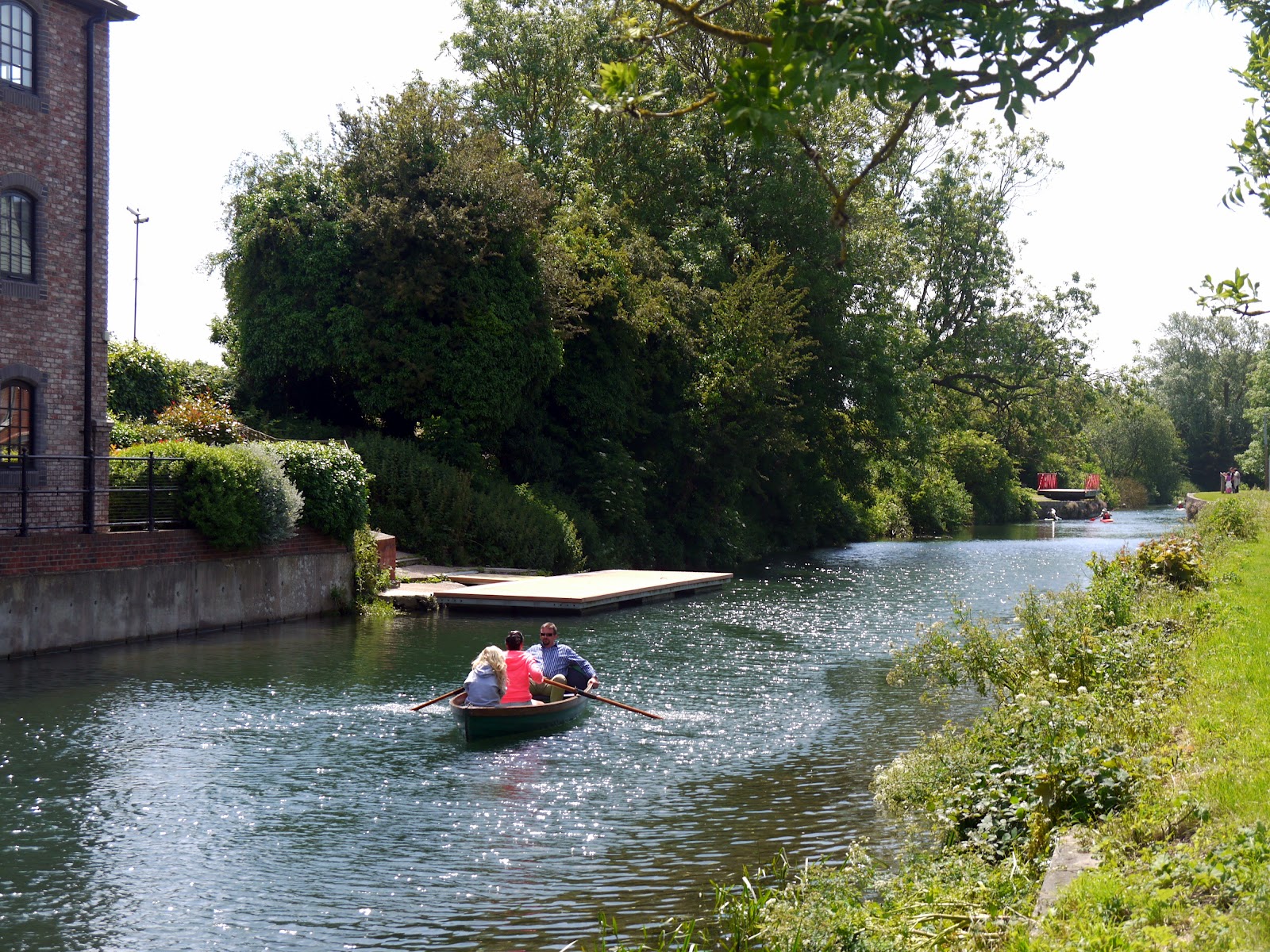
Rowing Near Poyntz Bridge
The Chichester Ship Canal was a short arm of a much bigger canal network designed to link London with the south coast of England, allowing for the distribution of materials to Portsmouth without using the open sea.  This network was conceived during one of the wars with France, but was built far too late to get any decent business.  

A Quick Breather
This part of the canal left the river Arun at Ford and cut across the open countryside to the north of Bognor Regis, coming out into open water at Chichester Habour where an inside passage route could be used as far a Portsea Island.  The branch into Chichester led off from Hunston to access the city centre itself (for more information please also see my walk at Portsmouth and Arun Canal).  The last shipping to use the ship canal was in 1906 when the canal basin was sold initially to Chichester City Council, who then passed in to West Sussex County Council in 1957.

Peaceful Canal Near Stockbridge
The basin was full of activity, with a group of sea scouts kayaking and messing about in various boats.  More building had taken place in the area since my last visit in 2010 and a new group of swish looking flats had been completed overlooking the south west corner of the canal basin.  With a route like this there was almost no chance of the children getting lost and they were thrilled to be let off the leash and explore further by themselves.  My older daughter was put in charge of her own camera so that she could take pictures of stuff that interested her along the way.  It soon became clear that she took this very seriously indeed and practically every blade of grass was recorded for awhile!

Coot Chicks
Just to the south of the basin is the old Poyntz swing bridge.  This is no longer in its original position but has been lovingly restored and looks to be in great shape in its new location.  It looks to be mostly for decoration these days as it seems to be stuck in the open position all the time.  The next bridge is a much more modern affair, carrying the bulky weight of the A27 Chichester by-pass across the canal.  The tow path takes a route underneath and for about 50 metres the path takes on a dark and dingy course.  This really is the only modern interruption to the sedate course of the canal though.  The onward fairly straight course down to Hunston is a delightful and peaceful route.

Egremont
The tow path is shared by National Cycle Route 2, the coastal route that connects many of the seaside towns in Sussex.  It proved to be very popular with cyclists and every few minutes we had to stand aside to let them by.  The canal sides were alive with life with irises, blackberries and large clumps of cow parsley among the many flowers in full bloom.  These in turn attracted quite a lot of butterflies, particularly Red Admirals, which seemed to be particularly abundant.

Punting By
About halfway to Hunston we were passed by the small narrowboat that conducts pleasure cruises along the canal.  The crew gave us a cheery wave, which was much appreciated by my girls.  We were also treated to an aerial display by a common tern, which showed some surprising manoeuvres in the air.  It was one of a number of birds that seemed to show interest in us, with sparrows, robins, black headed gulls and pigeons also joining us at various intervals along the way.

Return of Egremont
A couple of less conventional craft passed us as we approached the bridge at Hunston.  These were a couple of surf boards, being punted along the canal by a couple of very enthusiastic looking rowers.  They gave us a wave as they proceeded very quickly towards Chichester.  We took the opportunity of a refreshment stop here to mark the fact that we had walked the first mile of our route.  The path crosses the bridge at Hunston to provide a good view back towards Chichester.  By walking round the house being redeveloped on the other side we were able to regain the towpath.


Rosebay Willowherb
At Hunston, the canal does a sharp right turn. This betrays the fact that this was once a junction of canals, although the onward route towards Ford is now completely filled in and lost to history. Fortunately the Ship Canal is still in good shape and so we continued on towards the sea enjoying the plethora of flowers as we did so.


End of Navigable Section
About half a mile on from the former canal junction is another transport relic – the old bridge from the Selsey Tramway.  Only the bridge abutments remain but it doesn’t take too much imagination to work out where the route would have gone as on the towpath side a long straight, if rather overgrown, path heads off into Hunston Village and would once have gone on to the small town of Selsey.  The old railway was a short-lived and troublesome affair, being built on the cheap and not very passenger friendly.  It succumbed to road competition fairly quickly and had a service life of only about twenty years.  Flooding and breakdowns were a constant problem and the number of wayside halts on the journey probably made for very slow journeys.
Racing Along the Towpath

Not far past here was the end of the navigable section of the canal and we passed the narrow boat heading back in the opposite direction around here.  The numbers of walkers and cyclists had also dropped off, which made life easier as far as monitoring the children.  The picture taking from older daughter had lost its novelty by now too and I seemed to be carrying camera and younger daughter’s rucksack in a bid to keep the speed going!  Eventually we came to a road, where the canal had been filled in with the road foundations, presumably a good many years ago.  It wasn’t an easy road to cross as it was strangely busy for a ‘B’ road.
Extra Large Dandelion Clock

On the other side, the canal seemed to be at a lower level, suggesting perhaps that the road had originally marked a lock that no longer exists.  A little further on and we had a lengthy encounter with a cormorant, which fascinated the children no end as they watched it preen and clean its feathers.  Eventually it flew off with a languid kind of flight along the route of the canal.  This part of the canal proved to be a very hot section as the sun was fully out now and there was little shade.  As soon as we could we stopped again for a snack to perk up the kids and continued on our way through a delightful section full of trees sporting blossom still.
Chichester Marina

The next road that we reached was the one that we had used to get back to Chichester on the bus.  Again this was super busy and not so pleasant to cross.  However, we were by now reaching the ¾ mark of our walk and in the home straight.  We crossed over and headed along the side of the road into the large marina at Birdham.  This was perhaps the least pleasant part of the walk, although walkers were catered for and the traffic into the marina was quite light.  On the way we saw the biggest dandelion clock we had ever seen (although to be fair I think it might have been another plant with a similar seed head).  The canal here looked quite sorry for itself, with weed choked sides and looking a long way from being navigable.  Yet as a wildlife corridor it is probably invaluable since much of the surrounding countryside is now given over to arable farming.
Houseboat Norana

At Chichester Marina, the character of the walk completely changed.  Gone was the quiet and peaceful countryside and with it came the buzz of yachting folk.  The marina itself is a sea of masts of some very large looking craft.  I suspect many millions of pounds of boat traffic is tied up in the marina, although strangely given the type of day it was, the numbers left in port were a little surprising.  More interesting perhaps than the lines of yachts were the flotilla of houseboats moored along the last part of the canal route.  Most were moored on the south side of the canal, with some curious little moving platforms used by the boat dwellers to reach the parking area on the other side.  We were rather tempted by one houseboat that was for sale, but the price rather put us off!  Although no doubt a wonderful place to live in summer, I suspect that it would be pretty awful during the winter months.
Birdham Pool

At the end of the canal was Saltern’s Lock, which allegedly still works although looking at it I have my doubts.  We crossed over the lock and wandered down towards Birdham Pool, where another huge collection of sailing craft are stored.  The sea of masts just proved to me what a popular pastime yachting is, especially in this part of the world.  We had finished our route along the canal though and so all that was left was to walk the half a mile or so back to Birdham Church, where we had parked earlier in the day.  The girls had a wonderful time on the walk and it proved to be a good little project for both of them, enabling them to feel as if they had achieved something without being too much for them to handle.

Birdham Church


Thursday, 7 June 2012

1066 Country Walk Section 3 Battle - Winchelsea


Battle Abbey

It has been almost a month since my last walk, with the brief spell of good weather coinciding with a busy time for me and the return of awful weather just as my calendar is free again L.  A glance at the weather forecast immediately following the Jubilee weekend suggested that I might be lucky if I headed to the east of the county, so with a full afternoon and evening at my disposal I thought I would have time to finish the 1066 Country Walk that I started a couple of years back with my wife.  We seem destined not to finish the walk together as the logistics are too difficult, so I decided this might be the best opportunity.

Battle Church
The weather on the way over to Battle wasn’t great, but the odd glimpse of sunshine through the clouds suggested that I might just get lucky.  I parked up at the station and within minutes the sun came out!  I decided that I would head to the town centre first to have another look since the last time I was here the weather wasn’t great.  The sun obliged this time and I managed a few decent shots before getting on my way.  Battle is quite a touristy town of course and one of the few places in England where it is commonplace to see signage in French as well as English, courtesy of its place in the respective histories of the two countries.  For it is here, rather than Hastings, where the real action of 1066 took place (hence the name of the walk!).  Battle Abbey is at the heart of the town, marking the point where the erstwhile King Harold lost his life in the famous Battle of Hastings.

Battle High Street
The high street of Battle is full of interesting shops but sadly suffers from far too much traffic.  I can remember this being a problem for as long as I can remember and even today on Wednesday lunchtime it was choked.  I didn’t linger too long, wanting to get some miles in while the weather was good.  According to the forecast I expected conditions to get better, but with all the rain around the country I couldn’t be certain.  The clouds certainly cleared away quickly as I left Battle along the flower lined Marley Lane, passing an old school built in the Dutch Style and looking as if it has recently been refurbished.  A little further on, past the level crossing, I passed the first oast house of the day, Blackfriars Oast.  As with many of these old places the oast house had been turned into the centrepiece of a grand home, a far cry from the original use of drying hops for the brewing industry.

Wildflower Bank
Just past the oast house and I headed off into the woods, initially along a squelchy path through what felt like a tree lined tunnel.  Once across the main stream at the bottom though the path opened out into a large ride through the trees and took a very straight route through Great Wood.  The going underfoot was rather easier and this section was really enjoyable as the sun popped out now and again, giving rise to some real warmth as it did so.  I wondered about the need for my rain coat and long walking trousers at such moments, but I kept them on just in case of a passing shower.

Great Wood Rhododendrons
The woods were full of wild flowers – inevitably the rhododendrons were the most obvious with their big blousy purple blooms, but also the show of common spotted orchids were pretty impressive too.  It was an enjoyable section of the walk so early in the day.  Eventually I came out into Seddlescombe Golf Course, which was curiously empty save for a couple of old ladies that seemed to have trouble hitting the ball more than a few yards.  Luckily they had a golf buggy on hand to try and speed things up, as if they were walking I fear they would still be on the course!


Clouds Breaking Up
Shortly after I passed through Norton Farm, the scene of the next oast houses and the first that I managed to get up close and personal with.  The cowl vane at the top were decorated with a farmer and horse drawn plough, a familiar adornment to these features.  The main house at the farm looked like it had been a victim of the ‘windows tax’ of a couple of hundred years ago but strangely the house didn’t look old enough.

Common Spotted Orchid
I crossed the main road just ahead and headed down a path to the side of a house that had a very annoying barking dog that seemed determined to ‘see me off’.  Meanwhile the path was a bit weed choked and my trousers soon got very wet from all the moisture that the vegetation had clung on to.  Thankfully the sun dried them off a bit, but I was glad that I hadn’t been tempted to remove the lower legs as I would surely have been very uncomfortable from stinging nettle rash.  The onward path continued through some wet meadows flushed with the bright yellow of buttercups and thronged with damsel flies buzzing around.  Despite my best efforts I had a hard time getting any pictures of them – I have come to realise that the new camera really doesn’t handle such shots very well.


A Good Drive Spoiled
I crossed another road and the route now seemed to definitely follow a small stream as it wound around the countryside.  This made for nice flat walking and was nice and easy going through fields of sheep and cattle that didn’t seem to bother me too much.  The path wound around the landscape a bit before finally making an entrance into the edge of the village of Westfield.  Houses in this section of the village were still sporting their Jubilee decorations from the weekend just passed.  I was just starting to enjoy the decorations when the path suddenly turned right and headed down into a dark valley below.  This was only a short cut though and I soon came up the other side of the valley into a separate part of the village.

Norton Farm
I popped down to the shop to get some refreshments before heading on.  I caught sight of a couple of scarecrows as I passed through the village & I remembered these from Battle a couple of years ago.  I guessed they were part of the same festival, although I was surprised not to have seen any before this.  The first was of a gold medal winning athlete, while the doctor’s surgery inevitably had a doctor and nurse outside.

Westfield Approaching
The path didn’t give a lot of opportunity to look at the village, heading out across fields and past the cricket pitch.  Given all the rain we have had I did wonder how much cricket they have managed so far this year?  Just the other side was Downoak Farm, complete with oast house.  This one had a cowl decorated by a group of lambs.  Across the way from the main farmhouse was a large house hidden behind a very overgrown looking garden that was starting to escape into the surrounding fields in the shape of some very lush looking rambling roses and honeysuckle.

Winning The Gold
My onward path took a rather unwelcome course across a rapeseed field, now virtually devoid of flowers.  The developing seed pods had intertwined, making for a very difficult route across this and the next field.  In fact the second field at the top of the hill seemed to have developed quicker than the first.  This made the field even more difficult to cross as the plants had drooped over under the weight of the seed pods.  The interlinking between the plants meant that it took all my strength to push through!  I was very pleased to make it through eventually and was pleased that these were the only two fields like it today.  I wandered through yet another farm and then passed a very beautiful chestnut tree with bright pink blossom rather than the usual white. 

Escaping Garden
Once past Pattleton’s Farm I got a view of sorts as I passed through a couple of sheep fields.  The view was of Doleham valley, with the outskirts of Hastings creeping over the hill in the distance.  I made my way to the bottom of the valley, where my path was joined by the link from Hastings.  This will be a future section, probably to finish this walk completely.  The signpost told me that it was 6 miles, while Icklesham, the next village en route was a couple of miles further on.  Shortly after I crossed the Marshlink Railway just south of Doleham station.  Any notion of breaking the journey here is now virtually impossible for this little remote station now receives little more than a ‘sulky service’ with trains only calling at rather impossible times of the day.  These are clearly not for the benefit of passengers, but just a means of ensuring that the station doesn’t have to be closed.  Almost immediately after I crossed the line a train ran past, something I couldn’t have planned better if I had tried!

Walking Through The Rapseseed
I climbed up and away from the railway getting a great view back across the countryside that I had walked across as I did so.  At the top was a secluded pond, a fairly common sight throughout the day.  I wondered whether they were dug to provide a water supply?  Certainly most of them were now unused for that purpose and indeed many were so surrounded with trees that it was impossible to believe that they had any use at all.

Pink Chestnut Blossom
I joined Doleham Lane and had a short stretch of road walking, passing the most remote post box I have seen for many years.  In fact it was difficult to understand why it was provided at all as Doleham was at the bottom of the hill and in any case only amounted to a dozen houses.  I continued around the lane enjoying the activity in the hedgerow including all manner of insects servicing the flowers and the odd rabbit scarpering into the undergrowth as soon as they caught sight of me.

Marshlink Train
I left the road at Lidham Hall and after passing the farm next door I came upon a conundrum when I reached the end of the track.  I faced five gates and no sign showing me the onward route!  Luckily after some scouting I discovered the signs were buried in the hedgerow and managed to get the right gate.  As soon as I opened it, the three horses in the field came galloping over to greet me.  I wasn’t sure whether they were friendly or not as they came sniffing round me, but as I tried to close the gate behind me they spooked and ran away almost as quickly as they had come.  I was certainly very wary of them as I crossed the field. 

Being Reclaimed by Nature
The path at the other end of the field was almost as difficult to find as the sign was hidden behind a bush.  Thankfully I made it through and wandered across a corner of Brede Level, which was suitably marshy.  I was pleased to resume a course of higher ground at the other end and was surprised at the rather stiff climb to the top through yet another farm.  As I passed through the farmyard the clouds, which had been thickening up for the last few minutes started to release the odd drop of rain.  This seemed to provoke a couple of lambs into action and they yelled as loudly as they could as I passed by.  I guess they thought I was the purveyor of bottle!

Icklesham Village Shop
The ridge walking was quite pleasant as I pushed along a stony track.  Icklesham, which was my next destination was now coming into view.  Along the ridge were some interesting sights including a commercial vehicle from the 1960s that looked as if it had been parked here for decades rather than years.  Nature was slowly reclaiming it, along with the junk that scattered the adjacent field.  Further on and I came upon a broad bean crop that had been picked and put in baskets but left abandoned by the side of the field.  It was all decidedly odd!  I passed through the latest farm and headed downhill once again crossing a small valley before ascending once again into Icklesham.  I had a small break half way up the other side of the hill, thinking that the rain was well and truly stopped now.  A quick check of the weather forecast suggested that the sun would return shortly.  I hoped so, for the finale of this walk looked quite promising…

The Duchess of Cornwall
I found the shop in Icklesham, although it wasn’t exactly where I expected it to be.  In fact it was rather unlike any other shop I have ever seen – it appears to be set up in the annexe of one of the houses along the main road!  The inside resembled one of those shops that you find on a camp site.  The choice of drinks wasn’t great but I took what I could get and hoped that this obviously new venture makes a go of things.  When I came out the spots of rain had come back.  I casually looked at the bus timetable on the offchance there might be one back to Hastings but discovered that I would have a 40 minute wait.  My weather forecast was still suggesting better things so I pressed on.  I continued on my way, passing another scarecrow – this time one dressed as the Duchess of Cornwall!

Icklesham Church
As I reached Icklesham Church the rain stopped and I had a good look around the church yard.  The church itself seemed rather shy, being completely surrounded by trees and not really visible from outside the churchyard.  I pushed on, seeing the rather strange sight of a woman pushing a mobile clothes hanger along the path towards me, the kind you might see in a clothes shop.  It looked rather awkward and I offered help but she declined politely in a strong Italian sounding accent.  Not something you encounter very often & all rather surreal.

Icklesham Mill
The rain started coming back, a few drops at first but after a few minutes it got steadily heavier.  I passed by a field with some very distinctive markings – especially their black bottoms!  They seemed to have aroused the curiosity of a couple of young girls, who were taking lots of pictures of them and were completely immersed in what they were doing.  They certainly weren’t dressed for rain!  As I approached Icklesham windmill the rain got heavier still and by now I was getting quite wet.  Sadly I didn’t have the inclination to pause to look at the windmill in any detail and continued my journey to the road ahead.  I paused under the trees for a few minutes and consulted the weather forecast, which stubbornly suggested that we were due bright sunshine within the next couple of hours.

Winchelsea New Gate
When the rain eased a little I pushed on, through a field full of rabbits and then some nervous looking bullocks.  They looked as fed up as I felt especially as it was clear to me now that the rain had set in for some time.  I passed Wickham Manor, a wonderful looking old building and down to Winchelsea New Gate.  This curious edifice is all that remains of the town walls of this ancient town, one of the original Cinque Ports.  It was difficult to enjoy all this though as the rain continued to come down heavily.  When I got to Winchelsea proper I took a quick look around the old church yard and then decided that I would simply wait for the next bus, with no prospect of the weather getting any better.  From what I had seen since Icklesham, I felt this section deserved far better attention than I was able to give it and decided therefore to abort and come back on a more benign day when I could look around properly.  There certainly didn’t seem much point in pushing on to Rye for the end of the walk.

Winchelsea Church
Thus I had a frustrating end to the day, but the bus and train combination back to Battle worked pretty well and by the time I got back to Worthing the sun was out again!  I shall be back for more of this route – perhaps to try my luck from Hastings rather than Battle.  The last section from Icklesham in particular looked very interesting!