 |
| Crackington Haven |
It pays to think on your feet when doing any section of the South West Coast Path and that was especially the case with this section of the walk. For some reason I had a time that I needed to be at the path for the purposes of the bus but when I arrived I found that I had read the timetable incorrectly and I had to quickly change plans. So it was then that I started this section, having already committed to parking all day, rather than getting the bus over to Bude and walking from there.
 |
| Cam Head |
This is a longer section than from Bude to here and I reckoned that it was going to be very tight to make the bus at just after 6pm but I decided to go for it anyway. It promised to be quite a tough day of walking - one of the toughest sections I have left to do. The beach at Crackington Haven looked very inviting and was filling with people at mid-morning when I got underway. I made a mental note to try it out when I had finished walking for the day.
 |
| Cattle at High Cliff |
It was a fairly gentle introduction to the path on an undulating route away from Crackington Haven but soon I reached Cam Head and the first stiff climb of the day up a zig zag path. It was quite tempting to divert inland from here as there was a path cutting off the headland but I am glad that I didn't for the view at the top was quite magnificent and enabled me to get a flavour of what I had to do for the rest of the day. Way off in the distance I could see Tintagel and a little closer I could see Boscastle, an intermediate staging point and where I had already clocked would be a good ice cream stop. I paused to catch my breath and enjoyed the view for some time before steeling myself for the next section.
 |
| View From High Cliff |
I crossed a bit of a moonscape with very little vegetation and what looked like an area that had been extensively quarried hence the scarred landscape. My way forward was generally uphill but relatively gently and with quite a lot of up and down sections along the way. After escaping from Cam Head I largely had the path to myself now too and it was a delight. As I climbed steadily the inland landscape opened up too and the views became more extensive by the second. Strangely although I think there are far stiffer climbs in the county I eventually found my way to High Cliff, the highest point on the Cornish part of the South West Coast Path. At the top were a small herd of cows all clubbed together to presumably protect themselves from the worst of the heat. They were my only companions for quite a while. I was glad of that since I was probably quite a sight on this very hot day slogging up the hills.
 |
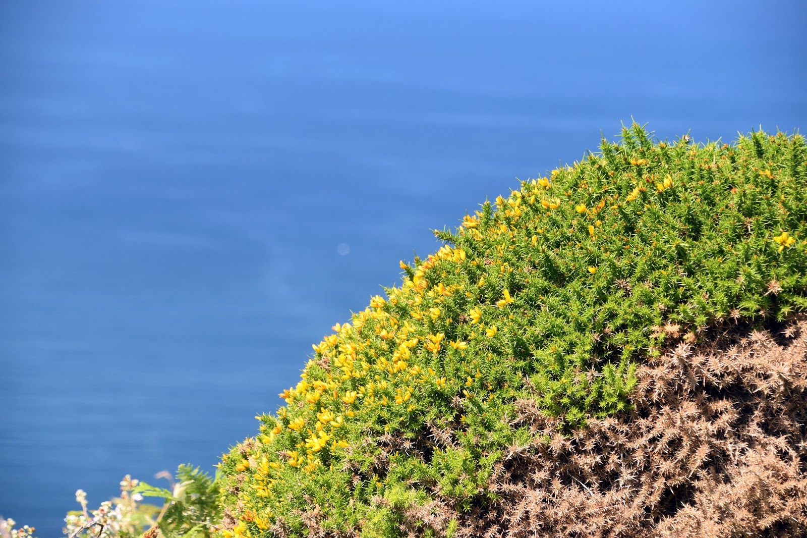
| New Gorse |
This section would not be for the faint hearted if they were to look down from any of the cliffs. They are truly vertigo inducing! However I found the contorted folding and general geology of the rocks utterly fascinating. The sea could be heard waging war on them from below but it is going to take a very long time indeed to denude them. Perhaps a sign of their robustness is that this part of the coast has few rock falls interrupting the flow of the path.
 |
| Popular Spot |
I passed by the first walker for a while near Rusey Cliff. I remembered him for his lack of shirt, very suntanned and weather beaten face, bushy beard and looked like he was carrying his life on his back. We exchanged pleasantries and went on our way - I would be seeing him later. Further on and I came upon a lot more walkers going in the opposite direction. Having been down a large dip and back up the other side in quick succession I felt a little smug as I headed down the next descent as they slogged their way up. I was now at Fire Beacon Point and as I made my way down to the bottom of this particular slope I could see gorse flowers already coming out for the new season. It amused me as I once heard that gorse actually manages to flower all year round - difficult to argue when I see them flowering in July!
 |
| Pentargon |
By now the path was getting a bit busier as I approached Boscastle. The path to the inlet called Pentargon was largely level and was a delightful interlude after all the climbing and descending but any notion that it would be like that for the short distance to Boscastle was soon scotched when I saw yet another plunging descent into the small valley and stream that empties into Pentargon. Once I was back up the other side it was a nice easy walk into Boscastle. I did have the sense that I was unlikely to get to Tintagel by the appointed time for the bus and quickly checked the timetable and realised that if I didn't make the bus I had intended to then there was no way I would get back to Crackington Haven as the last bus didn't stop there. A quick rethink was needed and a new plan was hatched. I would run along to the bus stop in Boscastle and head back to Crackington Haven straight away.
 |
| Entering Boscastle Harbour |
This proved to be a good plan as I made it with a few minutes to spare and the bus was also a bit late much to the chagrin of the couple already waiting at the stop. They reported that the previous bus a couple of hours earlier failed to show up at all and they were worried that the same would happen with this one. Thankfully it came and I snoozed on the short trip over to Crackington Haven, waking up only just in time! An ice cream here soon revived me and I headed over to Tintagel so that I could catch the bus back to Boscastle and recommence my day's walking. All a bit convoluted perhaps but it provided a much needed couple of hours break in the middle of a very hot day when I most needed it. I stocked up in the charming village of Boscastle before heading on.
 |
| Boscastle |
The path took me down the side of the very narrow harbour, which was the scene of a horrific flood in 2004 when the effects from more than 1000 people were swept away. Miraculously no-one was killed but the devastation took some time to repair afterwards. Looking at the narrow river mouth it was easy to see how such an event could take place. Even the pleasure craft had only a small entrance to negotiate before being able to head out into the open sea.
 |
| View From Willapark |
The path out of Boscastle was possibly my favourite part of the day's walking. I plodded up to Willapark - a rather curious looking tower on the cliff above Boscastle Harbour. It was orginally built as a summerhouse but its lookout potential was obviously realised quite quickly as it soon doubled up as a watch tower for the Board of Trade to help with the war against smuggling. It then served as a coastguard lookout until the 1970s and is now a Coastwatch station, one of so many that I have passed along this coast.
 |
| Willapark |
Further along the coast was a structure of a different sort - it looked like the remains of a mine. I haven't been able to find out much about it but apparently there were seams of silver and lead that were exploited here. I felt my pace slowing down as the miles under my feet started to tell and I was very please to see a eat with a great view back to Willapark a bit further on. I found that the seat was actually dedicated to a certain Harry Hill MBE. Well done that man - much appreciated! After lingering here for a few minutes I felt ready to push on along Trevalga Cliff and soon swapped the view back to Willapark for a forward view to Tintagel that was starting to get quite close.
 |
| Harry Hill's View |
I had a couple of narrow valleys to cross first - the first was the delightful Rocky Valley where I had to negotiate a valley that was definitely rocky! It was obviously popular enough of a local attraction that it had managed to acquire a caravan park next door. Quite what the dog walkers thought of me as a sweaty mess when they were out on their sedate evening stroll is anyone's guess. Having traversed Rocky Valley I had a smaller one to cross a bit further on - this time crossing a track that led down to a secluded beach. Even at this late hour there were a number of families heading down for a late swim, no doubt taking advantage of the low tide. I suspect that the beach disappears when the tide comes in.
 |
| Top Man |
One more big climb awaited me and I was mighty relieved when I got to the top of the rather confusingly named Willapark - I hadn't gone round in a circle; the locals obviously ran out of names for headlands! As I headed along this stretch I was followed by a friendly stonechat - I have really appreciated their curiosity and friendliness along the path. They make nice companions and it's almost as if they are willing me on to finish! This little one I reckon was the welcoming party into Tintagel. I certainly welcomed the end of the day's walk - it was spectacular through but I felt like I had had a thorough examination!
 |
| Stonechat |


No comments:
Post a Comment