 |
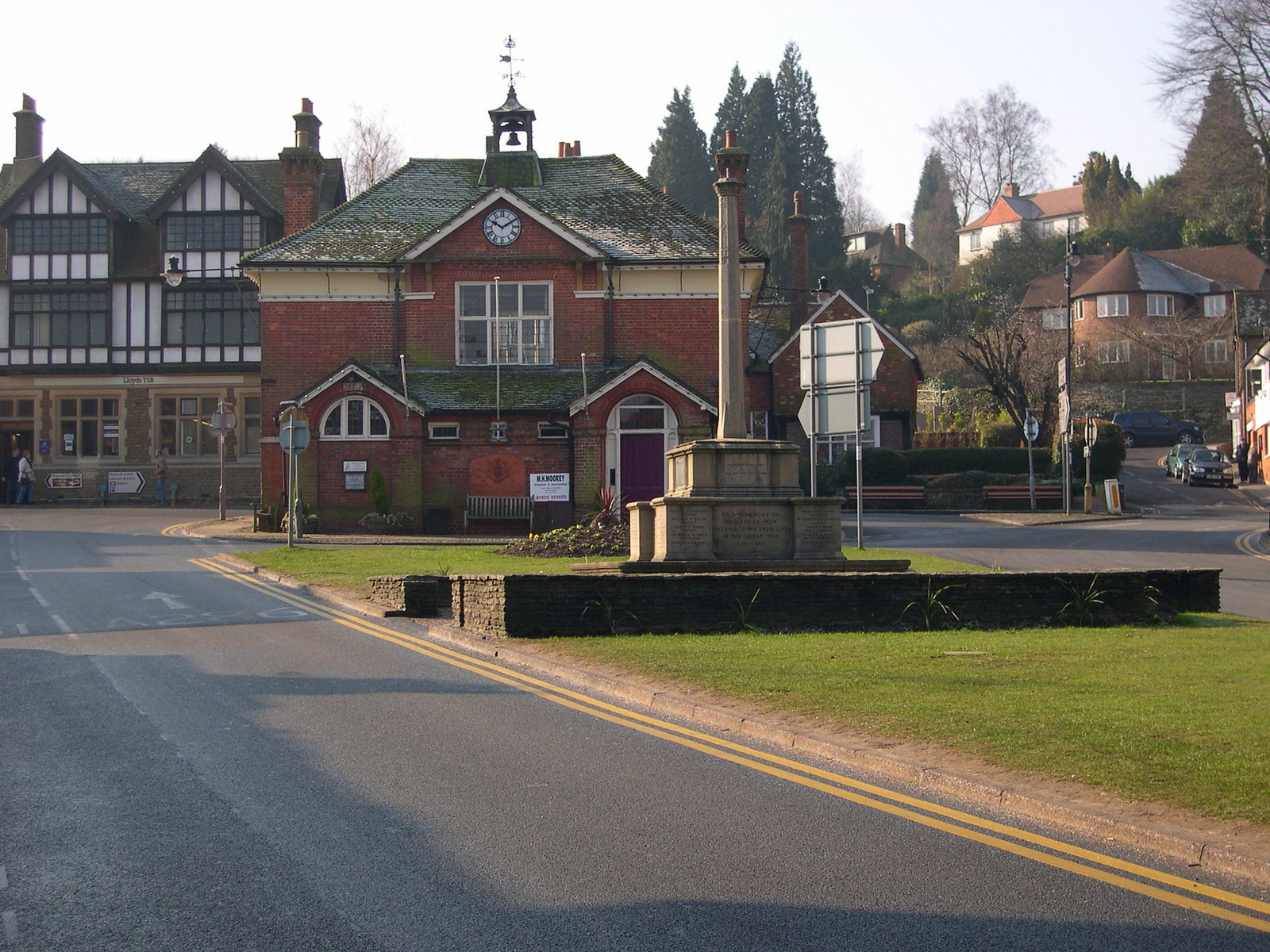
| Haslemere Town Hall |
The Greensand Way is an excellent alternative to the North Downs Way, tracking a few miles to the south along the less well known Greensand Ridge. This is rather intermittent in places but also has the highest hills in South-East England, making for some great views. The best bit about this walk is that so few people know about it! As with all my walks the route can easily be followed using a mixture od car and public transport - I did not stay away from home for any of the legs. I completed this walk during 2004.
 |
| Official Start |
For me this was actually half a day, since I also walked the next stage on to Shamley Green. However, this made for a very long day of 18 miles and to be honest, I think the day is better being broken up.
 |
| Wintry Start |
Haslemere is a market town in the very southwest corner of Surrey. It can easily be reached by train via Chichester or by car in about an hour from Worthing. My advice would be to drive to Witley station, between Guildford and Haslemere and take the hourly train to Haslemere (about a 10-minute ride). The Greensand Way official start is at the Town Hall in the middle of Haslemere. Just up the High Street is a small twitten on the left, where you will see a sign proclaiming the start of the route and giving the distance to Ham Street and Limpsfield (the halfway point, which lies on the Surrey/ Kent border).
 |
| Ponies at the Devil's Punch Bowl |
The first part of the walk takes you through the outskirts of Haslemere and past some very large houses before you climb up onto Hindhead Common near to the wonderfully named Devil’s Punch Bowl. This is so named because of the shape of the valley and the way that the mist appears to ‘spill over’ the valley sides. Climbing up to the top of the Common is by far the hardest part of the day and the rest of the walk is fairly comfortable and a good way to gently ease you into the countryside that follows. You will soon become accustomed to the heathland that dominates this part of the Greensand Ridge. Scots pine trees, bracken and heather are very much the order of the day the scenery is more reminiscent of the New Forest or parts of Scotland than the nearby Downs.
 |
| Gibbet Hill |
At the top of Hindhead Common I came across a memorial to a hapless sailor who was robbed by three locals two hundred years ago. They were hanged at the spot, now known as Gibbet Hill. This section of the old London-Portsmouth Road was notorious for highwaymen and it is easy to see why. Away from settlements, there were many places that robbers could hide on this busy road. Nowadays the roar of the traffic from the nearby A3 detracts from what is a very beautiful piece of countryside but the view across to the North Downs and Guildford is still spectacular, despite the traffic.
 |
| Old Portsmouth Road |
From the memorial, the path follows the old road down the common and onto the more fertile pastures of the clay vales between the Greensand Ridge and the North Downs. The boundary between the common and the clay vale is quite startling, and in March the brown of the bracken immediately gave way to the lush green of the fields.
 |
| Thursley Church |
After a while I reached the small village of Thursley. This is dominated by the church, which has an interesting sundial clock on the outside and apparently is the burial place for the sailor murdered on Gibbet Hill. Once past the village it was back to playing chicken, trying to cross the A3 although this time thankfully it was slightly easier as it was a dual carriageway stretch.
 |
| Country Pad |
The Greensand ridge is not obvious for the next few miles. Unlike the North and South Downs the ridge is intermittent and although it can rise to 900 feet at Leith Hill there are also stretches where it is almost undetectable. Not until you reach Witley, approximately four miles later is there any hint of the ridge. The last mile of the day hints at what is to come as the path wends its way along the side of fields with a steep wooded slope on the other side of the path. During March these woods offered tantalising glimpses of a view across to the South Downs but during the summer months these views would be entirely obscured.
 |
| Wind Damage |
When I arrived at Witley station, I still had five hours of daylight remaining and so decided to push on. However, the next section of the walk is more strenuous and I would suggest it is better saved for another day so that it can be better enjoyed. If you decided to park at Witley station you will appreciate the sight of your car once again. If you are in need of refreshment, there is an inviting looking pub next to the station but alas, when I walked by it was closed.
No comments:
Post a Comment