 |
| Winchester Cathedral |
It’s been a good many years since I walked the South Downs Way – in fact apart from a reacquantaince with the Lewes-Eastbourne stretch in the mid 1990s I hadn’t walked most of it since I last competed in the Downsman Hike of 1989. Since then another 20 miles has been added to the beginning of the hike, meaning that a sizable chunk now crosses Hampshire as well as Sussex. Given that it has been almost twenty years and a number of route changes have taken place improving the whole route, I thought it was high time to give it another try.
 |
| Winchester Town Hall |
Most guidebooks suggest that the first stage of the walk should be to Exton, a village a couple of miles to the south of West Meon, but for the day walker there is no contest as there is a direct bus service between West Meon and Winchester. This makes for an easy public transport connection between the two, which is only enjoyed a couple of times a day from Exton. By now it was the end of January, really the earliest I like to get out walking. The days are getting a little longer and I had the rare luxury of a lovely sunny day, perfect for walking.
 |
| Alfred The Great |
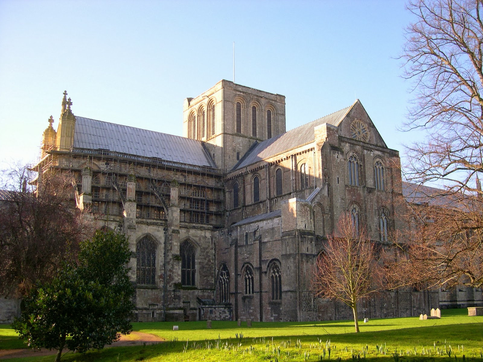
Before getting started on the trail I took a few minutes to have a look around at what Winchester had to offer. The path proper starts from Winchester Town Hall, a beautiful church like municipal building that dominates the street. Behind the Town Hall lies the cathedral with its slightly squat tower. It positively gleamed in the low winter sun and all around the precincts daffodils were in advance stages of growing, with flowering only a week or two away. Just along the road and perhaps the de facto start of the trail was a large statue to perhaps Winchester’s most famous resident, Alfred the Great, who was King when Winchester was the capital of all England.
 |
| Chilcomb Firing Range |
I followed the path as it left Winchester, going along by some old timber framed buildings and across what was clearly an old railway line, long since defunct but still clearly visible even though part of it had been turned into a road and car park. The path then turned sharply up the hill and out along a very attractive suburban road towards the M3. The motorway was an unwelcome intrusion on the landscape but today was fairly quiet. The roar of what traffic was about though could be heard for a couple of miles.
 |
| Cheesefoot Head |
Once across the motorway the path headed into the countryside along the edge of a field which seemed to last for some time until getting to the small village of Chilcomb. At this point it was surprising how many daffodils were already blooming, some five weeks before the time I would traditionally think of them. I didn’t get to see much of Chilcomb as the path rather detoured around what I assumed was the central part of the village (which I don’t think amounted to much).
 |
| Looking Back to Winchester |
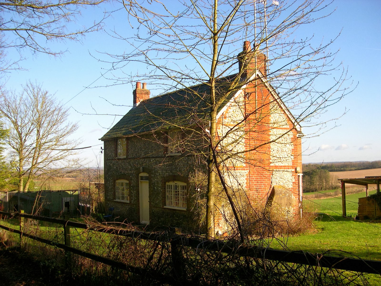
From Chilcomb the path started climbing up on to the ridge of the downs, slowly at first but with a short steep section at the end. At the top was the edge of a shooting range, which today was off-limits as the red flag was limply flying. Adjacent was a very attractive cottage with a garden full of crocuses. Although I assumed I was at the top of the hill, when I got round the corner I soon realised that I had a bit more climbing left to do to get to the top of Cheesefoot Head.
 |
| Golden Boughs |
After climbing for some time the view all around me began to unfurl and what a view it was. To the north I could see the Science Centre and its unusual pyramid shape with views across to North Hampshire and the Wessex Downs beyond. Behind me was Winchester, dominated by the Cathedral and a rather ugly square looking sixties tower block (rather unfortunate!). To the South was the Hampshire coast and the Isle Of Wight. The view was staggering on the clearest of days imaginable.
 |
| Cheesefoot Cottage |
When I got to the top of Cheesefoot Head, the mud started. I had an interesting time trying to stay out of the mud which was extremely sticky. I managed to stay upright despite the slipperiness for some time before failing not long after crossing the main road and falling in a muddy heap. It was a pity this section was ruined by the mud as this was the only true ridge of the day. I recovered my composure and the mud eased as I entered a very beautiful beech wood. The light shining through the trees was almost unreal, with a slightly watery golden colour.
 |
| Lonely Path |
After half a mile or so of woodland walking it was back out into open countryside and past a small farm where I turned right back towards the A272 that I had crossed at Cheesefoot Head. I found myself a piece of farm machinery that meant that I did not have to sit in the mud to eat my lunch but had a dry seat instead. After a welcome break I continued across fields to find the first lambing activity of the spring going on. My first clue was the seemingly endless line of sheep coming towards me from a large scrum going on at the top of the hill ahead of me. I couldn’t quite decide what was going on at first but soon realised that the melee of sheep were having their scans to make sure their babies were healthy. It was a fascinating process with sheep, dogs and people all very focused on the task ahead.
 |
| Lomer |
I passed through another farm and then the path seemed to follow a number of roads for a while. These were pretty quiet luckily and a welcome respite from the mud although in a strange way they also sapped my energy due to the pounding of my feet on the hard surface. I passed the Millburys public house, which didn’t seem to be open before heading out along another really muddy track. I passed Lomer Pond and could just about make out the outlines of the plots of the old houses of Lomer village, long since lost to the sands of time (I think a victim of the Black Death, like so many other villages at that time). I returned to the road after half an hour of boggy conditions until reaching Beacon Hill nature reserve. Because of my public transport requirements I took the bridle path alternative route here rather than carry on to Exton village.
 |
| Meon Valley |
The path weaved its way down through the trees to Warnford village and after a few minutes I was able to admire the view of the Meon Valley stretching away from me. As I walked down through the field I was followed by the sheep, a rather disconcerting experience. It was as if the sheep were attempting to herd me away from their territory.
 |
| Descending Into Warnford |
At Warnford village I passed a watercress field, a feature for which this part of Hampshire is famous. To my untrained eye it looked pretty well advanced for being so early in the year. I didn’t hang around, pushing on to the old railway line just outside the village. At this point the railway was in a deep cutting so I had to scramble down to gain the path that now passes where the rails once were. I continued to the site of West Meon station along a fairly unremarkable piece of disused railway line. There wasn’t much left of the station, but the old platforms were clearly visible through rather dense vegetation. Shortly after the station, the track abruptly stopped since the old viaduct that used to cross the River Meon had long since been removed.
 |
| West Meon Station |
I headed into the village, famous for two residents; Thomas Lord who founded the Lord’s Cricket Ground, and Guy Burgess, one of the Soviet spies from the 1950s. Otherwise West Meon appears to have little excitement about it, although undoubtedly a very attractive village that would be a joy to live in.
No comments:
Post a Comment