 |
| Reynards Hill |
There is only one word to adequately describe this section of the hike – height! This stretch is quite a challenging day but due to the vagaries of public transport it is quite a difficult section to split into two. It can be done using a bus service that serves Holmbury St Mary, but this only runs a couple of times a day and only from Dorking, making the journey to the start quite difficult. However, given enough time (about 7 hours should do it) this is perhaps the most enjoyable day of the whole hike and if you only manage to do one section make this the one!
 |
| Winterfold Hill |
Parking in Dorking proved to be quite easy. I parked by Dorking Halls just off the A24. I took the train to Shalford, where I connected with the bus service to Shamley Green. There is a nice little shop on the green selling pasties, which I availed myself of before starting out.
 |
| Ewhurst Windmill |
Soon after leaving Shamley Green, you start climbing Winterfold Hill. This is the first of many hills today and for the majority of the day you will be following the highest scarp in the South-East (higher than either the North or the South Downs). At each of the hills you will find excellent viewpoints across the Weald to the South Downs beyond. Pick a clear sunny day and you won’t find a better ridge walk in the South-East!
 |
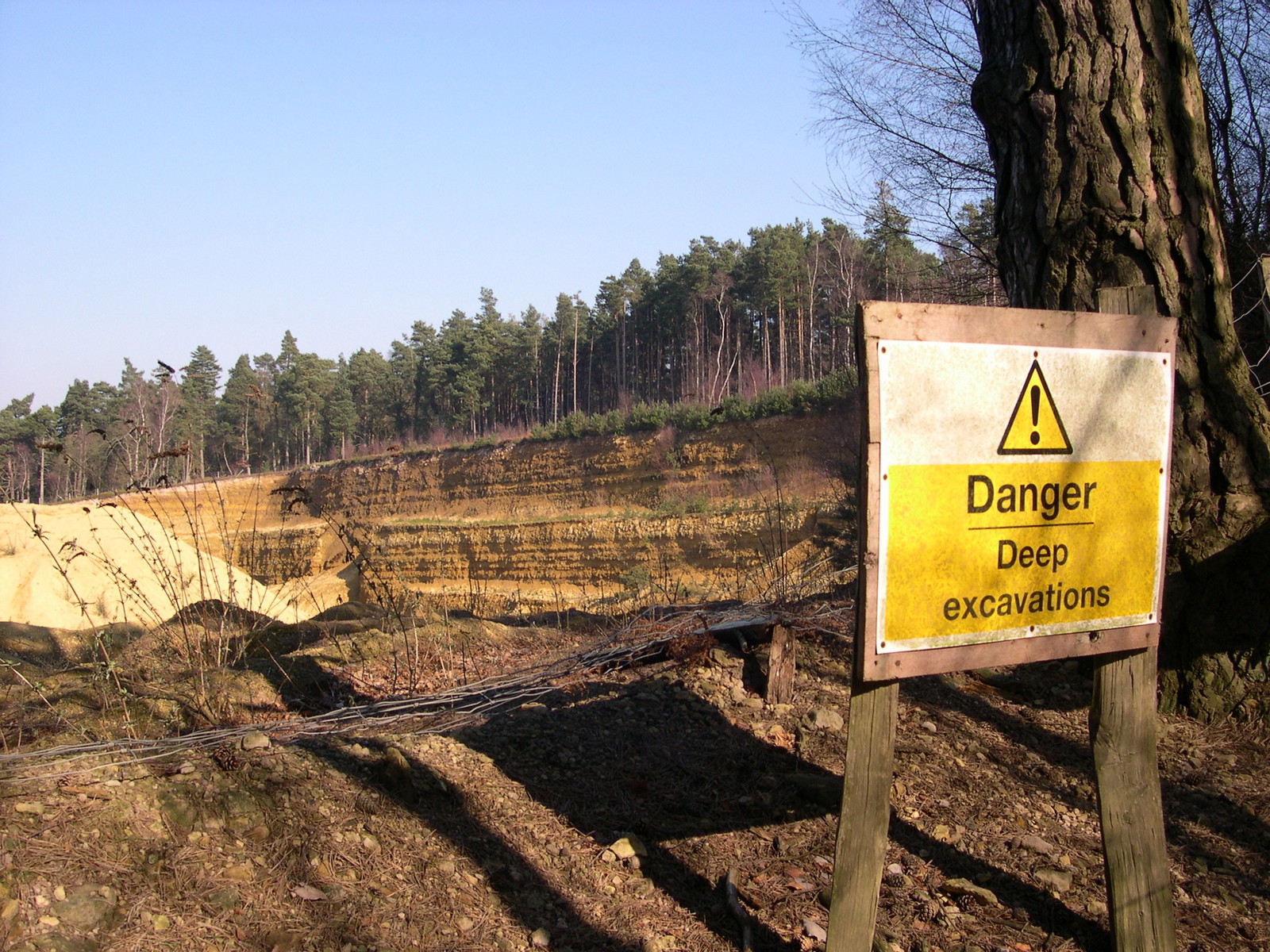
| Quarrying |
This stretch of the Surrey Hills is ambitiously known as Little Switzerland. While it is true that the terrain and vegetation is unlike anywhere else in this part of the country, Little Switzerland is rather stretching a point! Continuing on from Winterfold Hill, you soon reach the next one, Pitch Hill. Here there are reminders of the working landscape of the past as you pass a very large quarry and Ewhurst Windmill. This is reputedly the highest windmill in Surrey and was built in 1840 as a corn mill. It hasn’t worked since 1885 apparently, but is now a very attractive residence.
 |
| Foxy Weathervane |
When I passed Pitch Hill, there was a very large group of schoolchildren noisily doing their schoolwork. As I descended the other side it became obvious that they came from the Duke of Kent’s School, a large private school at the foot of the hill. It was slightly disconcerting crossing the school grounds during the lunch break when there were hundreds of children running around and this may be something to consider when undertaking this section of the walk.
 |
| Coverwood |
Once past the school you cross a couple of lush fields, which contrast starkly with the rest of the countryside before regaining the scarp at Holmbury Hill. This is an easily identifiable Iron Age fort and has excellent views across to Leith Hill, the highest and last of those we have to tackle today. The path descends once again to the village of Holmbury St Mary. If you are feeling tired at this point there is a bus service back to Dorking but it is pretty infrequent and you might face a long wait. The village itself is delightful and has a very nice looking pub which would probably be good for lunch. In fact it made me wish I hadn’t bothered with the pasty! One house caught my eye, it had a little plaque on the side dedicated to a ‘Pioneer of Plastic’.
 |
| McKinney Gate |
Once out of the village you are faced with a two mile climb to the top of Leith Hill. Despite this being the highest point in the South-East, the climb itself wasn’t as daunting as I first feared. Most of the climb is through thick woodland, which is difficult when trying to check your progress but the shade does at least keep you cool while you climb.
 |
| Path Stretching |
Reaching the top of Leith Hill feels special. The hill boasts a large tower built by a wealthy landowner in 1765 and was designed to ensure that you would be 1000 feet above sea level at the top (actually it is slightly higher than when first built). Alas when I passed it was closed, but you can climb to the top on certain opening days. On a clear day you can apparently see thirteen counties. Not sure which ones they are!
 |
| Pioneer of Plastic |
The best feeling about getting to Leith Hill is that it is all downhill from here! The path takes a sharp turn to the north and goes down through dark woodland to begin with, eventually opening out to pastureland. Just past Home Farm you pass through some parkland where you will see a waterspout and an attractive waterfall (looking a bit out of place it has to be said).
 |
| Leith Hill |
Just before the village of Wotton, the path takes another sharp turn and you head eastwards once again on the last stretch past Westcott and into Dorking. Heading back into an urban setting is a little strange after the loneliness of the route but there are still a couple of interesting sights before the day is done. The Rookery is a landscaped estate with some very attractive (if slight twee) houses, while a little further on is The Temple, a folly in a common area known as The Nower. Once past here you are into Dorking proper and the route winds its way along various twittens at the edge of the town. By now you will probably feel pretty tired and I wouldn’t blame you if you don’t bother trying to navigate them all. I didn’t.
 |
| Wotton Waterfall |
Fortunately, the journey back to Worthing was the shortest I had to make on the entire route after such a long day walking. If you attempt this section of the Greensand Way, it is even more important than normal to ensure that you are properly equipped. There are very few settlements en route apart from Holmbury St Mary, where there is a pub and bus service. I would strongly suggest wet weather gear and plenty of water as well as some lunch. The car parking, bus and train fares will add up to about £14 for the day. Don’t let any of this put you off however, it is one of the best walks I have done for many years!


No comments:
Post a Comment