Showing posts with label Greensand Way. Show all posts

Tuesday, 20 January 2009

Roaming along the Greensand Way Day 10 Pluckley - Ham Street

Pluckley
As autumn dragged on, the weather became more unreliable and it was mid-November before I got another chance to get out and complete the walk I started in early March. By now the clocks had gone back and daylight hours were at a premium so an early start was required.

Sheerland Farm
It was a beautiful sunny Sunday and I headed out to Pluckley station, which appears to be in the middle of nowhere. Luckily, as with many rural station parking is easy and most importantly free of charge.

Little Chart Church
I retraced my steps back to Pluckley village and lingered awhile in this rural idyll, taking in the atmosphere and trying to decide whether it felt haunted. To be honest on such a day it was hard to envisage; perhaps I should return on a foggy day to get the real atmosphere.

Little Chart
The Greensand Way left the village through yet more orchards, although seven weeks on from my last visit, there were few apples left on the trees and mostly yellow leaves. This made for a different atmosphere; gone was the closed in feeling created by the trees in full leaf and fruit and a more airy feeling in its place.

Chestnut Farm
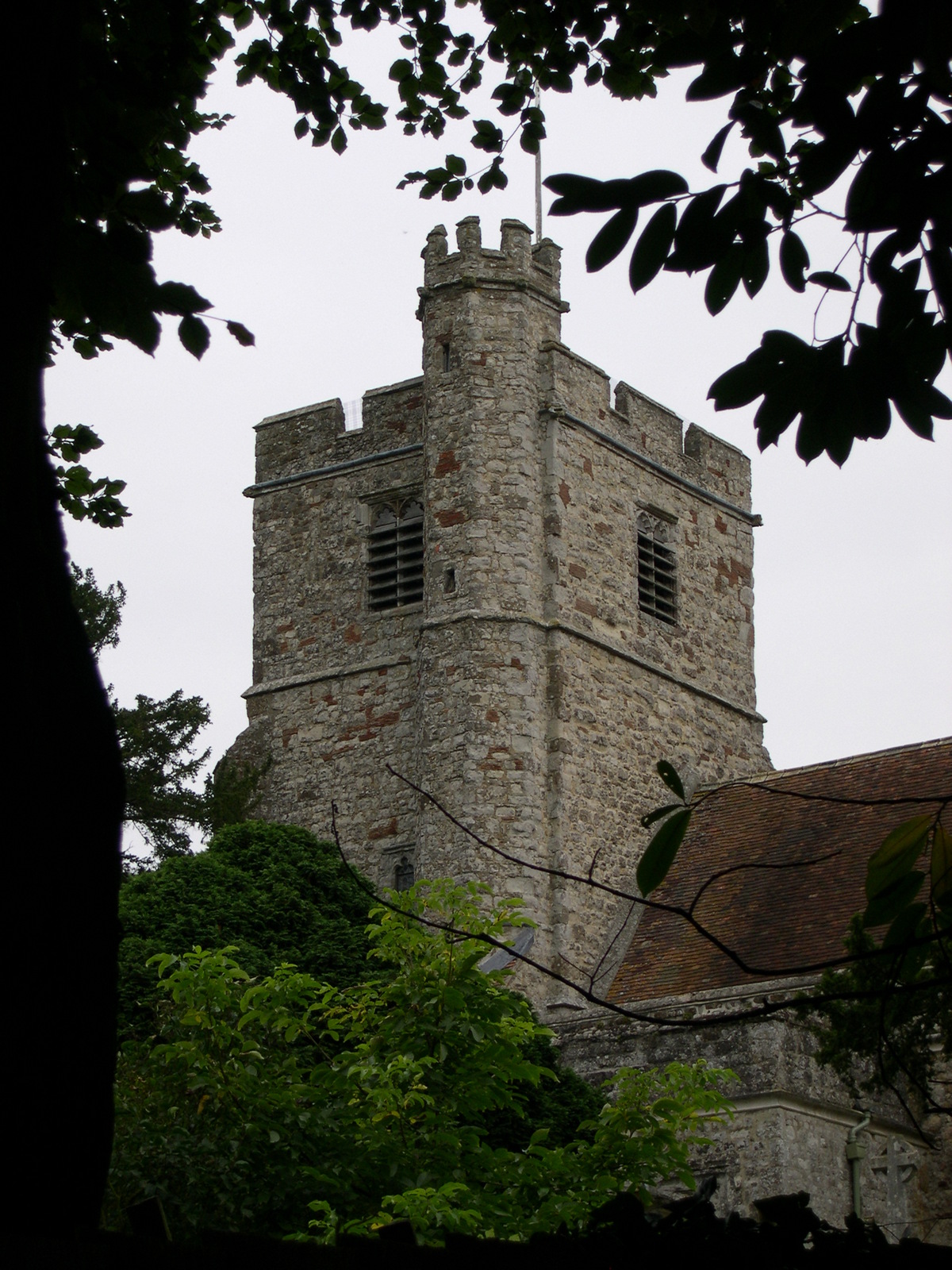
I soon came across Sheerland Farm, which had a very impressive rose garden still in flower despite the lateness of the season. After crossing a couple more orchards I reached Little Chart village. Here the church is of 1955 vintage and looks a little out of place, but apparently was a replacement for the original mediaeval church that was destroyed by the Luftwaffe in World War 2. Little Chart marks the end of orchard country and the way continues through patches of woodland and grazing land for most of the remaining part of the day.
Hothfield Common

Just before the village of Hothfield the Way enters Hothfield Common, a unique heathland area in this part of Kent. A crowd of BTCV volunteers were clearing some of the scrubbier parts of the common as I passed presumably one of the many tasks necessary to maintain this feature. In one corner of the common were some peat bogs, not something you readily associate with rural Kent.

Hothfield Common
As seems to be common in this part of Kent, Hothfield Church was also some distance from the village and was located by the large mansion presumably owned by the original country squire. The mansion was still complete with dovecote, and there was much cooing and flapping as I passed.
Hothfield Church

The next couple of miles of the Way skirt round Godinton Park, which was fast becoming another suburb of Ashford. The Way appears to have been designed to by-pass Ashford, but as one of the towns in the south east to be earmarked for growth, it is creeping out into the countryside at a fairly alarming rate. At certain points along the path it almost seems that you can reach out and touch it! At the village of Great Chart I reached the 100 mile point. I still had eight miles to complete and about two and a half hours of daylight left. I had a choice of heading into Ashford along another link route or cracking on to the finish point. Not knowing when I could come back and the possibility of another trip down into Kent spurred me on to want to finish.

Great Chart Church
Much of the remaining part of the route was across fields with some road walking and appeared to be mileage just to make it to a convenient point to finish. However, the last couple of miles through Ham Street Woods were particularly attractive, if very muddy. Here the Way is joined by another long-distance footpath, the Saxon Shore Way. This is a 165 mile footpath that follows the ancient shoreline around the Kent Coast and a likely candidate for my next walking project now I have completed this one!

Hothfield Chestnut
Reaching Ham Street station was a big relief just before it got dark. The end of the Greensand Way was rather an anti-climax though as not only was there no welcoming committee to acknowledge my achievement but there wasn’t even a sign to tell you that you had made it!

Lone Barn Farm
The Greensand Way is a very enjoyable walk and is to be recommended. I personally found the Surrey sections more enjoyable than those in Kent and some of the orchards can get a bit tedious. However, the villages and churches along the Way are delightful and there is much of interest to see. Undertaking the walk over a period of months as a series of day walks has a big advantage in that you get to see the seasons changing. The atmosphere and character of the walk changes over the course of the year and this adds a good deal of interest to the landscape.


Ham Street Station

Having completed the walk in November, this marked the end of the walking season for me and I now had three months to plan my next expedition before the days would become long enough again in mid-February to get out again. Now that I have done one of these long-distance footpaths as a series of day hikes I couldn’t wait to get started on the next one!

Monday, 19 January 2009

Roaming along the Greensand Way Day 9 Sutton Valence - Pluckley

Young Offender's Dahlias
Generally September is the best month of the year to go hiking as it is dry underfoot and the weather is pretty reliable without the heat of August. I managed a second day out on the Way at the end of the month, completing another pretty easy section through the orchards of Kent. Even though only three weeks had passed since my last trip, the change in season was well underway with most of the apples now cropped and fields ploughed. The trees were mostly still green although there was a definite change of colour.

East Sutton Village Sign
Sutton Valence had proved to be an easy place to park so I headed there first, leaving the public transport bit to the end. The village itself is quite interesting, with a ruined castle in the centre of the village and some attractive old buildings and would be worth some time exploring. The Greensand Way largely by-passes the centre of the village and heads out through the orchards at the top of the ridge.

Ulcombe Church
After a mile or so, I passed the attractive church of St Peter and St Paul at East Sutton. There was a buzz of activity as several of the congregation were getting ready for the harvest festival and I was invited in to have a look around. I took one look at my muddy boots and politely declined since I didn’t want to make a mess when they were working so hard!

Foxton Sheep
Next door to the church was a young offender’s institute. All was quiet although I did admire their magnificent dahlia display at the entrance. This was obviously someone’s pet project to keep the miscreants out of trouble! The path then headed out across fields and there was a fine view of the now diminished ridge stretching away into the distance.

Egerton House
The path passed by yet another church at Ulcombe, which was hiding behind a large yew hedge. The church was some distance from the village which nestled in a hollow in the clay vale below.
Egerton Pub

From here it was back to orchards for some considerable distance. As most of the apple harvest was now complete the overriding memory of the day was the smell of rotting apples! Thankfully there weren’t too many wasps about although it must have been ideal territory. Maybe they were drunk on the cider-like fumes!

Egerton Village Sign
The path continued to skip from village to village along this part of the ridge and the next was Liverton Street, presumably built to serve the impressive looking Boughton Place, a further half mile along the way. This apparently is only a small part of the original house, with the rest being left to ruin over the years.

Elmstone Hole
Here there was a break from orchards, but initially not a welcome one as I reached a freshly ploughed field, with the path being taken away. This created a rather unwanted obstacle, although luckily it wasn’t wet enough to cause too many problems. A passed through some woodland and up a flight of steps to reach another impressive house at Egerton. The village of Egerton, a little further beyond had a very impressive church although this was sadly bathed in scaffolding.

Shipland Ridge
Egerton had a village shop and a nice looking clapperboard pub, which would make for a good lunch stop. The path left the ridge for a short while and headed out across the clay vale once again to the village of Pluckley, famous for the location of ‘The Darling Buds of May’ and reputedly the most haunted village in England. I didn’t hang around in Pluckley as the weather had turned by now and I was anxious to get to Pluckley station to get the next train. The station is almost two miles from the village and can be reached by a ‘link’ route that is waymarked. However, the path is clearly not used anything like as often as the main route as I came across some overgrown sections and the waymarking was patchy. Transport back to the car was easy. I took the train to Headcorn and from there the bus back to Sutton Valence, which left from the front of the station. This section of the route is easy, with few hills, some attractive villages and a lot of orchards!

Sunday, 18 January 2009

Roaming along the Greensand Way Day 8 Yalding - Sutton Valence


Twyford Bridge
I next managed to get out in early September for a fairly short section of the walk round the south side of Maidstone. By now the wheat harvest was in full swing and the fruit trees were abundant with apples, pears and plums making for a very attractive walk.
Yalding High Steet

Transport proved to be a bit of a nightmare as I misjudged how long it would take to get to Sutton Valence and this meant that I missed the bus into Maidstone I had intended to catch. I ended up waiting almost an hour for the next one and when it got to Maidstone it was a bit late which meant that I missed my onward train. In all I wasted over two hours that I could have been walking. Be aware of the frequency change of services when attempting this section of the route! The bus and train service that you need both appear to dry up a bit during the middle part of the day.
Buston Manor Oast House

By the time I did get out walking it was mid afternoon and I was anxious to get going. Luckily, this section is pretty easy and can be done in about three hours. Once out of Yalding station the path crosses the River Medway via a very old bridge, which is very attractive but potentially dangerous for walkers as there is no pavement. I made full use of the little refuges that jut out into the river.


Harvest Time
Yalding village is some distance from the station that takes its name. It looked like a very attractive little place although despite the fact that there were quite a few shops, it was absolutely deserted. Once out of the village the Greensand Way regains the ridge which recommences after the Medway gap. The path stays on the ridge for the rest of the day so after this initial climb there is a level path from here on.

Linton
The theme of the day is orchards! The path crosses successions of orchards on its way to Sutton Valence. The harvest was in full swing, but seemingly the days of apples being picked by hand were over with machines undertaking much of the work. Although the day had started promisingly, by now it was becoming quite murky and the views across the Weald weren’t anything like as interesting as they could have been. This was a pity as the views were uninterrupted for much of the route.

Linton Manor
Linton was the only village that was encountered on the way and the church could be seen from quite some distance away, with its spire poking out of the trees. Linton itself was quite an attractive village although spoilt somewhat by the very busy road passing through it. Beyond Linton, orchards are left behind for a short section of the walk as the estates of Linton Place and Boughton Monchelsea are crossed. The parkland made for a pleasant change from orchards!

Chart Sutton Church

I reached Sutton Valence in about three hours and by now the day was really quite murky and had turned quite chilly, so I was pleased that this was a pretty short section of walk.

Saturday, 17 January 2009

Roaming along the Greensand Way Day 7 Sevenoaks - Yalding


Knole
It was late July before I managed to get out on the Greensand Way again. The day was very hot and after a couple of months of inactivity coinciding with the birth of my daughter, I found the day a real struggle. I have to say that this was largely due to my fitness levels rather than the difficulty of the walk.

Knole Deer
Luckily it was one of the easiest days for transport. I parked at Yalding station and returned to Sevenoaks by train, changing at Tonbridge. Parking is free of charge at Yalding station. Once at Sevenoaks, I walked up through the town to return to the route in Knole Park. I made sure that I stocked up on provisions before leaving town, as I wasn’t certain that there would be any shops on the way.

Ightham Mote
While not officially on the route, Knole House is too good to miss. There is a link route across the park, which crosses just in front of the house. Bambi-like deer roam around, getting in the way of visitors cars and no doubt gorging on the remains of picnics. Presumably this has become quite a problem, since there are many signs around warning people not to feed the deer. The park associated with the house extends some distance away from the town centre and makes for a very pleasant escape route.

The Chaser Inn
After a couple of miles you reach a road and here is where the park ends. Shortly afterwards you reach the crest of the ridge again at One Tree Hill. Surely this is a misnomer, as the hillside is wooded! There is a good view across the weald, although this is the first and last of the day. From here on the ridge diminishes and views become a premium.

Shipbourne Church
The early part of the Greensand ridge in Kent is dominated by large houses and having already passed Chartwell and Knole, perhaps the next is the finest of all; Ightham Mote. This is a fortified manor house surrounded by a moat and owned by the National Trust. The path runs past the house itself, but you need to make a very short detour to actually see it properly. It is worth it as in my opinion it is the finest building along the whole route.

St Michael's Church
By now, although it was late July, the colours in the fields were already changing from green to gold suggesting that the end of summer was perhaps closer than I thought. During a restful moment I had a look to see how much was left after today and reckoned on about three more days of walking. Having not got out much since the spring my ambition of completing the walk by the end of the year looked in some doubt!

St Michael's Plaque
After the next hill the way dropped off the crest of the ridge again and crossed the clay vale to the south. The path runs through the villages of Shipbourne and West Peckham, both dominated by their churches. In between the villages the farmland took on a completely different look as fruit farms dominate the whole area. The fields in July were a hive of activity, with fruit pickers swarming over the strawberry, raspberry and blackcurrant crops.
Kentish Fruit Pickers

At West Peckham I had a rare navigation problem as I missed the sign that would have told me the path had left the road. Instead I carried on until eventually reaching a junction with a busy main road. It was only here that I realised my mistake and tried to devise an alternative without retracing my steps along the narrow and busy road I had come along. No off road alternatives were available so I swallowed hard and turned down the A228 to regain the path. This necessitated a walk of a mile along this busy road, which was a very unpleasant experience and made me wish that I had retraced my steps after all.
Votes Court

Eventually I regained the route shortly before East Peckham church. This building was an oddity as the village had moved away from the small hill on which the church was located. Stranded, the church had obviously lost a lot of custom over the years and was now officially a redundant church, looked after by a trust.


Arrival at Yalding
The path then crosses the Medway valley, a major feature in the Kentish landscape and the boundary between the so-called Men of Kent and Kentish Men. Again the signage in this area was very poor and I had to really be on my toes to ensure I stayed on the right path. Added to this, much of the path was overgrown and this presented me with a bit of a problem. I had worn shorts because of the hot weather, but spent the last couple of miles of the day getting stung and scratched to blazes by the stinging nettles and bramble bushes. By the time I returned to my car at Yalding station I was not a happy camper!

Friday, 16 January 2009

Roaming along the Greensand Way Day 6 Limpsfield - Sevenoaks


Blossom Time
Move forward a couple of months from the last stretch of the walk and the landscape has been completely transformed. It was now mid-May and all the leaves were out, there were still bluebells in the woods and the May and rhododendron blossoms were in full swing. This made for a spectacular walking day, although compared to the previous sections it was very hot and sticky. I took plenty of refreshments with me as again there were few villages en route and shopping opportunities were at a premium.

Rhododendrons
Parking in Sevenoaks is not particularly easy so once again I parked at Limpsfield Church and walked first and got the bus back.

Kent Border
Limpsfield is set back a little from the crest of the ridge and apart from a short section with good views back to Tilburstow Hill, most of the first part of the walk is through woods. During May this was a very attractive section as the leaves were only recently out and as the sun shone through they were very pale green in colour. The bluebells were hanging on manfully, leaving a blue tinge to the floor of the woods although in fairness they were well past their best and were on their last legs.

Colour Palette
A couple of miles into the walk, you reach the Kent border and there is a sign to mark this in similar style to the one at Haslemere. Coincidentally, this also marks the halfway point of the walk. Once into Kent the style of the waymarkers changes as well; the rather unimaginative GW waymarkers are replaced by ones depicting an oast house and you should now look out for these for the rest of the hike.

French Street
It isn’t long before you spot the first oast house after entering Kent. Traditionally these distinctive buildings were used for drying hops and are unique to Kent and the very eastern part of Sussex. Nowadays most have been converted to housing, ensuring that they are preserved in the best condition they probably have ever been in!

Impending Storm?
The next few miles are reminiscent of the section of the hike around Leith Hill, for this is the highest part of the ridge in Kent. In fairly quick succession the path crosses Ide Hill and Toys Hill, both of which have fantastic views across the Weald. Close to each of these hills are villages carrying the same name, which are idyllic spots probably inhabited by people now working in Sevenoaks and beyond rather than in the local communities. There was a shop in Ide Hill but unfortunately it was closed as I passed. They obviously enjoy a long lunch hour!

Church at Ide Hill
After Ide Hill the way leaves the ridge for a short time, passing through the top end of the village of Sevenoaks Weald. The A21 then comes into view and luckily there is a tunnel under the road, which means that you don’t have to dodge the traffic to try and cross the road. The last part of the walk was one of the most difficult to navigate as signs evaporate for the next mile or so. The field I crossed were also quite overgrown with hay and wildflowers, which although attractive were very difficult to walk through. Eventually I reached the old A21, which used to pass through Sevenoaks before the by-pass was built. I mistakenly thought I would miss my bus at this point so followed the road into town. However, a more attractive (if slightly longer) route would be through Knole Park across the road.

Ide Hill
A word on public transport here. There are buses back to Limpsfield from Sevenoaks via Westerham where you have to change buses. However, as I found to my cost, the services are irregular during the afternoon and there is a gap of approximately two hours where there isn’t a service. I expect the buses are away doing school services at this point. The bus I took did connect at Westerham, but this isn’t always the case so you might have a little time to spare having a look around the town closest to Winston Churchill’s house at Chartwell.

Crossing the A21
This was a particularly attractive day’s walking, possibly the best of the Kent section. It is a much more undulating part of the way than most, so be prepared for a few steep climbs and descents. Also ensure that you take refreshments with you as there are few opportunities en route. However, Sevenoaks itself at the end of the route offers lots of attractive places to eat and drink so you could save yourself until the end of the route!

Thursday, 15 January 2009

Roaming along the Greensand Way Day 5 Earlswood - Limpsfield


Pollarded Trees at Earlswood
Day 5 is an interesting and varied day, with stretches of lonely countryside interspersed with obvious signs of human activity, both past and present. There is a much more discernible ridge once again after the section on the clay vale, although it is much less spectacular than the western end of Surrey.


Abandoned Tractor
Park either in Limspfield village or in one of several car parks to the south of the village. The easiest way to get to Earlswood is to use the hourly bus service from Westerham-Redhill, which stops by Limpsfield church. In Redhill the bus stops close to the rail station, from where you could get another bus or train to Earlswood. I found it was just as easy to walk the mile to regain the route although the main road is a bit offputting.

Friendly Horse
Regain the Greensand Way by Earlswood church and cross the golf course to Earlswood Lake. This is a haven for wildfowl and when I passed in March there were several Canada geese that had cleared the pond of most of the ducks. Once across the busy A23, you pass through the old Earlswood hospital, a very imposing building that is now being redeveloped for housing. This is the last part of the built up area, for you are soon in open fields with views across to Redhill to the north.

Abandoned Boat
At Nutfield you once again regain the ridge after a period of road walking. The path hugs the south side of the ridge and from here there are fine views across the East Surrey countryside to the Weald. At Nutfield I found a detour which was much more walker friendly than the official route, bypassing another section of road walking. Soon you come to the M23, where the way passes through a dark underpass and into the fields beyond.

Leigh Pond
The path climbs back on to the ridge and along the tree line. Above the path is a Norman motte and bailey castle though you would be hard-pressed to find any sign of it in the undergrowth. The path passes to the south of Bletchingley village where you see the remnants of an industrial past, with much evidence of quarrying. The path descends the ridge once again and for the next few miles you actually walk along the foot of the ridge through very attractive hangar woods rather than along the top.
Tilburstow Hill

At Tilburstow Hill, you cross the busy B2236, an old Roman Road that once went from London down to the Sussex Coast. This can clearly be seen if you look down the line of the road. However the modern road is the A22 some way to the east and even this has been by-passed. Before this however, you reach Leigh Pond, a site of special scientific interest that has existed for hundreds of years. Viewing the pond proved to be quite difficult since there were a number of private houses around its perimeter, whose residents were quite protective of their view! However, you can get a peek at this idyllic spot that was a haven for wildfowl.
Crossing The Fields at Tilburstow

Once across the A22 you cross several fields until reaching the village of Tandridge. Here there was a very walker-friendly pub that also offered bed and breakfast in case you wanted to make this into a weekend expedition with the next section.

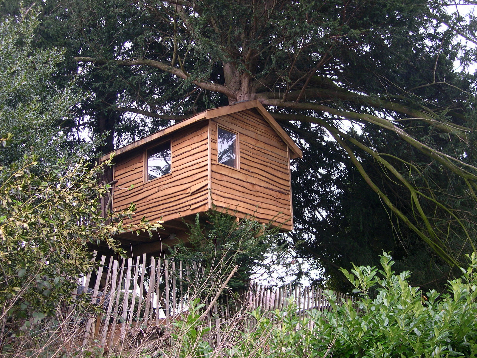
Tree House
The path from the village leads across more fields and once again the ridge is harder to define. Eventually you will come to Oxted Mill, a fine old building that has been given a new lease of life by being renovated into a residence. The path now skirts the southern edge of Oxted through some delightful tunnel like lanes caused by overhanging trees before you reach the National Trust owned Limpsfield Common. At this point you can be rejoined with your car.
Oxted Mill

This is a fairly easy day, which can be undertaken in about four to five hours depending on your pace. The pub at Tandridge would make for a good overnight stop if you wanted to continue on to Sevenoaks and make a weekend of it.