Showing posts with label Solent Way. Show all posts

Monday, 23 March 2009

Solent Way Day 7 Hilsea - Emsworth


Hayling Billy Track
I just couldn’t bring myself to walk the stretch from Hilsea across the Farlington Marshes to Langstone. The roar of the traffic was too much for me and despite the attractions of the nature reserve I decided to skip this part on account of having little time. I did walk the short stretch immediately to the west of Langstone, but being midwinter it wasn’t particularly pleasant and so I did not even bother getting the camera out.

Langstone Mill
The section that I did walk from Langstone to Emsworth was very pleasant however, and rather a different character to anything that had gone before. Langstone is a small village to the south of Havant and is the only bridging point to Hayling Island. At the north side of the bridge is a useful but very popular car park, which acted as my trailhead. Unusually as the distance was so short (only about 3 miles) I walked this as an ‘out and back’ route rather than the normal public transport option to get back to the start.


Shoreline Walk
After taking a look at the now redundant Hayling Billy railway line that once offered a rail alternative to the island I headed east through the lovely village of Langstone. I couldn’t help but think it felt a little out of place among the generally unlovely towns nearby. In particular I admired the mill outside Langstone, which seemed to be half watermill and half windmill.

Warblington Castle
From the mill the path continued along a very picturesque piece of coastline past a large mill pond and along a very narrow sea wall. This was quite entertaining to try and negotiate as the path was extremely narrow and the tide was in, so I couldn’t take the beach alternative.


Warblington Church
Eventually I came upon Warblington Church and Castle. Not much of the latter was left so I disregarded what was there, focusing my interest instead on the church, which was full of people milling about on this fine September afternoon. Sadly the graveyard had a high number of children’s graves, perhaps explaining the visitor numbers.

Emsworth
I pushed on to Emsworth, which was a short distance across a couple of fields and past some woodland that was obviously used for outdoor activities given the number of different items littering the woodland floor. Just beyond this was I hit the houses and for a brief moment enjoyed the views that these residents get every day of the year. Emsworth had one final surprise for me when I came across a large mill pond, no longer in use but impressive nonetheless. I rounded this to reach the town and found that a food festival was in full swing. I wished that I hadn’t parked in Langstone as the thought of carrying all those goodies back was too much for me to think about!


Emsworth Tidal Pond
So ended the Solent Way. A slightly unsatisfying walk compared with many others that I have completed, but I think that was more down to the time constraints I was under rather than the route itself. There are some hugely enjoyable sections and the path is undoubtedly full of interest. However, there are sections which are a bit uninviting due to the amount of road walking required, or because of surrounding industry. However, as a 4-5 day walk these sections could be skipped or just put up with as necessary mileage.

Wednesday, 18 March 2009

Solent Way Day 6 Portsmouth - Hilsea

Southsea Pier
Once across the short stretch of water that separates Gosport from Portsmouth the character of the Solent Way changes significantly. Initially the path goes through a port related urban area and the historic defences of this most famous of naval cities before passing the seaside resort of Southsea and eventually it begins the long process of circumnavigating Langstone Harbour.

Historic Southsea
This was another section completed in its entirety and rather fittingly for a section that includes a seaside resort I decided to do it in the first week of July. It was late afternoon when I started and there had obviously been a big public event during the day because it all looked to be packing up now it was 4pm. Fortunately I had plenty of time, as I had the rest of a light evening ahead of me and cooling temperatures, which would make for pleasant walking. Being a Sunday I took advantage of the free parking along Southsea sea front and started by Clarence Pier, the point from which the hovercraft dashes over to the Isle of Wight. Sadly there wasn’t a hovercraft in sight and I didn’t fancy waiting around for it to come back.


Rose Garden
I headed eastwards along the promenade admiring the summer gardens now just about at their peak. Southsea front is full of interest and the feeling of space is quite at odds with the rest of Portsmouth, which is one of the most densely populated cities in Europe. Just along from Clarence Pier is the aquarium and beyond that another of those coastal forts that pepper the south coast. This one is grandly called Southsea Castle, another of the forts built by Henry VIII to defend the nation against the French back in the 1500s. As such it follows the rather squat designs of the others already seen on this walk at Hurst and Calshot as well as those I saw on the Saxon Shore Way in Kent. Allegedly Henry VIII watched the Mary Rose sank from this location.


HMS Warrior
The direction of the coast turned here and I now faced Southsea Pier and hoards of sunseekers enjoying the last of the sunshine on the main beach. The pier itself had a very large pavilion at the shore end, but the rest of the pier was strangely devoid of buildings, petering out somewhat into Spithead. I’m not sure if that is because of some of it being removed during World War II and not being replaced, but it did look a bit odd.
Langstone Harbour

Past the pier and I had a little look at a couple of landward attractions, firstly the boating lake and then more interestingly the rose garden which is housed in the ruins of yet another fort, this time the curiously named Lumps Fort. As I headed eastwards the seafront turned rather military again with the very imposing Royal Marines museum at Eastney dominating the eastern end of the front. Before leaving the seafront for good I had a last look at the shipping on Spithead before heading inland through a succession of housing estates and across a large recreation ground before finally emerging on the shores of Langstone Harbour. This large expanse of inland water is dominated by yachts and forms part of a low lying stretch of coast that also includes Hayling Island and Chichester Harbour. A coastal walker would take several days to negotiate all of it before reaching open sea once again at Wittering, on the Selsey Peninsula in West Sussex.


Portsmouth Cathedral
Fortunately today I was only walking a relatively short stretch along the eastern shore of Portsea Island. Initially the going was quite peaceful and the views pretty good, but as I got further north I was soon met by the A2030, one of the few roads that access Portsmouth from the outside world. Inevitably it was incredibly busy, even on an early Sunday evening. After a couple of miles I was quite pleased to head into the industrial estate opposite to reach Hilsea station, where I got the train to Portsmouth Harbour.

Bombed Out Church
My walk wasn’t quite over for I had a half hour walk to regain the car on Southsea front and this last section was packed with interest. The whole scene was dominated by the Spinnaker Tower, definitely a worthwile trip on a sunny day (if you don’t have the opportunity or need to whet the appetite you can make a virtual visit at http://www.spinnakertower.co.uk/) . I also passed the rather anonymous Portsmouth Cathedral and through the old part of Portsmouth before once again regaining the seafront at Royal Garrison Church, bombed out during World War II and left in the state it was after a cosmetic clean up. It was a stark reminder of the damage caused by the war. I soon returned to my car after this and continued on my journey towards Southampton for my week of studies.

Spinnaker Tower
On the whole in interesting section and probably best experienced as I did on a short summer evening walk, rather than as a full day’s walk. Challenging it is not!

Sunday, 15 March 2009

Solent Way Day 5 Lee-on-the-Solent - Gosport

Lee-on-Solent Coast
Another nice short section, with a wild section in the middle across a firing range (watch for the red flag flying!). I completed this section in one complete go, taking just over a couple of hours on the day the clocks went forward in March 2007. This enabled me to have a little extra time late afternoon/ early evening on my way to Southampton. I took advantage of the free Sunday parking on Gosport front and got the bus over to Lee-on-Solent picking up where I left off from the last walk. The way along the front soon changed character from a nicely maintained promenade to an army firing range with no path to speak of.


Walking Through the Army Range
Progress along the army range was quite hard work, wandering along the shingle and doing my best to find a way through in the absence of any waymarking or obvious route. It was a strangely wild piece of coast and in places the shingle had formed almost dune like structures. I felt a bit self-conscious as I wandered through the range, like I was being spied on and it didn’t help when I saw some activity offshore by what looked to be landing craft. I kept a close eye on them to make sure they weren’t going to come my way and somehow involve me in their war game.

Fort Gilkicker
Eventually I passed out of the army range and passed yet another coastal defensive battery before finding a nice promenade once again. Even on a late March Sunday afternoon there were plenty of people about and it made for quite a pleasant walk with a good deal of atmosphere, quite unlike the previous couple of miles.

Fort Gilkicker
Along the front were a sailing club and inshore lifeboat station, both of which were open and full of people doing maintenance work and taking advantage of a not so great but dry and mild afternoon to carry out maintenance work ready for the summer ahead. About half an hour later I reached Fort Gilkicker, the latest of coastal defences, which was reminiscent of Hurst Castle but on a much smaller scale. From here I headed away from the coast and back up to the road that weaves its way through the various military installations and residential areas that dominate this part of Gosport. I deliberately kept the camera away especially as there were lots of military personnel carrying big guns.

Spinaker Tower

By now that most annoying March weather conditions had started too – swirling mist so pictures of the Spinnaker Tower on the opposite shore were fairly difficult to come by. I also had a view of the submarine museum in Gosport but not good enough for pictures. I soon came back to the car past the submarine museum for the end of this short section. People going on from here could take the ferry to Portsmouth which leaves from just by the bus station.

Wednesday, 11 March 2009

Solent Way Day 4 Warsash - Lee-on-the-Solent

Solent Sunset
It was back to another fragmented section, necessary as I had very short opportunities to walk this part of the coast. It was slightly disappointing not to ride the very striking pink ferry that plies its trade across the Hamble River between Hamble-Le-Rice and Warsash, but it wasn’t really practical. I split this walk into four distinct sections, from Warsash to Hook Lake (only about a mile), Hook Lake to Solent Breezes Caravan Park, Solent Breezes to Hillhead and the last part into Lee itself.
Sailing
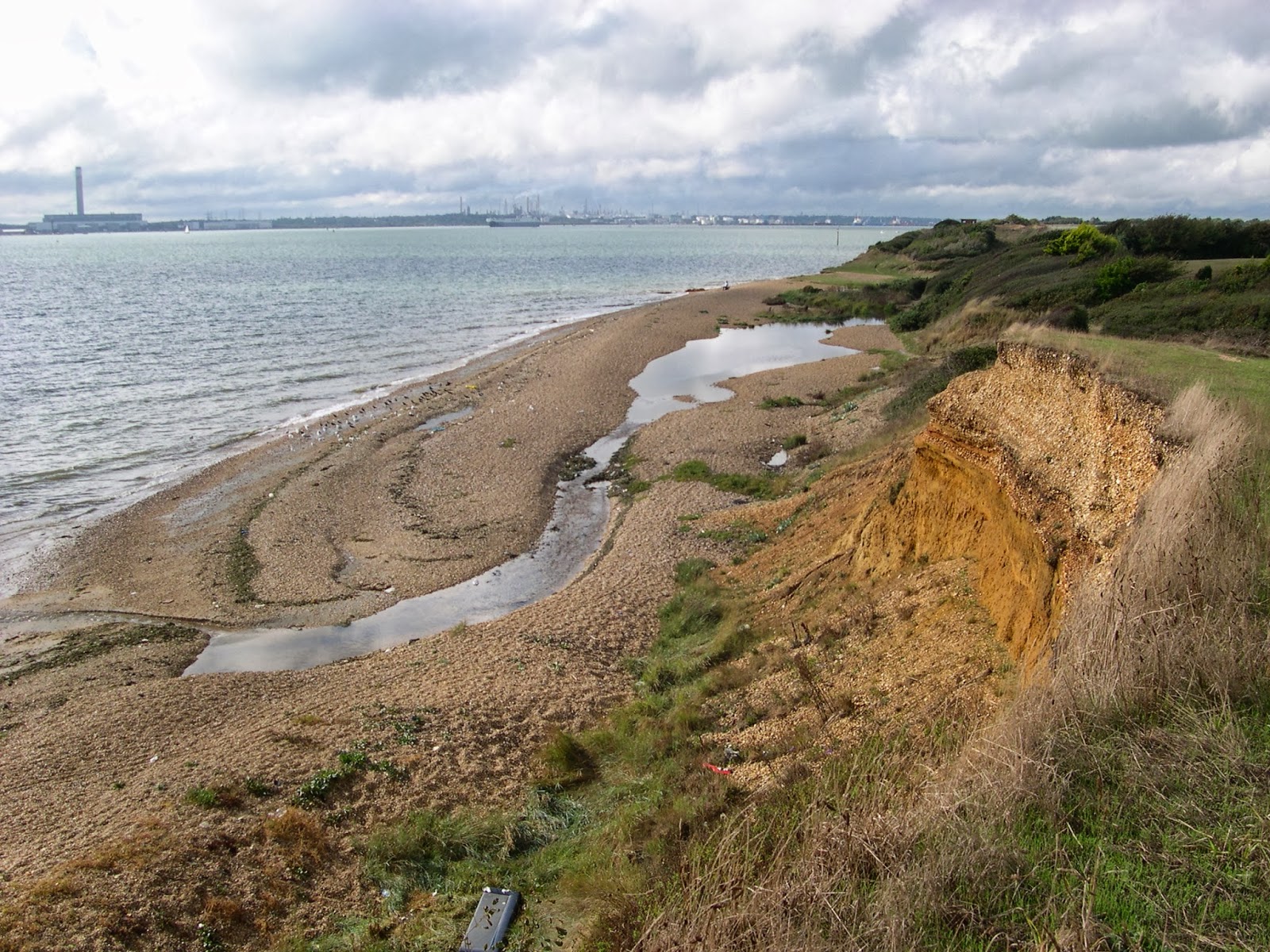
The first mile or so was necessarily short as it was completed on a September evening, when the sun was already very low in the sky. I was able to park up at Warsash just near the ferry and wander down to Hook Lake, a freshwater lake formed from the damming of a small stream by a shingle spit. It had been a very beautiful late summer afternoon and I was anxious to see the sun setting over the Solent. I wasn’t disappointed although it was questionable whether Fawley Refinery right behind the sun setting was the best backdrop!

Warsash Pond

The next short section as far as Solent Breezes was completed as part of a circular walk that I cribbed from one of the excellent Jarrold/ OS walking books that have served as an inspiration to me for many years. This particular one is in the Hampshire edition in case you’re interested. The coastal part of this walk was perhaps the most disappointing element although I did pass some of the best shingle plants I have ever seen including a very lush looking sea kale. Just inland was a large lake where all the local birds seemed to be, ignoring Southampton Water on the other side of me.


Shingle Plants
The best section of the walk is the other side of Solent Breezes Caravan Park, which acts as a major barrier on this part of the coast. I didn’t bother negotiating this as I did the next section as a linear walk from Hillhead Harbour, simply retracing my steps when I got to the caravans. The main feature of this walk is the unexpected cliffline – only small perhaps but definitely cliffs! I also enjoyed the relative solitude of this part of the coast, again a surprising feature considering how many people live in this part of Hampshire. Along the cliff top were more reminders of the strategic importance of this port with Calshot Castle now visible at the entrance to Southampton Water on the opposite shore and a pillbox guarding the side I was on.
Hook Lake

Away in the distance I could see Cowes harbour and the sea between us simply sparkled in the late September sunshine. What was very surprising about this day’s short walk was that I was able to do it all. I detoured there on the way home on Friday afternoon only after the most incredible rain shower had passed by. It gave the air a clarity that you only get after rain, although it has to be said that the intensity had gone from the sun as a result.
Watching Post

The Solent was a constant buzz of shipping, with huge container vessels going to and from Southampton and being raced by the Isle of Wight vehicular ferries and passenger hydrofoils. They were all dodging the dozens of sailing boats that were like a huge swarm on the fairly small area of sea between here and the Isle of Wight. It did make for an enjoyable spectacle and was a constantly changing view.


Hovercraft Museum
The last stretch of the walk was completed on the way home in January 2007. The days were very short and the weather was typical January; very blustery and cold! The last section from Hillhead to Lee-on-the-Solent is much more developed and a complete contrast to the cliff top walk I had completed before. It was however perfect for a January day for essentially it follows the promenade. It was great for blowing the cobwebs away after a tough week at the University. The most interesting sight was the view of the Hovercraft museum that is housed at Lee-on-the Solent. One day I shall visit, but today I had to content myself with the view of the SRN4 craft that is parked just behind the gate. Details on open days can be found at http://www.hovercraft-museum.org/ . Might see you there!

Monday, 9 March 2009

Solent Way Day 3 Hythe - Hamble

Woolston Feather
After the problems with the last section, this was a much easier proposition. For one thing it was a short distance and secondly I was able to complete it on the Sunday afternoon before my course started. I was now the ‘right’ side of Southampton (ie on the way to and from my house) and this was in the land of the Sunday bus! Unfortunately I couldn’t bring myself to walk the section through Southampton and over the Itchen Bridge; I would suggest that this is really for completists only. Instead I started my afternoon out at Woolston, a suburb of Southampton immediately across the River Itchen. The afternoon’s walk would take me down the side of Southampton Water and this made for a fascinating section where I could spend my time watching ships going backwards and forwards along one of the busiest waterways in the British Isles.


Woolston Toll Bridge
On my way to Southampton the weather was absolutely fabulous and even when I boarded the bus at Hamble the sun was still shining. However, it worsened very quickly and when I started walking the glorious September afternoon I had been expecting quickly turned overcast and even started raining some way into the walk. It was pretty disappointing and I was pleased that the boat traffic was so interesting.

Royal Victoria Coast
On reaching Woolston I quickly found the route and didn’t linger long in this rather unattractive quarter of Southampton. A couple of sights did catch my eye; a rather large feather put there in the Millennium to commemorate flight and sail (for Southampton was once the home port of ocean liners and seaplanes). The other was an old cinema converted to a bingo hall, which was once probably the centre of local entertainment but now a forgotten part of history. Across the water was a glimpse of the new; St Mary’s Stadium, home of Southampton Football Club. Along from there I could see the P & O Cruise ship ‘Arcadia’, looking magnificent at its berth and presumably loading up with supplies ready for its next trip out.

Netley Abbey
The first mile or so of the day’s walk was not particularly promising as I headed past a very large building site and past a down at heel housing estate dominated by Canberra Towers. Even the official website for the walk describes these as ‘ugly’! Yet once past these the walk became a lot more interesting as I passed through the seaward end of Westwood Woodland Park and then came upon Netley Castle. This was originally built by Henry VIII but is much altered and now serves as private accommodation although for a period it was bizarrely owned by Middlesex County Council, who used it as a convalescence home. More information about Netley can be found at http://www.netleyabbey.info/ . The path then left the coast briefly to pass through the village of Netley, a surprisingly attractive place considering the proximity to Woolston.

Royal Victoria Chapel
A little past the village, I entered the Royal Victoria Country Park. This is a most interesting place, dominated by the old chapel that was once part of the military hospital here. The park has many attractions for families and the place was really buzzing. The views across Southampton Water were probably at their best here too and I got quite excited when I suddenly heard the unmistakable horn of a passenger liner, which could only mean one thing – Arcadia was on her way!


Watching For The Enemy
The final section from Netley to Hamble was surprisingly quiet in spite of the fact that this stretch of coastline has only the thinnest strip of countryside running along it. However there were reminders of other development, with the view across to Fawley Oil Refinery dominating the skyline and a little further ahead was an enormous jetty clearly in place to service oil vessels. There was also a reminder of how heavily defended this coast must have been as I passed a couple of pillboxes, one of which was a particularly interesting design that I had not encountered elsewhere.


Arcadia
As I passed along this stretch of coast I was soon joined by Arcadia and I could now see how big she really was. Although several hundred meteres away I felt as if I could almost reach out and touch her. When one of the Isle of Wight ferries passed alongside it was absolutely dwarfed. As I looked back towards Southampton I was utterly amazed to see that a little further behind was another P & O cruise vessel, this time Oceana. It was a much smaller vessel but still full of people in holiday mood I’ll bet.
 
Hamble Ferry
Having got the excitement of seeing these fantastic ships out of my system (how would I have felt if I’d stood here in the 1930s when such sights were commonplace?) I left the coast to head across Hamble Common and return to my vehicle. Wouldn’t you know it? As I wandered through the village the sun came out again!

Sunday, 8 March 2009

Solent Way Day 2 Lymington - Hythe


Heritage Unit at Lymington
This is where the route began to unravel as due to the difficulties of public transport and the time I had available I could only manage this section in small chunks at a time during light evenings after lectures. This part of the Solent Way involves a lot of road walking unfortunately, so I essentially skipped those parts and just did the off-road sections. I also never quite got to Hythe, as most of the way from Beaulieu was along the road between the two places.

Ripening Fields
Still despite this, there were some very nice small sections of walk which fit the bill perfectly from my point of view. The first little section from Lymington started at the ferry port, where I was lucky enough to see the heritage electric train that had been temporarily assigned to ply the short branch line to Brockenhurst. I’ve never been sure how busy this route actually is, but obviously enough to warrant a half hourly service. The train was one of the old style slam door trains that had been recently replaced. It was painted in the old Southern Railway green colours although I’m not sure it ever actually carried those colours in service. Further information can be found at http://en.wikipedia.org/wiki/British_Rail_Class_421 .


Pylewell Park
The route then headed inland a bit through a small piece of woodland before coming out on to open fields. It soon became clear though that these were not ordinary fields but the remnants of an airfield, used in WWII but still equipped with a hangar, windsock and makeshift runway. This is still in private use apparently and more about the site can be found at http://en.wikipedia.org/wiki/RAF_Lymington . Ahead there were some wonderful views of the Isle of Wight, including still across to the Needles. I headed down the lane for a stretch before eventually coming to the western end of Pylewell Park. At this point I returned to the car and drove a bit further along the road to walk the next stretch of the path through Pylewell Park itself. I parked at the end of Tanners Lane and walked back through the park, catching sight of a cricket match on the way as well as have a nose at the large house which is at the centre of the Park (see the interesting history at http://www.peerage.org/genealogy/pylewell.htm) . On this July evening the weather was absolutely superb and the light fantastic. After reaching the point that I had left the previous short section I returned to the car and then headed away for a couple of miles east. It was rather a dissatisfying way of walking along here, but necessary as the last bus through these parts was around 5.30pm, shortly after I had left lectures! By now it was about 8.30pm and I had only about another 40 minutes or so of daylight so did what I could and then returned to the car.


Buckler's Hard
I didn’t walk the three miles or so to Bucklers Hard, since it was completely road walking and this coincided with the route I was taking in the car. The section from Bucklers Hard to Beaulieu did look most interesting however, and on another evening in late March I rushed out of Southampton to make the most of the short piece of light evening I would get immediately following the clocks going forward. I parked at Beaulieu village and walked the couple of miles along the Beaulieu River. On the way out I followed the riverside walk exactly, although this is not the official route of the Solent Way. If you get time I would urge you to do this, there were some truly magnificent views of the river through the trees on this late March evening. Of course the trees were completely devoid of leaves which helped provide the views. I am also a great fan of boardwalks, which this section of riverbank uses extensively.


Beaulieu River
When eventually I reached Bucklers Hard I had the place pretty much to myself, which I am sure is in complete contrast to a summer’s Sunday afternoon. It gave me about half an hour of snooping around unmolested before I decided it was time to get back to Beaulieu before the sun went down. The only down side to coming on a midweek evening was that I was outside opening hours and couldn’t therefore do much except enjoy the ambience of the place. One day I shall return as a tourist and get the most of what is a beautiful place. Want to see more? Take a look at the website to whet your appetite at http://www.bucklershard.co.uk/ipus/bucklershard/index . I returned to Beaulieu via the official path which heads in a straight line through the woodland that flanks the river, getting back just as the sun was setting.

Beaulieu Heath
I have to confess that I never walked the section from Beaulieu to Hythe. Most of the route is alongside a busy road, which is the way I drove to Beaulieu from Southampton and I never had the appetite to complete it. One day I shall take a trip out and complete the whole of this section in one day as I’m sure it will be more satisfying than doing bits and pieces over a period of time and missing out great chunks.

Thursday, 5 March 2009

Solent Way Day 1 Milford-on-Sea - Lymington

Milford View
In 2006 and 2007 I undertook a course at Southampton University, attending for an intensive residential week on eight separate occasions on an approximately quarterly basis. This was the perfect opportunity for me to explore the Solent Coast although I would only have the odd couple of hours here and there, which meant that unlike some of the walks I have done, there was no flow to the walk and many sections I had to have a few goes at until I completed them. One big section I decided to leave altogether due to the difficulty of timing a walk with public transport. Despite the difficulties with the route and lack of time, I did nonetheless find it very interesting and varied as it traversed the length of the Hampshire Coast and crossed countryside as diverse as the Lymington Marshes, the New Forest, Southampton Water and Portsmouth.

Hurst Castle
The first section was completed one September afternoon on a rare afternoon off from coursework and was undertaken in one complete section in line with my usual tradition of parking at one end (Lymington) and using public transport to reach the other end (Milford). Today I took the frequent bus from Lymington to Milford on the Bournemouth route. Milford is a pleasant if unremarkable place but its real attraction is its seafront, which has fantastic views to Hurst Castle, Bournemouth and beyond and the Needles on the Isle of Wight. It was a very sunny and blustery place to start my walk and had the impression of the meeting place of south west coast and south east coast, with their very different and distinct characters.


Hurst Castle
The way ahead was slightly odd since the first port of call would be Hurst Castle, approximately a mile away along a shingle spit. It was required viewing despite the nuisance of the difficult walk along the shingle, only to have to return the same way. Eventually I made it after feeling as if I had been walking on a conveyor belt for half an hour and I took the time to have a good look around the outside of the castle. I was a bit short of time and a bit skinflint to want to go inside, but will bank it for another time when I’m next down this way. Even from the outside the place looked very impressive and certainly looked as if it offered plenty of protection against would be invaders thinking that the Solent would be an easy way in. While there I tinkered with the idea of heading back using the small ferry that was calling my name, but as the overall mileage of the day was relatively short I resisted the temptation and headed back along the spit.

Hurst Spit Lighthouse
On the way back I decided that the front edge of the spit was not for me and found much easier going inside on the way back. As I headed back towards the Keyhaven shore I watched various seafood collectors out on the mudflats collecting cockles and whatever other treats lurk beneath. It wasn’t surprising that the shoreline road was pretty chock full of cars, partly because of visitors to the castle and the rest from the various fishermen.
Keyhaven Ferry

Now that I had returned from the spit and castle the rest of the walk wound around the sea wall that protected the Keyhaven Marshes from incursion by seawater in the Solent. It was a path that was very frustrating as it never seemed to get any further forward! Luckily the views across to the Isle of Wight and back to Hurst Castle and Lighthouse helped somewhat and on the landward side many of the marshes and flooded areas were teeming with a massive array of birdlife with various gulls, wading birds, ducks and swans all sharing the same space. It was easy to see why this is well known for being a birdwatchers paradise.

Keyhaven Marshes
As I neared Lymington I saw the strange sight of the Isle of Wight ferry seemingly crossing fields! It was an optical illusion of course, as it was actually weaving its way through various vegetated muddy islands in order to get into port after its short crossing from Yarmouth, quite visible to the naked eye on the Wight shore opposite.

Lymington Ferry
Eventually I reached Lymington, a lovely little port that is probably by-passed by many visitors heading to the Isle of Wight. That’s a shame because it deserves a few tourists in its own right. For me this was the perfect introduction to the Solent Way – a bit wild and whetting the appetite for more to come.