Showing posts with label North Downs Way. Show all posts

Thursday, 26 February 2009

North Downs Way Day 5 Oxted - Otford

Downs Near Oxted
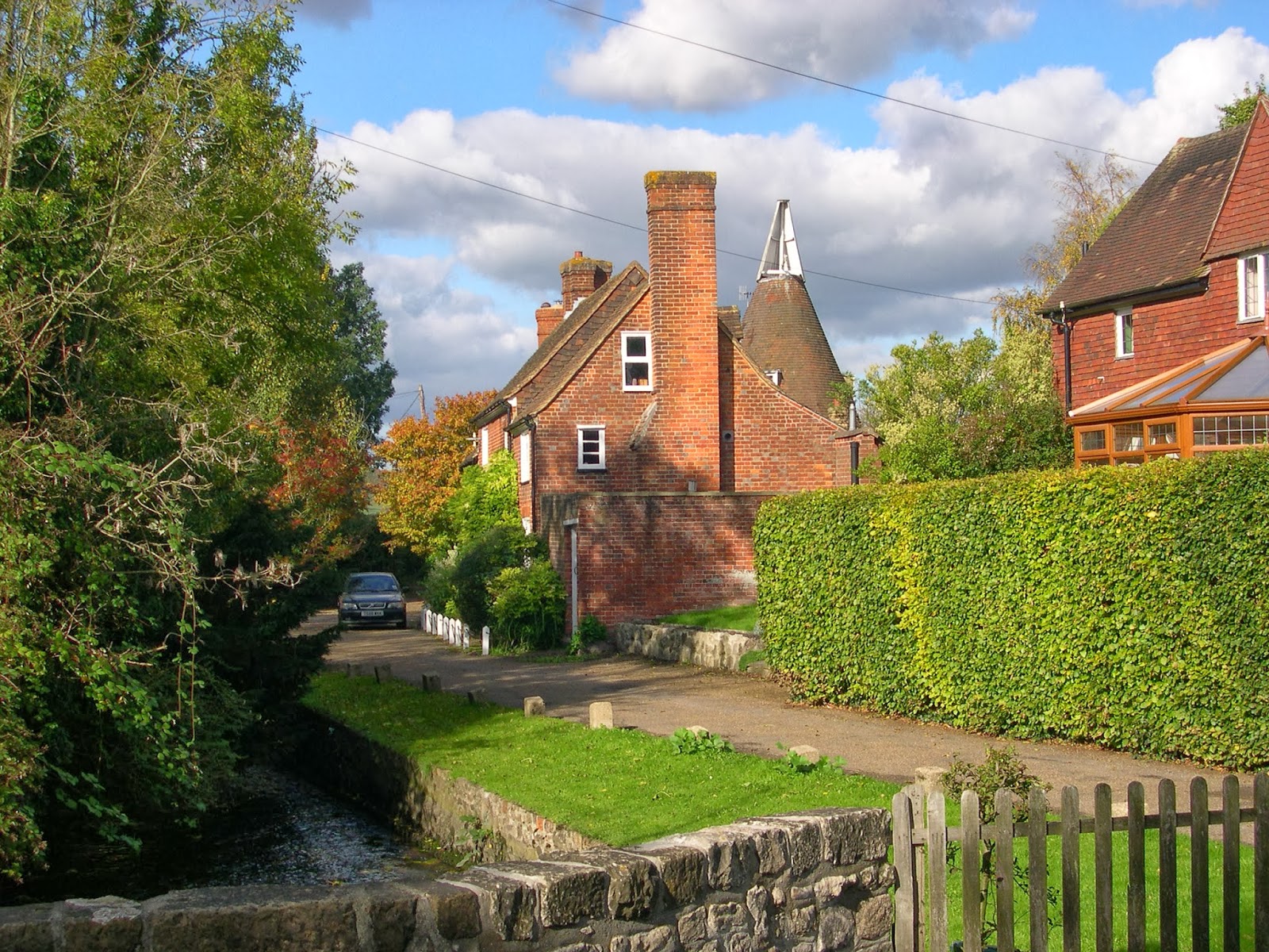
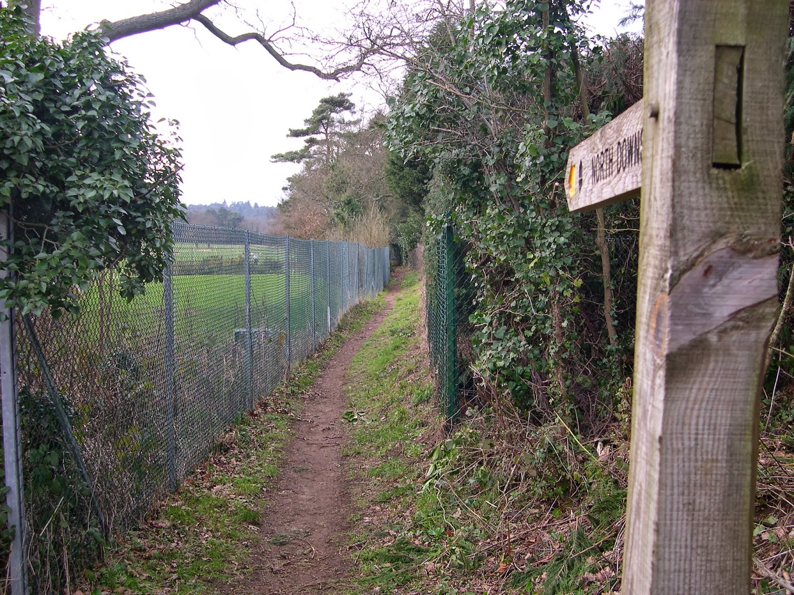
Almost another year had passed since my last outing on the NDW and it was now October 2007. The weather was almost identical to my last trip out on the Downs with sunny weather that was unseasonably warm. As I had found it fairly easy to park on the edge of Oxted last time out I returned to the same spot and once again used the Greensand Way link route out of town and crossed the M25 to reunite once again with the NDW.

AONB Sign
Initially the route ran alongside a number of fields that were in various stages of harvest and I was surprised that there were any crops left at all at this late stage of the year. Soon I would climb the escarpment up a sunken track through woodland. This marked the point at which the Vanguard Way crossed the North Downs on its way from Croydon to the south coast. At the top of the hill I reached a main road and lost my bearings a bit when I started out on the wrong direction, not realising that the true path was to head down the hill once again. When I realised I decided to regain the path by stomping through the woods rather than retrace my steps! It was around this point that I passed from Surrey into Kent, a fact marked by a sculpture of the symbol of the Surrey Hills Area of Outstanding Beauty.

Surrey-Kent Border
The next couple of miles of woodland and then across fields were unremarkable until I reached Tatsfield where the path initially went along a road accessing some very expensive properties next door to a golf course. This was a very attractive woodland path resplendent with large conker trees dropping their fruit like mad with every breath of wind. Through this section I also passed a milestone suggesting that I was about a third of the way along the route.

Rabbit Encounter
I found the going a little frustrating in that I was now towards the bottom of the hill once again and as I turned out of the woodland I started heading back up the hill. The NDW is not like the SDW in terms of following the ridge and giving great views along this stretch, although it may well improve later on. Nonetheless the countryside was very pretty and I felt good about having it pretty much all to myself. A little further on and I saw a sight that was a little upsetting, but still surprisingly common. I came upon a rabbit that was probably suffering from myxamatosis, since it made no attempt to run away as I approached. A little further along the field I was greeted with another problem, a churned up gateway that would be very hard to negotiate without getting extremely muddy.


Chevening Hillside
I got through it relatively unscathed but through luck rather than judgement. The going after this was much better and I soon came upon a great view of Chevening House, which I could see below me through a line of hedge. It made for a great picture but imagine how annoyed I was when I could see a contractors vehicle parked right in the middle, spoiling any chance I had of taking the perfect photo! A little further on an the best view was north, with a sudden view of the City of London that made it seem so close you could almost reach out and touch it!

Otford
Eventually the path wound round to the end of the ridge and descended into the outskirts of Sevenoaks and across the motorway once more. The last stretch of the route was to cross the Darent Valley and once I had negotiated a few roads in Riverhead it was out into open countryside once more for the short distance into Otford village. I soon crossed another railway line, one of the many that radiate out from London, but it wasn’t the one I wanted. For my train I would have to head through Otford village, an attractive place that seemed very prosperous. The station was at the other end of the village and I faced a fairly lengthy wait when I got there for my train into Sevenoaks. It was a fairly convoluted journey back as I had to get a train to Sevenoaks, change to a bus outside the station which took me as far as Westerham, where I changed once again for Oxted. Although the initial wait was long the rest of the journey connected up quite well and only took about half an hour in total.


Monday, 23 February 2009

North Downs Way Day 4 Merstham - Oxted

Merstham Fire Station
It was now November 2006 and I took the opportunity of heading out onto the North Downs again to enjoy some autumn tints on a fabulously sunny and warm day. I parked in Oxted on the outskirts where the link path from the Greensand Way to the North Downs Way met the town. From here the easiest way to get back to Merstham was to go by train via East Croydon although this was a fairly costly and time consuming business.

Crossing the M25
By the time I actually got walking it was about 10.30am, about an hour after I had started my train journey (by road it was only about eight miles!). When I got to Merstham I took more of an opportunity to look around a bit more than last time I was here. It was difficult to appreciate that this small town was only a stone’s throw from one of the busiest motorway junctions in the country, the M23/ M25 interchange. The A23 which still passed through town was pretty quiet, but it must have been grim before the motorways opened. On my way to the path from the village I found an old fashioned fire station that had presumably only had room for one small appliance. It was well preserved but was now functioning as a upholsterers.


Merstham Church
The path left town along a narrow lane that was obviously frequented by dog walkers as there were numerous signs telling them that they should not allow their dogs to foul. Although the roar of the traffic should have given me the clue that the motorway was close, it was nevertheless quite a shock to come out blinking into the sunlight from the shady lane to find myself on top of the M25 quite literally. As I crossed the footbridge I couldn’t help but speculate about where all the vehicles were headed and thank my lucky stars that I was out enjoying the sunshine rather than be cooped up in my car!

The Quarry Line
Once across the M25 it was back to rural England and I quickly came upon a very hidden pond where the reflection on the water was a complete mirror image of the surrounding bushes. I then went past a very large church and back across the A23 to head east once again. Considering it was such a wide road it was a cinch to cross, with all the traffic now diverted away a mile or so to the north. Once across the road I then crossed an older transport corridor, the London to Brighton rail line. This is in two parts, as the slow lines were by-passed by the ‘Quarry Line’ which ran parallel but would avoid Redhill to the south. As soon as I watched a train go past (which happens every few minutes), I continued on my way.


Chaldon
After wandering along a road with some very well-to-do houses with some great views, I crossed the M23 although this time it would be underneath. On the other side I climbed up on to the North Downs Ridge and continued along various farm tracks for the next few miles. There were actually a fair few people about, mostly using the opportunity of such fabulous weather to get their houses and animals ready for the winter. I had now gone behind the crest of the ridge slightly and across the fields in the distance I could see central London and Croydon, both scarily close!

Whitehill Tower
I passed Chaldon village, which had a very nice sign installed in 2004 (although they don’t say why?). Across the road was Whitehill Tower, which looked like it was once some kind of fortification but which was in fact a sham. Now a bit derelict, it is a folly like many others that litter our countryside and turn it into some kind of landscape park. That’s not to say I don’t like them however, they make our country special and give it bags of character.

Approaching Oxted
Eventually after passing through some lovely woodland stretches I reached the A22, yet another dual carriageway heading into Croydon. This wasn’t as busy as the motorways though and the footbridge was a welcome way of crossing. I next climbed up Winders Hill and passed a very attractive Lodge House before heading into the woods. The sound of the motorway running along the foot of the Downs was still very evident although fortunately it was a little dulled by the foliage still left on the trees. The leaves were now golden and gleamed in the sunlight and there was still quite a lot of birdsong.

Oxted View
Eventually I came to a set of steps above Oxted that were in direct line with the rail line that emerged from the tunnel I had passed through on the train in the morning. From here I continued around a large redundant quarry that was slowly returning to nature. A couple of fields later and I was crossing the M25 to head into Oxted and reunite with my car.

Saturday, 21 February 2009

North Downs Way Day 3 Dorking - Merstham


Mole Stepping Stones
A year had passed since I had been out on the North Downs Way. It was now February 2005 and I found a free day after dropping off my wife at Heathrow Airport. It would be my first day out of the year, but unfortunately the weather was pretty awful and while I needed the exercise it was not at all conducive for taking pictures. So, instead I waited another almost eighteen months before attempting the walk again. This is the day I will describe, since there was much more to be interested in than the fog, rain and mud endured first time out!


View From Box Hill
It was now July 2006 and it promised to be the hottest day of the year. It had been nearly three months since my week long outing on the South West Coast Path and I was feeling desperate to get out once again so I grabbed the opportunity even though it wasn’t the ideal day. I set out very early as I felt fairly sure that I could complete the day’s walking before the sun got too hot. I parked at the bottom of Box Hill (it’s free there, but unless you are a National Trust member there is a fee at the top). Almost immediately I crossed the River Mole by means of the stepping stones and then prepared to slog to the top of Box Hill. This was a very steep climb and by the time I reached the top I was already dripping and the day’s heat hadn’t even got going yet!

Path Companions
At the top of Box Hill I lingered for awhile, gathering my breath and admiring the view. The air was surprisingly clear for a summer’s day and I enjoyed the view over Dorking and across to the South Downs before getting on my way once again. This section of the North Downs was a little frustrating since it did not follow the ridge for most of the way, instead alternating between halfway up the slope and the top. It made for an unusually strenuous day, given the modest number of miles I would be covering.

Brockham Lime Works
As I left Box Hill I wandered through some shady woodland, most welcome on such a hot day. Soon I would reach Winterfold Hill and the path negotiated the side of an active landfill site and wound its way down to an old limeworks at Brockham. There wasn’t much left of the place, save for a very large Kiln Tower and a big scar in the landscape that is now ironically a site of special scientific interest. There was quite a lot of vehicle activity in the area so I couldn’t hang around long. I wandered further down the hill where I met the old quarry cottages, which now make for very desirable looking homes.


Brockham Quarry Cottages
I soon met a main road and had to walk alongside it for a short stretch, which was just as unpleasant as any other road walking. I was thankful to eventually cross the road and continue ever eastwards across open countryside. Eventually I reached a field of wheat overlooking Reigate Hill and found it so easy to cross compared with my winter walk from before. Last time the mud was so deep and thick that it was a real struggle to cross the field. Now, the ground was baked hard and I just heard the whispers of the ears of wheat as they waved slowly in the wind.
Reigate Hill

I faced another climb to the top of the ridge and eventually wound up above Reigate. It was now that I heard the roar of the traffic from the M25, a noise that would dog the remaining part of the walk. I passed an interesting old milepost that was nicely painted but horribly skewiff. Their was also a very large water tower hidden in the trees, which was obviously still in use judging by the railing fence around it and all the mobile phone masts on top. I couldn’t help wonder what it would be like to live there though, if it was ever declared redundant. Would make for an interesting project!

Art Installation
I soon left the trees behind and wandered along to Reigate Hill. The view from the top was truly magnificent and in my opinion vastly superior to Box Hill. I stopped for a long drink at the ‘temple’ on the top of the hill and admired the view for a bit. From here it was a short walk down to the car park adjacent to the Reigate to London road. I took a quick look at a fortification that looked as if it were from World War II vintage before getting to the car park and the very welcome little refreshment bar that operates here. After a top up with drink I continued on and once again down the hill although this was the last time. I wended my way around some school grounds, where the students were knocking off for the summer by the looks of activities going on.

Lodge Cottage
After leaving the school grounds via the lodge house I then negotiated Merstham golf course and found my way into the village. Not a hugely interesting place although it did once have one of the earliest railways when the Surrey Iron Railway once ran through here carrying freight to Croyden using horses. Some old rails are still in place in the village to serve as a reminder. For me though it was off to the station and a train via Redhill to rejoin my car back in Dorking and a breather from the hot weather.

Friday, 20 February 2009

North Downs Way Day 2 Guildford - Dorking

River Wey
A few weeks had passed since I had made a start on the NDW and it was now March although at the start of today you wouldn’t have known it as the weather was extremely cold and miserable. Unusually I was out on a Sunday and that meant only one thing; my options would be limited because of public transport limitations. In fact that is why I settled on a second day on the NDW as I knew that I would be able to get from Dorking to Guildford by train on a Sunday. I parked in the small car park at the bottom of Box Hill and wandered down to Depedene station where I caught the train to Guildford.

St Martha's Church
Of course the NDW does not go through the middle of Guildford but rather crosses the Wey Valley to the south of the town. I had a mile or so to walk down the towpath of the Wey navigation to reunite with the NDW, which was quite a pleasant little run. When I reached the NDW my first task was to dodge the Sunday League footballers who were out in force in Shalford Park. From Guildford I would link up with the ancient Pilgrims Way, once the route of people travelling to Canterbury Cathedral. This route either shares or follows most of the way from here on until the city of Canterbury. I climbed up out of Guildford and headed for the first major landmark of the day, St Martha’s Church a couple of miles further on. This is a very large church not near any village, which is a bit of a surprise. By the time I got up here it was perishing cold and snow was in the air. The air was heavy with black clouds, which gave the church a rather dour atmosphere, although on a sunny day I’m sure it feels somewhat different up here. The Church also marks the starting point of the Downs Link, a forty odd mile journey south to meet the South Downs Way. The church was also very much on a sandy hill and not chalk, which meant that in geological terms I was on the wrong ridge.


Albury Downs
That was soon put right as from the church I headed up on to Albury Downs, the first true section of a downland Ridge and only 13 or 14 miles into the walk. The view south from here was pretty amazing even on such a gloomy day and the Greensand Ridge was very evident. This would be the last view for awhile as after this short section (which was very densely populated with dog walkers) the NDW plunged into woodland where it very firmly stayed for a good couple of hours, with only occasional glimpses of the wider countryside. While I am a great fan of woodland walking there were few items of particular interest along the way.


Hackhurst Hill View
One bugbear of mine is the damage done by off-road vehicles and after the recent rainfall I can across perhaps one of the worst examples ever on this section. One of the tracks through the woodland had been turned into a muddy quagmire by goodness knows how many vehicles, making it almost impossible to get through without getting completely covered in mud. How I didn’t fall in it is beyond me. A little further on from here were a whole load of pillboxes, tucked away in the trees. I had never seen so many in such a small area before, but undoubtedly the result of needing to protect London at all costs.


Protection
Eventually I reached Ranmore Common and the character of the remaining part of the day changed considerably. The walk opened out into a plateau and by now the sun had made an appearance, brightening up the countryside considerably. I also got views once again and Dorking was not far ahead now. Ranmore Common had an interesting Victorian church, with an unusually shaped tower that was very large considering the size of the village it was meant to serve. From here the path ran down through the Denbies Estate, now locally famous for being a wine producer. Being March, all the vines were rather dead looking now, but I did fancy that one day I might come walking along here in the summer to see how different it might look. The other thing that caught my eye were the isolated Scots Pines on the estate. For my money these are the most interesting native trees we have, for although they have rather sparse foliage and can look a bit weedy, you rarely see two that look like each other.

Box Hill View
The dominating view though was ahead, with Box Hill standing proud above the Mole Valley. This would be for another day though as I only needed to reach the car park at the bottom, which I did within half an hour.

Thursday, 19 February 2009

North Downs Way Day 1 Farnham - Guildford


Beginning of the Journey
It's time to delve into the archive now to try and motivate myself to finally finish this walk. Back in 2004 when I started the walking season I had high hopes of completing the Greensand Way and the North Downs Way in the same year. The first was no problem and I completed by November, but even though I completed three sections of the NDW back then and have had a few nibbles since I've never got round to completing it and have only walked six sections in total.

Leaving Farnham
However, it's time I rectified that and so I shall give it another good go in 2009 with hopefully fewer distractions this year. This was one of the first times I had tried the model of parking the car at one end of the days walking and linking back using public transport. This was quite a good route to try it out on as Farnham and Guildford are connected by train and there is a good Park and Ride facility at the Guildford end quite close to the NDW.

Unusual Seat
The NDW proper starts on the south side of the A31 close to Farnham station. This is very convenient although it precludes a good look at Farnham if you arrive to go walking as I did. That's a pity because Farnham is quite an interesting town and warrants a look if you have time. The start of the NDW is what I call a proper start to a walk, coming complete with a large information signboard showing the highlights of the route, and most importantly a pointy sign proclaiming that it is a mere 153 miles to Dover.

Back to the Path After the Flood
Other than that it's a fairly inauspicious start, following a track alongside the river Wey and giving no clue to some of the dramatic ridge walking that will follow on later sections. It was quite a pleasant day, although one of those stubbornly overcast ones that give this country a bad name from Aussies and people used to more sunshine. The snowdrops were in full swing, and there was generally a vague hint of spring in the air.

Seale House
I came armed today with a new toy, my first digital camera and I was eager to use it! I began to realise that I could take a lot more pictures than I had been used to with my old film camera and so began snapping away. I soon passed a very curious seat that also proclaimed that it was 153 miles to Dover although it gave no other hint of how it came to be put there. After a fairly short distance of off road walking I was unpleasantly surprised to find myself back on a road as I crossed the Wey for the last time and headed for the embryonic ridge of the North Downs. The next section was a bit contrived weaving its way around a golf course and through a wood before I came across a major obstacle. The path ahead was completely flooded, with about a foot of water. It wasn't what I expected on a supposedly chalk route and after several dry days!


Seale Tree House
Luckily not being long out of civilisation there was an alternative route around the flood and within ten minutes I had managed to correct myself once again. Now the way forward, although not yet on a recognisable ridge, did head ever eastwards as I expected. It was not what I thought of as the main ridge however as this was occupied by the A31 dual carriageway just to the north on the Hogs Back. At first the path ran past an active landfill site with lots of activity going on using heavy equipment. Yet this was not as distracting from the countryside as might have been expected.

Lodge House
The way to Puttenham from here involved diving in and out of woods, which was very pleasant although not good for views. There were a couple of points where there was a good view across the Hogs Back, but perhaps the most interesting feature I came across was a rather curious 'tree house'. Someone had put in a pretend door into a tree and dressed it up to look like a place that a dwarf or similar lived in.


Puttenham
I soon reached Puttenham, the first substantial village en route and which was strangely quiet. Then I realised that as it was a weekday most of the residents were probably at work in Guildford or further afield. I didn't linger long in the village, although the church was as ever the focal point and deserved a bit of a look.


A3 Bridges
Just outside the village I crossed the very busy road that links the A31 and A3, which took some time. I headed out past the golf course (it's a popular game in these parts) and across Puttenham Heath and Monkgrove Copse. The woods were starting to show life with catkins already out and particularly attractive in the afternoon sun, which had finally put in an appearance. Shortly I reached the A3 and was struck by the contrast of old and new bridges across the road I was walking along.

Cheeky Sheep
When I reached the A3 I assumed that I was practically in Guildford, so the next couple of miles were a bit of a shock since it seemed as if Guildford wasn't getting any closer. Underfoot though it was very nice going as this section of walk was across very sandy terrain, which was firm and devoid of mud. Eventually I got the view of town I wanted and also found some amusement in watching some sheep climb over each other trying to get the best hay from a feeding station. Upon reaching the A3100 it was a short detour back to reunite with the car and the end of the first day of 11 miles walking.