Showing posts with label Wey-South Path. Show all posts

Monday, 6 October 2014

Loxwood and the Wey South Path

Merry Hills
Back to Sussex again now after all the trips away.  For the next few weeks at least it is unlikely that I am going to be able to do any ambitious trips but we are trying to pack a number of shorter walks in to keep up our fitness and enjoy the progress of autumn.  This next walk is from the Pathfinder Guide “West Sussex and the South Downs” (volume 66) and walk number 8.  Much of the route reprises footpaths I have taken when walking the Wey South Path and the Sussex Border Path, but I was keen to see the progress of restoration work along the canal.


Viewpoint
We saw this as possibly the last opportunity for an evening walk – by now the evenings were noticeably drawing in and soon we’ll have no evening daylight at all.  I do like the early mornings and evenings for walking – it is such a treat to have them.  The winter months do seem so very long.

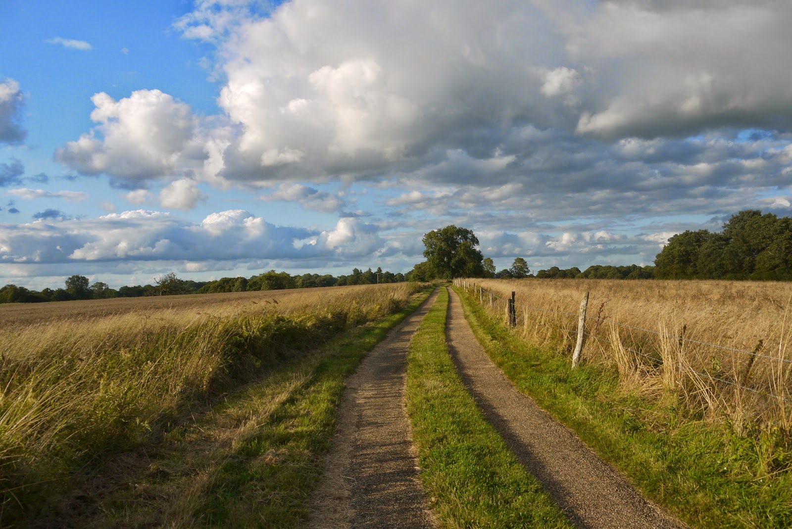
Golden Fields
Because of the lateness of the day we did not chance our arm at the Onslow Arms car park as suggested in the guide book but instead parked in Loxwood village. The first part of the walk was along the intriguingly named Spy Lane (I wonder how it got that name?) until we reached a small church.  He we turned and headed into the countryside where we were greeted with a sight that we only half expecting - a healthy crop of blackberries already ripe and ready to collect.  Luckily we had brought some containers on the offchance and set about collecting as many as we could, completely filling what we had brought.  We did linger for quite a while before I became aware that the light was going to fade on us unless we continued our walk.

Common Fleabane
After crossing a couple of fields we headed northwards but only after stopping to admire the view back towards the South Downs.  In these Wealden parts of Sussex it is easy to forget how high you climb for the terrain is not as pronounced as the Downs.  Yet there are spots such as this where a view can extend for many miles.

Sir Roger Tichbourne Pub
We continued to pick as we walked alongside golden fields of wheat and barley.  They would surely be cut any day now looking at their ripeness.  All around us were the beautiful golden colours of late summer - scenes that are short lived and very special.  The hedgerows were brimming with the fruits of autumn and the last flush of summer flowers and it was hard not to be distracted especially as my family were heading off into the distance while I stopped to look!

Oakhurst Farm
Eventually we came back to the main road after passing the wonderfully named Songhurst New Farm and Merry Hills.  The path came out opposite the Sir Roger Tichbourne pub, now looking in rude health once again after several years of neglect and closure.  We had to walk a short distance along the main road, which was not pleasant before turning right and heading down another country lane devoid of traffic. 

Purple Loosestrife
At Oakhurst Farm I was curious to see progress on the large farmhouse that had largely been a building site when I passed by in January 2012.  Much progress had been made but the site was still far from finished.  I guess it will be some time before completion.  For now though it wasn’t easy to see what still needs to be done, for most of the site is now obscured from view unfortunately.

Restoration Work
We wound our way through the countryside along the Sussex Border Path before reaching the old Wey and Arun Canal.  This is a path I have walked a few times and it was very interesting to me to see how much progress had been made on restoration works since I was last here over 18 months ago.  It looks like a significant stretch will be completed in the next few months, weather willing.  Much of the walk here though is rather spoiled by the current restoration works which has turned the towpath into a mudbath and ruined by caterpillar tyre tracks in places as the heavy machinery rumbles along here to do most of the donkey work.  It is all a far cry from the days of the navvy back when the canal was first built.

Devil's Hole Lock
Since my last visit along here I was rather heartened to see a whole new section of canal had actually opened to boat traffic, with another mile surely ready anytime within the next couple of years.   It is starting to really progress.
Flight of the Heron
Along the path we also saw a few natural wonders with sightings of deer, a kingfisher and a heron all making an appearance, much to our excitement.  The sun had most disappeared by the time we got back to the car but what a beautiful evening it had been (and good pickings too!)

Thursday, 8 October 2009

Wey South Path Day 3 Billingshurst - Amberley

Rowley Lock Bridge
Six weeks on from my last excursion and how the landscape has changed! We have been lucky with September weather this year, but unfortunately I didn’t pick the best day today, as it was resolutely gloomy for most of the morning with a lot of dampness in the air first thing. This is my final official expedition on the Wey-South Path, although I may be tempted later on to have a go at completing the route dubbed ‘London’s Lost Route to the Sea’. The navigation itself continued beyond the length of the Wey South Path, down the River Arun and along another canal between Ford and Chichester Harbour that was closed even earlier. That though is for another time.
Rowley Lock
I parked at Amberley Station (I wasn’t tempted to start my rail journey from Worthing as connections are awful) and took the hourly train service to Billingshurst. The single fare for the 12 minute journey was an eye watering £4.20, but at least parking was free at Amberley (be warned though, there are only a handful of spaces). Billingshurst isn’t terribly convenient as a staging post but probably as good as you’re going to get. I then retraced my steps along the footpaths I had stumbled along the other week to get back to the Canal at Love’s Bridge. I went back as far as there to right the wrong of not having any pictures on the previous day’s walking. This stretch of canal is tantalisingly close to Drungewick Lane and surely it can only be a short time before this stretch of canal becomes navigable once again. Indeed as I went further south to Rowley Lock, the restoration of the old lock is both remarkable and a little strange. This is because it seems to be stranded from the rest of the canal and offers a brief glimpse of what the whole thing will look like when restoration is finally complete. My eye was drawn to a large pylon straddling the canal at this point, for it appears to have been planned that way, with no attempt made to infill the canal to accommodate it.
Stranded Section
Ahead is some good canal walking for a mile or so as far as Newbridge. On the way I passed a lifting bridge that had been put back into place as early as 1980 by a group of task force volunteers. As I wandered further along I was joined by the River Arun, a rather more attractive waterway at this point. Alongside the canal though were some fantastic looking blackberries, which I just had to take with me! Within 15 minutes I had plenty enough to make me a crumble later – fantastic!
Restored Lifting Bridge
Newbridge is the crossing by the A272 and the river crossing is quite impressive. The canal crossing has sadly been reduced to a culvert, but there is still a canal cottage alongside. Further on though there is a much better canal cottage, alongside what would once have been a wharf. As I continued towards Lordings Lock, it was quite obvious that the canal was once again disappearing into the countryside and for a good quarter of a mile or so across one field it has almost disappeared, having been infilled.
Newbridge
Eventually as I got towards Lordings Lock I heard a very strange clanking noise and naturally assumed that a working party were out. The lock comes as a real surprise after the obliterated section of the canal. It has been mostly restored and I soon realised that the clanking noise wasn’t a working party but the waterwheel which supplies water to the canal (or the bit of it in the lock – either side is obliterated). It is a truly remarkable relic from a bygone age, completely stranded from other parts of the canal but just about complete (apart from lock gates). There is a small picnic area on the site (presumably put there for the benefit of canal volunteers) and it seemed the perfect spot to have my picnic lunch. I can’t say it was particularly peaceful as I was accompanied by the constant clank clank of the waterwheel. The air was full of the pungent smell of ripe blackberries as all the adjacent bushes were absolutely groaning with ripe fruit. I guess that being so far from a parking area, this is not a spot that attracts many fruit pickers.
Lock Keeper's Cottage
After inspecting the lock and waterwheel for some time and scoffing my sandwich I started on again. The aqueduct across the Arun here is missing but on the other side I picked up the course of the canal once again. For the next couple of miles it doesn’t appear that much work has been done to the canal bed itself, but in truth this is probably more to do with the time of year I am here (all the vegetation still in place from summer growth) rather than lack of effort on the part of the volunteers. It is obvious that this part of the canal is being very much readied for boat traffic as most of the major engineering features such as bridges and locks have all been restored as far as Haybarn Bridge. It is a very pleasant walk along this stretch and because all the infrastructure is now more or less in place it is easy to imagine the canal in working order some time in the not too distant future.
Lordings Lock

Haybarn bridge is an oddity. It isn’t the original bridge and is also the only swing bridge on the canal. It has been brought here from the Leeds and Liverpool Canal and was installed in 2004 (see http://www.weyandarun.co.uk/haybarn.html for pictures of the installation). For canal path people now though it represents an abrupt end to the towpath that the Wey South Path has followed for about 4 miles. In fact it is the last proper section of towpath walking at all heading south. From here I immediately passed through a deserted farm (probably because all the farm workers are busy getting ready for winter out in the fields) and then along a track seemingly heading towards Toat Monument, a folly tower that was built in 1827 to commemorate a hapless London tea merchant called Samuel Drinkald who apparently was thrown from his horse and killed on the very spot. Apparently his brother was a local racehorse owner, perhaps suggesting why he is commemorated here. Alas the tower cannot be reached on foot as it is sited on private land but acts as a tantalising landmark for miles around.
Haybarn Bridge
As it happens this is the closest the path gets to the monument and apart from a very brief meeting once again with the canal at Lee Farm Bridge a little further on, the route now takes on a slightly frustrating and lengthy detour away from the canal. This is because there has been a denial of access across the private land straddling the canal and there are relatively few footpaths in this area of the Arun Valley.
Pallingham Folly
By now it was early afternoon and the sun had finally put in an appearance. In fact within minutes it was pretty warm, which made the unaccustomed climb up past Pallingham Lane quite uncomfortable. The path heads up through pasture land and eventually reaches a country lane, where I turned left. A mile or so tramp along the country lane followed while I anxiously looked out for the lane that would reunite me with the canal for the last time.
Lengthy Deviation
All in all the deviation was more than two miles by the time I got back to Pallingham Quay Farm. This was once a substantial port, very difficult to believe now as the canal is mostly overgrown and the River Arun looks like not much more than a trickle. Just past the farm and the path crosses Pallingham Bridge, the last evidence of the canal itself and just a few yards from its very overgrown southern junction with the River Arun. Having completed a sizeable diversion to get here I soon realised after looking at the map that there was no prospect of a riverside walk either as the Wey South carries along the only available right of way swinging to the other side of the valley to follow another country lane almost all the way to Stopham Bridge.
Pallingham Quay
Eventually I reached a racehorse training area and the path deviates from the road here which was a welcome relief. The view from this spot was fantastic – ahead I could see the line of the South Downs and the ridge from Amberley to Washington. In front were the Amberley Wild Brooks and Pulborough Marshes, where I would eventually be headed. Nearer was Pulborough dominated by its church and just in front of me. While I admired the view I could also see the task ahead of me still for my ultimate destination was of course Amberley Station, situated just at the foot of the Downs ahead.
The Downs Ahead
I was pleased to leave the road behind a little further on and initially I wandered up through a sunken lane with lots of roots on show from the trees that were desperately trying to cling on. The lane was the main access to some very lucky homeowners who had the whole of the Arun Valley spread before them as a view. I turned left here and headed towards the remains of a Norman Motte and Bailey Castle, now completely hidden from view by woodland. The trees were a mixed bunch but with lots of sweet chestnuts among them. Squirrels were busily trying to gather what they could, while the trees themselves were starting to lose their spiky nut casings with a vengeance.
Stopham Bridge
Ahead I could hear the unmistakable sound of a busy road and soon enough I came upon the A283 at Stopham Bridge and reunited with the River Arun. The main road now passes over a modern bridge, but just to the south is the very attractive Stopham Bridge, which is essentially mediaeval and was unbelievable still carrying traffic until only a few years ago. In fact the old road markings and traffic light fittings can still be seen. Now thankfully only non-motorised transport can use the old thing, which is a scheduled monument. Adjacent is the very attractive White Hart public house and I made a mental note to come here for a spot to eat sometime soon.
The White Hart
Stopham Bridge marks a complete change of pace for the walk. The canal seems a long way behind me now as I negotiate the marshes that are the main feature of the Arun Valley between Pulborough and Amberley. Initially I crossed the Rivers Arun and Rother, which were once linked by a canal tunnel with remains still to be found hereabouts (I didn’t look, but this man has - http://www.dumpman.co.uk/page5.htm). By now I was getting slightly anxious about time as all my blackberry picking and picnicking loitering had caught up with me a bit. I crossed the old Pulborough - Midhurst rail line (mental note - explore this some time) and then the A29 before I headed across the marshes past Coldwaltham alongside an old canal cut that was constructed to cut off the large meander loop of the river.
Greatham Bridge
The next bridge across the River Arun is another corker – the 18th Century Greatham Bridge. Crossing this is a little tricky though as there is no footpath – it’s as well to make full use of the reservations on each of the masonry arches to make sure that you don’t get run over! Fortunately it was pretty quiet today and so I didn’t have to worry too much about traffic. The middle span is metal and slightly out of keeping with the masonry arches, but I suspect this was because it was needed for navigational purposes. This was my last crossing of the Arun today, the fourth in total and the river at this point looks much more like it is still capable of handling some decent sized boats.
Amberley Wild Brooks
I headed along the Arun bank for a short distance before the river meandered away once again. The path forges a fairly straight line across the Pulborough and Amberley Wild Brooks and after the closed in nature of the canalside section is was good to once again get out into ‘big sky’ country. I passed through a couple of farms and a herd of deer who couldn’t decide whether to watch me or flee (in the end they did neither – they ran a short distance before realising that I was no threat).
Foot of the Downs
When I reached the marsh I was slightly perturbed by the rather ancient looking sign suggesting that the marsh was dangerous. My imagination worked overtime, thinking about swamp monsters and quicksand, but in truth after such a period of dry weather it was an easy crossing. I bet it wouldn’t be much fun in the depths of winter though! As I approached Amberley I could here the most horrible sound. At first I couldn’t decide what it was, it sounded like a conveyor belt that needed oiling. As I got closer I realised it was a very large excavating monster with caterpillar tracks being driven by a grinning Environment Agency officer. He gave me a cheery wave for getting out of his way, but in truth I was never going to hold him up – he was big and mighty and I was an insect ready to be squashed!
Amberley Village
The Downs started getting closer and closer and I was starting to look forward to meeting the car once again. The sun was out again irritatingly, just as I was thinking about finishing my walk. The view across to Amberley Castle was lovely, although the best side is definitely the front side. This walk though wasn’t going to pass that close and this was the best view I was going to get.
Amberley Castle
Eventually I reached Amberley, one of the picture postcard villages of Sussex with its thatched cottages, castle and church. I poked into the village shop which had a lovely array of homegrown tomatoes lined up outside. Mundanely I only got a drink to wet my whistle, but this is a hidden but lovely little village shop well worth visiting.  The last section of the walk leaves the village and follows the road up over High Titten to give tantalising views of the old Amberley Museum below. This is also the route of the South Downs Way and a number of walkers were heading towards me, making the most of the lovely sunshine in this late afternoon. For me though it was a short plod down to the station to meet with the car and the end of the official walk.The Wey South Path is a hugely enjoyable short walking project. For speed walkers it’s not much good as there are many obstacles and diversions en route. It’s not particularly challenging as there aren’t many hills but for anyone interested in industrial archaeology I can’t recommend it highly enough. In fact I enjoyed it so much that I shall definitely continue down the Arun at some point and explore the rest of the waterway, including not just the river but the old canal between Ford and Chichester.

Wednesday, 19 August 2009

Wey-South Path Section 2 Cranleigh - Billingshurst

Canal Bed

After the appetiser a few weeks ago, I was keen to get back to this path although I knew that the next section from Cranleigh to Billingshurst would require longer than the extended evening walks/ cycle rides that I have been doing during the summer. It has been almost three months since I last did a walk of greater distance than 8-10 miles and so I thought this would be a good one to kick off the autumn season back on my three weekly frequency between days out. In truth it was a late substitute though as I had planned a trip along the seafront, but a forced mid afternoon start had put me off.
Scarcely Noticeable
Billingshurst is not the typical place to begin or end a walk using the Wey South Path, since it is a good mile off route, but it is an easy place to use public transport across a surprisingly remote and rural part of West Sussex/ Surrey. Since the demise of the rail route through Cranleigh, a less obvious interchange between buses is needed in the village of Slinfold. Despite being only about ten miles apart the bus journey between the two ends of the route is approximately fifty minutes, with a fifteen minute wait outside the Red Lyon pub in Slinfold.
In Water
I didn’t get to Cranleigh until almost 3pm, leaving about five and a bit hours to cover the twelve miles along the Wey South path to Billingshurst. At my normally steady 2.5 – 3 miles an hour that did not leave much room for manoeuvre. On reaching Cranleigh I retraced my steps up the Downs Link for a short distance until I regained the canal route just north of Rye Farm. Initially although on the route it was almost impossible to tell for the canal bed was obliterated although the path itself followed the original line. There was no going north along the line of the towpath though, any temptation was quickly extinguished by a warning sign of private property and dogs patrolling. Luckily I was heading south and within a few yards, a very overgrown stretch of canal started, mostly out of view behind a huge thicket of brambles but there nonetheless. I don’t know why but this early re-acquaintance got me quite excited about the exploration ahead.
Improved Section
The brambles eventually gave way to more established hedge and tree growth, enabling me to get down into the canal bed and have a closer look. There was no water and the canal bed was surprisingly wide and shallow. I wasn’t sure if it had been this way when built or had suffered some infilling over the years. As I continued past the very attractive Rye Farm, the canal bed got wetter and by the time I reached Elmbridge there was some very weed choked surface water.
Approaching Dunsfold
Elmbridge is still used by the B2130 road to Godalming and despite the fact that it has not been necessary for the canal for over 130 years, it still appears to be its original width and on occasion must cause a bit of a hold up for traffic since only one car can pass at a time. I also got very confused about the way forward here and thought I was going mad when the map suggested that the route continued due south of the bridge and I was confronted by a very high fence. Eventually I realised that a very high gate at the side of the bridge was actually where I was supposed to go and wasn’t just a private entrance to a garden. Clearly the owner does not want to go out of his way to publicise the route over his land. As it was I felt quite uncomfortable crossing the garden, while a couple of children were playing there. On the right of me where the canal should have been was completely infilled and built upon, leaving the path as the only remnant of the route (presumably a left over right of way?). I was glad to be across the garden and continued southwards. Further along the infilling was obviously still carrying on as a woman was returning with a wheelbarrow from the head of the tipping area. The canal here is being filled in with tree cuttings and any vestige is slowly being removed. I am sure having the hollow would be a pain if you had plans for the land, but I couldn’t help thinking that this behaviour is seriously undermining the effort going on elsewhere to restore the route.
Three Compasses
South of the tipping head and the canal bed was in much better condition, albeit still without water. The sun was beginning to emerge too and the fleece I had been wearing thus far had to go as the air warmed considerably. The official Wey South path did not continue very far along the towpath, and a deviation via West Cranleigh nurseries seemed on the cards. However, the towpath seemed to stretch forward ahead of me with no warning signs of private land or landowners releasing the hounds so I took the risk of continuing (if you follow too, on your own head be it!). It cut out about half a mile of unnecessary and from looking at the map, rather tedious looking walking. I instead enjoyed the towpath and looking at all the plantlife that had slowly taken over the canal bed. Himalayan Balsam in particular covered great swathes of the canal bed and wooded fringes, crowding almost everything else out. The bees and other insects seemed to love the stuff and with big gawdy pink and white flowers, it is perhaps easy to see why.
Road Causeway
At Mill Farm I had hoped to continue along the towpath in much the same way as a mile further back, but a big fence ahead of me put paid to that idea and I instead had to make do with the diversion along a nearby road. This emphasised the problems that the would-be restorers of the Wey and Arun Canal will have. If even the rights of way that would once have come with the towpath have been extinguished, what hope is there for a group of people wanting to rebuild the whole canal, fill it with water and potentially have dozens of pleasure boats going backwards and forwards along it? In these days of NIMBYism, people are very protective of their privacy and their land and don’t want the hoi polloi trampling all over it.
Reedbed
Ahead of me the canal bed was devoid of water and almost all structure, but could still be distinguished by the shape of the terrain. As I wandered sadly towards the road I could hear the sound of screeching tyres and a rather annoying plane that seemed to be taking off and landing every few minutes. Initially I thought the screeching of tyres was due to some very bad driving but when it persisted I remembered that I was approaching Dunsfold Aerodrome, where Top Gear is filmed. It all made sense to me now; maybe the plane was also involved in the filming?
Hint of Sunshine
The next part of the canal I reached was a bit of a milestone, since Flash Bridge coincides with crossing the main Horsham to Guildford road and also is the summit point of the whole canal. On the northern side of the road is Flash Bridge, perhaps the best preserved bridge on the route southwards so far. Since it is privately owned I did not inspect it too closely, but at last I felt that the canal was worth exploring not just for a few muddy and weed choked watery sections, but also for some of the remaining infrastructure.
Winding Hole
On the south side of the road the canal looks to be fairly well preserved as it skirts along the southern edge of Dunsfold Aerodrome (http://en.wikipedia.org/wiki/Dunsfold_Aerodrome). I followed the towpath for some distance until the next overbridge. There was absolutely no chance of exploring that as it was firmly fenced off by British Aerospace, although it is no longer owned by them. Apparently the current owners are trying to develop the site as a housing estate and retail park, or possible Eco-Town. When I crossed the field and rounded the mobile home estate further along I wandered along past the Three Compasses Pub to inspect the canal at this point and was rather surprised to see that the gate still suggested a military presence, such was the tightness of security and warnings not to take photos (I later discovered that a significant amount of test flying still takes place).
Derelict Garage
The Three Compasses was the pub that hosted the opening of the canal way back in 1816 and the owners are probably quite keen on the reopening of the route. The pub has lost not just passing trade from canal boat owners, but also the road in front was completely cut off when the aerodrome was built, severing the original route from Alfold to Bramley and necessitating in a more modern route to the east. Nevertheless the pub seemed quite popular as I passed by on a Saturday teatime, with quite a few people outside having a drink. I’ve no doubt that having a mobile home park on the doorstep helps, and maybe even Jeremy Clarkson pops in for a half of shandy when he needs a rest from the rigours of driving round the test track and pontificating on the various features of the cars he drives.
Sidney Wood
From the Three Compasses, the route follows the road again for a bit, which is fortunately quite quiet since there isn’t much room to get on to the verge. At Cobdens Farm the canal meets the road once again and when operational this must have been the scene of a fair amount of activity since there is obviously the remains of a wharf and winding hole (area used to help turn the narrow boats around). This is a recently restored section and the towpath is available for use, although I wasn’t sure for how far. I instead continued along the Wey South path through the adjacent forest until reuniting with the tow path about a mile further along the route.
Access Bridge
The next section was a joy as the route follows the towpath through Sidney Wood. In fact, I didn’t know it at the time, but apart from a few short diversions, the path now follows the side of the canal for getting on for six miles. As I wandered through the woods I could now see the vision of the Wey and Arun Canal Trust. Restoring this section is surely not a pipe dream but will become reality in the next few years, since much of the canal bed is intact and the route positively beautiful. By now most of the cloud from earlier had burned off and I was treated to a lovely early evening woodland walk. I passed by another winding hole and a section that was obviously once governed by some long disappeared locks, since the level of the canal abruptly changed at one point. A little way past here and I reached a large fenced off house, which was a bit of a surprise. This house, and the old lock keepers cottage a little further south are likely to be the cause of the most serious obstacle to restoring the route through here. It is unlikely that the homeowners are going to want to restore the route immediately past their houses, and the Trust are thinking seriously about re-routing the canal entirely here.
Awaiting Restoration
The path diverts away from the towpath for a short distance before coming to High Bridge, where the tow path is regained once more. The line of the old canal is obvious through the back garden of the old lock keepers cottage (now rather bigger than the original house!). I now left Sidney Wood and continued alongside the canal bed all the way to Loxwood and beyond. This is a section undergoing restoration and active work seems to be going on in a number of places, since I passed a number of warning signs about the path being closed. Fortunately I managed to get through without being inconvenienced in any way, but some sections have no real alternative routes so it would have been tough on me if I had come across any closures. In one place the bank looked as if it had been repaired to help with water tightness, while further along the lock at Devils Hole was undergoing what looked to be the final throes of restoration to help connect another section for cruising.
Work Underway
At Loxwood, the dry canal bed suddenly gave way to the very newly restored section under the B2133, which only opened in May 2009. This was a major obstacle to progress northwards from the adjacent Onslow Arms, since the road was built across the canal bed many years ago, completely severing the north and south sections. To enable the road to continue its present course without a level change (and maintain visibility along the route), the canal profile had to be altered to enable it to cross underneath the road.
Loxwood Improvement
The Onslow Arms is a very popular pub and is the point that most visitors will get top see the restored canal. Boat trips are run from here to help get people interested in the route and act as a fund raising opportunity (restoring the canal looks like it is hideously expensive!). It was pretty quiet as I passed, probably because of being a Saturday night. However, there were a few dog walkers about ambling along the towpath. This section makes for a very pleasant walk and seeing the canal properly restored here gives a lot of hope for the future.
Onslow Arms
As I meandered around the canal I came upon the Wiggonholt, the electric boat now operated by the Canal Trust, which was taking out a group of enthusiasts. I couldn’t help but smile as most of their cameras were focused on a very bemused looking swan going about his business on the canal. I crossed the Drungewick Aqueduct shortly after, another obstacle overcome a few years back which takes the canal over the River Arun. Sadly, this was to be the last of the towpath walking for the day, for beyond the lane bridge next to the aqueduct, the towpath forms a dead end and for onward walkers like me another lengthy diversion was ahead.
Zecchariah Keppel
By now I was also getting quite concerned about the time. With all the route problems earlier and the stopping and looking at features along the route, I was faced with the prospect of darkness falling before I got to Billingshurst. My camera battery had also died and so I decided that I would hot foot it to Billingshurst as quickly as possible, not stopping too much to look at any further features but save them for another day. However, I had not appreciated how much further it would be and the relative difficulty of the route (including a fairly scary section of road walking along the B2133). It was another hour between Drungewick Lane Bridge and Billingshurst and by the time I reached the car I got back just after the sun had set.
Improved section
This is a most enjoyable day’s walk, spoiled only by some fairly unpleasant road sections that are unavoidable but mercifully quite short. Eventually as more of the canal becomes restored hopefully there will be rights of access along the towpath and as and when this becomes reality this will make it a very enjoyable route indeed. As I wandered along the towpath I felt as if I needed to come back along here on a five year frequency to see how much progress has been made!
Open Sesame
In addition to my additional Flickr pictures of my walk (click title to view), you might also like to look at the excellent http://www.canalnavigations.co.uk/weyarun/wyarun01.html site where there are more pictures available. Some of the winter pictures of the section through Sidney Wood make for a good contrast with mine from high summer.
Evening Trip