Showing posts with label Worthing Area Walks. Show all posts

Wednesday, 31 December 2014

Cissbury Ring From Findon


Setting Off

Sometimes I am in the mood for a walk that is purely all about the views and doesn’t necessarily provide lots of historical or natural interest.  The Downs to the north of Worthing are definitely a case in point.  Largely devoid of trees or landmarks there is nevertheless an overwhelming feeling of space and freedom and this latest walk was definitely out to capture as much of that mood as possible.  This is walk 4 from the Pathfinder Guide volume 52 ‘More Sussex Walks’, rather misleadingly called ‘Cissbury Ring From Findon’.  I say misleadingly because the walk actually starts from the car park at the top near to Cissbury Ring and more than a mile from Findon.
Dewpond

My girls joined me on this walk as they were anxious for some fresh air too after a week of being cooped up indoors courtesy of the wet weather.  Today was a different prospect – big skies with puffy white clouds billowing across the landscape and lighting which showed off the South Downs at their very best.  From the car park we headed due east, not a direction we normally go from here.  The chalky path was surprisingly tricky underfoot due to the rather jagged looking flints that poked up to provide some rather nasty tripping hazards for anyone not paying attention.
Hawthorn Berries

Along the path was a very wintry looking landscape becoming rather devoid of colour as the lushness of the vegetation has diminished considerably.  A few of the hawthorn bushes were manfully hanging on to their red berries but the early lustre of shiny autumn fruit had been replaced by matt versions…  The girls wandered along behind me chattering to themselves leaving me to admire the landscape and the magnificent clouds.
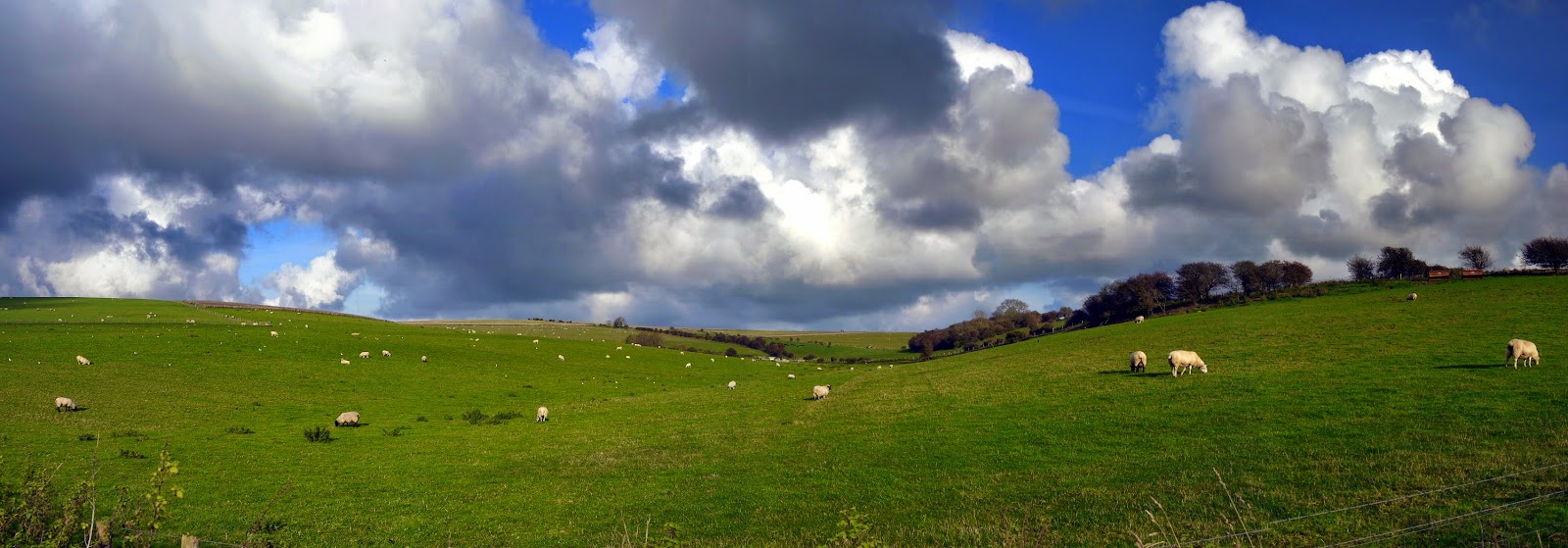
Magnificent Clouds

At Stump Bottom we paused briefly to take a look at a rather interesting looking dewpond.  I have never really understood why they are called dewponds, for they cannot be fed by dew.  What is indisputable though is that they are vital on the dry landscape of the South Downs.  Water cannot normally collect on the Downs as the underlying chalk is so permeable.  The days of the dewponds wholly servicing the refreshment needs of livestock are gone though and many, including this one, have become mini-ecosystems in an otherwise alien environment.

Lychpole Farm
We pushed on to the crest of the hill and then took a turn down to the right into a valley now occupied by Lychpole Farm.  This rather well appointed farm is tucked down into one of the dry valleys of the Downs and judging by the size of the farmhouse I would suspect that the original farmer did quite well for himself.  As we headed down into the farm we passed the only person that we met along the whole route before the end at Cissbury Ring.  Given that this was a Saturday afternoon with pleasant weather it was perhaps surprising that there were not more people about.

Farm Equipment
Once through the farm we wandered along a tarmac road through to Beggar’s Bush admiring the array of farm machinery that was in evidence as we did so.  Before reaching the main road we headed off on a track that took us to the foot of Lychpole Hill.  This is where the mud started in earnest!  For the next mile or so it was a struggle as we picked our way through the brown stuff in what is clearly a bit of a frost hollow.  There was no sign of the sun as we wandered along in the shadow of the hill.  It was also evident how tight the loop of walking is as Lychpole Farm almost looked within touching distance.
Into the Trees

After walking across a field that seemed to go on forever the path then passed into the woodland alongside Tenants Hill.  The underfoot conditions didn’t really get any better as we passed through the largely damp woods.  The trees had largely lost their leaves now and much of the understorey within the woods was dominated by old man’s beard and various other dead looking weedy plants.  Sadly there were no fungi even though we looked hard to find some.

Looking Back to Lychpole Farm
The path eventually came out at the ramparts of Cissbury Ring, our local beauty spot and much loved place to walk.  The official route would have had us walk to the centre of the old fort and then down to the car park from the trig point.  For us though we could not go to Cissbury Ring without walking the ramparts – that is the best part about visiting!  Whenever we come we always muse about what life must have been like for the hardy souls that lived up here in 300BC.  On a cold day like this it must have been very quiet with most of the inhabitants hunkering down in their huts with a big fire going.  I suspect though that the location would have been surrounded by trees so perhaps it wasn’t quite so windswept back in those days?

Cissbury Sunset
One of the main reasons for wanting to walk around the ramparts is that by now the sun was setting and I am of the firm belief that this is perhaps the best place in all of Worthing to see a sunset.  The orange disc cast wonderful light across the West Sussex coast and picked out the outline of the Isle of Wight in the distance.  It was quite a treat and a fitting finale to our short walk in our back yard.

Monday, 7 July 2014

Highdown Hill, Patching and Clapham


Highdown Towers

Another sunny Sunday morning arrives and I am up bright and early ready to enjoy another walk in my local area before the weather gets too hot.  This time I thought it was high time I explored more of Highdown Hill and the two villages of Clapham and Patching to the north west of Worthing.  I am familiar of course with these places but never before have I plotted a route that takes them all in together as one walk.


Iron Age Hill Fort
Highdown Hill is a familiar haunt for us when we want to go for a short evening walk.  This small outlier of the Downs overlooks the western fringes of Worthing and on a clear day it is easy enough to see the view from Beachy Head in the east and the Isle of Wight in the west.  On this particular Sunday I managed to find a very clear view and Brighton in particular shone in the early morning sunshine from my vantage point just above the car park.
Highdown View
Highdown Hill has an interesting history and the first hint of the history is the Miller’s Tomb, which is the burial chamber of John Oliver, who was the miller in question.  John Oliver was reputed to be a notorious smuggler who used the mill to warn his gang of impending investigation by customs officers by turning the sails in a certain direction.  He built the tomb when he was 56 but lived until he was 84, dying in 1793.  Some suggest that he used the tomb to stash his contraband.  The mill has long since disappeared but the tomb remains, providing a historical curiosity to all the dog walkers and other visitors to these slopes.


Far Off Arundel Castle
 Early people settled on Highdown Hill as the remains of an Iron Age hill fort will testify.  I imagine that the hill was sufficiently strategic as a vantage point that it was never likely to be ignored for long.  The panorama from the hill is magnificent with a view of at least 50 miles of coast spread before me.  I’m not sure whether the view would have been impeded by trees back then but I suspect that the view would still have been excellent.  Even on the inland side of the hill where there are still a lot of trees I was still surprised how much I could see.  The most eye catching landmark was Arundel Castle, which I have never seen from up here before despite the number of times I have been up here.


Highdown Poppy
From the crest of the hill I headed down towards the now sail-less windmill on the western slopes. This is Highdown New Mill (or Ecclesden Mill), built in 1826 but by the end of the 19th Century it was out of use and by the 1930s it was an ivy clad ruin.  You wouldn’t guess it now as in 1970 it was renovated to become a house and looks quite smart these days, although it never recovered its sails.


Roundstone Boot Fair
As I walked down to the mill a glint of sunlight caught my eyes and as I looked down to where it came from I noticed the large array of cars all gathered for the weekly boot fair at Roundstone Farm below.  The farm is so named apparently after an incident in which a mill stone rolled down the hill following an accident.  The boot fair is an enormous undertaking and from my high vantage point I could see hundreds of people milling around the site like ants.


Highdown View West
Eventually I came  upon the Angmering by-pass, only built within the last ten years but given how it has integrated into the countryside it seems a lot older.  Luckily I didn’t have to mess with it at this stage for my path doubled back around through the estate of Ecclesden Manor, a house of Tudor origin I believe although it was hidden from sight much to my disappointment.  I did enjoy the old estate cottages on the approach road though and especially their well-tended gardens.  Soon I was out into open fields and after wandering alongside some crops I came upon a camp site that I never knew existed (remember that I am no more than five miles from home here!).  The campsite appeared to be populated by a girl’s youth group (Girl Guides maybe?) and they were all busy striking camp.  The frenzy of activity seemed strange considering the peace and quiet I had enjoyed so far.


Highdown New Mill
A little further on and I passed to the side of a farm and then headed down to the Angmering Road that I had by-passed earlier. This time I crossed and walked along it for about quarter of a mile before heading under the dual carriageway section of the A27.  On the north side I met with the old part of the A27 that I remember from my childhood when this stretch was notorious for accidents.  I passed the World’s End pub, which used to be called the Horse and Groom.  As a child I remember the A27 passing through most of these sorts of places in single carriageway, making the journey quite slow but also affording us the perfect journey in which to play pub cricket.  This game kept us amused for ages and relied on scoring runs by the number of legs in a pub’s name.  This one, the Coach and Horses and the Fox just up the road was a big score with the ‘batsman’ getting at least sixteen runs for passing.  In pub cricket if the pub had a name with no legs (eg The Crown), the batter would be out and the turn would pass to the next person.


Ecclesdon Manor Cottages
My road walking continued all the way into the village of Patching but was ok because the road was pretty quiet for its whole length.  I don’t remember exploring this village very much before but I was taken with how picturesque it was.  It was hard to believe I was so close to Worthing as it was so peaceful.  The village has a large number of thatched cottages and yet somehow it managed to stay the right side of being a bit twee.


Dog Rose at Patching
I walked up through the village to take a look at the church at the north end.  The church can be seen from quite a distance away but up close it seems to be nestled into the countryside.  I had to satisfy myself with looking from outside only as it was being readied for the morning’s church service.  I doubled back and took the road over to Clapham village just the other side of the dry valley from me.  By now the day was warming up as it was gone 9.30am.  I had the feeling that it would be quite a hot one later so I was thankful for the early start.


The World's End
Clapham village is not quite as picturesque as Patching but nonetheless there were lots of lovely houses lined up along the main street.  Both are proper Downland villages though with flint cottages largely the order of the day.  I wandered up to Clapham church, which unlike its near neighbour is almost completely hidden from view and even stands away from the village it is meant to serve.  I went up to take a look although as with Patching I had to satisfy myself with an outside look for it was a Sunday.


Patching Church
I then made the mistake of crossing the field behind the church and heading into the wood thinking that this would be my onward path.  When I realised my mistake I didn’t have the motivation to go back so luckily managed to right myself by taking a path through the woods that wasn’t marked on the map.  This was a delightful walk, for the woods were thronged with butterflies and I was pleased that I had finally left the road walking behind.
Patching Cottage


Once back on the right path I left the woods and the air was suddenly filled with a much less pleasing sound as work was going on at what I took to be a rest home for the elderly although it looked like it might have had a former use.  My path then took me across fields towards the north western edge of Worthing and as I got nearer to the A27 once again the sound of traffic disturbed the peace.  I enjoyed looking at the houses on the edge of the woodland that marks the section of Downland between Clapham and Worthing but otherwise I was now reaching a much less interesting part of the walk.  At the end of my track I headed down towards the main road and as I did so the turrets of Castle Goring could be seen above the trees.  Sadly at this time of year that is all you can see of this old building as the frontage is hidden by the trees.


Clapham Church
I crossed the A27 but not without difficulty as this is an extremely busy section.  I could hear loudspeakers on the other side of the road and it took me a while to realise that these were coming from a local Gymkhana.  The piece of countryside to the south of the A27 has a scruffy and unloved feel to it although in truth this wasn’t helped by the rather dishevelled looking rape seed crop that was awaiting harvest.  This area is also zoned for housing so at some point this last piece of major undeveloped land in the Borough will probably be built on.  So far though all such plans have come to no avail as the last set were thrown out by the planning committee.


Zoned For Housing


I wandered around the side of fields and past the large Tesco that has been built here in the last few years, probably in readiness for the new housing estate.  I skirted the existing edge of Worthing and crossed another busy road in the shape of Titnore Lane.  Now my nose was filled with the pungent smell of composting as I passed by the composting facility that occupies the small quarry on the eastern side of Highdown Hill.  The track up the side of the hill was pleasant and thankfully not too steep as by now I was ready for refreshment and an end to walking. 

The Farmhouse Durrington
This was an interesting walk and plenty of history along the way.  Sadly my enjoyment was somewhat diminished by the last couple of miles which were largely uninteresting and seemed to be unnecessary mileage.  I think if I am to repeat this walk I might need to modify the route slightly but on the whole I was satisfied with my morning’s work.

Saturday, 28 June 2014

Washington and Sullington

 
Rowdell

This year I seem to have been doing walks little and often.  Getting out to do the big expeditions has been very difficult due to family commitments but instead I have been enjoying early morning Sunday walks a lot more locally.  In fact considering I have lived in Worthing for 14 years I am still surprised at how many local walks I haven’t done and I am very keen to redress this over the coming months.  What I am aiming for is to develop a bank of local walks that I can just do without thinking too hard about where I want to go.


Common Spotted Orchid
On this particular morning I thought it was high time that I explored a section of the Downs on the other side of the valley from Chanctonbury Ring.  Most of the time when we head up onto the Downs we focus attention on the part between Washington and Steyning and almost ignore the adjacent section along to Amberley.  Yet, in many respects this ridge of the Downs has more to commend it.
Monument


I set off from Washington village, parking by the church.  I am not sure how this small Downland village came to have the same name as the founding US President as apparently he took his name from another Washington in the north east of England.  However the village is typical of Downland villages in Sussex with predominantly flint built houses and a popular looking pub that came with the construction of the east-west and north-south turnpike roads that are now the A283 and A24 respectively.  The main roads now by-pass the village giving it a rather tranquil air slightly removed from modern life rushing by.
Dog Rose


I crossed the by-pass bridge and headed initially along the path along the foot of the Downs.  This is actually an alternative route for the South Downs Way which avoids the dangerous road crossing further south on the main route. The traffic noise soon receded as I dog legged around some of the rather well appointed looking country houses.  It would soon be clear that this would be a day for enjoying wildflowers.  Although most of the spring ones had now gone, including bluebells and wood anemones there was a lingering smell of the wild garlic from the now withered looking leaves.  Other flowers were also taking their place including bramble flowers, poppies and various types of orchid.  With the flowers were large numbers of insects and the air was alive with the buzzing of bees and flies and it truly felt that the transformation from spring to summer was well underway.
Small Tortoiseshell


Once clear of the houses I headed up a track that took me slowly up the scarp slope of the Downs.  This was not a steep climb but a slow and steady one and I took the opportunity to wander slowly so that I could take in the ever-changing view as I ascended.  The heat of the day was tempered by a lovely breeze and as I reached the top of the Downs I got the full benefit.  Alongside my path were lots of brambles and these were alive with butterflies, especially small tortoiseshells, which seem to absolutely love these extensive thickets.


Chantry Hill Poppies
At the top of the slope a large piece of stone caught my eye, principally as this is so unusual in a Downland setting (chalk doesn’t tend to last too long in the open air).  When I got up close I discovered a memorial which looked half finished.  It seemed to be fashioned into a kind of chair, but the block that had been removed from the larger piece of stone to create the ‘seat’ was left to one side.  When I looked at the date of the memorial I realised that it probably was its finished state, which struck me as even odder.
Chantry Hill Views


After pausing for a few minutes I headed on my way and soon met up with the South Downs Way.  This was initially set back from the top of the ridge so my views were southward rather than northward as I would have expected.  Below me in the far distance I could see Worthing, although it looked close enough to easily walk to.  As I headed west the view of the western end of the Sussex coast and beyond towards the Isle of Wight opened up.  I always am surprised at how green this area looks, considering that the Sussex Coast is so densely populated.


Chantry Hill Views
I followed the South Downs Way until the Chantry Post Car Park.  This rather handy place is good as a base from which to launch other walking opportunities and I have no doubt that in the months to come I shall probably try a few possibilities out.  I stood and admired the view south for a few minutes (and also the radiant poppies in the adjacent fields) before heading over the ridge on to the north side. 


Common Rock Rose
This was perhaps the most delightful part of the walk.  I had a very welcome breeze in my face and a fantastic view right out across the Weald of Sussex towards Horsham and Box Hill beyond.  The sky was full of wispy cirrus clouds and I couldn’t take my eyes off the view!  Sadly my route soon took me back down the scarp slope and to the farm at the bottom of Chantry Lane.  All the way down the grassland was full of a profusion of flowers, most notably common spotted and pyramidal orchids.  At the bottom of the hill I had to cross a field of racehorse who bowled over to me to see whether I had any titbits for them to eat.


The Chantry
I headed east along the foot of the Downs, passing a hayfield getting its early summer cut.  It seemed weird seeing this already but looking at the uncut part of the field it clearly needed it.  On the other side of my path the field of barley was looking in a complete state, albeit very green and some way from harvesting.  It waved in the wind in a rather mesmerising way, creating sweeping patterns as the stalks were caught by the breeze.
Wind Blown Crops


I soon reached Sullington Church, a rather small parish church at the foot of the Downs that appears to have lost the village it was meant to serve.  I took the opportunity to take a look inside and discovered that it was very well kept and obviously well used which was rather heartening.  The stained glass windows looked particularly good in the bright sunlight.


Sullington Church Windows
My onward route back to Washington was largely through fields of broad beans.  I wouldn’t necessarily have known that from the appearance of the plants (I am no bean expert!), but the smell was unmistakable!  Virtually all the plants were in full flower and the scent from the flowers was broad beans – I can’t believe that I have lived all these years and not previously known that! 
Sullington Church

My route back to Washington was undemanding but with the day now getting a lot hotter I was rather relieved by that.  About half a mile short of the village I found myself back on the path that I had taken my outward journey on and the traffic noise soon returned.  Despite this small annoyance though this was a delightful walk and one which I think may well become a regular for me.  The view from the top of Chantry Hill is probably the highlight but I also enjoyed the two churches of Washington and Sullington

Monday, 2 June 2014

Chanctonbury Round


At The Foot of Chanctonbury Ring

My latest Sunday morning walk was quite close to home as I had limited time available.  I think this particular one could become quite a popular route for us over the next few years as it has almost every element of the perfect outing – history, woodlands, a great view and even some sea if you crane your neck enough.  It was rather a strange mixture of very muddy in places and very dry elsewhere so my pace was rather intermittent and the whole thing took slightly longer than I had anticipated.

Abandoned Tram
I started out at the car park at the foot of the Downs at Chanctonbury Ring, which is approached via a short lane from Wiston.  I headed east through Great Barn Farm and as I did so I made sure to look out for any old farm relics as I did so.  I have found that there are some great old rusting tractors and other machinery lurking in some of these yards.  I wasn’t disappointed although I was rather unprepared for what I found – a disused tram car.  Not sure where it came from but it looked continental and is now being used to store all sorts of what I euphemistically might call memerobilia.

Morning Light
My walk along the lane was very muddy and I soon got quite practised at hopscotch around the puddles and the worst of the mud.  This looked like an old coaching road, but progress along it by horse and cart back in the day must have been very slow and uncomfortable.  The light along this section of path though more than made up for the muddy conditions.  My nose was full of scent from the wildflowers and especially the cow parsley that lined the verges all the way along. 

Wiston House
I soon came to Wiston House, a rather large manor house that is home to the Wilton Park Conference Centre, established immediately after World War II.  This is renowned as a venue for international politics and started life helping shape peacetime Europe as hosted by Winston Churchill.  The building has a long history too dating back to Tudor times and being a key building in the English Civil War.  It is now owned by the Goring family and has been for many generations back to the middle of the 18th Century.  Views from the path aren’t that great though – I guess somewhat deliberately.  No statesman is going to want to be gawped at while eating their breakfast kippers by a dishevelled and sweaty hiker…

Mouse Lane View
As I continued the path opened out somewhat and the conditions underfoot dried out.  I was now walking along Mouse Lane towards Steyning and the open aspect of the path made me realise that the air was rather murkier than I expected.  Instead of being clear there was a vague mist hanging around the countryside, possibly courtesy of the early hour. 

Glimpse Back at Wiston
Just before reaching the edge of Steyning I took a left along a narrow path and climbed steadily up the scarp slope of the Downs.  Initially the path followed the edge of a field and was lined with a profusion of wild flowers and especially pink campion, may blossom and dog roses.  As I climbed I got a brief look across towards the scarp slope of the Downs at Truleigh Hill and then back towards Wiston House before plunging into woodland for the rest of the climb.  This is clearly a popular route for mountain bikers as there was evidence of them being around all the way up the hill, but I think I had managed to get up before any of them!

Truleigh Hill View
I puffed my way to the top enjoying the coolness of the trees now they are fully clothed.  This certainly made for easier walking conditions as the day was already starting to get surprisingly hot even though it was only breakfast time.  At the top of the hill I finally ran into some cyclists and in fact I soon realised that there were plenty about – they just seemed to be restricted to the South Downs Way.  Seeing how dry it was though I can’t say that I blame them.  The views south from here were rather better than northward – maybe the sea air was fresher than that north of the Downs?

View Across to Cissbury
For me I was now walking a well worn route to Chanctonbury Ring.  This viewpoint is one of my favourites and seems to change every time I come up here.  Today though the view wasn’t that great on account of the misty conditions that I described earlier.  I couldn’t even see an inversion – just murkiness, which was rather disappointing.  The grassland surrounding the old ring though was pretty as a picture, covered mostly in buttercups and clover.  I did hang around looking for some good photo opportunities but in truth I think that I had better luck back in the autumn and winter.

Summer Meadow at Chanctonbury Ring
Just past the Ring and I headed down the steep track that leads towards the village of Washington.  I was pleased I hadn’t come up this way for it was very steep and I soon heard the puffing and blowing of a group of girls that were heading in the opposite direction.  When they approached I soon realised that they were half my age and I knew then that if they were struggling I certainly would!  They did slightly annoy me though for I had the perfect butterfly image lined up until it was disturbed by their panting…

Murky View
Ahead through the trees I could see the former windmill at Rock Common.  It looks worthy of investigation (maybe a future exploration?) and certainly an unusual home.  My view was short lived as once again I disappeared down into the woodland for the short distance back to the car park.  This was not a particularly pleasant walk though for the track was very muddy, courtesy of the shade created by the trees and the clay underfoot.  I was very relieved when I got back to the car. 

Rock Common Windmill
For a couple of hours walk this was perfect.  I may well try it again when conditions are dryer and maybe in the evening would make for a different mood?