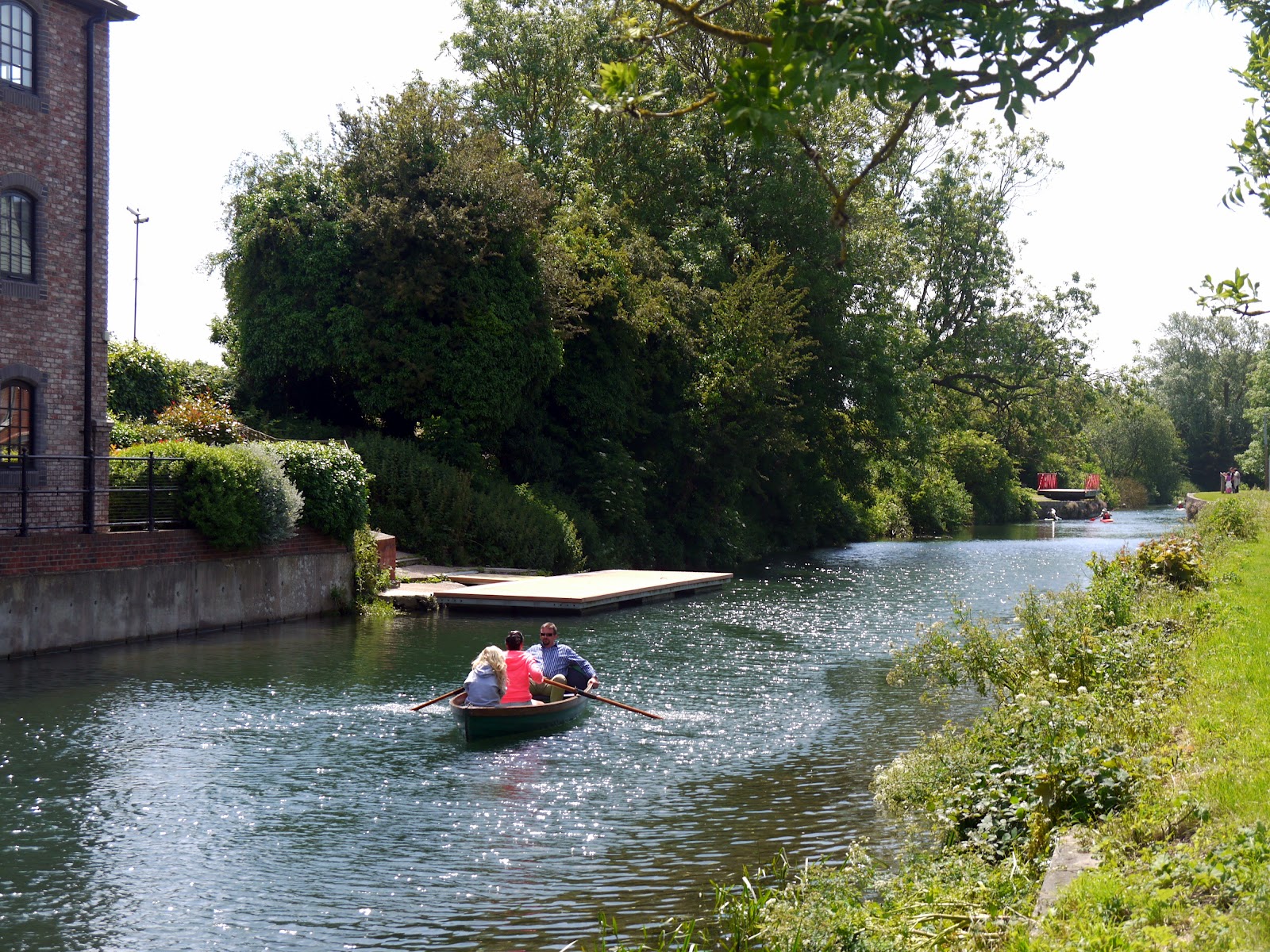
Friday, 13 July 2012

1066 Country Walk Section 4 Winchelsea and Rye


St Leonard's Church

Last week I finally managed to find a small window of opportunity to finish off the section of the 1066 Country Walk that I had had to abandon at the beginning of June on account of the torrential rain.  Given that there was only a three mile stretch left between Winchelsea and Rye I decided that it would be a good opportunity to do a loop and incorporate a section of the Saxon Shore Way
that had equally been spoiled by weather back in 2005, although on that occasion it was heavy snow.
Winchelsea Houses

I parked close to the bus stop where I had previously abandoned the walk and was pleased to see how much sunshine was around over Winchelsea.  With a fairly stiff wind and lots of puffy white clouds around I knew that the conditions may not last long, so I took the opportunity to take a good look around the town/ village (locals argue over the status!).

Strand Gate
As well as the half ruined church (apparently damaged in a French Raid in the 1300s and not fully repaired) the town is very much like a quieter and smaller version of Rye, the tourist honeypot that Winchelsea faces across what would have once been the sea.  I wandered down to the Strand Gate for a look at that entrance and then a looping route to pick up the official path heading off to Mill Hill.  This was once the home of a windmill that became a victim of the 1987 Great Storm.  Only remains of the mill can still be traced after the structure was almost completely destroyed in the storm.  Just along from the remains of the mill is also an old boundary post from Hastings, a reminder of the extent of that Borough before local government reorganisation.
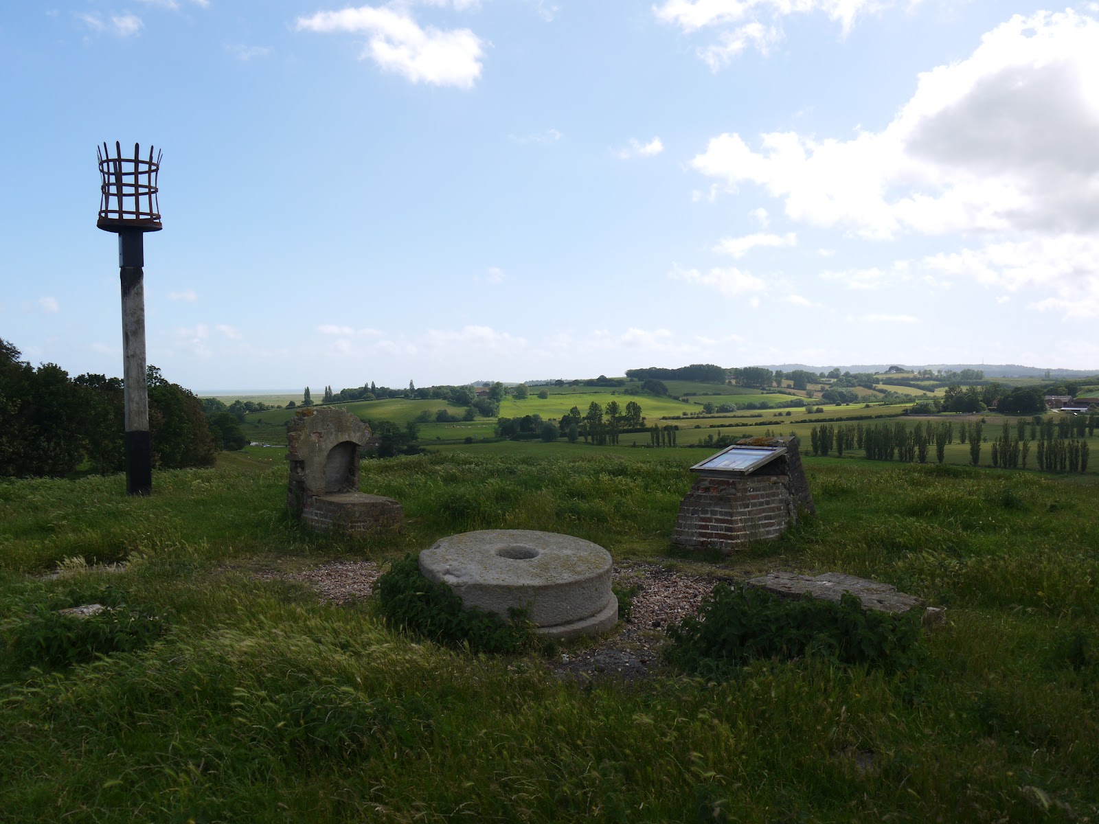
Site of Winchelsea Windmill

The hill itself had a prominence that far outweighed its height.  In Roman times the low lying land was full of seawater, although I suspect that it actually resembled a bit of a salt marsh and was affected greatly by the tides.  Now it is pasture and arable farmland for the most part and the former appearance can only be guessed at.  I suspect that the hill on which I was stood had a modest cliff line.  The path wound around the hill to appear back on the main road that I had crossed only a couple of hundred metres away.  In order to climb the hill, the A259 takes a tortuous route around the foot and via an enormous turn of almost 270 degrees.  I would not like to meet a double decker bus headed towards me on the bend!

Daily Commute

After my brief dalliance with the main road I headed along a country lane towards Winchelsea Station, more than a mile from the place it is meant to serve.  Probably for this reason the station has been downgraded somewhat and now only gets a service of half a dozen trains per day, with lengthy periods between them.  Not a very convenient way of getting to Winchelsea – I guess this is a ‘Parliamentary Service’ put on only to prevent the closure of the station rather than be of any real benefit to the passengers wanting to use it.  The station itself has also been rationalised, with the old station house now a private residence and that platform no longer in use.  Only a concrete open platform remains, although the railway staff have done their best to prettify it by putting some planters with flowers along its length.

Winchelsea Station

I continued along the lane until reaching a junction at the foot of what would have been the old cliff line at the far side of the valley.  The took a right at the wonderfully named Dumb Woman’s Lane – I’d love to know the provenance of that one!  I also had to take evasive action to avoid a large number of cyclists that were coming up behind me – they were also taking advantage of the small amount of good weather being enjoyed that day.

Former Cliff Line

I left the tarmac road as it headed up the hill and continued my course along the foot of the old cliff line.  This turned out to be a most agreeable section of walk – full of bird and butterfly life.  I wasn’t good enough to be able to capture any on film alas.  The constant light and shadow from the clouds scudding across the sky made for constantly different views and in this rather flat landscape the sky looked very big indeed!

Spider Meal
I had a happy moment as I approached a gate for in the opposite direction was an old gentleman, who looked to be on a similar mission to me, with his binoculars ready and camera poised.  We reached the gate simultaneously and shared a moment as we speculated on how coincidental that was when we were probably the only two walkers within a mile radius!

Rye Windmill

A little further on and in between the frustration of trying to photograph Red Admiral butterflies and rabbits running away hell for leather as I approached, I caught sight of a spider eating a hapless looking bee.  It wasn’t a spider in a web though but one cunningly camouflaged on a wild carrot flower.  An amazing sight that I had never seen before!

Swan Family
As I approached Rye I passed by a very unusual water treatment works – in fact it looked surprisingly grand for such a modest sized building.  Sadly it had been made vandal proof which had rather spoiled its good looks.  Above me was worse news though when a very large black cloud came overhead and rather spoiled my picture taking for a few minutes as it became rather dark.  Any notion of taking some pictures in Rye were rather dashed therefore and while I did linger for a short while at Rye Windmill, I decided that I would push on back towards Winchelsea rather than hang around for some more blue sky that might never come.

Looking Back to Rye


This ended my walk along the 1066 Country Walk – I have only the Bexhill and Hastings links to do now for this most agreeable little project.  It really does cover most of the main points of interest in this part of East Sussex, although if I am just a little critical of the route it would be that the Saxon Shore Way and 1066 Country Walk should swap routes between Rye and Winchelsea to make both walks a little more authentic for what they are respectively trying to achieve.

Guarding Camber Castle

Anyhow, I took the Saxon Shore Wayroute out of Ryeand headed through some very large sheep fields.  For most of the way to Camber Castlemy ears were full of the sound of bleating sheep, with the call of the lapwings that live in these parts accompanying them every so often.  It was a most peaceful evening besides that and despite the pretty good weather there were very few people about.  Before I got to Camber CastleI also had an encounter with a swan family that were getting pestered by some black headed seagulls.  I gave them a wide berth as they didn’t look too good tempered!
Royal Military Canal

By the time I reached Camber Castle, the large black cloud above me had dissipated and the castle was periodically lit up once again.  Camber Castlewas one of Henry VIII’s Device Forts, built to a similar design to others at Deal, Walmer, Southsea and Pendennis.  It was originally built to protect the Ryeanchorage, but since the retreat of the sea in these parts it now looks rather incongruous.  I was rather bemused to see that it now charges an entrance fee, which seemed a bit much considering that it is a mile from the nearest road and consists of only a ruin.  I hope English Heritage raise enough £3 entrance fees to make opening worthwhile, let alone have any money left over for renovations.  Anyhow, I wandered all round this fairly complete and lonely structure, fascinated by the enormous pits that have appeared in the stonework through 500 years worth of erosion.
Canal Crossing

By now the wind seemed to have whipped up more and the trees were blowing inside out and the clouds racing along as I re-approached Winchelsea.  I decided to walk along the Old Military Canal to the west end of Winchelsea so that I could re-enter the town through the New Gate and take another look at that in the sunlight rather than the driving rain I experienced last time.

New Gate
Walking along the canal was quite an experience.  I initially passed a young family trying their best to have a picnic hunkered down in the long grass.  Every so often a big black cloud looking like it would be full of rain would pass by and the path wasn’t the most pleasant to follow as it was quite overgrown.  I was glad to regain the road back through the New Gate and was pleasantly surprised when the sun reappeared properly for my triumphant entrance back into Winchelsea.

Wickham Manor View
On the way back into Winchelsea I saw many of the same sights that I had on the last stretch, but with the added bonus of seeing them in sunshine!  I did get a better look this time though of the house called Greyfriars, a large house built on the site of a former priory that was dissolved by Henry VIII during the Reformation.  Not much of the original priory is left for much of the stone was hauled away to build Camber Castle.  Priorities eh?  Sadly the glimpse of the house, which looks a rather grand affair, is all too fleeting and as you get closer to the house it is mostly obscured by trees.
Road into Winchelsea


I soon got back to Winchelsea to conclude my evening walk & a rather more pleasant walk it was too than trying to fight through the rain as was my prospect last time here!  The walk I followed would make for an excellent family walk, with plenty to see and learn about on the way.  I must admit to being a huge fan of this little corner of Sussex.  Sadly there is only one long distance walk I haven’t tried around here, so my excuses for coming will be soon run out…

Back to St Leonard's Church

Saturday, 7 July 2012

Arun Valley Walks - Arundel to Amberley

Arundel View

After the success of our family expedition a couple of weeks ago the weather was nice enough for us to have another go & so we had to find another route that was of similar length that had enough interesting things to see on the way that the girls would enjoy the experience.  Not really an official walk, but one which I had fancied for some time was to walk across Arundel Park and the Arun Valley between Amberley and Arundel, in a sense continuing the exploration of the countryside that would have been followed by canal craft using the ‘Lost Route to London’ followed in part by the Wey-South Path that I completed in 2009.  However, in view of the windy weather, the small children we had with us and having the sun at our backs we followed the route northwards from Arundel.

Arundel High Street

The journey on the train from Amberley is an hourly frequency and takes only five minutes, but left the wallet a bit light, being a very steep £7.40 for the four of us!  Arundel station isn’t the most convenient, dumping passengers on the busy A27 about half a mile to the south east of the town and leaving a rather unpleasant walk for would be visitors to the town.  Luckily, when we reached the bridge over the River Arun things improved immeasurably.  The bridge was the first opportunity for a sit down and the surroundings were pleasant enough for the girls to want their picnic already.  This worked out nicely as it meant that we had less to carry for the rest of the trip!


Arundel Post Office

Looking at the size of the River Arun, it is hard to believe that this was once a thriving port.  The odd pleasure boat comes through here now, but the former wharves have long since been replaced by housing.  Littlehampton took over port duties from Arundel some miles further downstream, but even that has long since ceased to be a port in the meaningful sense. 

Castle South gate


Arundel is probably one of the most picturesque towns in all of Sussex (and there is quite a lot of competition in that regard).  On this sunny Saturday it really looked at its best and despite the odd closed shop the town centre looked to be in fairly rude health.  We marched up the hill past all the antique shops and galleries designed to cater for the many tourists that descend on the town.  At the top we passed the enormous gateway to Arundel Castle, the gothic seat of the Dukedom of Norfolk.  Strangely, I have not visited the castle since before I can remember, but have a feeling that this will change very soon!  The castle itself is a bit of a sham, as much of what can be seen is the Victorian vision of how a castle should look.  There is an original castle somewhere inside but it isn’t easy to see from outside the walls.

Arundel Castle

Further along the road and we passed by Arundel Cathedral, another gothic creation that vies with the castle for prominence on the Arundel skyline.  It probably succeeds from the western side since the Castle occupies the eastern slopes of the town.  The Cathedral wasn’t dedicated as such until 1965, as the main Catholic Church of the newly formed diocese of Arundel and Brighton.  The girls were in a hurry to get out on to the open Downs so they could run about so only a cursory look at the architecture was afforded as we passed by.

Arundel Cathedral

We crossed the road and headed up past the cricket ground.  This is one of the most picturesque grounds in all of Britain, hosting at least one County Championship game for Sussex each year and is a thoroughly enjoyable place to watch this most English of games.  The arena is not actually visible from the track sadly, but ahead we could see Hiorne Tower, which acted as a good focal point for the way ahead.  The tower was built as a folly by Francis Hiorne for the 11th Duke of Norfolk in the 18th Century for apparently no better reason than proof that he could.

Hiorne Tower

The onward path wasn’t quite so easy to spot as we headed down into Swanbourne Valley below.  This heads down slowly to a point where two dry valleys meet to become the one that is now occupied by a small lake so beloved of water birds from miles around.  Normally our walk in this area extends only as far as a loop around the lake.  Today though we would be heading onward, up the initially steep hill on the other side to the very top of Arundel Park.  We plodded our way slowly up the hill, admiring the wild flowers as we did so.  This year seems to have been a bumper one for wild flowers – they are in such profusion everywhere and this part of the Downs was no exception!


Arundel Park
We were rewarded at the top of the hill with one of the best views from anywhere on the Downs, looking out towards the upper reaches of the River Arun.  Far below the river meanders around the base of the hill we were stood on, cutting a cliff as it does so.  The puffy white clouds together with the wind made for some interesting shadow patterns on the landscape as they raced along.  In fact the skyscape was almost as interesting as the landscape, with high level cirrus type clouds in evidence high above the fair weather clouds.  Trails from aeroplanes heading to the London airports also added to the mix, creating some very interesting patterns indeed.
Arundel Park View

For us though the high level walking was very short lived as our path headed down the other (steeper) side of the hill.  The wildflowers that had been lost through the sheep fields that we had travelled through now returned in profusion, mostly a palette of purples and yellows, with the odd common spotted orchid thrown in.  It was quite a steep track though and we had to keep our wits about us so as not to slip over.  At the bottom where we entered some woodland the path was especially slick after all the rain we had had.

Common Spotted Orchid

We passed through the large flint wall that surrounds Arundel Park and turned right to follow the path back towards Arundel alongside the River Arun.  We wanted to cross the river at South Stoke via the only bridge in these parts.  The path through the woods was no joke though – some of the forestry vehicles had obviously been this way before us and there were a lot of very large muddy puddles disrupting our progress.  For the kids this only added to the adventure of the trip, especially as it was touch and go in some instances whether they could hang on to their shoes!

Shadow Over the Barley

Eventually we picked our way through the woods and came out into a section alongside some large barley fields.  The combination of sun breaking through the clouds, picking out certain parts of the fields and the wind waving the feathery crops around was quite a mesmerising spectacle that we all enjoyed.  Eventually we reached the  small village of South Stoke, where we stopped in the churchyard for a bit of a breather and an afternoon snack to help small people’s energy levels.  Fortunately St Leonard's Church was open and so we took the opportunity to look inside.  It was a very peaceful church, not very large but well kept and with a modest stained glass window at one end.  The church itself was built of knapped flint, like most proper downland churches, but also had an unusually thin tower.  In the churchyard was a small flock of sheep being used to try and tackle some of the grass that had grown up around the graves.

Fearsome Mud

After some refreshment and a few minutes to rest we pushed on, heading around the perimeter of the church and making our way down to the River Arun.  We crossed via the substantial bridge that looked as if it were provided for a possible road route that never quite happened.  A look at the map will show that the roads stop no more than about half a mile apart on either side of the river.  I guess having a through route would encourage far too much traffic, so perhaps it is a godsend that it doesn’t exist, for the tranquillity of the valley.

St Leonard's Church

We turned immediately left and followed the riverbank for a short distance before heading through another stretch of woodland that appeared to follow a former meander loop.  Again the mud through here was fearsome in places and we had to lift the children over the worst of it.  Yet, the flowers through here were doing really well, with guelder rose, elderberries, cow parsley and briar roses all doing really well and adding a lot of colour to the woods.  The second bridge of our walk was a distinctive little suspension bridge, which seemed to take us across the bog that had now formed from the old meander loop.

Arun Bridge

The field the other side was full of bullocks – almost all of them stopped what they were doing as we headed through and stared at us.  It made us all feel rather self conscious!  We headed quickly but steadily across the field, breathing something of a sigh of relief the other side (although we weren’t seriously in any danger).  At the far end of the field we entered the village of North Stoke, a place that seemed to be stuck in a time warp, well out of range of normal passing traffic or visitors, stuck down here at the end of a lengthy cul-de-sac road.  I guess this would be an ideal place to live for lovers of peace and quiet!

North Stoke Suspension Bridge

We headed along the road initially for the last leg of the journey, but soon opted to take a slightly longer route along a footpath heading back to the river after we had some uncomfortable encounters with cars.  The footpath turned out to be little better as we had to use various pieces of wood to try and help us cross the path-wide puddles that had formed.  By the time we had reached the riverbank once again we had stretched every leg muscle possible trying to avoid the worst of the mud, getting stung or prickled!  At the riverbank we found another obstacle in the shape of another herd of bullocks completely blocking the path the other side of our stile.  They formed quite a formidable barrier to our onward progress but luckily a few handclaps soon moved them on and they didn’t cause any bother.  The rest of the walk along the riverbank to Houghton Bridge was uneventful and surely nicer than walking along the road.

Being Watched

We did face one last unpleasant stretch though across Houghton Bridge, a rather narrow structure that can only just accommodate two lanes of traffic.  As pedestrians the crossing is a little scary, so we hurried across when there was a momentary absence of traffic.  It was a bit of a sting in the tail after such a pleasant and peaceful walk.  We were really proud of the children who completed the five miles with no great problems and had a thoroughly good time exploring on the way.  I have a feeling we may well try other routes in this area, helped by the presence of the train line.  There are numerous possibilities between Billingshurst and Littlehampton to keep us amused!

Houghton Bridge

Monday, 25 June 2012

Chichester Ship Canal

The Richmond Arms

For my latest outing it was Father’s Day and so it seemed highly appropriate to design a walk that we could all do as a family rather than a solo outing as I normally do.  With my daughter’s little legs in mind (they are 8 and 5), I thought that the perfect outing would be to explore the Chichester Ship Canal, a short walk of four miles.  We parked in the small village of Birdham and caught the bus to Chichester, getting off at the canal basin just to the south of the City Centre.

Chichester Canal Basin
Although for the most part the weather this summer has been pretty dire, it was a much better day and spirits were high as we embarked on our outing.  The tow path was pretty good too, not suffering too much with the amounts of mud I have had to endure elsewhere on my recent walks.

Rowing Near Poyntz Bridge
The Chichester Ship Canal was a short arm of a much bigger canal network designed to link London with the south coast of England, allowing for the distribution of materials to Portsmouth without using the open sea.  This network was conceived during one of the wars with France, but was built far too late to get any decent business.  

A Quick Breather
This part of the canal left the river Arun at Ford and cut across the open countryside to the north of Bognor Regis, coming out into open water at Chichester Habour where an inside passage route could be used as far a Portsea Island.  The branch into Chichester led off from Hunston to access the city centre itself (for more information please also see my walk at Portsmouth and Arun Canal).  The last shipping to use the ship canal was in 1906 when the canal basin was sold initially to Chichester City Council, who then passed in to West Sussex County Council in 1957.

Peaceful Canal Near Stockbridge
The basin was full of activity, with a group of sea scouts kayaking and messing about in various boats.  More building had taken place in the area since my last visit in 2010 and a new group of swish looking flats had been completed overlooking the south west corner of the canal basin.  With a route like this there was almost no chance of the children getting lost and they were thrilled to be let off the leash and explore further by themselves.  My older daughter was put in charge of her own camera so that she could take pictures of stuff that interested her along the way.  It soon became clear that she took this very seriously indeed and practically every blade of grass was recorded for awhile!

Coot Chicks
Just to the south of the basin is the old Poyntz swing bridge.  This is no longer in its original position but has been lovingly restored and looks to be in great shape in its new location.  It looks to be mostly for decoration these days as it seems to be stuck in the open position all the time.  The next bridge is a much more modern affair, carrying the bulky weight of the A27 Chichester by-pass across the canal.  The tow path takes a route underneath and for about 50 metres the path takes on a dark and dingy course.  This really is the only modern interruption to the sedate course of the canal though.  The onward fairly straight course down to Hunston is a delightful and peaceful route.

Egremont
The tow path is shared by National Cycle Route 2, the coastal route that connects many of the seaside towns in Sussex.  It proved to be very popular with cyclists and every few minutes we had to stand aside to let them by.  The canal sides were alive with life with irises, blackberries and large clumps of cow parsley among the many flowers in full bloom.  These in turn attracted quite a lot of butterflies, particularly Red Admirals, which seemed to be particularly abundant.

Punting By
About halfway to Hunston we were passed by the small narrowboat that conducts pleasure cruises along the canal.  The crew gave us a cheery wave, which was much appreciated by my girls.  We were also treated to an aerial display by a common tern, which showed some surprising manoeuvres in the air.  It was one of a number of birds that seemed to show interest in us, with sparrows, robins, black headed gulls and pigeons also joining us at various intervals along the way.

Return of Egremont
A couple of less conventional craft passed us as we approached the bridge at Hunston.  These were a couple of surf boards, being punted along the canal by a couple of very enthusiastic looking rowers.  They gave us a wave as they proceeded very quickly towards Chichester.  We took the opportunity of a refreshment stop here to mark the fact that we had walked the first mile of our route.  The path crosses the bridge at Hunston to provide a good view back towards Chichester.  By walking round the house being redeveloped on the other side we were able to regain the towpath.


Rosebay Willowherb
At Hunston, the canal does a sharp right turn. This betrays the fact that this was once a junction of canals, although the onward route towards Ford is now completely filled in and lost to history. Fortunately the Ship Canal is still in good shape and so we continued on towards the sea enjoying the plethora of flowers as we did so.


End of Navigable Section
About half a mile on from the former canal junction is another transport relic – the old bridge from the Selsey Tramway.  Only the bridge abutments remain but it doesn’t take too much imagination to work out where the route would have gone as on the towpath side a long straight, if rather overgrown, path heads off into Hunston Village and would once have gone on to the small town of Selsey.  The old railway was a short-lived and troublesome affair, being built on the cheap and not very passenger friendly.  It succumbed to road competition fairly quickly and had a service life of only about twenty years.  Flooding and breakdowns were a constant problem and the number of wayside halts on the journey probably made for very slow journeys.
Racing Along the Towpath

Not far past here was the end of the navigable section of the canal and we passed the narrow boat heading back in the opposite direction around here.  The numbers of walkers and cyclists had also dropped off, which made life easier as far as monitoring the children.  The picture taking from older daughter had lost its novelty by now too and I seemed to be carrying camera and younger daughter’s rucksack in a bid to keep the speed going!  Eventually we came to a road, where the canal had been filled in with the road foundations, presumably a good many years ago.  It wasn’t an easy road to cross as it was strangely busy for a ‘B’ road.
Extra Large Dandelion Clock

On the other side, the canal seemed to be at a lower level, suggesting perhaps that the road had originally marked a lock that no longer exists.  A little further on and we had a lengthy encounter with a cormorant, which fascinated the children no end as they watched it preen and clean its feathers.  Eventually it flew off with a languid kind of flight along the route of the canal.  This part of the canal proved to be a very hot section as the sun was fully out now and there was little shade.  As soon as we could we stopped again for a snack to perk up the kids and continued on our way through a delightful section full of trees sporting blossom still.
Chichester Marina

The next road that we reached was the one that we had used to get back to Chichester on the bus.  Again this was super busy and not so pleasant to cross.  However, we were by now reaching the ¾ mark of our walk and in the home straight.  We crossed over and headed along the side of the road into the large marina at Birdham.  This was perhaps the least pleasant part of the walk, although walkers were catered for and the traffic into the marina was quite light.  On the way we saw the biggest dandelion clock we had ever seen (although to be fair I think it might have been another plant with a similar seed head).  The canal here looked quite sorry for itself, with weed choked sides and looking a long way from being navigable.  Yet as a wildlife corridor it is probably invaluable since much of the surrounding countryside is now given over to arable farming.
Houseboat Norana

At Chichester Marina, the character of the walk completely changed.  Gone was the quiet and peaceful countryside and with it came the buzz of yachting folk.  The marina itself is a sea of masts of some very large looking craft.  I suspect many millions of pounds of boat traffic is tied up in the marina, although strangely given the type of day it was, the numbers left in port were a little surprising.  More interesting perhaps than the lines of yachts were the flotilla of houseboats moored along the last part of the canal route.  Most were moored on the south side of the canal, with some curious little moving platforms used by the boat dwellers to reach the parking area on the other side.  We were rather tempted by one houseboat that was for sale, but the price rather put us off!  Although no doubt a wonderful place to live in summer, I suspect that it would be pretty awful during the winter months.
Birdham Pool

At the end of the canal was Saltern’s Lock, which allegedly still works although looking at it I have my doubts.  We crossed over the lock and wandered down towards Birdham Pool, where another huge collection of sailing craft are stored.  The sea of masts just proved to me what a popular pastime yachting is, especially in this part of the world.  We had finished our route along the canal though and so all that was left was to walk the half a mile or so back to Birdham Church, where we had parked earlier in the day.  The girls had a wonderful time on the walk and it proved to be a good little project for both of them, enabling them to feel as if they had achieved something without being too much for them to handle.

Birdham Church