Sunday, 23 February 2014

Chichester Walls Walk

Western Wall
In this wettest of winters walking opportunities have been a bit thin on the ground.  Following on from the trip to Brighton over the festive period I focused my attention on walking the city walls of Chichester as I had a short window of opportunity to do so after dropping off my daughter at an event in the city.

Cathedral From Bishop's Palace
It started out as a rather austere January day, with steely grey skies and not a particularly good forecast.  However the walk was a fairly modest distance and with no worries about dealing with mud I decided it would be the best way of filling my time while waiting for my daughter.  I also wondered whether it would be a good family trip when the weather improves (sure it will?).  I decided to pick up the route at the site of the south gate (no longer in existence) and head clockwise around the wall.

West Street
I am a regular visitor to Chichester but was immediately struck by how little I had seen of the city from the walls and even more surprised by how complete they are after all these years.  The south west quadrant of the walls along the walk allows for inspection of both outside and inside the wall as after walking around the perimeter following the River Lavant, there is the opportunity for the walker to go inside the Bishop’s Garden that would once have been part of the estate of the Cathedral.

North West Wall
Of course being the middle of January I didn’t get a feel for how colourful the garden would be in the summertime, but the layout is most pleasing and I can definitely see myself coming back for another look when the time is right.  I thought the garden a bit of a hidden gem, for in all the years that I have been coming to Chichester I didn’t even know it existed!  I took a look around and climbed up onto the ramparts and doubled back to the main route.  As I did so I got to have a closer look at perhaps the best preserved bastion on the whole circuit.  The lookout from here gave some indication of the defensive capabilities of the wall although I am not sure they were ever severely tested.
Repairing Wall in Mediaeval Times (From Interpretation Board)

Perhaps of more interest than the bastion though is the fabulous view of the Cathedral, which not only dominates the skyline of the city but also the surrounding flat countryside.  The view from the Bishop’s Garden is surely the finest along the wall walk for unlike most other sections it is completely uninterrupted and doesn’t have to compete with other buildings for attention.

North Street
At the Westgate the walk climbs on top of the wall for perhaps the best preserved section.  Outside the confines of the wall I was able to have a nose into people’s gardens below, although it has to be said that most were rather drab looking in the January gloom.  Inside the walls the cramped nature of the city was rather less obvious in modern times than the interpretation boards suggested, partly as a result of 20th century housing and the large expanse of County Hall that rather dominates this quarter.

Priory Park
Although the wall crosses one street along this section, the North Gate no longer exists and I therefore had to descend to street level once again to regain my route.  At each of these main crossings the roads into the city all descend on the iconic market cross and it was perhaps from the North Gate that I got my best view of this fine looking edifice that defines the city.
Priory Park Motte

As I walked around the north east quadrant of the walls there was the merest suggestion that I might perhaps see some sunshine after all as there were hints of blue sky in all the grey clouds.  This for me was the most interesting section of wall as it was the part of the city that I know least about and the part I found most attractive.  The wall skirts around the green space of Priory Park, an area obviously dedicated to sports and recreation for there is a good looking play area as well as bowling green and a cricket pitch all accommodated within the walls.  Overlooking them all is the historic building of the Guildhall, built in 1270 by Fransican monks and presumably where the name for the park comes from.  One interesting story about the old place is that it once served as the venue for the poet William Blake, who was tried for treason over the rather piffling matter of trying to forcibly remove a drunken soldier from his garden.  I suspect there was a hidden agenda as Blake was rather well known for his sympathies with revolutionaries in France and America at the time.
Eastern Wall

There is also a very obvious looking motte in Priory Park, built by the Normans for a wooden keep to protect the surrounding area.  Apparently the motte would once have been 4 times the height it is now.  I imagine its main use these days is for children to climb up it and run down at great speed (at least that is what I would have done as a small child!).

Corn Exchange
At the far end of Priory Park I crossed Priory Road, where the wall has been breached without there being an ancient gate.  Inset into the wall was a plaque advising of the former use for this area as a gunpowder store.  Apparently storing the gunpowder in this way ensued that the explosion would have been isolated if there had been a problem! 

Southern Section
Not far beyond Priory Road and the walls disappear for a short while around the Eastgate area and I had to negotiate a number of roads instead.  The Eastgate was demolished in 1783, I imagine to help ease congestion and make the incoming road wider.  A consequence of the demolition though was that the authorities had to find another venue to house the city's prisoners for the gatehouse also served as the local gaol in its final years.

Cathedral
As I negotiated the streets to reunite with the wall by the district council offices I passed by the old Corn Exchange.  This very prominent building in East Street has had a good number of uses, including a market building for farmers, a Granada cinema, a branch of MacDonalds and latterly a branch of Next.  The outside of the building still looks very grand but its current retail use has hidden any of the internal detail. 
 
Market Cross
The south-east section of wall has not lasted as well as the other sections.  There is a short section by the Council offices, including a bastion tower, but in truth this did not detain me long.  By now the sun really had decided to show its face but my time was almost up.  I took the opportunity to check out the inside of the Cathedral and the Market Cross before finishing up.  Although not officially on the Walls Walk, they deserved some attention.  This was a most enjoyable stroll through history - next time I shall bring my girls as they will love it!

Friday, 31 January 2014

A Wander Around Brighton


Brighton Station


With the extraordinarily wet weather we have had this winter we have had to turn our attention to town and city walks to avoid the sea of mud and floodwater that appears to be enveloping our countryside.  After our successful little tours of Lewes and Horsham it seemed to make sense to have a closer look at Brighton.  The biggest population centre in Sussex seems to be missing a trick, for there does not seem to be a definitive City Trail for tourists to see the main sites.  I did find one that concerned itself with architecture and so as time was short I decided that we would give that one a go.
Trafalgar Terrace
We started the trail at Brighton Station.  This is surely the finest railway building in the whole of Sussex but is very maintenance hungry and seems to be constantly being painted and tidied up.  However its 2013/14 presentation seems to be far less cluttered than previously.  The concourse is now largely free of shopping facilities, although a large Christmas tree did stand in the way on the day we arrived.  The station with its marvellous trainshed was built into the side of the hill in 1841 high above what is now the city centre.

The Pond
Our route took us down underneath the frontage of the station along the curious Trafalgar Street, which once presumably looked less incongruous without a large station plonked over the top of it?  The scene in Trafalgar Street is now rather different from that which would have greeted us 40 years ago when the land adjacent to Brighton Station was occupied by a large locomotive works, where the London Brighton and South Coast Railway (and subsequent operators) built most of their locomotives from Victorian times until the 1960s.  Now this is only a distant memory as the loco works has long since been demolished and replaced by shiny new apartments, shops and hotels.  The whole area has a new modern lease of life that is completely at odds with its former use.

Queens Road
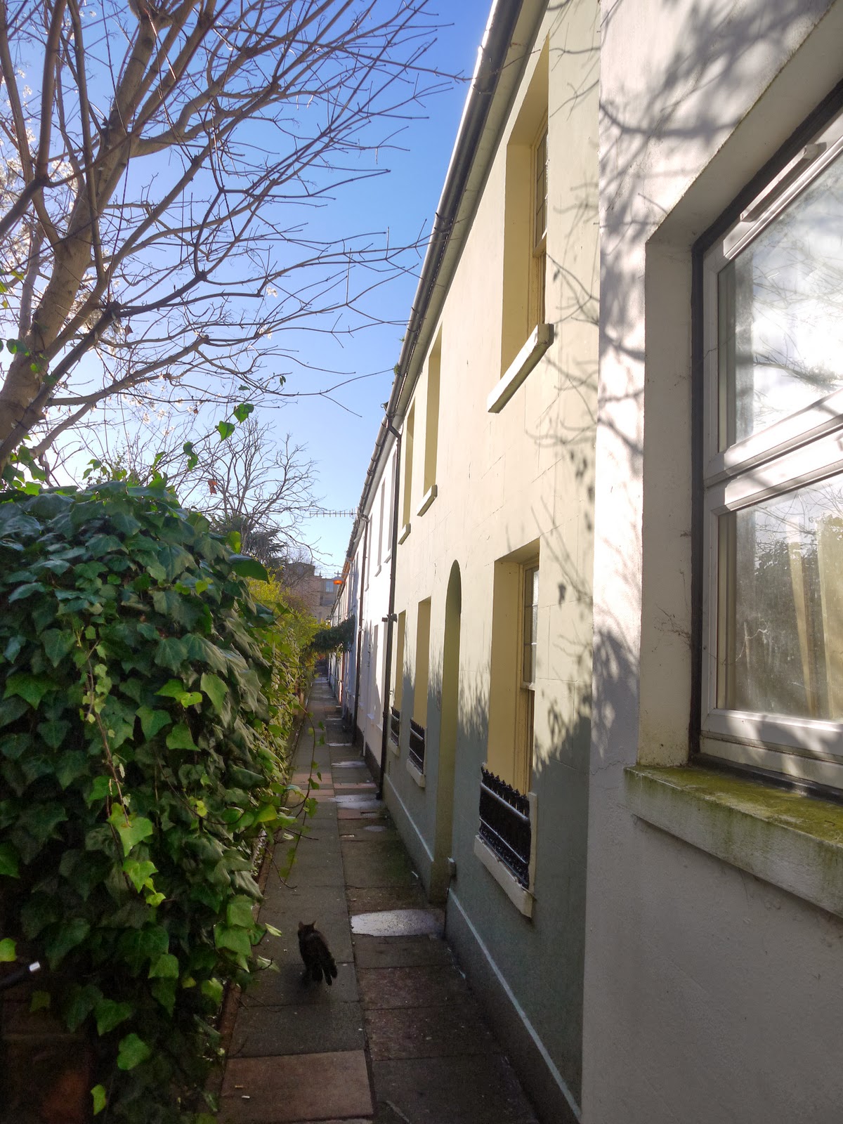
Our onward route took us along some twittens to North Road.  A ‘twitten’ is a Sussex word for an alley and the two that we walked along were the survivors of a long since disappeared environment in this part of Brighton.  Apparently the frontage of the houses would once have looked out over an extensive area of market gardens that are now long disappeared under more housing and commercial development.  The houses themselves look like very desirable places to live, although the lack of parking may well be a problem for many.

St Nicholas Church
At the end of the twittens we came out opposite the Brighthelm Centre, a community and church building that I remember being built in the late 1980s.  I cannot claim to be a fan but the carving on the front of the five loaves and two fishes parable is a nice touch, something rather different to see in a modern building.  The back of the church is still occupied by a graveyard of sorts, although most of the headstones have been moved to the side of the green space that should act as a bit of a green lung for the city.  Sadly it is a bit of a honey pot for street drinkers and even on this cold and frosty day there were a couple in evidence so we didn’t hang around long.
Wykeham Terrace

Our route took us up the hill through an old part of Brighton that I have always loved.  The buildings here are quite grand looking and the streets were all laid out at a similar time after the arrival of the railway.  It has an air of class about the area and I am sure that house prices reflect it now.  At the top of the hill we passed the parish church of St Nicholas that gleamed in the low winter sun.  The voices from the congregation singing hymns inside, which added a lovely atmosphere to the still winter’s day.   The church itself is perhaps unsurprisingly the oldest in Brighton but what is surprising is that it was not built in the heart of what was the original fishing village that was to become the city.  One school of thought is that the church also acted as a lookout in case of enemy attack from the sea.

Brighton Clock Tower
Further down the hill we passed by a very eye catching building known as Wykeham Terrace.  This was originally built by an order of Nuns to take care of ‘fallen women’.  One story has it that one of the residents was taken in after being acquitted of putting her baby down the toilet.  On her death bed she admitted her guilt.
Rag Freak

By now lunchtime was upon us and we dived into Churchill Square for a bite to eat.  This mecca of shopping is very different from the one I remember growing up.  That incarnation was an outdoor affair borne of 1960s town planning.  It was intended to look rather continental with wide open spaces and public art, but by the 1990s it looks like an ageing concrete monstrosity and was given a complete overhaul, turning it into a more up to date looking indoor shopping mall.  I can’t help thinking that it is starting to look its age once again – how long until the next refurbishment?

Herbie In The Lanes
Feeling refreshed we headed down through the Lanes towards the seafront.  It is amazing to think that this iconic part of the Brighton landscape was almost bulldozed in the 1960s and only survived due to a public outcry.  The first lane that we headed down was Duke’s Lane.  This is actually a more modern addition as although it is set up to look and feel like the main part of the Lanes it was actually laid out in the 1980s from an earlier development.  The atmosphere and types of shop that occupy Duke’s Lane make it almost indistinguishable from the remaining area now – a testament to how the developers envisaged the future.
Brighton Town Hall

During the latter half of the 1980s I worked in this area of Brighton and The Lanes were my lunchtime entertainment.  Although many of the businesses have changed since then, the nature of the businesses have not really changed and it is still the same mix of jewellery shops, fashion boutiques, knickknack parlours and little cafes.  It may be a bit twee but there are few better places to browse even for non-shoppers like me!

East Street
At the other end of the Lanes we passed by the very grand looking Brighton Town Hall.  As a child I thought the place was a royal palace and as a civic building it is quite the statement.  It was built in 1832 and was supposed to be in the shape of a Greek Cross.  However, the developers couldn’t buy the land to the south of the building and so it ended up as a T shape instead!
Brighton Pier

Just along from the Town Hall is probably the dingiest and smelliest tourist draw in Brighton, the alley that is often known as Mod Alley, after its appearance in the film Quadrophenia where two lovers end up after running away from the police.  Its appearance hasn’t improved since the shooting of the film.
Brighton Wheel

Our route took us down East Street and past the old cinema where I spent a lot of my youth.  Sadly it no longer functions as a cinema but the building is still intact, operating now as an all-you-can-eat Chinese buffet restaurant.  Ho hum.  The rest of East Street has definitely gone upmarket in recent years with many of the grungier looking shops now turned into fashionable eateries to cater for just about every taste.  The bus station around the corner at Pool Valley has also improved somewhat in recent years although it is far from the best welcome to a city if you arrive by coach.  Service buses have long since ceased using it, although when I was a boy all the busies terminated here and the place was alive with activity.

Brighton Pavilion
Across the road from the bus station is one of the main draws in the south, Brighton Pier (or more properly Palace Pier).  Allegedly it is the most visited free attraction in the whole of the UK, which is some boast!  It was buzzing with people as we passed, with many more taking a ride on the adjacent big wheel that was installed in recent years.  By now time was running low for us, which was a shame.  I think I would have liked to linger a little longer but on we went, past the historic aquarium and back around Steine Gardens across to the Royal Pavilion.

George IV
Sadly views of the Pavilion were obscured by the ice rink that was installed in front of it for the winter season.  However, it is still an astonishing building and so unexpected in the heart of a seaside resort.  It’s George IV’s idea of what an Indian Palace should look like and all the turrets and minarets were added to what was essentially a grand house that already existed and forms part of the structure.  The rather fat playboy King has his own statue next door.  He didn’t do Brighton’s long term prospects any harm though – people have flocked here ever since he popularised the place in the 1820s.  His Royal successors snubbed Brighton though and the Royal Pavilion was soon offloaded.
Duke's Legs

Our journey back to the Railway Station took us via what is called the North Laine area of Brighton, a vibrant shopping area full of interesting shops selling second hand goods, unusual clothing and the sort of trendy things that bring so many people to the area.  The walk was a rather whistle stop affair but it did remind me what a great place Brighton is to wander around.  I think I might like to do a variation on this trip on a summer’s evening but maybe with a slightly different route so as to look at different stuff.

Thursday, 2 January 2014

A Tale of Two Rings


Setting Off From Findon
Our last walking trip of the autumn season was necessarily a local affair due to the lack of time we had at our disposal.  We only had a short afternoon in which to complete our walk, so I thought that we ought to explore the two Iron Age Hill Forts close to our house and then return back to the house.  My original intention was to get the bus from where we live up to Washington village so that we could walk up and over Chanctonbury Ring first and then Cissbury Ring.  Unfortunately I misjudged my bus timings and discovered that the bus would only take us as far as Findon village, some two miles short of our intended destination.

Chanctonbury View South
Once off the bus but before we got going we had a sandwich in the play area and the girls had a little swing.  Our immediate problem was that we only had about three hours of daylight available and it was imperative therefore that I got the girls going as quickly as I could so that we could complete the 5 miles or so before it got dark.
Brooding Sky


Our first task was locating the right path up to Chanctonbury Ring and this necessitated a walk alongside the A24, which was fairly unpleasant.  The only saving grace was that we had plenty of distance between us and the cars, courtesy of the wide verge.  It was a relief though when we turned right after quarter of a mile or so and headed up the hill.  Not far along the way and we encountered a rather dishevelled looking hiker who looked very confused.  He asked us whether we could help him with his directions as he was lost and I could immediately see why.  His only navigational aid was a battered old newspaper clipping of a walk at least six miles away at the nearest point.  I did my best with directions but since he disappeared so quickly I have no idea whether he found his way to where he needed to go or not.  Hopefully he isn’t still wandering about on the South Downs!

Chanctonbury View North
The climb up to Chanctonbury was long and slow going. Although the girls are getting used to distance we haven’t put too many hills in the walks we have done so far and so getting them to the top of the hill proved to be a bit of a struggle.  However, our efforts were rewarded when the rather overcast conditions we had experienced thus far turned into glorious sunshine as we reached the trees that mark Chanctonbury Ring.  These were planted by Charles Goring in the 1700s, some say to ensure that the 5th Century BC Iron Age Hill Fort was not excavated.  Even now there is a lot of folklore about the place, including one tale that suggests that circling the trees anti-clockwise 7 (some say 13) times would summon the Devil.
Chanctonbury Ring

The Ring itself is now starting to recover after the trees were almost completely decimated by the Hurricane of 1987 and is almost back to what it was back then.  We enjoyed the view from the top especially as the light was so good.  To the north of us there were lots of threatening looking clouds although the odd gap was penetrated by the sun shining a spotlight on small areas of the Wealden countryside.  The view is surely one of the finest in Sussex and certainly somewhere worth lingering.  Sadly for us there wasn’t really enough time to linger as we had the small matter of heading on  down the gradual and lengthy slope to Cissbury.

Distant Chanctonbury
Cissbury Ring is a much grander affair than Chanctonbury.  It is the second largest hill fort in England and covers an area of 60 acres.  Walking the ramparts is one of our favourite evening walks and during the summer the turf is a profusion of flowers and attending butterflies.  

Approaching Cissbury
As we got closer and closer to Cissbury we became acutely aware that the sun was sinking fast and we enjoyed the most glorious sunset from the top of the hill.  The Isle of Wight formed the backdrop to the orange sky and a ship marked the horizon, making for a fantastic scene.

Cissbury Sunset
However much we enjoyed the sunset the main problem was that we still had a fair bit of a walk down into Worthing in the gathering gloom.  This provoked a good deal of imagination and stories from the children that weren’t altogether helpful, but they did complete the route without too many complaints. Any thoughts that I had walked them too far were dispelled by the fact that they still didn’t sleep that night!  This was a very good route for them – lots of great views, plenty of interesting things to look at and the sunset topped it all!

Saturday, 21 December 2013

Lewes Historic Trail


View From The Mount
We struck lucky once again with the weather and the girls and I had another day to amuse ourselves. They were keen to have another outing in the lovely autumn sunshine, but with the countryside all around under a sea of mud I fancied a rather different kind of walk and we therefore headed over to my home town of Lewes for a history trail.  The girls lapped it up - we downloaded a trail they could follow and we parked at the railway station for the start.
Lewes Priory


Our first port of call was Lewes Priory, which was an absolute revelation to me!  For my whole life it was dismissed as a dangerous structure and surrounded by a high chain link fence to deter visitors.  However, with a good deal of lottery money spent on it the ruin of what was left.  The result showed that there is value in the remains of what is left (and it isn't much!).  This once extensive priory was destroyed by Thomas Cromwell during the reformation.  Having been demolished in situ the remains were then systematically plundered for building materials and especially for Southover Grange, a short distance away.  Interpretive boards showed us what I have been looking at without a clue for many years. Ironically the main part of the building still left is the toilet block!  What was particularly striking to me is how much of the original estate is now under nearby housing and the nearby railway line.  Indeed during the excavation of the railway in the 1840s, the bodies of William and Gundrada De Warenne (the founders of Lewes Castle) were found and removed to nearby Southover Church for reburial.


Battle of Lewes Memorial
The Priory has been imaginatively restored and it was quite possible to feel the atmosphere of the old place.  Where the walls had been completely mined of their stone, outlines of the old structure had been drawn out in the turf, giving a good idea of how extensive the complex must once have been.  I also found out more about the little tower at the far end of the site, which had always fascinated me. Despite appearances it wasn’t that old, although its history is a little unclear.  It is thought to have been built by John Blaker, who owned Lewes Priory in the middle of the 1800s and later became the town clerk.  It appears on the OS map of 1873 so was probably built soon after the railway came through.


Prospect Tower
Having had a good walk around the ruins we headed off to a building with another connection to Henry VIII, the so-called Anne of Cleves House.  This 15th Century house was given to Anne of Cleves as part of the annulment settlement from her ill-fated marriage to Henry VIII.  She never actually lived in the house though and most of the articles on display illustrate life in Sussex rather than being connected to those far off Tudor times. The house does have some Tudor furnishings though and the children liked having a poke about in the bedroom and perhaps the kitchen even more.  Here they were able to open pots that had typical Tudor smells in them, some of them good and some plain awful!  I was drawn more to the room full of Lewes artefacts and two pictures on the wall caught my attention most of all, which were of Lewes Bonfire in Victorian times and what still counts as the worst avalanche in Britain, which killed 9 people in the Cliffe back in Victorian times. The visit occupied us for about 50 minutes and the girls came away with some little Tudor rings as souvenirs of their trip.


Inside Anne of Cleves House
Opposite Anne of Cleves House is the former Southover Manor School, an independent girls school of some repute that was opened in the 1920s and lasted until 1988.  I can remember seeing the girls playing hockey in the fields outside when I passed by on the train.  Now sadly all you see is housing as the playing fields are now occupied by Cluny Street.  One of the former pupils of the school was none other than Camilla, Duchess of Cornwall who grew up in this part of Sussex.


Southover Manor
Our next stop was the wonderful gardens at Southover Grange. As mentioned before the old house (dating from the 16th Century) was largely built from stones that came from Lewes Priory.  The gardens are what draw people here though, and even this late in the season there was plenty to look at.  The colours of some of the shrubs were at their zenith and a fiery red one by the house itself really caught my eye.  The sunlight picked out the textures of the grasses  and the autumn colours perfectly, while we also enjoyed the sculptures that seem to have popped up in the gardens.


Southover Grange
We wandered around for a short while before passing my old school and heading up the steep climb of Keere Street.   For two years I used to walk this way home each day from school and always seemed like a mountain! This cobbled hill was the unlikely spot where a royal dare is supposed to have been carried out.  The Prince Regent (later to become George IV) drove down the street with a coach and horses to win a bet.  Judging from the steepness of the street it must have been terrifying for all concerned!


Grange Grasses
We stopped off for a sausage sandwich in the cafe at the top (on the request of the two girls) and a welcome rest.  Once refreshed we passed by Thomas Paine's house (he of the 'Rights of Man' fame) and on to the castle.  Thomas Paine was rather a colourful character, being an excise officer during his time living in Lewes and this experience resulted in him becoming politically active.  He became one of the main characters in the War of Independence in the USA as his papers were widely admired and helped to draw up the documentation of the Founding Fathers.


St Michael's Church
The castle is the centrepiece of the town and used to be a mainstay of all school trips when I was a kid.  There isn't a huge amount left but it does provide a great view across the town.  We started our visit in the small museum across the road from the castle, which houses a lot of archaeological material found on the chalk hills that surround the town.  There was time to have a look at the town model, which I think I must have seen about 20 years ago last.  These days it is possible to go into The Barbican as well as the castle (this wasn’t the case when I was a boy) so we started our castle visit there.  On one of the intermediate floors the children got to have a go at dressing up in mediaeval clothing, which pleased them no end.  While dressed up they also had a go at the siege engines that were placed out as demonstrations (models of course).


Rights of Man
The displays in the main part of the castle tell the story of the Battle of Lewes in 1264.  We were taught as children that this was one of the pivotal battles in English History as outcome led to the setting up of the English Parliament.  The battle was fought by the forces of Henry III, a deeply unpopular and autocratic King and the barons led by Simon de Montfort.  The Kings forces were well beaten largely because of the tactics of De Montfort, although he didn’t live long to see the fruits of his win as he was killed in the Battle of Evesham the following year.  He did enough though to win the concession of having the King recognise baronial influence in the ruling of the country, a forerunner of what we now know as Parliament.


Lewes Castle
By now it was mid afternoon and the light was sadly beginning to fade. We wandered down through town as far as Cliffe High Street.  The immediate impression I git from walking down the High Street was how much the town had changed since I grew up here.  The buildings largely remain the same of course as most of them are listed (save for the odd awful 1960s one thrown in), but the businesses on the ground floor are almost totally different.  
Castle View


At Cliffe Bridge we headed across the Railway Land Nature Reserve that was a beloved playground for me as a child (and when it was a proper wild place!).  This part of the town has now been turned into a visitor attraction, but when I was a child the old sidings had been gone for about 12 years and vestiges of them still remained.  There was also a short stretch of embankment of the old Uckfield line where we used to try and catch slow worms and butterflies.  I realise of course that we were here during the autumn months, but my experience of coming on to this nature reserve is that there is far less biodiversity than there ever was back then.  


Harvey's Reflections
By now it was getting increasingly dark and we found the car back at Lewes Station.  My trip down memory lane was very enjoyable for me and the kids thought the museums were very cool. I was only sad that there wasn’t more daylight for I think we would have happily walked further.  Maybe another time?

Tuesday, 10 December 2013

Angmering Park


Road Through The Park
We have been really lucky with the weather during November especially as a number of uninspiring weather forecasts have turned out to be anything but.  One of our favourite local walks is around Angmering Park, but we mostly go only in the spring when it is bluebell season so I thought it would be good to see how it shapes up for autumn colours for a change.  We only had a short time before it would get dark so it was important for us to get a bit of a wriggle on if we were to complete in the couple of hours we had. So as not to burn the children out on ‘walks’ this one was instead billed as a nature ramble and they both ran upstairs after lunch and got themselves kitted out with notebooks and pencils so that they could record their findings!

Sign Fungi

On arrival at The Dover, the kids jumped out and set about their task very enthusiastically, recording every leaf, chestnut case and fungus they could find.  I felt like I was taking them on a scientific field trip!  It did make for very slow walking at times but in truth it was glorious in the woods and didn’t make it a trial at all.

Glimpse Out of the Trees

Our route took us from the car park at The Dover (just north of Poling village) and along one of the estate roads heading east.  It was very wet everywhere and we already had the sense that the mud would be fearsome later on so it was good initially to get some distance under our feet along a tarmac path.  At the next junction we lost the tarmac and almost instantly the going got distinctly worse.  My sharp eyed daughter did discover a rather unusual sight – a fungus that I had never seen before growing on a signboard for the Angmering Estate.  What was particularly striking about this fungus was that it had very helpfully grown in the same colour scheme adopted by the Estate, a sort of maroon colour.

Pine Avenue
The onward track rather reminded me of the sort of cart tracks that would have been used by coaches and horses hundreds of years ago.  Deeply rutted and with the ruts full of puddles it made for challenging walking and yet roads like these were the only ways people could get about in days of yore.  The woods all around us were dark and had little of the late autumn sunshine penetrating through.  I think we were all mightily relieved to get through that section and out into more open countryside.

Staghorn Fungi

At the corner of a set of paths we changed direction and headed north through open beech woodland.  This was a delightful stretch of walking – the path was drier and the sun filtered through the increasingly brown and yellow leaves.  Along our route I paused a number of times, finding different species of fungi along the way.  By now though the season for fungi was coming to an end as many of the specimens were well past their best or chewed up by slugs and other creatures.  The only ones that were looking particularly good were the curious little Stag Horn fungi that are a surprisingly colourful addition to the woodland floor at this time of year.
Reflections of Autumn

We briefly took a route along the Monarch’s Way through the woods.  This long distance footpath through England is supposed to be a close match to the route taken by the fleeing future King Charles II after he had been defeated by Cromwell’s New Model Army at Worcester in 1651.  This would be a fantastic route to do as a complete walking project but at 615 miles in length it would be a major undertaking.  It certainly demonstrates the size of the task that was necessary in getting the King to safety 350 years ago.

Old Man's Beard
At the north end of the woods we left the Monarch’s Way and headed out onto a ridge above the Downs where we got a grand view out towards Chanctonbury Ring and Amberley beyond.  We were lucky enough to spot a pair of red kites wheeling around over the Downs looking for things to eat.  These amazing birds have made something of a comeback in recent years after they were hunted to the brink of extinction in this country.

Red Kite
The section of ridge is quite short but has an amazing view, one that would be more associated with the scarp face of the Downs some 3 miles or so further north.  Across this part of the Downs are a few homes associated with AngmeringPark.  It appears to be very much horse breeding and training country for most of the buildings and fields are set up for horsey type activities.  Of course this isn’t too far from where the famous trainer Josh Gifford was once based before his recent death.

Ridge View
At the end of the ridge we turned back south to complete the last section of our loop around the park.  We wandered down a surfaced track that was quite a relief after all the mud, heading down through some farm buildings that gleamed in the golden light of the sun.  It soon became clear that these too were horse-owning people and the girls delighted in the friendly horses that came up to say hello.

Fading Light
By now the girls had lost interest in their nature note-taking and had reverted back to discussing fairies.  This seems to be their default chatter wherever we go now and keeps them occupied for hours!  My thoughts were focused on trying to get them back to the car in good time for the sun was already sinking in the sky and I was acutely aware that the car park gate shuts at dusk.  It was a bit tricky to get them moving quickly as they were so embroiled in their stories but thankfully we did get back in time.  All of us were covered in mud, but it was a glorious afternoon and we came home feeling that we had truly earned our dinner!