Sunday, 1 October 2017

Blickling Park and The Upper Bure Valley

Blickling Hall
After a couple of days rain in Norfolk we were raring to go again and chose this walk largely because we wanted to explore Blickling Hall, sometime home of Bono (according to Alan Partridge anyway!).  I'm always partial to a walk through a country estate and this provided a good opportunity of seeing some deer and a preposterous folly or two along the way.  This is walk number 14 from Pathfinder Guide vol 17 Norfolk and Suffolk Walks.
Blickling Park
As National Trust members we were able to park for free at Blickling Hall but under a new system had to obtain a ticket first which wasn't very easy.  We then struggled to find the official onward path from the car park, a problem that we had elsewhere on this walk.  Eventually we struck out in what I took to be the right direction and found ourselves in the landscaped park.  All the attributes were there - a man-made lake; rolling countryside and large oak trees dotted across a park largely dominated by grassland.  Sadly we couldn't see any deer - I reckon they had made themselves scarce ahead of a music event that was scheduled to take place a few days hence.
Tower House
Eventually we reached Great Wood and took the opportunity to leave the path for a few minutes to check out the mausoleum of The Earl of Buckingham.  As with so many mausoleums funded by unfathomly rich people this one was a testament to bad taste being a large pyramid  dating from 1793.  It was fun to find in the trees though!  We decided to head off in the vague direction of the original path rather than retrace our steps and found it after squelching our way through some pretty waterlogged conditions, not something you expect at this time of year.  Out across the fields we could see another of the follies in the park - this time Tower House.  I suspect that would be a fun place to stay.
Mausoleum
We turned left when we reached a road and for half a mile or so we had tarmac under our feet.  The fields on either side were at different stages of harvesting and the clouds above were showing signs of parting to show us a bit of sunshine.  At the end of a lengthy straight section we crossed into the adjacent field and picked our way across a surprisingly swampy field.  The torrential rain that we had experienced during the last two days had clearly taken effect here.  On the other side we could see a bridge across the River Bure, by now just a trickle.

End of the Rosebay Willowherb
It was a relief to find dry land again at the edge of the field on the other side and we wandered across rough pasture to a corner that tapered into a gateway.  We went through and at this point we made a massive mistake in following the onward path.  Signage wasn't helpful and we picked our route based on the field boundary that we thought we needed to take.  We weren't to know but we picked wrong and even as the landmarks didn't seem right further on I took it that things had changed on account of the age of the book (this edition was from 1997!).  We passed by a mother and daughter who looked equally lost at this point and we swapped notes about our respective walks. Even when the ground got swampy again I didn't realise how wrong I had got.  It was only when we found ourselves back on the road we had come from half an hour earlier that the penny dropped!  It is very rare I go this wrong on a walk and I was really cross with myself.  Rather than retrace our steps through the bog we decided to complete the route by doubling back on ourselves and meet the official route later on.

Harvest Time
A good mile of road walking followed and while normally I don't like doing this I have to say it was a relief after the poor walking conditions that had gone before.  Just after passing Blickling Mill we left the road and passed through a small tract of woodland and crossed the River Bure once more.  As we did so we met the couple we had seen earlier.  Both of us were now thankfully on track and we shared a joke about our experience as we passed each other.

Bridge Over The Bure
We were now on the network of estate roads that cross the countryside here.  Off in the distance we caught the merest glimpse of Wolterton Hall - the guidebook suggested that we would have really good views of it.  I kept looking but no better views were forthcoming not helped by the large hedges that prevented any view in that direction.  I wonder whether they were as tall when the guidebook was written?  We had to make do with admiring the lodge houses on the edge of the estate instead.  Thoughts also turned to lunch and as we were as far from Blickling Hall as we were going to get we were praying that the Saracen's Head pub marked on the map was still functioning.  It is very difficult to tell now as so many pubs have closed in recent years, especially isolated ones like this.

Elderberries
Thankfully the pub was open to a cheer from both of us!  I am pleased to report that we had a very nice lunch and real ale to fortify us for the onward journey back to Blickling Hall.  Initially we had some road walking to do but at the edge of the next village we headed off across country again, with hints of views across the estates of Blickling and Wolterton, the adjacent country piles.  The walk back to Blickling wasn't hugely interesting although it was generally pleasant.  Perhaps it would be better during the spring or autumn when the colours are more vivid but on a dull August day it wasn't too special.

Saracen's Head
Eventually we got to the Park once more and preparations were in full swing for an outdoor concert due to take place in a few days time.  It was rather fascinating to see all the deliveries and work going on to accommodate I imagine quite a sizeable crowd.  It wasn't far past the showground to reach the lodge at the edge of the main estate.  This apparently is a holiday house - it looks smashing and worthy of consideration for the future I reckon.

At the end of our walk the sun began to shine again and the clouds rolled away much as they had for the last walk.  All rather typical!  We did take the opportunity to look around Blickling Hall, which was once the estate belonging to Thomas Boleyn - father of Anne.  The earlier reference to Bono is of course a joke - Alan Partridge is a spoof local TV and radio host who wanted to impress a girlfriend by bringing her to the house.  As with so many National Trust houses this one has a long and varied history but perhaps the most surprising connection was with the Declaration of Independence of India and there was a fascinating exhibition detailing how Blickling came to be part of this slice of history.  It all revolved around a visit to the estate by Nehru and his daughter Indira and discussions at a party held here.  The garden was equally absorbing and we spent an hour or so soaking up the atmosphere outside. 
Toadflax

As a walk we found this one a bit disappointing - I think we both expected a more scenic route.  Blickling Hall itself though was magnificent and we were very pleased that we made the trip. 

Blickling Hall Gardens

Sunday, 24 September 2017

How Hill and Ludham

How Hill
After a lengthy walk the previous day we wanted something a little shorter today that explored a different part of Norfolk away from the coast.  We settled on walk 12 from Pathfinder Guide volume 45 Norfolk Walks, principally because it was close to where we were staying and also because there looked to be a pub lunch opportunity half way round!
Mill House
We parked outside How Hill, being one of the first vehicles to arrive.  It was a pretty overcast day although the sun did threaten to shine a number of times through sporadic gaps in the cloud cover.  Adjacent to the car park was the rather magnificent Toad Hole Cottage, rather more substantial than a cottage in my book.  Apparently it ended up being on a grander scale than first envisaged when it was built in 1903.  Being on the side of a hill, even as modest a size as How Hill is, means that it must have the most amazing views.
Ready For Harvest
Our route took us out on to the lane we had arrived on although we turned left rather than right.  We almost immediately passed The Mill House, a converted residence from what was a windmill.  There must be countless properties like this in Norfolk - there is a lot of scope for them!  We continued for a short distance along the lane and then left via a pretty substantial looking farm track.  It really reminded me of the tracks between fields that we explored in Normandy a couple of years ago.
Kings Arms
When the substantial track took a left turn we headed right crossing a stile and into a freshly harvested field.  Late summer was really upon us now and the harvest was in full swing.  I imagine that at this time of year Norfolk would once have had thousands of people working the fields.  Now it was just the odd tractor driver going about his business (I never saw a female tractor driver but presumably there are plenty out there?).  Once across the fields we found another farm track bordered by a pretty substantial hedge.  What was immediately apparent to us as we passed the hedge was the sheer amount of insect life associated with it.  I expected to see butterflies, bees and hoverflies but wasn't prepared for the number of dragonflies that we saw - there were enormous numbers!
Ludham Village Sign
Soon we were to find the road and sadly for us we had about half a mile of road walking all the way into the village of Ludham.  The first part of the lane was the way we had driven and we soon witnessed an incident that I am glad had not happened to us.  Two cars were caught in a standoff while they decided which one of them was going to back up.  Eventually one relented and had to reverse a significant distance.
Ludham Church
On reaching Ludham we first went through the part of the village where all the Council houses had been built.  I think every village in England has an area like this although most of the houses are now privately owned rather than under the control of the Council.  Judging by the magnificent gardens on show I imagine that this is true here too.  Eventually we came upon the King's Arms where we were to stop for lunch.  I am pleased to report that both food and pint were excellent and very welcome.

Old Jalopy
After a leisurely lunch we roused ourselves for the rest of the walk and crossed the main road that leads through the village.  Apparently this route has some historical status and has been selected for speed measures to preserve its character.  Across the road and we admired the church, which stood on its own right in the heart of the village.  It looked like some renovation work was taking place for a lot of the windows were blocked out.  It looked rather uninviting for a visit so we pushed on down the lane and out of the village.  We took a right turn at the wonderfully named Lovers Lane and soon we were out in the fields once again and walking alongside one of those monstrous hedges absolutely teeming with insect and birdlife.  I would be curious to know whether any habitat surveys of these hedgerows have been done as I am not sure I have come across such a concentration of life in such a small area before.

The Dog
We crossed another lane and wandered through the farm of Ludham Hall.  This substantial old place was once the Bishop's Palace for Norfolk.  It is now a working farm and home to a number of holiday lets.  On the other side of the farm we took a right hand turn at another lane and wandered along towards the Dog Pub.  Flanking the road were lots of fruit trees that looks like they were cropping pretty well although most of the fruit wasn't quite ready.

Hammering
We were soon on the main road once again and had to walk a short distance along it.  Thankfully there was a pavement, probably important for road safety as there were plenty of potential pedestrians from caravan sites and the river further on who would want to access the pub.  The pub itself is well placed for just the other side of it was the bridge over the River Ant and plenty of boats use this as a mooring spot.  We turned right at the bridge and entered a new phase of the walk as we would be following the River Ant for the rest of the way.

Ant Bridge Moorings
This is a type of walking that I'm not normally a fan of and the overcast conditions didn't help matters.  Nevertheless the rushing noise of the reeds flanking the banks and the possibility of seeing one of the shy and retiring bitternes that live in these parts were enough to keep my senses alive.  I did find the meanders of the river a little diconcerting - it made some of the landmarks in this flat landscape look both nearer and yet further away at the same time.  a particular case in point was one of the drainage mills that characterise this landscape.  At the bridge it seemed very close but thanks to the meandering river it seemed to take ages to get there.

Neave's Drainage Mill
The river itself was barely seen for much of the time the reeds were too thick to be able to see the water.  A boat even passed without me realising!  As we meandered around the river the cloud seemed to break up again, just in time for us coming to the end of the walk!  As we left the river bank for a embankment along a drainage ditch something caught my eye moving very quickly across my path.  I thought it might be a lizard judging by its speed.  Unfortunately I didn't get a good view of it.  A little further on and we passed an old man who stopped to pass the time of day.  He was curious about what I'd seen but when I relayed it he thought that it might be a newt rather than a lizard.  I wasn't sure that I was too bothered about a lizard but I would like to have seen a newt.  He told me a little about the natural history of the area as he lived just over the way from here in a very nice looking cottage.

Turf Fen Drainage Mill
We parted ways and we headed for the mill in the distance which would be the end of our walk.  We got a good view of How Hill once again on this stretch and it glowed in the newly found sunshine.  Just up from the mill we came to a mooring spot.  I think this is the limit of navigation on this river for it was quite busy with young people in particular seeing to their vessels.  Adjacent is a science and nature centre and we did want to look in briefly but when we saw how many people were in there we thought better of it!
How Hill Moorings

This was a very pleasant if short walk greatly enhanced by our pub lunch.  It probably deserved a better day than we had available but nonetheless the section along the riverbank at the end was delightful.  Keep an eye out for newts if you come this way!

Monday, 18 September 2017

Nelson's Boyhood Home and Holkham Park

Red Roofs
After the rugged beauty of Northumbria and Cumbria our next destination was a rather different part of England, the flat county of Norfolk.  My wife and I had managed to lose the children for a week at Guide Camp and so we took the opportunity to investigate a county that I haven't really looked at much before.  Our base was just outside Norwich and this gave us the opportunity to investigate the Broads and the coast.

Dust
First up was this walk - one of the more challenging walks from vol 17 of the Pathfinder Guides Norfolk and Suffolk (walk 23).  All things are relative of course - this was far less challenging than some of the intermediate walks from other parts of the country.  It did combine the coast and a place we really wanted to visit though - Holkham Hall.  We began the walk in the village of Burnham Overy Staithe, a small fishing village on the coast.  It wasn't obvious that we were on the coast at the beginning of the walk and our route took us initially away into the hinterland countryside.

Former Railway
We walked along a lae that eventually turned into a farm track and the agricultural nature of this county became immediately apparent from the off.  The rumble of tractors pervaded the air and one in particular off to our left was particularly noisy - when we looked we could see it was muck spreading.  The smell soon hit us too!  The dustiness of the soil behind seemed very surprising considering how much wet weather we had experienced on our travels during the summer and even the day before we started the walk.

Field Fellows
We soon left the smell and noise behind and ahead we could see the countryside opening up.  Norfolk is not really a county for great viewpoints but occasionall you gain enough height to be able to see some miles ahead.  This was the case here and we could certainly trace the first few miles of our walk and the things we were likely to see along the way.  Peeping out of the fields and trees were a number of churches from each of the villages that dot this corner of Norfolk.  It wasn't just churches either - thre were also a couple of windmills.  Norfolk has more windmills than any other county and so this should not have been a surprise.

Burnham Church
Off in the distance we passed by Burnham Overy Town.  Our path did not allow more than a brief glimpse, which was a pity for it looked a most agreeable place when we drove through on the way to park our car.  We crossed a busy road and passed a small group of houses on the edge of the town and headed across some more fields to reach an old railway line.  This was the former Heacham to Wells-Next-The-Sea line, which closed as long ago as 1953.  Judging from the vegetation that now grew on the trackbed this is not a surprise but we could see the earthworks that definitely hinted at its past.  Nearby Burnham Market station is still extant and operates as a small hotel.  We walked a few yards along the old railway before dropping down the embankment and enetered a marshy looking field.

Yellowhammer
In the field was a large group of cattle - we gave them a wide berth as we headed towards the tower of a church in the distance.  Among the herd were a couple of animals that didn't look right and as we got closer we realised that two of the group were in fact donkeys!  They looked pretty as home among their bovine friends and gave us a look as if to query what the fuss was.

Lodge
At the other end of the field was the first proper feature of the walk - the church at Burnham Thorpe where Nelson's father was once the vicar.  It is hard to believe that one of the greatest military men in British history came from such a calm and serene place.  We lingered at the church for a few minutes enjoying the ambience of the place.  We didn't venture inside though as it was a Sunday and the next church service would be starting not too long after.  

Estate Road
The path looped around the village of Burnham Thorpe, past the pub inevitably called Lord Nelson and gave us a glimpse of the manor house.  Sadly the pub wasn't functioning - it would seem even its histrical connections weren't enough to save it.  We also passed a woman who seemed to be travelling in a genuine horse drawn gypsy caravan - she was parked up on a grassy verge and her horse seemed to be having a well earned rest.  The rest of the village was largely deserted - even the children's play area was devoid of customers.
Boating Lake

We headed up the lane away from the village and soon we were in open countryside again among fields of wheat and maize.  The latter didn't look too far away from being harvested and I suppose a lot of it ends up as animal feed or the makings of corn oil.  Not sure it looked quite good enough to be harvested as a vegetable.  Our path took as between two large fields to an old barn and were unbroken apart from an area of what can only be described as animal slurry - it stank to high heaven!  We were pleased to get past there very quickly I can tell you!

Holkham Hall
Eventually we reached a lengthy wall that formed the perimeter of Holkham Park.  It was an impenetrable barrier at this point so we had to turn left and follow it for some distance before reaching one of the main gateways overlooked by a very attractive lodge house and even lovelier garden.  Coincidentally the path alongside the wall was also a Roman Road although I am not sure where it went to and from.

Column
Inside the park we headed along an estate road.  This did not look like it was a tourist entrance for the road was mostly empty save for one vehicle that passed us halfway to the main house.  The estate road seemed to go on forever - it was certainly more than a mile long from the lodge house.  By the time we reached the main house we were so anxious to get there that we managed to missed the walled garden along the way, which was rather disappointing.  Up on a small hill away from the house was the ice house; not especially convenient if you needed a cube or two to go with your Scotch.

Cricket
Holkham Hall is really impressive, especially at the angle of approach on this footpath.  It is widely regarded as one of the country's finest examples of Palladian architecture, constructed by the 1st Earl of Leicester back in the 18th Century.  We certainly couldn't pass by without taking a look around and we also had a very enjoyable lunch in the café.  Inside the place is as opulent as you might expect, with lots of sumptuous furnishings, marble and incredible old paintings.  The guides in each of the rooms were very knowledgeable and we chatted to some of them about some of the old stories that a place of this size and history must have had.  The one thing that struck us about Holkham Hall is how well the staff were treated; almost as if they were an extended family rather than employees.  One thing to beware of if you decide to stop is that it is still privately owned (not National Trust) and therefore the opening times are not as often as you might expect.

Holkham Village
Outside the building the view out across the estate was equally impressive.  Off to the right was a large boating lake with plenty of people circling around in their hired boats.  Straight ahead in the distance was a large column, not dissimilar to the ones at Castle Howard and Blenheim.  I guess this must have been the fashion accessory for the well heeled at a certain point in history?  In front of the column a game of cricket was going on.  I'm not sure I would want to be playing cricket in these surroundings - my eyes would be drawn to the scenery rather than the ball!

Stripes and Chimneys
After stopping at Holkham Hall for about three hours we were ready to move on.  We passed the well filled car park and it was obvious then that visitors come in from Holkham village through a rather more impressive gate than the one we passed through earlier.  The village of Holkham was just as busy as the house and is impressively laid out.  Opposite the rather grand looking Victoria Hotel we headed along Lady Anne's Drive.  When I saw this on the map I imagined a rather impressive tree lined grand estate road.  Sadly it is rather spoiled now by the number of parked cars along here as the Drive now acts as a main thoroughfare to the beach.

Site of Holkham Station
Part of the way down we crossed backover the old railway that we had encountered earlier in the day.  You would need to be a really good detective to know it was here though as the only real clue was the fact that it was marked on the map.  Holkham station was once here but any trace of its remains are long gone and only a pillbox marks where it once stood.  It was about half a mile from the village it was supposed to serve and this was a common theme with all the stations along this route which probably explains why it was an early casualty.

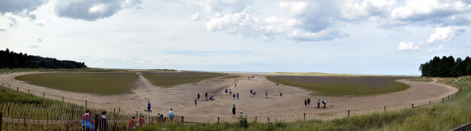
Holkham Beach
At the end of the car park the crowds of people formed what can only be described as a conveyor belt of visitors to the beach.  My heart sank as I didn't really want to be dealing with such crowds for the last stretch of the walk.  I needn't have worried.  By the time we got to the beach the tide was out and the expanse of sand was so huge that it swallowed everybody comfortably.  We also had the advantage of turning left when we got to the beach while most people headed straight on to the sea.

Approaching Burnham Overy Staithe
Our onward route was now through some enormous sand dunes.  This got quite difficult and it wasn't easy to see the way ahead at times so large were the dunes.  Eventually I tired of trying to plot a course through the dunes and so I encouraged my wife to follow me down onto the beach.  By now we pretty much had the expanse of sand to ourselves with only the odd wading bird for company.  A combination of light waves, hot feet and soft sand were all too much and soon our boots and socks were off and we waded along the beach for quite a distance.  We felt most indulgent as we did so!

Red Sail
Soon we came to the end of the beach and so reluctantly boots went back on and we plotted the course down to Burnham Overy Staithe and back to our car.  The path was quite easy compared to the dunes and as the tide was now coming in all the boats that had been trapped in port for several hours were now heading out to sea once again.  It wasn't too long before we got into the village and as we did so we were faced with a most picturesque harbour and plenty of activity around it as people scrambled to get out to sea.  By now we were ready for more refreshment but wanted something a little more adult than the mobile tea bar located by the harbourside.  We opted instead for the pub in the village for a lovely cold pint - it was a great choice.

Snack Stop
This was a fairly lengthy but easy going walk in three distinct sections with an agricultural section, one through Holkham Park and then the coastal section.  All were delightful in their own way and there were plenty of interesting features along the way to keep us interested.  We voted this the best walk that we did in Norfolk on this trip.  I'm now tempted to walk more of the coast too!

Sunday, 10 September 2017

Borrowdale

Borrowdale
After our sojourn in Northumberland we headed over to see an old friend of mine who lives in Western Cumbria.  This was a rare treat to renew acquaintances and have our children have some company of their own age for a few days before heading home.  As our children are all a little young for the high mountains of the Lakes just yet we wanted them to have the chance to taste Lake District scenery without the conditions putting them off.  We settled on Borrowwdale as being an excellent place to explore and used walk 10 in vol 13 of the Pathfinder Guides Lake District Walks as the basis for our day out.

Stepping Stones
Officially the walk commences in the hamlet of Seatoller, but for convenience we started halfway round at the hamlet of Grange.  As we got underway the heavens opened and we had a very sharp shower to welcome us to the beautiful valley of Borrowdale.  As one of the wettest places in the whole of the British Isles I suppose it was inevitable that we would experience rain at some stage on our walk.  Our little party stomped off along the lane that follows the River Derwent along the edge of Holmcrag Wood.  The sound of the river diminished a little as the lane headed away from it and around the other side of a small hill protecting some campers.  Most looked like the had had enough of the rain for their were several light green patches of grass denoting places where tents had been.  A couple of hardy souls remained but even they looked like they were on the brink...

River Derwent
Just past the campsite and we met the river once again, this time at a junction with another fast flowing stream coming down off the high moors above.  We had to cross by stepping stomes which added a little spice for all the children.  Luckily there wasn't a huge amount of water otherwise we would have had to consider another option.  We all got across without getting feet too wet which was a relief so early on in our walk.

Riverside Path
The path started to climb briefly away from the stream and went round a delightfully rocky path alongside the river.  By now the rain had stopped and we had a brief spell of bright sunshine which lit up the whole scene so that the countryside positively sparkled.  Further on and we saw the remains of mining activity in the rocks.  I'm not an expert on the geology of the Lake District but the rocks looked slate-like and I wonder whether they were quarrying for building materials?  The joints were almost vertical suggesting some serious forces at play when the rocks were formed.  They certainly needed a closer look in any event!

Quarry
Further on and the rest of the valley started opening up as we left the trees behind us.  We could also get a feel for the length of the walk as high above us to the west was the return route.  For now though we followed the river path, keeping it within metres of us almost all the way to Seatoller.  If we had taken the route from the official start this would have made for a pleasant end to the walk indeed.

Arched Bridge
As we headed down the river we passed a set of stepping stones that leads to the village of Rosthwaite.  It was a measure of how much rain there had been recently that the stones weren't usable.  Our friend advised us that they had been across only 3 weeks earlier.  At Longsthwaite we paused briefly at the bridge that could be used as an alternative access to Rosthwaite.  This allowed for the children to catch up.  They were doing pretty well but their pace definitely slowed as the chatter intensified along the way.

Submerged Stepping Stones
The stop at the bridge gave us all the chance to enjoy our surroundings for a bit and get some refreshments inside everyone.  Sitting on the rocks beside the river was very pleasant but I imagine on a hotter day the river would be more enticing!  After our break by the arched bridge we headed through the well appointed looking Youth Hostel alongside.  I haven't stayed in a hostel for a good many years - I understand that they aren't nearly as basic as they used to be.  I was never a huge fan - I am a bit too self conscious of me snoring for that!

Approaching Longthwaite
We had a bit of a scramble up some rocks along the river valley.  I suspect that the path was under water for it did seem a bit more rugged than I would have expected.  Even as we resumed our course on what I took to be the path it still somewhat resembled a river bed with water running down it with more than a trickle.  Elsewhere in the valley the sun was really doing its best now - we hadn't had any more rain and the sun was breaking through quite regularly between the clouds, making for some dramatic skies.  The moors and fells were also benefitting from shafts of light that looked almost theatrical.

Longthwaite View
Soon we reached Seatoller and had high hopes that the pub marked on the  map might still be open.  Sadly this wasn't to be and our hopes of a cold drink and a sit down were dashed.  We had to use a different tactic to get the children motivated to carry on - luckily we had just the thing; more about that later!  There were a couple of longing glances at the bus that had just pulled up - this could have taken us back to Grange but as we pointed out to the kids we wouldn't earn our reward if that was the case!

River Derwent
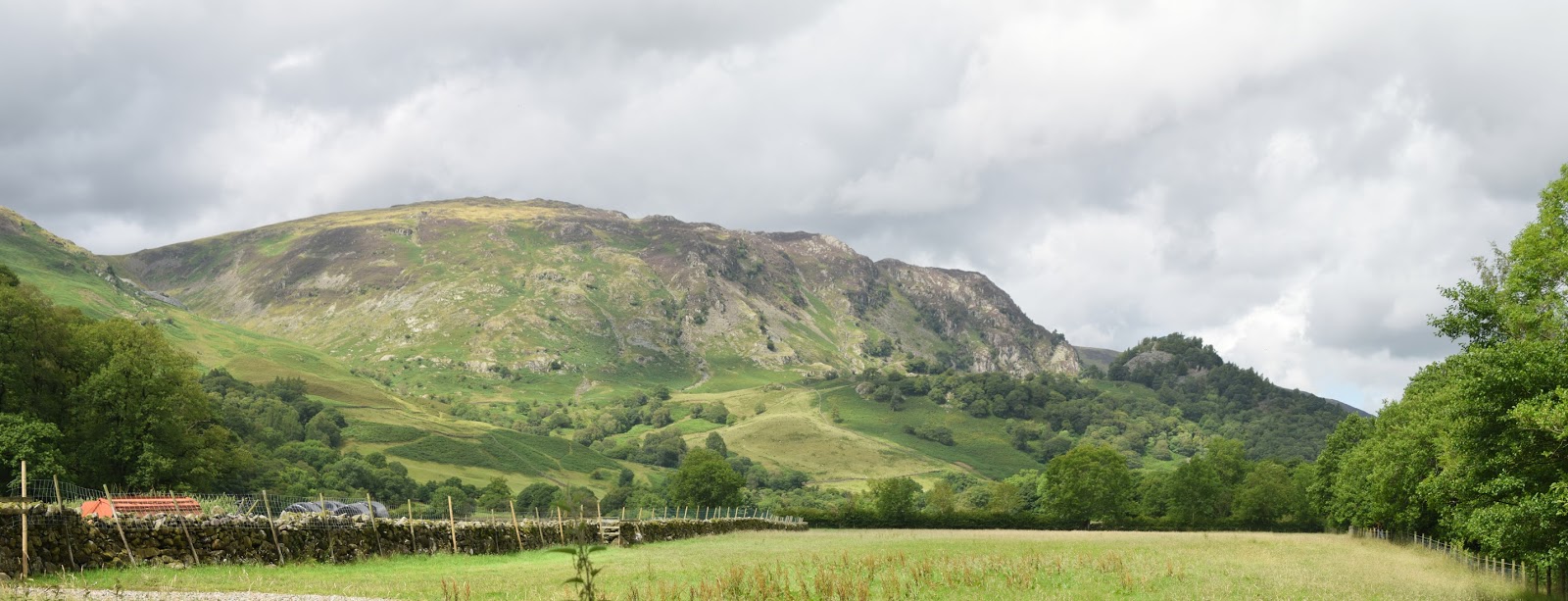
The climb out of Seatoller was quite modest by Lake District standards but quite tough for little legs.  They did make it though even if slowly.  They did appreciate the reward of the view at the top though - the view out across Borrowdale was quite special and by now we had also the benefit of bluer skies and the best conditions of the entire day.  The next couple of miles along to the distinctive Castle Crag were really enjoyable.  The path was mostly level and the views uninterrupted down to where we had walked earlier.

Scramble
The path passed to the left hand side of Castle Crag - we didn't get to climb it on this walk.  I imagine any suggestion that we might would have been met with mutiny!  The path instead took a downhill course along a quite loose surfaced route.  We had to be very careful with our footing to make sure that we didn't have any accidents on the way down.  It wasn't too much further until we met back with the path that we had headed out of Grange on earlier, just near the stepping stones across the stream.  By now the children realised that their special treat was getting nearer and we had no problem at all getting them moving along the last part of the path.  In fact we all decided to forego the small loop path of the original route here so we could finish more quickly.

Borrowdale View
What was the special treat at the end of the walk?  Ginger cake and ice cream at the cafe in Grange.  It went down a treat with everyone!  Bang on cue it started raining as we got back in our cars at the end of the walk.  We felt pretty smug by now though as we had managed to squeeze our walk into by far the best 3 hours of the day and had enough time for a treat at the end before the weather closed in.

Castle Crag
This walk is a great introduction to the best scenery the Lae District has to offer.  It was pretty quiet all the way round with only a few other walkers in evidence.  Contrast that with some of the more popular routes in the Park and you will know what I mean.  The view from the upper level section between Seatoller and Castle Crag was particularly memorable and I'm pleased my children had the opportunity to do it.

Descending Into Grange