Monday, 23 October 2017

South West Coast Path Section 34 Fowey to Looe

Fowey Harbour
Long time readers of this blog will know that at least once a year I make the pilgrimage down to the South West of England to tackle some more of the Coast Path.  Unfortunately over the past couple of years progress has been quite slow and I was pleased therefore to find a window of opportunity over the August Bank Holiday weekend to tackle some more sections.  I am now particularly conscious to try and close the gaps that I have created by my rather butterfly approach to the walk.  This 12 miles section is one I have walked before (twice in fact), but wanted to do so again for the purposes of this blog for the other occasions were while I was a student in Plymouth and for which no pictures exist.

Polruan Scarecrow
I set off from home at around 6am and after a very easy drive managed to be in Looe by 10am, sadly just missing the bus over to Polruan.  I made my way over to Polruan after deciding that I would have plenty of time to get the bus later in the day and not fancying the idea of having to wait two hours for the next one.  Both times I completed this walk before I did so from Par and using the train at each end.  Having split the walk in two I felt that it would probably be more enjoyable this time as it was a bit of a killer, even though I was a lot fitter 20 years ago!

Repair Yard
I parked in the free car park at the top of the hill in Polruan and wandered down to the ferry terminal to enjoy the view across to Fowey.  Sadly breaking this section in two meant that I wasn't going to get the ferry ride as part of the experience.  It did seem pretty busy though - plenty  of people were being taken backwards and forwards on the small craft.  The harbour was dominated by a large crane and a trawler out of the water undergoing repairs.  On the water it probably looks quite modest in size but out of the water it towered over the quayside.

Blockhouse View
I actually lingered for quite a while enjoying the view and getting the car journey out of my system before proceeding.  It was already building to a nice warm day and I made sure to provision myself properly at the village shop before heading off on the coast path.  I have to say that I have a certain amount of trepidation for this section - I remembered that some of the going was pretty tough.
Coastwatch

Initially the path took me through the narrow streets of Polruan.  It is a pretty little place but I sense that it is a bit cut off from the rest of Cornwall, with Looe some distance away and Fowey only accessible by ferry even though you can see it easily across the water.  It feels a bit like Fowey's poor relation, although its quietness might actually be a bonus if you live here.

Leaving Polruan
As I left the built up area the first place I came upon was a blockhouse.  The path didn't officially go out to it but I thought it was worth a look especially so I could sit and eat the pasty that I had bought earlier in the village.  Amazingly even though a good 10-15 minutes had elapsed it was still molten inside but was still very satisfying :)  Feeling fortified I set off from Polruan in good spirits and ready to face the challenge ahead.  I passed by the Coastwatch Institute watch house that looked quite busy with volunteers.  Out to see there were a few boats to keep an eye on so they were obviously quite happy in their work.

Pencarrow Head
The first part of the path was a fairly gentle introduction although I sensed that I was regaining most of the height that I had lost earlier walking down into the village from the car park.  Behind me was the unmistakable outline of the Gribbin and its candy striped day mark sitting on top of it.  As I gained height I could see the rollercoaster like landscape that stood between myself and Looe, some 11 miles away.  I decided that on such a hot day the best policy was to take things quite slowly and keep myself topped up with water.  Interestingly the weather was far better than predicted - it was supposed to be overcast with hints of sunshine today.

Lantic Bay
I walked around Lantic Bayand lost much of the height I had gained in doing so.  The sweep of the bay was quite memorable and certainly whetted my appetite for the rest of the walk.  As I reached the back of the beaches that are the back of the bay the path soon started climbing once again.  I was actually pleased that I had chosen to do this section fist of the four days I was here- it promised to be tough going if the next climb was anything to go by.  Strangely I also realised how little of the route I remembered.  I sort of remembered this climb, but I think that by this point before my legs were sufficiently tired enough to pay more attention to how I felt than take in the view.  On that basis I was pleased that I had come back.

Where Did I Leave My Glasses?
The path dog-legged around Pencarrow Head and I was surprised how busy the path had been up to this point.  As I headed east though I wasn't to see another soul for quite a time.  I paused at the top to get my breath back and admire the view.  Offshore I caught wind of the ding ding sound of the navigation buoy, a memory that had lingered with me for the 20 years or so since I last came this way.  As I headed down through the scrubby slope of the next bay I passed by a set of glasses left on a gate post.  Mindful that I was to be having a sight test just after I got back from this trip I thought I would try them on.  Suddenly everything looked a lot clearer!  That probably told me everything I needed to know about my forthcoming sight test...

Task Ahead
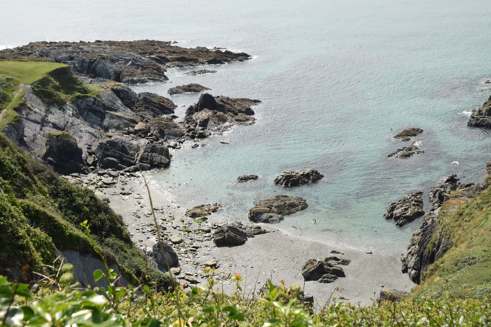
What I did see ahead of me was one of the distinctive churches with the tall towers that act as daymarks.  This is Lansallos church located in the heart of an extensive tract of National Trust land.  I descended almost to a small beach staying just above it on a low cliff.  This rather remote spot is very clean apparently but I didn't feel confident enough that  I would have time for paddling and so pushed on.  The path initially wound around the bottom of the following hill but I knew worse was to come.  It's funny what you remember about a walk - I remember a double hill and that is exactly what came next.  I slogged my way to the top of what I took to be the hill only to start descending a bit almost immediately.  Then the hill carried on upwards and upwards - it really sapped my strength during what was now the hottest part of the day.  Being hemmed in by gorse bushes didn't help either - it was almost as if they trapped a lot of the heat in.

Remote Beach
According to the guide book a small cottage near here that I never actually managed to pick out was once home to Marie Stopes sometime pioneer of birth control.  For some reason I kept thinking about this as I slogged up the hills - did she get inspiration from these parts or was she trying to escape?  Anyhow I was thrilled when I finally got to the top.  I think that was the hardest section of all.  From here it was largely downhill although quite gently downhill all the way into Polperro.  After the slog of uphill it was pleasing on the legs but it did seem like I was never going to get to this immediate destination.  I was in need of an ice cream now!

Passing By
It was as I started my final descent into Polperro that disaster struck.  I suppose it is quite amazing that I haven't really had any accidents thus far on this walk but I did now.  I lost my footing on the loose surface and over I went.  I didn't massively hurt myself but did graze my forehead and soon realised that I had a fair bit of claret coming out.  I feared the worst and tried to mop myself off with a tissue as I headed into the village feeling very self conscious.  It was just my luck that the public toilets and therefore my means of examining the damage and cleaning myself up was at the far end of the village.  I trudged through the crowds thinking that I must have been a sight for sore eyes.  As it happens it looks far less of a problem than I first imagined and was relieved to see that after a bit of mop down I was ready to face the world once again.

Polperro
I wandered down through the pretty streets of Polperro  and grabbed an ice cream at the first shop I could find.  The lady behind the counter didn't seem to notice that I had been involved in a brawl so that felt much better.  I wandered gingerly through the streets trying to get myself over the shock of what happened so I could be sure to walk the remaining 5 miles or so into Looe.

Tram Ride
As I left Polperro it was up yet another pesky hill.  When I got to the top of Downend Point I had to take a diversion courtesy of a cliff fall.  This led me inland towards a caravan park where I turned sharp right and headed down to Talland Bay down a very steep road.  A car passed me on the way down and I knew he would have to come back as the road was a dead end.  It came to pass a few minutes later - the driver sheepishly waved to me as he obviously realised that I had clocked him.

Speckled Wood
I passed by the beach at Talland which seemed pretty popular and climbed up on to the next headland.  I did notice that the hills were getting a bit smaller each time now and for that I was grateful.  As I rounded Hendersick the lump of Looe Island came into view.  This little island seemed like a perfect little hideaway.  Even though it was low tide it was still just out of reach by dry land.  By now I was really ready to finish my walk for the day and was thankful that the next couple of miles were largely flat.  As I wandered along in my own little world my peace was shattered by a large rescue helicopter that hovered for a while and then disappeared almost as quickly as it came.  I hoped that it was merely a drill...

Toadflax
As I wandered into Looe I became aware of a very small girl an her Dad ahead of me wandering along.  Despite the tricky terrain the girl was keen to walk and Dad was very patient.  I eventually reeled them in and was about to say something when Mum came to meet them and I didn't want to spoil their reunion moment.  Apparently they had been to the beach while Mum got her hair done.  Knowing how far back the beach was I was seriously impressed as the child (who was no more than 4) must have walked a couple of miles each way to get to the beach.

Looe Island
Soon I came to the road at the edge of Looe and from here it was a pretty easy walk to the bus stop by Looe station.  I even had the luxury of dawdling as I had plenty of time for the bus - this wasn't a given as I left Polperro so for that I was grateful.  Sadly the solitude that I had enjoyed for much of the day was deined me as I had to walk along the road in the company of a couple of girls who were discussing boyfriends and mobile phones.  I ended up pausing for a while as I could not seem to escape any other way for they matched my pace!

Looe
I do Looe a disservice by telling you this anecdote though - it is a most agreeable place and was a hugely welcome sight after the tiring day's walking.  As I walked along the harbour wall my eye was drawn to a statue of a seal - a most unusual thing to commemorate.  Apparently Nelson was a one-eyed seal well known by the townsfolk and who was fed by the fishermen.  He was clearly popular enough to warrant a bronze statue and I cannot think of any other seal that had this honour bestowed on him.  He now serves as a reminder of the importance of looking after the marine environment and I am certainly supportive of that.  He was unveiled in 2008 by none other than celebrated yachtsman Sir Robin Knox-Johnston - praise indeed!

Nelson
I trundled into town and had enough time to grab some much needed drink before waiting for the bus.  I didn't sit just in case I couldn't get up in time for the bus!  I needn't have worried - a ramshackle old minibus turned up and I turned out to be the only passenger all the way back to Polruan.  I can't imagine that the bus driver would get rich on my £4 bus fare.  As for the walk it was as tricky as I remember - I have no idea how I managed the extra section from Par on top of it.  Just shows how much fitter I was 20 years ago!

Sunday, 15 October 2017

Alfriston, Long Man of Wilmington and Jevington

The Long Man of Wilmington
To my mind this is one of the classic walks in Sussex and at 8 miles long makes for a satisfying day-long loop, especially if you take the opportunity to explore Alfriston and the other attractions en route. It is walk number 21 in Pathfinder Guide volume 24 Surrey and Sussex Walks (it also appears in vol... East Sussex and the South Downs as walk number...).  Officially the walk commences in Alfriston but mindful of how tricky it can be to park there I took the decision to park next to the church at Folkington about a third of the way round.  In that way we could also enjoy Alfriston and some of the other places to explore further towards the end of the walk.
Folkington Church
Folkington is a tiny spring-line village just to the west of Polegate at the foot of the Downs.  There is a large manor house here but hidden from view below the church.  Most of the land around here still belongs to the estate and it looks like an idyllic spot well out of the way of the rat race.  Parking was even a premium here though too - even though church wasn't in session there were enough cars about to suggest that we weren't the only walkers around.  We turned left at the church and began the loop in a clockwise direction.  Our path was the old coaching road from Lewes to Eastbourne, long since defunct as the main route but a very pleasing one to follow as a walker.
Foot of the Downs Near Folkington
I am writing this some weeks after the event so you will now understand why I refer to late summer.  The fields were a blaze of gold as they had either just been harvested or were about to be.  In fact only a few fields further on the path and we could here the unmistakable sound of a combine harvester and attendant tractor going about their business. We couldn't see it in action sadly as the high hedgerows shielded us pretty effectively.  They also afforded some shade on what was building to be quite a hot day.  There was a sickly sweet smell in the air primarily on account of ripening fruit and some that had been shed and squashed into the path.  The air was full of the sound of buzzing insects all going wild for the bounty available at this time of the year.
Ripening Berries
The path looped around the foot of the Downs and eventually changed direction and headed slowly uphill to cross into the valley of the next village.  I imagine Jevington was a spring line village too, although nestled in a dry valley in the Downs rather than at the foot it is a less obvious location.  The so called spring line villages are so-called because at the foot of the Downs where the chalk interfaces with the older gault clay below the water table meets the surface and groundwater is forced out to flow across the impermeable clay.  The springs that develop along this line were valuable water sources in a landscape where there were few and villages grew up around them.
The Eight Bells
Jevington is not one of the picture postcard villages usually depicted in tourist books and pictures of the area but it certainly deserves more attention.  Its chief claim to fame is the home of the Hungry Monk restaurant, where the world famous banoffee pie was invented.  Sadly its last meal was served in January 2012, when it became a victim of the economic downturn.  The pub, The Eight Bells, still trades though and is a very agreeable watering hole.  Sadly it was still closed when we arrived as we were a bit early in the day.
Farm Vehicle
We passed the pub and took a right turn along a narrow path towards the church.  It was quite a relief as the road was narrow and without pavement as it descended a small hill with steep sides.  There would have been almost nowhere to go if a car had come speeding around the corner.  The church is a pretty Downland one built of flint and with origins from the Saxon period (although I couldn't tell you which parts!).
Jevington Church
From the church we were now on the South Downs Way for a short distance.  I have completed this section many times although normally I am coming down the hill and on that basis it isn't easy to get a feel for how steep it is.  We all plodded up and away from Jevington, glad that the hill was completely in the trees.  To be fair this was the only decent sized hill on the route and it wasn't that bad.  It was only at the top that we escaped the trees and before us was a magnificent view across the Downs and the unusual feature of Lullington Heath.  This nature reserve is a rare example of a chalkland heath and abounds with a number of rare species.  Our route took us across it and we certainly saw plenty of insect life, especially butterflies and day flying moths.
Chalkhill Blue
As we cross the heath we passed a group of middle aged women all laughing hard.  When we got closer to them they explained to me that they could see something rather suggestive in the clouds!  They admitted they were dirty minded as they cackled off into the distance!  Onward we went and I smiled about this encounter for some time.  Lucky for me my children were out of earshot at the time otherwise I would have faced a barrage of questions.
Standing Proud
At the top of the next hill we paused briefly at a dewpond and had a little drink break and enjoyed the view.  For me the highlight of the whole walk was to come next as we descended slowly to the village of Alfriston.  The view across to the village with Bo Peep hill, Windover Hill and High and Over guarding this most scenic of Downland villages was quite astonishing.  By now clouds had bubbled up and the sky was filled with cotton wool like cumulus clouds bobbing along on the breeze.  It did look like they would take over the whole sky as forecasted but for this section at least they were perfect in enhancing the scene before us.
Windover Hill From Lullington Heath
On the way down the slope towards the village we passed something I had not previously seen in the UK, a field full of sunflowers.  I wasn't sure that the crop was wholly successful as the field didn't look as flush with flowers as I have seen in France.  A few looked in rude health but for the most part they looked a bit straggly and not in great shape.  I wonder whether these exposed Downland conditions suited them?

Alfriston View
At the bottom of the hill and we met a road.  I can remember cycling these lanes as a boy but wouldn't consider it now for they are surprisingly busy.  In fact I am not even sure I like driving them very much either.   We had to walk alongside the road for a short distance; not a great prospect.  We turned left at the next junction and then again into a field after about quarter of a mile, much to our relief.  In the short distance we had to walk along the road we had to stand aside for at least a dozen vehicles.  Each of them were so large that we felt uncomfortable as they swept by.  When are cars that size going to be banned from these country lanes I wonder?
Espaliation

At the end of the field we turned left again and headed across the bridge over the River Cuckmere.  As one of the four main rivers that cut through the Sussex Downs this one seems the most improbable.  He were are only about five miles from the sea and the river is scarcely 3 metres wide.  The idea of it cutting its way through the Downs seems a little far fetched and yet that is clearly what it has done.  I wonder whether it had some help during the last Ice Age?  As we crossed the bridge our eyes were drawn to a large green caterpillar.  I have seen one of these before - it is from a privet hawk moth.  Even so we were mightily impressed with the size of the blighter!
Approaching Alfrsiton

Once in Alfriston we went in search of some refreshment and had a picnic lunch just outside the magnificent 14th Century church, called by some the cathedral of the Downs although that is a little overblown.  It was lovely sitting in the sun watching the world go by for a little while - there is always plenty of activity on the Tye outside the church.  Alfriston was where Eleanor Farjeon wrote the hymn 'Morning Has Broken' and in these surroundings it is easy to see why she was inspired to write such a joyous song.

Caterpillar
Before moving on we decided to take a look at the Clergy House next door to the church.  The main claim to fame of this modest little house is that it is the first property that was acquired by the National Trust way back in 1896. It is quite a survivor, being originally built in the 14th Century.  By the time the Trust bought it for £10 it was in quite a state.  The house itself took only a short time to walk around for there are only a few rooms.  It was quite easy to imagine how it must have been to live there, unlike some of the grander houses under the ownership of the National Trust.

Kayak Instruction
As well as looking inside the house we also took the opportunity to wander around the garden.  This was very much a cottage garden and we were most interested in the kitchen crops that were being grown at the far end.  Insects busily tended all of the late blooming flowers and in truth I would have been quite happy sitting in a deckchair here for the afternoon reading my book and drinking tea rather than plodding on further.

Visit The Tye
The onward path did call us though and we retraced our steps across the River Cuckmere.  As we did so the thunder of the Red Arrows pierced the sky and they shot be on their way to the Eastbourne Airshow that was also taking place that day.  A few minutes later and another squadron of planes went by, a rather more sedate group of propeller planes that sounded like angry wasps.  On the other side of the river we looked again for the caterpillar but it was gone - hopefully not taken away by a bird?  We also gave some lost cyclists some directions and were pleased that they weren't going the same way as us.
Clergy House

We deviated from the official route slightly as we started climbing the hill away from the Cuckmere valley.  This is because I wanted to show the girls the tiny church of Lullington.  This has a claim to fame of being the smallest church in England.  I'm not sure about that but it definitely is the smallest in Sussex and sits only 20 people.  It was originally part of a larger church and the remains of the rest can clearly be traced in the area around what is left.  Apparently the remaining part of the church burned down, believed to be during the period of Oliver Cromwell's reign.  It strikes me as being quite a strange place even now.

Alfriston
After a little exploration we pushed on.  We paid the price for our detour by having to walk along the road again for a short distance before striking off to the right and commencing the climb of Windover Hill.  We did not need to climb to the very top though - our path cut underneath the main scarp slope so that we could be afforded the lassic view of the Long Man of Wilmington.  Before we reached that landmark we had magnificent views across the hamlet of Milton Street below us and across to Firle Beacon and Mount Caburn to the east.  This is one of the classic views of Sussex.  A little beyond that was another - the iconic figure of the Long Man.
Red Arrows

The iconic Long Man of Wilmington is one of the enigmas of archaeology for no-one can be quite sure when this chalk hill figure first appeared here.  An early theory was that it was drawn by the monks from nearby Wilmington Priory but this has been dismissed by most now as the man is not clothed.  Some say he is neolithic while the only definite date that he is known to have existed is 1766 when he appeared on an artist's drawing.  He may therefore be a lot newer than previously thought - the 2003 dig suggested that he might only date from the 16th Century.  However old he is he still commands a lot of attention standing proud on the side of Windover Hill and surveying the Weald.

Lullington Church
We passed through the village of Wilmington and past the Priory.  This is now a building owned by the Landmark Trust and rented out as holiday apartments.  I seem to remember it being open as a museum when I was younger but I never visited.  We stopped briefly to look at Wilmington church before picking up the coaching road at the foot of the Downs to return to our starting point at Folkington.  Sadly by now the clouds had completely covered over the blue sky and the remaining part of the walk through the woods that skirt the foot of the Downs was devoid of any sunshine.  No matter - by then we had seen most of the fabulous scenery that this walk has to offer.

Sunday, 8 October 2017

River Bure Walk

Upton Dyke
Our final walk in Norfolk for this trip saw us go back to look at The Broads just a short distance from the one we had completed in Ludham earlier in the week.  After the disappointment of the previous walk we chose one not based on what else we could visit but instead the pure beauty of the walk itself.  Walk number 17 from vol 17 of the Pathfinder Guide Norfolk and Suffolk Walks did just that as it promised to be one of the classic Broadland walks.
Traffic Jam
We started at Upton Dyke, a short stretch of drainage channel the serves the village of Upton.  Although the parking area was in the shade of a small wood we soon lost the tree cover as we headed out along the left bank of the dyke.  Immediately we could see this was big sky country as the countryside all around was almost entirely flat.  Perhaps unsurprisingly for such a flat landscape it is also entirely dominated by water and even those areas of dry land are separated by drainage channels that keep the grazing land from being swamped by water.  I imagine during the winter months it probably is covered in water much of the time. 
Looking Ahead To The Mills
For now the main interest was the variety of boats along the dyke.  In the past few years we have enjoyed walking along waterways and enjoying the different craft on view.  Those in Norfolk are less traditional, with a preponderance of motor cruisers and certainly no narrowboats.  We found them rather less interesting as a result, although they undoubtedly looked more comfortable inside.  On the right we also passed a small water pump - this hollow post mill is a rare survivor apparently.
Swanning around
It wasn't too long before we reached the main River Bure and the only option available was to turn left.  Unlike our walk the other day this path followed along the top of the river levee and that meant we had better views all around.  On the river side the boat traffic seemed relentless - this is obviously a very popular waterway.  On the land side we could see lots of bird life especially geese, swans and herons that all seemed to be in abundance.  The sky was full of puffy white clouds bobbing along gently, making this the perfect day for walking. 
Oby Mill
We soon passed the first windmill - a derelict affair called Oby Mill on the opposite bank.  It looked like it would take quite a bit to restore it even as a place to live.  I wouldn't mind betting that someone will in the next 20 years.  A little further on and on our side of the river was the rather more looked after Upton Mill, which has been turned into a home.  It does look like a nice place to live but I wonder how easy it is to access during the wet winter months?
Upton Drainage Mill
The path continued on towards some more mills in the distance but we were never destined to reach them.  The River Bure swung off to the left as it was joined by the River Thurne. As there was no bridge upon which to cross it was pretty obvious which way we had to go!  This area is obviously a popular place to moor for there was another boatyard on the opposite bank and a very attractive looking village (Thurne) behind dominated by the church.  In a flat landscape like this the churches seem to stand out more than ever.  Off to the left and it was bird life that caught our eye again - a heron hunched over watching the drainage ditch for any sign of movement underwater.  Further on and it was the little grebes that caught our eye.  They were easily disturbed though - any hint of us moving and they would dive under the water, only to pop up quite some distance away.  It actually took some patience to see one after they had initially dived!

St Benet's and Thurne Mills
On shore the banks were alive with dragon and damselflies all enjoying the warm late summer sun.  Butterflies abounded too, especially the browns, whites and red admirals.  In fact I am not sure I saw any other kind - perhaps they don't get a look in with all these about?  The reeds largely screened the river but I soon became aware of a couple of sailing craft approaching largely because of the flapping of the sail as the yachtsmen tacked into the wind.  It looked like a difficult job getting the yacht down the river using only wind power.  Any wrong move would surely have ended in disaster!  It was fascinating to watch their struggles and managing to avoid other powered craft also using the waterway.

Tacking
Further along I became aware of large groups of people on the opposite bank and as we got closer I realised that they were looking around an old ruin; the remains of St Benet's Abbey, founded in 1020 as a Benedictine Monastery.  Ironically the main structure left behind is an old windmill that was built among the remains.  This too was left to its fate in the mid 1850s, while the original abbey seems to have succumbed around the time of the dissolution back in the 1540s.  Some claim it was not destroyed by Henry VIII but it was seized by the crown at that time.  The monks all went their separate ways apparently and left the abbey to nature.  Judging by the crowds of people looking around it still attracted a good deal of interest although for us it was impossible to reach from our path.

St Benet's Abbey
A little further on from the abbey the bank took us along a channel away from the main river.  It soon became apparent that this was a channel built for boats to moor and we soon hit the line up as we neared the village of South Walsham.  According to the map the opposite bank was covered in woodland but this didn't seem to be the case on the ground.  The trees were more like shrubs and more widely spaced than I would have expected.  As we got close to the village we saw South Walsham Broad, a beautiful little haven that was surrounded by some lovely looking (and I suspect pretty expensive) looking houses.

South Walsham Broad
We were directed around the village by the boat yard and houses before eventually taking a hard left and entering a field.  Immediately the mood of the walk changed for no longer was the focus upon water but on the surrounding farmland.  At the other end of the field we crossed into a lane and went past a very attractive looking tile cottage.  The lane soon ran out and our onward route took us along a slightly elevated path through some thick hedgerows.  To our left were fields of horses, the grassland just high enough above the general level of the land to enable it to drain slightly more freely.

Boardwalk
We were 'welcomed' by several dogs on the next few hundred metres of the walk.  Evidently the local canine population doesn't take too kindly to interlopers and we were seen off from several houses as we passed by.  Eventually we disappeared into woodland surrounding Upton Fen Broad and the onward path was a delightful wander through a shady nature reserve, using boardwalks on a fairly lengthy section.  This was perhaps the nicest part of the non-water section of the walk although it was a shame we didn't get a decent view of the Broad itself as it was tucked just out of sight in the woodland.

Peacock
We came out on to a road at Cargate Green and followed this all the way back into Upton.  Normally I am not a big fan of road walking but I would make an exception in this case.  The houses were pretty and the gardens well tended.  Many of them were showing off their late summer blooms and crops by now including some showy dahlias and in one case some prize winning looking pumpkins.  By now we were feeling pretty hungry and so we headed to the White Horse pub for a spot of lunch.  We discovered that this place was now owned by the villagers through a share scheme and used funding from the Prince's Countryside Fund to re-establish the business after it was threatened with closure.  A poster showing the Prince of Wales pulling a pint was proudly displayed on the wall inside.  As for the food and drink - top notch!  We both really enjoyed it and would definitely call in again if we were back in these parts.

The White Horse
After a lovely relaxed lunch in the pub garden we headed the short distance back to the car feeling good about our walk.  This definitely was one to do again and again if we lived in this area.