Friday, 14 October 2011

The Rodwell Trail

Rodwell Station
When I completed my last outing on the Dorset stretch of the South West Coast Path I walked along a short stretch of The Rodwell Trail, a fairly short but extremely well used former railway line that once connected Weymouth with the Isle of Portland. It is a railway trail made famous by Julia Bradbury in her series on Railway Walks shown on BBC TV a few years ago. Given that the next stage of the coast path around the Isle of Portland is fairly short I took the opportunity of being in the area to take a look at The Rodwell Trail at the same time.
Ferrybridge
The official trail runs from Ferrybridge to the town centre in Weymouth, following the former railway for most of its length, a remarkable achievement given that it passes through an almost entirely urban area. Further sections of the trail can be walked unofficially along the causeway that linked the Isle of Portland and a short stretch on the island itself. I restricted myself to the official route, principally because I wanted to do this trail by bike and the unofficial sections are not bike friendly.
Site of Whitehead Torpedo Factory
The railway from Weymouth to Portland (Easton) opened in 1865 after a fairly complicated and convoluted construction involving three separate companies and some significant engineering work. Its passenger services were withdrawn as early as 1952, principally because of competition with buses. Its freight purpose to carry away quarried stone gave the line a slightly longer life span but it was completely closed in 1965. The line at the northern end of the Isle of Portland was subsumed within the naval base that once existed there (and which closed in 1996) and a few of the bridges were removed, but otherwise the course of the line is remarkably intact.
Wyke Regis Halt
As it was early in the morning I managed to find myself a parking space at the southern end of the trail at Ferrybridge (I wouldn’t mind betting that I would have struggled at any time other than 8am on a Sunday morning!). From the missing bridge across The Fleet the line is surfaced with tarmac and takes a fairly steady uphill gradient. With the salty air and frequent wet weather this must have been quite a struggle for some of the trains heading into Weymouth. For me on my bike it was not too bad as the surface was nice and smooth and apart from a few dog walkers there weren’t many people about to get in the way of my progress.
Wyke Regis View
Shortly after starting I passed the former Whitehead Torpedo Factory. The last torpedoes were built here in 1966 but the factory continued to produce a variety of engineering products until its final closure in 1994. The factory buildings were demolished in 1997 to make way for the housing development that now abuts the Trail.
Continuing Uphill
Shortly after I reached the overgrown platform of Wyke Regis halt. This was the first of several halts opened in 1909 to try and increase patronage of the line. It, like all the other halts opened at the same time, was short-lived remaining open only until 1952. Yet, most of the single line platform remains in place, complete with sign advising of its existence. I think this was added as a result of a Heritage Lottery grant which enabled the trail to be put on an official footing. As I looked at the platform with its bramble bush covering I couldn’t help think how inconvenient its location was, buried at the bottom of a deep cutting away from the built up area for which the station was supposed to serve. I wonder how successful it was as a station?
Sandsfoot Castle Halt
Beyond Wyke Regis and the line emerged from the cutting to show some remarkable views across to Sandsfoot Castle, Weymouth Harbour and the Purbeck Coast beyond. This reprised the section of route that I walked as part of the South West Coast Path earlier in the year, but it was interesting to see how different it all looked with foliage on all the trees and bushes. It was a very pleasant cycle ride along this section, although if I’m honest the views kept me from cycling more than a walking pace! For an October day the weather was unusually clear bright and hot – in fact it felt more like an August day.Already at this early hour I was starting to feel the heat of the day.
Rodwell Station
At Sandsfoot Castle the South West Coast Path left the trail and I continued along the section of trail that I had not previously explored. Almost immediately I came to a fragment of another former halt, which had been provided to serve the nearby castle ruin. This had an even shorter life span than Wyke Regis, lasting only from opening in 1932 for the remaining 20 years of the life of the line. All that remains is part of the old wooden platform that was provided for the expected tourist traffic, although I am guessing that this did not materialise.
Buxton Road Bridge
The climbing continued on to Buxton Road bridge, a handsome three arch bridge over the railway that appears to have lost nothing of its dignity since the closure of the railway. This marked a turning point in the character of the railway as it continued onward through a deep tree covered cutting that was nevertheless not hemmed in feeling. I am guessing that The Friends of Rodwell Trail, a group of volunteers that look after the line see to it that it does not become overgrown. At the far end of this attractive cutting was the station of Rodwell.
Rodwell Tunnel
Rodwell Station was a ‘proper’ station, having been opened with the rest of the branch in 1870. Even in closure and with most of the infrastructure long since removed it still has the feel of a more important station. For a start there are two platforms of pretty decent length and at the Weymouth end is the short (58 yard) Wyke Tunnel. The passing loop at Rodwell was added in 1909 as part of the drive to attract more passengers. The station was also bombed during the war but repaired and re-opened for its few remaining years of service.
Heading Down Into Weymouth
It was slightly disappointing to see that Wyke Road tunnel was being repaired and the passage through was via a boarded off section of path through the middle. Hopefully the work will prove to help the old structure last a bit longer. At the other side of the tunnel it was quite clear that I had now reached the highest point on the line, for the path started dropping away surprisingly steeply. This must have been quite a challenge for the small engines plying this route for most of its existence. For me it was a breeze now and the views soon opened up across to Weymouth Harbour. The Trail was now truly a green lung through the urban development that was probably built around the same time as the line judging by the appearance of the houses.
Gun Emplacement
On the side of the trail some way down the hill is another reminder that Weymouth was very much in the front line during World War II. A former gun emplacement has been restored and now acts as a viewing point across the inland part of Weymouth (ie away from the harbour). Just after this and the tarmac suddenly runs out as the former Newstead Bridge, a rather large structure that caused traffic congestion underneath it (on account of it being so narrow), has now been removed, forcing the walker/ cyclist to descend down a pretty steep path down the side of the embankment to road level. The road was not too busy of course on account of it being early Sunday morning, but it was a pain nonetheless, especially having to climb the other side, which was just as steep! Apparently, if new stories are to be believed, a new span is to be provided here so that walkers and cyclists no longer have to undertake this rather awkward manoeuvre.
Former Newstead Bridge
The remaining part of the trail was very short, with Westham halt soon creeping up on me. This small station still has a platform remaining but did not last very long as it was one of the 1909 additions. From here the line would once have crossed the busy road at what is now the end of the trail via a level crossing and then crossed Radipole Lake to reach the end of the line at Melcombe Regis. No trace of the line exists from here. Melcombe Regis station also officially succumbed to closure along with the rest of the line in 1952, although unofficially it was used as a summer relief station until 1959. All trace of the station has now vanished under the inevitable retail park and would once have been somewhere near what is now MacDonalds.
Westham Halt
I turned tail at Westham Halt to return back to Ferrybridge. As with so many of these closed lines I tried to picture in my minds eye what this one must have been like to travel on. I am guessing that if it could have clung on another 20 years or so it would have made for a spectacular preserved railway. Nonetheless it is amazing that so much of the trackbed has survived being redeveloped and as a railway trail it really has everything, possibly one of the finest I have followed even for such a short distance. It is highly recommended and although I didn’t do so this time, I could see the appeal in continuing onward to Portland. As it happens I did walk stretches of the onward trail, albeit by doing the South West Coast Path. More about that in the next report.

Thursday, 6 October 2011

Sussex Border Path Section 7 Linchmere and Marley Common

Milland Pond
More of the same please! After entering the pine forests of the sandstone ridge that dominates the north western part of Sussex on the last section, today was very much a continuation of the same theme. I parked today in the small car park at the top of Marley Common, south west of Haslemere. I am not sure it was the one marked on the map but it served its purpose nonetheless. As I was at the end of the section of Sussex Border Path that I wanted to do today I did the return loop first. This would largely take me along the foot of the ridge through various sections of woodland and occasionally into open fields before winding up at Milland House, where I had passed last time out. From here my route would take me back along the officialwalk from the Black Fox at the top of the ridge – a rather different world as I was to discover!
Autumn Colours
Sadly the sunshine that had accompanied me all the way up into Surrey disappeared behind some very thick cloud and I was thankful therefore that I would largely be walking in woodland to begin with, where overhead conditions didn’t affect my pictures so much. This thickly wooded fringe of Sussex earns its living as became abundantly clear quite quickly. Much of the woodland was being actively coppiced and the floor was thick with the prickly shells of sweet chestnuts. Most of those scattered around were too small to be worthwhile though.
Bodger's Quarters
The first curiosity I came across was a very secluded pond at the bottom of the ridge. Its water was a strange turquoise colour, although it was very clear and full of weed so whatever caused the colour was clearly not doing much harm? All around was silent with no birdsong and not even a ripple on the surface of the water. It was certainly a quiet place to meditate!
Fungi Crop
The onward track became a little monotonous as for the next mile or so I headed through thick woodland, broken up only by a large clear cut section that had been removed for coppicing. A small woodland workshop had turned most of the harvested wood into fence posts. I gather that the people that would once have carried out this kind of work were known as ‘bodgers’.As they only did part of the job of turning wood into finished articles, this term has been translated into common English as a job that is serviceable but only borne of necessity (not a botch – which is a total failure). A little further on was a section of woodland that I suspect was harvested last year, since it had plenty of fresh new growth.
Tangle of Roots
There were a few odd sights through the woods as the seasons are now on the turn. A few rhododendron flowers were hanging on, trying to inject a bit of colour into woodland that was starting to turn from green to brown. I found the fact that some branches on trees had leaves that were still as good as new while others had completely died and were probably only a few days away from dropping off. Most of all though it was the various types of fungi that really fascinated me. Until the last couple of years I haven’t been that interested in fungi, but various woodland walks taken recently have made me change that view.
Looking Out Over the Forest
Certainly today I would find lots of different types on my walk, from the bright red spotty fly agaric (seen in all Disney films) to the rather understated brown ones. I also kept a lookout for interesting tree roots as the path followed a sunken course through the woods. I saw at least one that looked rather like a face and I couldn’t help thinking that it was sights like this that made folk think that there were spirits in the woods.
Linchmere Marsh
Eventually I came out into open countryside briefly at Linchmere Marsh. I negotiated my way around some fine looking houses and crossed a small road before entering more woodland, this time via a rather mysterious looking drive. I wasn’t quite sure of what kind of house I would find at the far end, but was rather surprised at how little it was! It did have the most marvellous views across the surrounding woods, courtesy of a small break in the forest. The owners were floating about and I got the impression they didn’t want me to linger too long as they asked me whether I was lost in a thinly disguised but friendly manner.I did have the opportunity to admire their vintage Jaguar and tractor parked behind the house before plunging into more woodland.
Old Tractor
The next part had some particularly fine fungi specimens and some gnarled old yew trees that were resplendent with red berries. I don’t know why but my little camera really struggles with decent pictures of these – a real pity as I would like to get a decent shot one of these days. I was curious to see that many of the fungi appeared to have bite marks taken out of them. Surely they aren’t on the menu of many animals?
Plump Bounty
Eventually I reached the edge of Hollycombe Mueseum. This is an open air steam museum not just dedicated to trains, but all things steam, even fairground rides! I’ve not visited, but one day I must. Seeing some signals set to clear in the distance was the only clue that I was in fact passing this place, although I am sure on operating days it is possible to see the steam engines in action. A couple of old National Carrier lorry trailers parked up weren’t the best advert from this corner of the museum though.
Little Nibble
I dropped down through a sunken lane and eventually came upon a road where I turned right. What followed was a rather unpleasant mile-long walk along the surprisingly busy country road. As I passed by Hollycombe Hanger I came upon a rather odd well looking structure. There was some water in the depths of the blackness but guarding the entrance was a very large spider that had used it as a convenient place for its web. I didn’t look further as I didn’t want to disturb the poor chap.
Hollycombe Signals
I was relieved to turn off the main road and on to a much quieter country lane. The hedgerow alongside me was full of bees turning their attentions to the bounty of fruit on offer rather than the flowers from earlier in the summer. Fruits were aplenty too, from the usual blackberries to the colourful honeysuckle berries, rosehips and hawthorn berries. I even saw a speckled wood butterfly but it wasn’t keen to play ball with me, fluttering off extremely quickly but hanging around as if to tease me!
Home Farm View
I passed through the large and extensive Home Farm and saw some of the few people I encountered all day in the shape of a building crew working on one of the buildings. Shortly after and it was back into the woods. I must admit that I was now becoming a little bit disorientated. Maybe I should have taken advantage of a pair of glasses that I found hanging over an adjacent stretch of fencing?
Lone Tree
Eventually I emerged from the woods by Milland Place, a rather gloomy looking house that looked rather deserted. The house has been covered in pebble dashing, which seemed rather out of place for a building of that size and style. A pair of very large iron gates deterred anyone from even thinking that a closer look would be possible! The estate was rather cut off from the outside world by a very high wall that surrounded it, and at the end of the perimeter track that I followed were a couple of enormous gateposts that announced its entrance.
Traffic Light Berries
By now the sunshine that had graced the day had disappeared once again and all around were grey clouds. It was a shame that I couldn’t have had just a little more sunshine, for I had now reunited with the Sussex Border Path and had a return trip to the car along the official route. I passed initially through Liphook Golf Course, which for a non golfer like me looks like a very pleasant place to spend the day in among its heathland setting.The path through the golf course and onward is along what looks like a former road that somehow didn’t quite make it into the modern age. A proto-A3 maybe? It passed through an estate of gated properties and houses with huge entrance gates and big fences. It wasn’t exciting but did enable me to make some quick progress.
Linchmere
Eventually I reached a road junction, where I got a reminder of how close to the Sussex Border the path actually gets. Almost within touching distance was a sign proclaiming a welcome to Hampshire. I kept straight on, following a route also shared by the Lipchis and Serpent Trails, surely future walking expeditions? I splite from those routes fairly quickly as I headed on a northerly course while they headed south. For me the route continued across Stanley Common, a beautiful heather clad piece of heathland marked with the odd stretch of pine forest. As with a lot of sections of today’s route, the woods provided a navigational challenge although to be fair I was conscious of keeping my wits about me and so didn’t go wrong.
Milland House
I reached another road that led to the small village of Linchmere. Rather than continue on the route I dived into the centre of the village to take a look at the church. It was rather different than I imagined, with a small spire and distinctive clock. I was given rather a dirty look by a woman busying herself with bedecking the nave with flowers. I took the hint and continued on my way.
Linchmere Church
In truth the last couple of miles of today’s walk were rather uninspiring. I was rather glad that I had taken the outward route that I had today, for it was rather more interesting than this stretch of the Border Path. I’m not sure if that had to do with the weather, which by now was rather overcast and dull. It may also have had to do with the fact that I was anxious to finish the day. Anyhow I got back to the car on Marley Common about half an hour after visiting the church feeling quite satisfied with my day’s work. The next section takes me to the highest point in Sussex, a milestone in itself!

Saturday, 17 September 2011

Sussex Border Path Section 6 Rake and The Black Fox

Storm Damage
My 6th outing on the Sussex Border Path took me back to the rather convenient car park that I had found at Durford Heath. Rather than an early morning expedition, the weather forecast dictated that this would be a late afternoon/ early evening trip. In fact the weather in the morning was pretty foul and it was rather a leapof faith on my part that I went at all. However, the rain stopped about half way to Midhurst and a small break in the cloud ahead gave me some reassurance even though the air was thick with moisture.
Bracket Fungus
When I finally got going from Durford Heath I was rather glad that I was walking through the sandy heath and pine forests of this corner of north west Sussex, for it did reduce the amount of mud that I had to trawl through. The first half mile was down rather a narrow lane with steep sides. Although the rain had stopped there were some rather large drops of water that gave me something of a wetting, especially every so often when a gust of wind blew. There was no doubt about it – it was far from the usual conditions I like to walk in!
Flying Bull Pub
I turned left off the road withsome relief, having been passed by only two cars on the half mile section. It was not a pleasant encounter on either occasion and I was pleased that it hadn’t happened more often. The path through the woods felt like an ancient trackway that had managed to stay a track rather than be turned into a country road. It was pleasant walking through the forest and the canopy of trees rather shielded the fact that it was quite cloudy above me. I also caught up with some fellow walkers which rather surprised me so soon after the wet weather had passed.However, when I approached it was clear that they weren’t seasoned walkers as they had completely unsuitable footwear for the wet forest conditions. I smiled sweetly and inwardly wished them luck picking their way through the mud and puddles with their canvas shoes on…
Hedge Woundwort
I eventually reached the first settlement of the day, the village of Rake. People were now emerging from their houses and into their gardens now that there was a hint of sunshine. Hedge trimming and snipping of dead plants seemed to be the order of the day now that the end of summer was fast approaching. I crossed over the former A3 trunk road, now by-passed some distance to the north.Although now very quiet it was obvious that this was a very busy road in its former life, for it was built with a much better specification than its current status as a ‘B’ road would suggest. I passed the Flying Bull pub, which was probably originally a coaching inn with a rather less silly name. From here I faced just over a mile of road walking, which wasn’t great but at least the road was relatively quiet.
Railway Crossing
Just past Brewells Farm I was rather alarmed to find a dog running helter-skelter towards me. It didn’t stop when it reached me luckily but kept on going seemingly at 100mph. I wondered where it was off to in such a hurry? A few minutes later it became clear when I passed the owner grumbling that the dog had chased after a vehicle up ahead thinking that it should be on board! By now the sun was properly out and in the hedgerows blackberries and elderberries were dripping with water, while the bushes they hung on groaned with all the extra weight of their fruit and rain.
Weavers Down
I passed over an obviously rebuilt railway bridge (it had very shiny new bricks, although the design was far from modern) and passed the small hamlet of Langley. From this point the character of the walk changed again. I had now entered a heathland environment and the path continued along the side of a pine woodland with views out across what was a surprisingly wild piece of countryside. The area to the north of here is Weavers Down, partially occupied by the military. The rest looks like a chunk of the New Forest dropped into this part of north-west Sussex. I am guessing that it is agriculturally useless, for there seems to be little attempt at any kind of obvious cultivation.
Folly Pond
Even though it was only early September, autumn seemed to have really got underway already. Fungi of various descriptions had pushed their way up through the soil and leaf litter and colours on the trees were showing beginnings of autumn tints. The wet weather that had passed through earlier in the day seemed to heighten the sense of autumn. Glimpsed through the trees was Folly Pond, a surprisingly large body of water that was full of swans.I tried getting close for a good look but it was soon obvious that from the south side this wasn’t going to be possible. I therefore decided to wander around the northern edge of the pond to get a better look and was pleased I did so for the setting was absolutely beautiful.By now most of the clouds had cleared and the air was clear and bright with late afternoon sun. On one side of the lake overlooking the view was a large looking building that I later learned was a health resort. Rather a grand setting and I am sure it does very good business. How could it fail being here?
Folly Pond
My onward route took me through fields and sections of more pine woodland until finding my way back to the old A3 at yet another coaching inn, this time the rather lonely looking Black Fox. All was quiet at the pub, although it did look as though it was still trading, which was some relief. So many have closed now that only the strongest seem to survive and these solitary places need to offer something extra special to stick around. It was here that I left the Sussex Border Path to start my return journey to the car park.
Back to the Railway
I crossed the road and headed off across a section of woodland that had recently been felled, leaving only tree stumps. Away in the distance I could see three large birds of prey (possibly buzzards) circling around above the still intact woodland and calling to each other. It was almost as if the three of them were working as a team. I joined what looked like it might once have been an estate road, marked as it was by some rather large columns on either side. It was obviously now a public highway, marked by the surprising number of cars that passed me as I walked the few hundred metres I needed to along it.
Black Fox
At the rather grand looking Milland House I turned to head across a still rather wet field. I passed by some more woodland and was just admiring a big clump of flowering heather in front of me when a small copper butterfly alighted on one of the stems posing and almost begging me to take a picture of it. Of course by the time I set myself it had taken flight – tease! I briefly came upon the old A3 for a third time, an unusual section for here it turned into a dual carriageway, very unnecessary now! The onward path left again almost at right angles and I felt rather odd as I crossed what appeared to be the bottom end of the garden of a rather large house in the distance.
Milland Estate
At the other side of the garden I passed through a gate to come into the extraordinary churchyard of St Luke’s Church. This Victorian church is certainly very pleasant and looked its best in the early evening sunshine, but it is surely eclipsed by the adjacent and redundant Tuxlith Chapel. This old church is now cared for the by the Friends of Friendless Churches (a rather bitter-sweet concept) and dates from some time in the 16th century although its origin seems to vary depending on which report you read! Declared redundant in 1974 the old chapel stands empty, but it is still possible to explore inside (I did).There are no longer any pews and I guess that its demise was principally because it was too small for its local audience, hence the bigger church was built next door. Nevertheless, it was a most enjoyable and unexpected find. I was amazed to think that I had never heard of this place, even though it is in the county that I have lived in for so many years.
Gatekeeper
From the churches I dropped down the side of a very steep and wooded hill via a set of slippery steps and passed the horse loving residents of Maysleith who were grooming their steeds. The next couple of miles were along a path through game bird shooting territory. There were literally hundreds of pheasants wandering about making the most awful racket calling to each other and warning their friends of my approach. By now I could tell that I was in a race against time to get back to the car as the sun was getting very low in the sky. I guess the pheasants were nervous as they were readying themselves for roosting down for the night.
Tuxlith Chapel
I passed through Combeland Farm, which seemed to be yet another full of junk as well as a hay barn that was literally falling down around the hay it was supposed to be protecting. A little further on and I reached Combe Pond, yet another delightful oasis of calm in the woodland. Judging by the fishing platforms this looked like a popular spot with the angling fraternity, although at this late hour I had the place completely to myself. I did linger for a short while enjoying the moment but from here on I did not hang about. I was anxious to get back to the car for daylight hours were running low.
Friendly Pheasant
In all honesty there was little to report on the last stretch for much of it was through rather dark and foreboding woodland, heightening my desire to return to the car! The only thing I have to report is that inevitably perhaps I did take a wrong turn and ended up having to walk the last mile or so back along the road. Not pleasant, but at least I didn’t get horribly lost!
Combe Pond
This was a nice easy walk with some really good highlights at Folly Pond and Tuxlith Chapel. There are few sections that are unpleasant and I am sure the last mile could have been avoided with more haste and less speed. The car park at Durford Heath is convenient for it lies directly on the path and there are a couple of pub stops en route for refreshments if needed. The only facility that isn’t available is a village shop, so make sure you have fluid with you before you set out. Conditions underfoot were mostly dry although there are a couple of the forest stretches where I could see that mud would be a serious problem in the winter months. I am looking forward to more of the same kind of terrain on the next section of the Sussex Border Path as I head towards Haslemere.
Last Sign

Saturday, 10 September 2011

VeloRail Perigord Vert


Ready to Depart
Ever since our first velorail experience in Normandy last autumn I had wanted to have a go at this activity. Our family holiday this year was in the Dordogne area of France and a quick search of the Velorails Federation website pointed to another opportunity at the nearby town of Corgnac-Sur-L’Isle (http://www.veloraildefrance.com/velorail-24.html). I persuaded the tribe to come again to explore a different line! A rather different type of outing this time!
Trains Heading Out
As a quick reminder for those that haven’t read about our previous experience, France still has many miles of disused railway lines that are still intact. Apparently they are retained for strategic reasons in case the military need to use them and removal only happens once a solid case is put forward. This has led to the development of velorail (railway cycling) as a popular way of exploring some of these otherwise redundant and unused lines. There are approximately 40 velorail operations across the country.
Corgnac Sur L'Isle Station
The Perigord Vert operation is a rather different kind of experience to the one in Normandy. Firstly we had to turn up at a specified time, which we had to book in advance. We chose the 10am slot, on the basis that it might be a bit hot later in the day. We needn’t have worried as the weather was decidedly overcast, which was disappointing from the point of view of taking pictures. For pedalling though it was a bit of a godsend.
Rolling Stock
The ‘station’ at Corgnac Sur L’Isle where the rail cycles are collected is actually a little way out of the small town and not at the railway station. There is a small booking office and a line-up of rail cycles which is the only clue that the operation exists. According to the website there is a choice of routes from here, one way to Thiviers and the other to St Germain. The reality, certainly on the day we visited, was that the route to St Germain doesn’t actually seem to be available for the moment since all the timetabled slots were for Thiviers only.
River Crossing
The line forms part of a longer route that once ran from Brive to Angouleme across a very rural part of what is now known as the Perigord Vert. A railway line still crosses this part of the country, although from Limoges to Perigueux. It does at least pass through Thiviers, although I don’t think there are many stopping trains. The Brive-Angouleme line was opened fully in 1889, although some sections of the line opened rather earlier on a piecemeal basis. It closed for passenger traffic in 1940, presumably due to the war, and it never re-opened.
Heading Uphill
Goods traffic continued for some time afterwards in the shape of tobacco, wood and materials from foundries. The line closed in sections from 1960 and finally closed for good in 1993 and the remains were bought by the Departmental Government of the Dordogne. I understand that other sections have no track remaining, but the trackbed has been converted into cycle path, although the route is a bit fragmented.
Signage
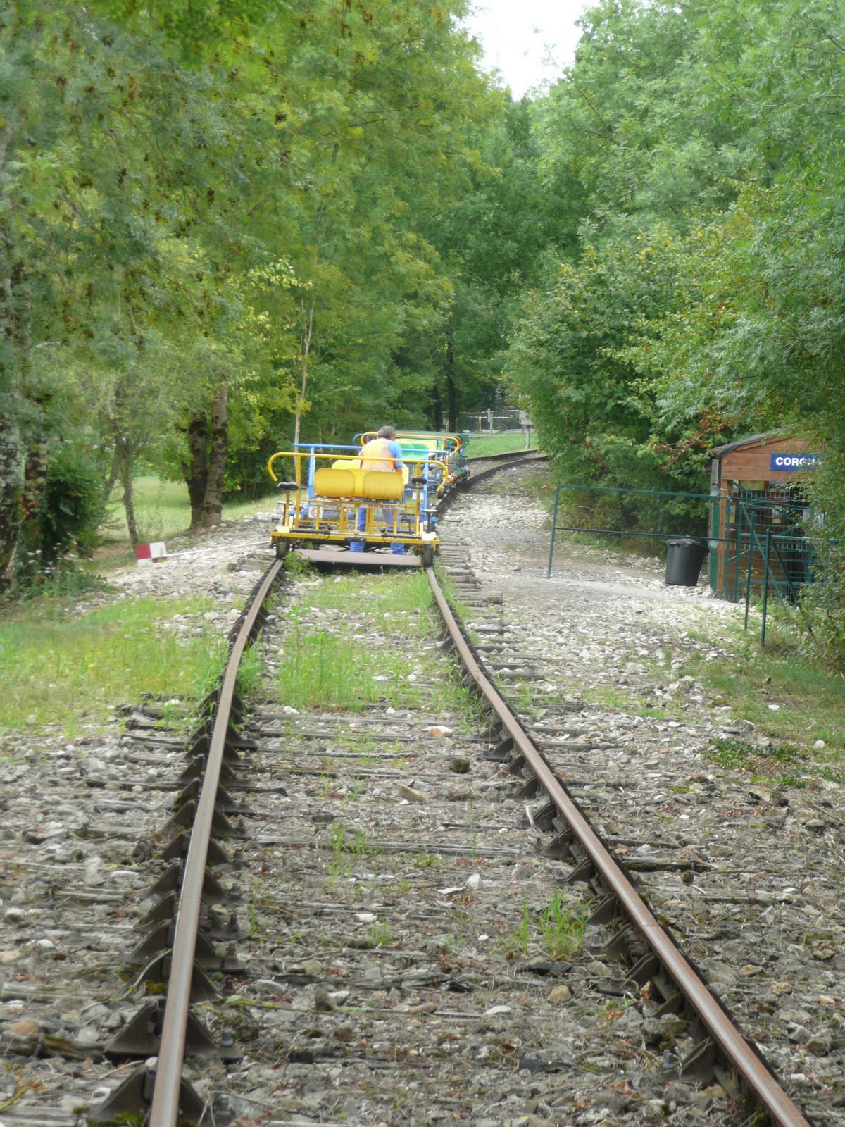
This velorail was a little more expensive than last time (25 Euros) and slightly shorter at 6.5km (13km there and back). There were no rules of the road to worry about before we left. The reason for being timetabled soon became clear when we set off with all the other participants at regular intervals. Thus everyone was initially travelling in the same direction, meaning that no lifting cycles off the railway was necessary. The cycles themselves were very similar to the ones on our previous experience with no gears and so only modest speeds can be achieved.Braking is fairly rudimentary with a metal shoe being applied directly to the wheel! Anyhow, after the initial novelty value of the cycling it felt really good to be cycling along real rails again.
Level Crossing
Shortly after getting going we came upon the former station at Corgnac-Sur-L’Isle. This was still in very good condition and a siding still contained some vintage looking rail inspection vehicles and even an old looking diesel unit that still looks serviceable. The platforms of the station were pretty grassed over and would probably need to be relaid if the line were ever to re-open, even as a tourist line.
Woodland Viaduct
Past the station and we crossed the L’Isle river by way of a cantilever bridge, a rather interesting way to cross a relatively modest sized river. The L’Isle drains away into the mighty Garonne at Bordeaux. A little beyond there and we came to a level crossing. Unlike ‘live’ railways the priorities are different at level crossings. Velorailers give way to road traffic and the owners of this operation were not taking any chances.A barrier had to be opened in order to continue on our way and we actually had to cross carefully on foot for this first crossing was actually a well used road.Indeed, there was a slight build up in velorail traffic as we had to wait for a couple of cars to pass. As with Normandy, the crossing keeper’s cottage had a beautifully laid out garden alongside the rail line.
Eyzerac-Labaurie
Just beyond the first level crossing the reason for the style of operation became clear. From a fairly level section of track, the line began to climb gently and rather more effort was required to move our ‘train’. Another level crossing followed shortly after although this time there was no barrier. We were required to get off and walk again across the level crossing. Probably a sensible requirement, but slightly frustrating nonetheless as it seemed slightly unnecessary.
Final Crossing
From the second level crossing the line began to climb a little more steeply and as we puffed a bit we passed a sign that advised that it would be uphill for the next 4km and offering some encouragement to keep going! The third level crossing soon came and this one was protected by quite a loud bell, which appeared to be activated by a trip sensor between the tracks triggered as we passed by. I suspect that this technology is still employed on rural lines that are still operational in France.
Tunnel
The line became a lot more wooded in nature from here on and views out across the surrounding countryside were only fleeting. The countryside was largely agricultural with plenty of cows in evidence. Most seemed to be laying down – were they trying to tell us something? Of perhaps more interest than the surrounding countryside though was the wobbly nature of the rails. They had obviously suffered from years of not being maintained to a standard that would be suitable for powered rail transport. Even on a rail cycle we leaned and rumbled a bit over the rails. Some of the sleepers looked pretty rotten and I suspect that some replacements will be needed in order to maintain the operation.
Thiviers By-Pass
Towards the top of the slope we reached the station of Eyzerac-Labaurie. Some distance from the villages of the same names, it is now a private residence although the rather elderly chap that lives there seems to be very friendly towards velorailers as he gave us a cheery wave as we passed by. He keeps the old station beautifully, although the platform now resembles a lawn rather than its original appearance. No passengers have got the train from here since 1940 and yet the old place looks like it could reopen for business tomorrow!
Refreshment Point
At the end of the platform we again came across a level crossing, the last time that we did on the way out. Not only was there a barrier crossing but also a rope that we had to lift over the kids in order to move forward. This was clearly a reminder to make sure that all riders crossed the road on foot rather than on the bike. The slope continued beyond the level crossing and we passed through a short tunnel, which caused a little excitement with the small passengers on our ‘train’. A little way past the tunnel and we reached the end of the line. Thiviers station is on a busy operational line and so the velorail operation stops short of the junction at the back of a house with a decent sized garden. This has been turned into a refreshment stop serving coffees, ice creams and other drinks.It was a welcome break after the surprising slog up the line from Corgnac.
Heading Back
Turning all the rail cycles was performed by the staff rather than the riders. All the outward riders had to be accounted for before there was any chance of us heading back and so the layover was approximately 20 minutes. We sat and had a coffee, which was a very civilised way of passing the time.
Downhill all the way
We re-boarded in turn and waited for our slot. The system resembled a ‘real’ railway in that the start was signal controlled. I am guessing that the departing cyclists would trip something on the rail on the way down in order to reset the colour light signal in front of us. Once the green light came on it was go-go-go!
Kinky Track
As soon as we set off it immediately felt like a different ride! Of course we were now losing all the altitude that we had gained and once through the tunnel and across the first level crossing we gave it as much speed as we could. Our speed was probably fairly modest as the gearing of the rail cycle wasn’t set up to allow for great speed. Yet, it did feel like we were licking along at the speed of an express train – very exhilarating! Even the bumpy track didn’t feel too bad, although going round the corners Pendolino style was a little scary! Going along at this speed quickly made me realise why this line had operated in this style. Trying to stop one of these rail cycles to allow another coming the other way to get off would be nigh on impossible.
Speeding Along
As we hurtled down the track we were acutely aware that we had to stop at the elevl crossing. Firstly though another unexpected hazard became clear as a shoe came speeding past us, having left the foot of one of the cyclists ahead of us. There was no way the poor lady was going to stop to retrieve it. Countless drinks bottles and other ‘luggage’ could be found on the track, I am guessing from others having had a similar experience!
Stop!
Eventually we drew into the village of Corgnac once again and reached the level part of the track. After the downhill section it was rather hard work trying to pedal very fast again as we had to put some effort into the last couple of kilometres. After passing across the bridge and through Corgnac station once again we were back at the beginning in rather less time than on the outward journey!
Inter City Coming Through
This was another hugely enjoyable velorail experience. My only criticism of these operations is that they seem to have little in the way of information available about the lines themselves – I had to rely on other sources to find out anything about this one and even then there wasn’t a big range of sources to choose from. The railway infrastructure though is largely complete and for this I am very pleased for so much has been lost of our rail heritage in this country. I was less sure that this operation would be a pre-curser to a heritage railway project and slightly mystified by the advertising of a route that didn’t seem to exist, onward from Corgnac to St Germain. It might be my only just able to ask for necessity French that meant I was missing something about the onward route. If you do visit though and you manage to do the section to St Germain I would be very interested to know about this route and how you get to ride on it…
Final Stop