Thursday, 29 August 2013

Alsace Castles

Windstein
For our last day on our recent holiday in Alsace we decided to go castle exploring.  There were a good many to choose from as the border between this part of France and Germany has always been heavily defended.  Our main focus of the day was to explore the castles near to Fleckenstein, where we had been earlier in the week but on the way was the castle at Windstein and so we thought we would add that in as an appetiser.  The castle is in the small community of Windstein, effectively just a scattering of houses in this small wooded corner of Alsace.  We parked up some distance from the castle and had to walk up the last quarter of a mile of road and then up along a track through the trees to get to the castle.  When we got there it wasn’t at all obvious how much structure was left for all we were greeted with at our side of the rock were sandstone outcrops.
Windstein View
We climbed some steps that had been cut into the rock to get in and found ourselves in semi-troglodyte caves at the top, with much of the remaining structure of the castle on the other side.  We spent about half an hour exploring the old place and admiring the view out across the forests.  Of particular interest to the girls was the enormous well cut into the rock in the centre of the castle. I have to say it was pretty impressive, being cut in a perfect circle and being at least 80 feet deep.  That must have been quite an engineering feat in its day for the castle was built in the early 1200s and lasted until being destroyed some 500 years later.  Once we had admired the view at the front of the castle, we decided to move on to the main course of the day…
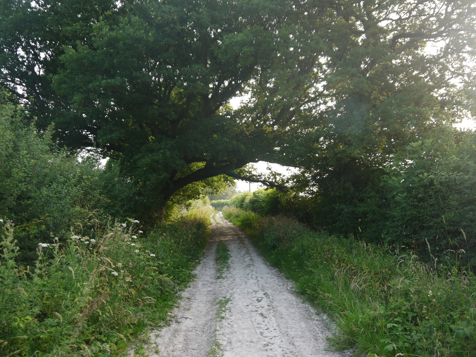
Fleckenstein
After our short visit to Windstein we headed back to Fleckenstein a short car ride away and parked up at the start of the charcoal burner’s trail where we had started a few days earlier.  The weather this time could not have been more different – the grey cloudy conditions replaced by blue skies and burning sun.
Fleckenstein from Above
We were here to check out a walk between four chateaus that we had clocked on our earlier visit.  The first was of course Fleckenstein, but we had already visited that one so we plotted our route to Loewenstein, the next one on the route.  This involved a long and slow climb through the heavily wooded hills to the east of Fleckenstein, which was mercifully cool on account of the shade afforded by the trees.  Towards the top we started to get glimpses of the view through peepholes in the trees suggesting that the view would be something special.
Loewenstein Viewpoint
At the top we were not disappointed.  Although the sun was relentless now that we had left the cover of the trees, the view was spectacular.  Far below us was the castle of Fleckenstein, while much of the rest of the vista was an endless forest.  It must have been quite the place to be holed up during mediaeval times when the castle was built.  As with many of the others, this one was partly built into the rock on which it sat and little of the structure remained.  Lizards and butterflies were constant companions, attracted no doubt by the reflected heat of the sandstone rock.
Hohenbourg
After a refreshment break we headed on to the next castle, Hohenbourg, just five minutes walk away along the ridge.  It seemed a bit of a mystery why there should be two castles so close to each other?  I assume they were both garrisoned, but maybe the view was sufficiently different that they afforded more of an all round view of the enemy?  Anyhow, this had more of a structure about it and we climbed the narrow steps to the top of the tower.
View From Hohenbourg
This was clearly higher than the last castle and seemed to have more of a view towards the fourth and final castle across the border in Germany.  Perhaps they were signalling stations?  It certainly felt like an eagle’s nest high up here on the top of our perch.
German Border Post
We gathered our strength for the assault on the last castle.  This required us to cross the border into Germany, although we were in fact only 10 minutes away.  On the way we passed by a spring, with lovely cool water bubbling out of it.  That enabled us to have a bit of a face wash and cool down a little before heading on.
Wegelnburg
Surprisingly, given the loneliness of the place there was an old hut at the border. We weren’t sure but I wouldn’t mind betting that there would once have been a border guard here.  The border itself was marked for a distance by some tree trunks laid on the ground.  I should imagine these were pretty effective at keeping out unwanted visitors J.
Gateway to Wegelnburg
It was a short climb up through the trees to Wegelnburg, the last of the three castles.  This looked fairly and squarely out over GermanyFrance was behind us and although we could see Hohenbourg we could not see the other two castles.  Our view was northward towards the Eifel region of Germany and the small town of Pirmasens, some 15 miles or so away.  This was the highest castle along the border, although strangely it did not feel as high as Hohenbourg, perhaps because the layout of the castle was a lot flatter and more elongated along the sandstone rock.  After exploring thoroughly and getting plenty more drink on board we headed back down the slope to our starting point.

Wegelnburg View Into Germany
At the bottom we had remembered how nice the café looked and so we availed ourselves of it for lunch, having some well deserved sausage and chips for our efforts.  Despite the moans and groans from the children all the way to the top of the hill, they later agreed that this was her favourite trip of the whole holiday.  Contrary?  Not our two J

Tuesday, 23 July 2013

Sussex Border Path Section 15 Charlwood to Copthorne

Providence Chapel, Charlwood
It’s been awhile but I managed an early morning outing on a Saturday and although I toyed with the idea of continuing along the Serpent Trail I decided against it on account of the exceptionally hot weather we have been experiencing.  I decided that a better bet would be the short and tricky section of Sussex Border Path around Gatwick Airportas this has held me up from onward progress for some considerable time.  I have to confess to not being overly-motivated to doing this section, but thought it would be a good idea to finish it while I have only a short timeframe.

Lane Out of Charlwood
Due to the heat (it was later to reach 30 degrees Celsius), I decided also to complete the walk first and get public transport second especially as at least two bus journeys were going to be needed.  I parked in Charlwood, where I had finished up more than a year ago.  I picked up the Sussex Border Path as it led northwards out of the village, passing initially an attractive little school and then a surprisingly old looking church hall before heading out into the countryside along a green lane.

Curiosity
In the relative cool of the morning there were plenty of insects about and a few cows in the field next to the path lazily swishing their tails and grazing happily.  Yet any thoughts that this would be a nice quiet walk were soon dispelled by the roar of jets taking off and landing at nearby Gatwick Airport every couple of minutes.  Yet, the intermittent sound of the jets did not bother me as much as I thought it would as the noise was not as continuous as traffic.

New River Mole
I turned right at the next junction of paths and wandered along a very dusty farm track for half a mile or so.  The underfoot conditions were very different to the last time I did any of the Border Path, when I had to play hopscotch between boggy parts of the path.  The wildflowers grew in profusion and so far at least I was enjoying more countryside than I had dared consider.

Hookwood
At the end of the track I crossed a busy road and headed through a broad hedgerow, coming out into the managed course of the River Mole.  This has been diverted considerably in order to fit the perimeter of Gatwick Airportin.  Yet, despite that it still looks quite authentic as it follows a twisty path in much the same way that you would expect to see in a completely natural setting.  All along the banks were profusions of flowers, all seemingly at their peak now in mid July.  The butterflies were having a great time flitting between flowers trying to sup the nectar from the best ones.

Mole Valley
The warmth of the day was properly getting going now after a surprisingly cool start.  Away on the bank opposite I caught a flash of ginger hair as a fox crashed through the undergrowth, quickly followed by another.  I soon became aware of a pair of eyes upon me and some barking like noises and realised that I was witnessing a family of foxes with the young ones having a great time playing in the bushes while being watched by a vigilant parent looking for signs of danger.  I stood and watched them for some time, transfixed by their antics.

Perfectly Framed
After a few minutes I moved on and had the fright of my life as I turned the next corner when I was confronted by a startled deer that bolted into the bushes as soon as it caught sight of me.  I think I was almost as startled as the deer!  The foxes and the deer were all within a stone’s throw of the built up area to the north of the airport itself and yet this was more animal action than I had seen for a long time on the path.

Brighton Main Line
I crossed the road ahead and to my surprise the path followed a green tree corridor down the side of the dual carriageway of the A23.  Although I was aware of its presence the trees did a remarkable job of screening the road and made this section of path far more bearable than I dreamed would be possible.  Eventually I had to bow to the inevitable though and enter the world of Gatwick Airport.  The path was fairly badly signposted through the complex and it took a good deal of map reading to find the right route across the approach roads.  The noise of the planes was by now joined by the noise of the people mover that takes passengers between North and South Terminals and the traffic heading to the car parks.

Landing in the Fields
Eventually I managed to find my way through the complex and crossed the main Londonto Brighton railway line into a quiet stretch of countryside once again.  Far from being the hideous stretch of walking that I had expected, the section through the airport area was surprisingly short lived and far from being the horror that other commentators have suggested I found it fairly interesting although I was thankful I didn’t have to walk much further. 

Choked Path
I rounded another field with grazing horses and came out opposite a pub that now serves as an Indian restaurant.  It is surprising how many pubs have found this fate, although it is preferable to see them still functioning at all than be boarded up, as has happened with so many others.  The onward path took a course down the side of the M23 spur with pleasant views to the north even if the southern aspect was dominated by the high motorway embankment.  The path is clearly not very well used for it was very overgrown and I questioned the wisdom of wearing shorts that day.

M23 Crossing
At the end of the path I turned right under the motorway and headed down a rather strange road.  I passed some well-to-do looking houses living cheek-by-jowl with some that had fallen on hard times and were in some cases completely derelict.  On my left hand side was an old nursery but the glass houses had clearly seen better days, with most of the glass smashed and the vegetation inside now running riot.  I did think it might make for a cool photograph but got a sense of life at the other end of the property & hesitated.  I was glad that I did, for in the far corner there were some very furtive looking men that appeared to be dealing in scrap metal or some other such thing.  My watching was clearly not welcomed and so I hurried on, feeling rather uncomfortable about the area as I did so.
Burstow Manor

Further down the road a lorry was reversing in the lane.  This seemed quite a complex manoeuvre and I wasn’t quite sure what the lorry was even doing there.  It was registered in Bulgaria and at first I thought that it had got lost on the satnav but realised that it was in fact connected with the men I had seen back at the ‘scrapyard’.  I was rather relieved when I left them all behind as for some reason I felt a bit vulnerable as I walked past them all.

Burstow Church
Eventually I turned off this road and up another lane towards Burstow, crossing the main M23 as I did so.  After passing some more rather strange looking storage units and being stared at again I finally came upon the lovely little hamlet of Burstow, which seemed like a world away.  I took the opportunity to have a look inside the wonderful old church and its stained glass windows, enjoying the coolness of inside as I did so.  Across the way was an old school house, now turned into a nursery.  It really was a beautiful and unexpected oasis after all the industrial stuff earlier.

Burstow School House

My onward walk was mostly through fields of various crops although I did have an encounter with some fairly fierce looking white geese. I showed them who was boss though and they didn’t push it.  I was by now feeling very hot and when I approached Copthorne I checked the bus timetable and was very pleased to see that I could get one only nine minutes later.  I decided that I would save the onward walk for another day – it was far too hot to push myself too much.
Fierce Geese


It wasn’t the best walk if I’m honest but far better than I had expected, with far more countryside than urban areas. It reminded me of sections of the London LOOP, darting from sections of countryside into urban areas almost at whim.  What did please me most about this modest length of walk though was the fact that I had overcome an obstacle and I now could continue this walk in loops in much the same way as I had previously done.

Saturday, 20 July 2013

Kennet and Avon Canal Section 5 Kintbury to Bedwyn

Turning Circle
Our second day on this latest trip to the canal started at the last station of the commuter line from London, which rather curiously is the very rural Bedwyn.  It seems rather an arbitrary place to terminate the line and is about as far as you can imagine a Londoncommuter station to look like.  Anyhow, it does mean that this is the last ‘easy’ stage of the route westwards along the canal for the next station at Pewsey is further away and after that there are no stations at all for a while.  All that though is for another day as this time we headed back to where we had finished yesterday at Kintbury.

Large House at Kintbury
Our route today would take us through the small town of Hungerfordback to Bedwyn; a distance of 8 miles.  We hoped that we weren’t pushing the girls too much but had remembered that they completed a similar distance out of Reading on day 1.  The start of the day was a bit grey as the early morning mist and swirling low cloud hadn’t burnt off quite yet.  It did make for cool and clammy conditions to begin with, but none of us were particularly complaining for it had got a little hot the day before.

Goods and Chattles
We passed a cycling family eating their breakfast and soon realised that they weren’t the only ones.  Kintbury seemed gripped with breakfast fever as many of the canal boats had the various aromas of coffee, bacon, eggs and toast all wafting over the towpath.  Fortunately we had already had a substantial breakfast otherwise the smell of all this cooking would have been torture!

Poppy Side
Kintbury is obviously a very popular stop for boating traffic for the line up of boats was surprisingly long considering that we had not seen a moving vessel east of here for some miles.  Some of the vessels were not here for pleasure though as the banging and sawing sounds revealed.  I guess maintenance and DIY is a common theme for Sunday mornings in this corner of Berkshire.

Orange Tip Butterfly
At the next bridge though the moorings gave way to clear canal once again and at this point the clouds finally drifted away to reveal the true nature of the day, which was going to be another hot one.  We passed a very large and ornate house on the left hand bank and off into open countryside.  Bridges seemed to come along at regular intervals on this section and the number of locks seemed to increase too, suggesting that we were heading uphill a little more quickly.

Wire Lock Bridge
The path passed through some lovely shading woodland for awhile before coming out into open fields once again.  This change in scenery was to happen a number of times during the day, providing a nice balance between the two.  Along the towpath the flowers were attracting a number of butterflies, including small tortoiseshells and orange tips which were the most eye catching. 

Yellow Flag
We crossed under the railway and then across the canal itself to resume our trip down the left hand side.  Curiously this was to be the only canal crossing of the whole day.  Across the other side of the canal was the unmistakable features of an old mill, this one called Dunmill. It looked like the old place had had a significant facelift for the brickwork in places looked very new.  I suspect it is now luxury apartments although it was impossible to see them properly from our side of the water.

Dunmill Lock
The town of Hungerford soon came upon us and we took the opportunity to head into town for a little looks around. Sadly the first thing I think about Hungerford is that awful day in 1987 when a large number of people were shot dead by a deranged gunman in what was the first event of its type on this shores.  The fact that it happened in this fairly sleepy but very picturesque town makes it all the more shocking.  By now the day was getting properly hot and so we thought that a nice cold lemonade in the nearest pub would help flagging spirits.  We took the opportunity to sit out in the street and watch the world go by, which was very pleasant. 


Hungerford Town Hall

On the way back to the canal we caught sight of a very pleasant looking bakery, which to our surprise was actually open on this Sunday lunchtime.  I always have a hard time passing a bakery shop and it wasn’t hard to persuade me to go inside.  We grabbed some snacks and made our way back to the canal for our journey westwards.  As with Newbury the canal seemed to find a course through the town that did not seem to prolong the urban stretch very much.  The last sight before we headed into the open meadows was a view of the large and well appointed church that wasn’t dissimilar in style to the one we had passed in Newbury yesterday.

Hungerford Church

As we wandered along the towpath through the meadows to the west of Hungerford I got the unlikely sight of a canal boat coming towards me sporting a Brighton and Hove Albion flag, my local team in Sussex. I couldn’t pass up the opportunity of a photo & we exchanged pleasantries as he chugged by.  A little further on and we passed a sadly derelict house before finally finding the seat we had been looking for to stop and eat our snack.

Albion Fan
We passed under the railway once again and our onward walk from here seemed to be very much more open in character. We seemed to have finally left the woodland behind and the canal followed a much straighter course.  This had the effect of the mileage seeming to be chalked off more quickly but it also meant that there was less interest overall.  Every so often the trains thundered or rattled by, depending on whether it was a stopper or an express.  The difference between the two could be identified long before they passed by.

Derelict Lock Keeper's House
A couple of miles of pleasant but unremarkable countryside ensued with the main interest points being offered by the canal-side flowers in the shape of some lovely yellow flag irises and the odd orchid that hid surreptitiously in the grass.  We also passed by a section of canal that was being repaired, which forced us out into the neighbouring road.  Other than this annoyance though we largely had the towpath to ourselves until we got to Bedwyn.


Southern Marsh Orchid
Our arrival at Bedwyn was prefaced by another long line of boats, although this time there was a lot less activity.  We took our leave of the canal after eight miles and four and a half hours of walking - a pretty good effort from the girls & with no complaints.  The only sadness this time was that we didn’t have a third day as we had had last time out.  This was an enjoyable walk but short on highlights after Hungerford.  A stop at this small town is surely a must though for any walkers/ cyclists/ boaters along this stretch.

Burnt Mill Footbridge

Monday, 15 July 2013

Kennet and Avon Canal Section 4 Newbury to Kintbury

Newbury Market
Only a month after our last trip and we were eager to get back for more although this time we didn't have the luxury of a bank holiday so had to settle for a two day trip.  The weather had not promised anything other than being dry so it was particularly good to see some sunshine out when we got to Newbury.  We parked at the small station of Kintbury and took the short train journey to Newbury.  When we arrived it was rather busier than last time out & the town itself was busy with Saturday market traffic.

Feeding the Swans at Newbury
We wandered over to the park where we had completed last time out & found that it was full of kids and families out enjoying the warm sunshine.  It was quite a contrast to the deserted state that we found it in before.  We relieved ourselves of our picnic lunch in the park to enable us to have light loads for our walk today.

Newbury Lock
With full tummies and a sweet in mouth to get ourselves going we headed along the canal after lunch.  Like so many towns the canal seems to manage to avoid most of the built up area.  The town of Newburyseems to have grown up around the canal with it being only incidental to the town.  In that sense canals are very different to rivers, which tend to be the focal point and reason for being in many towns.  However, we crossed the main shopping street at level and for a moment at least we witnessed the hustle and bustle of the place.

Newbury Church
The busy High Street was a fleeting moment in otherwise peaceful surroundings and the canal cut a channel past the substantial church and past some beautiful old buildings that I guess were built around the same time as the canal (if not before).  There was also some buildings that clearly had some canal use although inevitably these are now just residential places.

Reflections at Newbury Wharf
Newbury is clearly a popular spot for mooring canal craft as the queue of boats continued for a long way along the towpath.  Eventually they petered out just before a rather strange looking wall on the opposite shore.  It turned out that this belonged to a long lost railway to Lambourn, which closed to passengers in 1960 and never managed to reopen despite an attempt to preserve it as a heritage railway.  It has now almost completely returned to nature here, with the brick wall of the bridge abutment as the only clue of its existence.  The bridge also rather strangely marked the limit of the built up area of Newbury and it would be countryside from now on.

Newbury By-Pass
Our progress westwards was along rather a straighter canal than we had been used to thus far.  We swapped to the other bank at Enborne Bridge and this was surprisingly the last time we would do this on this section.  According to the interpretive board here this was something of a milestone as we had moved officially from improved river to cut canal and this probably explained why we were now following a much straighter course.

Pickletimber Bridge
The next bridge was far less sympathetic to its surroundings as it carries the main A34 Newbury By-pass.  This was perhaps the most controversial road scheme of the 1990s and the one that became the watchword for fights between the Government and environmentalists.  I suspect it even contributed to the pulling of the plug of so many other subsequent road schemes.  Even though the environmentalists lost the battle here they could arguably have won the war on road building.  For my part I have mixed feelings about road schemes.  As a motorist I get frustrated by bottle necks, but as a walker I value the countryside.  It’s a very difficult one to balance.  However, I couldn’t help but smile at the permanent marker under the bridge.  The design had been celebrated by the Concrete Society and yet the environmentalists had also managed to scrawl ‘death to 10 thousand trees’ on it as the plaque had been placed.  I wonder what the local population made of the canal when it was first built?

Lunchtime
The climbing was still slow and steady with another lock just after the by-pass bridge.  We had already passed three locks and so far they had all been uphill since Reading.  We briefly headed through a wooded section of canal and under the wonderfully named Pickletimber Railway Bridge.  As we approached we heard the distinctive rumble of a train but for a change it wasn't one of the ubiquitous Inter-City 125s but a freight train; something almost unheard of for the girls to see.

The Red House
The next couple of miles was very pleasant walking. There was nothing remarkable to see and the countryside was nothing particularly special and yet it was.  Summer was in full flow and the canal banks were a riot of colour with thistles, cow parsley, buttercups and wild roses among the many flowers trying to vie for the attention of the local bee population.  Every now and again we would stop and catch up with each other but the afternoon wore on pleasantly with the adults nattering and the kids swapping stories.

The Drinker Moth Caterpillar
At Hamstead Bridgewe began to realise that the children were starting to lag behind and we noticed a sign inviting us to a nearby pub.  We thought that the perfect tonic, although we weren’t prepared for the fairly unpleasant walk up the road.  Fortunately the pub, The Red House, was well worth a visit.  Sadly we weren’t much in the mood for food because the dishes being served looked absolutely mouth-watering.  Instead I grabbed a cup of tea (the first time ever in a pub) and the girls some fizzy pop and we sat outside in the delightful garden, enclosed by a large hedge.  It was the perfect antidote to tiredness as the pace quickened a bit after we returned to the canal.

Dreweats Lock
The remaining couple of miles of the walk were very peaceful and we saw no boat traffic whatsoever apart from a couple of boats moored some distance away from any settlement.  One in particular seemed to be the focus of a lot of work by its occupants as they hammered and chiselled away to the sound of heavy metal. It rather ruined the peace and quiet of the surrounding countryside but I couldn’t help but smile because it was obviously helping their productivity.

Maintenance
Other than a few cyclists though we had the towpath pretty much to ourselves, in contrast to the earlier sections.  After a section of open countryside in which we got to see a lot of the surrounding area we were suddenly plunged into woodland again and this persisted for the last mile into Kintbury.  By the time we got there we were feeling pretty hungry and saw what looked like the perfect spot on the island ahead of us.  The Dundas Arms certainly looked idyllic and we flirted with the idea of having an early dinner there until we saw the prices.  They were certainly proud of their food!  I think if had been just the two of us we probably would have gone for it, but with two tired children in tow and in our present state we thought twice.  Sigh – maybe next time?
 
The Dundas Arms
This was a smashing walk, every bit as enjoyable as what had gone before but quieter and more understated. While the countryside could not be described as remarkable it was English pastural scenery at its very best.  We all thoroughly enjoyed the six miles over from Newbury and were happy that we got to have a second helping the following day!