Monday, 25 April 2016

Burwash and Bateman's

Burwash
The village of Burwash is perhaps one of the most scenic in all of East Sussex and it was inevitable that one of the walks from the Pathfinder Guide "East Sussex and the South Downs" (volume 67 walk 8).  It also appears in volume 24 "Surrey and Sussex" (walk 8).  After a pretty long dry spell of weather we felt safe doing this walk despite a warning of muddy conditions.  It was a dry and slightly chill spring day with no clouds but a slight haze in the air and it was a pleasure being out in a different part of Sussex than we are normally used to visiting.

Reminder
We parked in the village car park in Burwash, which was rather quiet for such a nice day.  I guess the next door pub wasn't open yet so perhaps we got here before the rush?  We started our walk along the High Street, an inviting looking place with clapboard and tile hung houses and shops lining the main road.  The village sign showing a forge reminded us of the iron heritage of this part of Sussex.  We didn't linger on the High Street for long as our path took us down a side street and past the very attractive looking Rose and Crown pub.  The earlier volume talks about a fire station down here too but that is long gone.

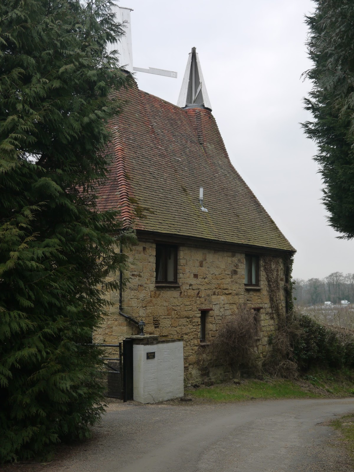
Oast House
Soon the lane gave way to a track that weaved its way through fields with some purpose.  On our left hand side some views of the Weald opened up and the fields had some sheep and lambs although they were rather a long way off.  Soon we were to leave the comfort of this track and head off across the fields and into a wood where we encountered our first mud.  It didn't bode well for later on the walk but for now it was relatively easy to pick our way through.  We headed for a stream and upon meeting it followed it for a short while and then crossed via a small wooden footbridge.  As we climbed away from the stream we headed up towards a largish oast house.  This has become the most fabulous looking house - must be fantastic to live somewhere with so much character!

Dead Orchard?
The oast house was actually part of a small hamlet when we got closer and each one of the houses looked splendid.  The gardens were well tended and resplendent with their daffodils on show.  Just as it looked like we would cross the garden of one of the houses the path took a detour out through what almost be described as a tradesman's entrance!  We entered what at first looked like a dead orchard but on closer inspection we decided that it was alive.  The trees didn't look in great shape though - perhaps they needed some extra tlc to get them going once again?

Franchise Manor Drive
At the other end of the orchard we entered rather a grand looking track that was tree and daffodil lined.  Almost immediately we also came upon the war grave of Reginald Rimmer, a young pilot who was shot down here by a German during the Battle of Britain and crashed here.  He was just 21 years old.  A brief history and his picture can be found at here.  It was rather sobering stuff and a reminder of how widespread the fighting was during the desperate struggle of 1940.  I certainly never realised that dogfights took place over the Sussex countryside as well as in Kent.

Reginald Rimmer Memorial
We walked up the driveway I am guessing away from the place it leads to for eventually we found ourselves at a white gatehouse (which didn't look too shabby itself!).  I later learned that the house the drive led to was called Franchise Manor, but it was out of sight for us.  The dalliance with the road didn't last long as we were soon on Holton Lane, one that looked rather like it could have become part of the highway network but which the authorities never quite got around to surfacing.  The going became sticky for a while and there were patches that were pretty difficult.  Just as we thought we had got through the worst of it we realised how mistaken we were for the mud became impassable about three quarters of the way along.  We managed to scramble our way through using some fairly tenuous looking routes clinging on to banks, tree trunks and even barbed wire fences as we did so.  Beware a winter walk here - it won't be fun!

Woods Along Holden Lane
Eventually we got through the worst of it and crossed a main road.  The last half mile had taken nearly half an hour to walk and had sapped our energy considerably.  The road was a welcome relief in terms of surface but it is also very busy and a great deal of care had to be exercised in walking the sort length to the onward path.  We managed to escape from its clutches feeling very relieved as there is virtually no room to be here.  

Cyclamen
On the other side of the road we followed another drive down to another oast house.  This time we didn't just have daffodils lining the route but cyclamen too - rather an unusual sight for the countryside but a welcome burst of colour nonetheless.  Upon reaching the house we crossed into a horses field which was churned up but mostly dry at least.  From here the route took a very pleasant course across fields and through a few small tracts of woodland down to the back of the Bateman's estate.  Along the way we got views of the church in Burwash - a landmark for some miles around by the look of things.  Our first glimpse of Bateman's came at the start of the millstream that fed the estate watermill and which still functions.

Burwash View
Bateman's is famous as being the home of Rudyard Kipling, author of the Jungle Book and one of the most popular writers of his generation.  He certainly was not a penniless writer as the large house demonstrates.  We had intended visiting as part of this walk but in our current state this was out of the question as two of our party had sodden feet and we were all covered in mud.  I don't think the National Trust would have particularly welcomed our visit!  We contended ourselves with a brief look at the water mill and a view of the house from the outside before heading on to finish our walk in Burwash.  We had visited the house a couple of years previously and it was certainly worth a trip then - maybe we will come again soon?


Bateman's Watermill
The onward walk from Bateman's was largely uphill.  The house is not visible from the village despite its proximity.  I imagine this was part of Mr Kipling's thoughts when he was here.  The walk was pleasant but a little bit of a sting in the tail at the end.  At five miles total length though you shouldn't feel too tired at this point, although we did feel like we had walked a lot further courtesy of the muddy conditions!  If you try this walk - do yourself a favour and come in the summer or autumn...

Bateman's

Monday, 18 April 2016

Sussex Border Path Section 19 Ashurst and Bolebroke Castle

Sussex House Farm
This ended up being another day where sunshine was promised that never materialised.  That was a great shame because it put a bit of a dampener on the walk that in hindsight was a bit unfair on the scenic quality of the landscape.  It had been almost 18 months since I last visited this walk and it has to be said that trips out by myself are becoming fairly rare commodities.  Encouraging the family to accompany me on a partially completed project isn't very fair and not a particularly attractive proposition for them.
Ploughed
I pitched up in Cowden and parked once again by the church.  Despite the length of time away it didn't seem like it had been anything like that long.  The church is one of the most attractive I have seen in this part of the country and certainly has an unusual design.  The village was pretty much deserted and I imagine it is something of a dormitory village as it has a railway station on the line to London, albeit some distance from the village.
Dead Machinery
I retraced my steps through the nearby allotment site, which was rather empty looking save for a few rather tired looking cabbages and a couple of pensioners digging over their plot.  They were the last people I saw for some considerable time.  When I entered the golf course that I had had such trouble with before I turned left instead of right and that enabled me to enter an adjacent field and leave the golfers in peace.  The path headed due east through a number of fields and following a stream that formed the boundary between East Sussex and Kent.

Dead Machinery
The path bounced between the two counties for a while along paths that were surprisingly dry considering how much rain we have had over the winter.  It was pleasant if slightly uninspiring countryside and not helped by the stubborn overcast conditions, which did not seem likely to change however optimistic the forecast was.  The highlight though was the sounds in the air - the birdsong definitely suggested that spring was well and truly underway.

Under The Railway

When I came to a main road I cross back into East Sussex by crossing the stream bridge and passed through a horse field that looked very cut up and rather unwelcoming for the various horses that lived there.  No wonder they tried to make friends with me as I passed through - I would have done too if I had had that type of dining available.  They probably wanted to find something else more tasty to eat!
Ashurst Viaduct
I proceeded along the stream valley which seemed strangely quiet and for the south east of England at least rather remote feeling.  I did spot a couple of oast houses along the way reminding me of my proximity to Kent and passed by a golf course rather unsurprisingly.  The number of golf courses in this area is pretty surprising - I'm not sure how they all manage to get enough custom?
Wonky Chimney
I eventually found my path blocked by a railway line and briefly had to follow it before I was able to cross via an underbridge.  This line would once have taken me back to my home town of Lewes but is now truncated at Uckfield.  The frequency of trains has been affected recently as usage of the line has increased enormously and the stations along the way are having their platforms lengthened as a result.  It has also meant that there are no trains during the day on weekdays until the work is completed.  It gave the air of an unused railway as I followed the line for a while.
Primrose Banks
I left the stream I had been following for a while after another half mile or so.  My path across a field was not a particularly pleasant experience through the softness of the turf.  I eventually reached a farm full of old machinery and a small unit that made ice cream.  I've always wondered about the assorted scrap machinery at farms - there must be enough about to provide raw material for a steel works for several weeks if it were all sold for scrap?
Primroses
I wandered through the farm and turned to head across another field adjacent to the railway.  I was now in the main valley of the River Medway and the river was surprisingly large here considering how far from the sea I was.  As the area between the river and railway narrowed I wondered where I needed to go next and soon discovered that there was a narrow walkway underneath a metal viaduct that enabled me to continue following the river but cross the railway.  The path on the western side of the railway didn't last long for I was soon to meet a main road whereupon I turned left and across river and under railway once again!
Lyewood Common
This was the village of Ashurst, a familiar name for a settlement in these parts (I know of at least two others locally).  There wasn't much of a village to explore but on walking past the railway station I saw the magnitude of the task that the contractors extending the stations had.  There were piles of materials and loud machinery disturbing the peace as the work progressed on making the platforms bigger.  It was heartening to see this largely rural line getting such a makeover.  I hope that would-be passengers haven't been put off by the lack of service while the work continues.

Oast at Perry Hill
I was soon past the station and the peace soon returned.  The path followed the railway for a short time although at arms length.  One house on the edge of the village caught my eye because of its very wonky looking chimney.  Just past here and the path did a sudden turn to the left and headed up the hill along a lane that was flanked by primrose banks on either side.  They brought some much needed colour to a very grey day.  At the top of the hill I turned left and headed down through some rather lovely woodland.  I imagine that on a summer's evening with all the leaves on the trees this would be a delight as even today I derived much enjoyment from this short section.
Bolebroke Lake

All too soon I reached a junction at which I would leave the Sussex Border Path to take my route back to the start.  I had devised a route that would take me back via Bolebroke Castle - not officially on the Sussex Border Path but one that was probably too good to miss.  Sadly the route was rather uninspiring not helped by very bare trees, large numbers of bare fields, little in the way of bird song, muddy paths and a day that was getting increasingly gloomy.  I chalked off the miles with little joy it has to be said.  The only highlights were a very green looking pond at Lyewood Common and the odd oast house along the way.  I walked along a road for some distance and then cut down through Perryhill Farm.  There were some very nice looking houses in the vicinity it has to be said and no doubt command some very high prices when they get sold.

Bolebroke Castle
I crossed the main road shortly after and was thankful for a farm shop on the other side when I could get some refreshments.  This was at the entrance to the road up to Bolebroke Castle.  I wandered up the drive and as I did so I caught sight of some rails in the woodland but they didn't look too healthy.  I remembered then that there was a miniature railway that operated around the grounds of the castle some years ago.  Clearly it wasn't functioning any more and I later learned that it closed upon the death of the owner in 2012.  A sad end to what had looked like a nice little operation.
First Bluebell of the Season

Bolebroke Castle looks to have changed hands too - it was once a hotel that catered for haunted weekends.  Guests would allegedly get the opportunity to look for the ghost of Anne Boleyn who is said to roam the corridors of this former royal hunting lodge of King Henry VIII.  The reviews of the hotel make for pretty grim reading though and so the new owner has perhaps decided not to keep it going but just use it as a residence.  The price was £1.6m - a pretty hefty price tag but there looks to be a lot more investment than that going into the place judging by the works going on.

Golf Course
The onward path disappeared into the woods that were probably home to the quarry being chased by the royal party nearly 500 years ago.  For me this was the most enjoyable part of the day's walking as the woodland was most attractive and the going pretty easy.  There were signs of bluebells already coming up and a few hardy plants were already flowering - I was rather surprised to see bluebells this early in the season.

Cowden Church
As I emerged from the woods the path was rather less pleasant due to the boggy conditions and in places it was treacherous.  I was pleased to reach a main road, which I crossed and headed round a field and through some woods to emerge onto the golf course to the south of Cowden once again.  It was a relief to finish this walk - ground and weather conditions did not make this the most enjoyable of days sadly.  My faith in the weather forecast today was also misplaced - if the conditions had been better I think I would have enjoyed my outing far more.

Thursday, 31 March 2016

Derwent Valley Heritage Way Section 5 Belper to Derby

Long Row
Alas my birthday walk this year was on a stubbornly grey day which was rather disappointing for we had booked another trip to Derbyshire to hopefully finish off our walk along the Derwent Valley Heritage Way.  We failed on that front too as we had pressing matters to attend to at home which would mean that we didn't have time for the second day either.  That I guess will have to wait for another time...

Belper Church Tower
It was strange seeing the area with bare trees as the first four sections of this walk were all completed in the late summer of 2015.  We parked in the free car park in Belper and retraced our steps back to the large mill at the northern end of the town.  From here we climbed up the street known as Long Row characterised by a rather eye-catching set of mill workers' houses.  This street has long since been gentrified and looks rather good for it.  I imagine that the houses are pretty sought after these days...

War Memorial Gardens
We wove our way through the streets of Belper and deduced that it was a most agreeable looking place and probably quite a popular place to live if you worked in nearby Derby.  At the far end of the residential area we came upon the main shopping street and were rather disappointed to note that our path did not enter the very attractive looking War Memorial Park opposite.  Although slightly devoid of flowers this early in the season it was pretty obvious that during the summer it is almost certainly a blaze of colour.  The garden looked very well manicured as well, which is good to see considering that it is a place of remembrance.

Market Square
Instead we headed up the hill to Market Square.  There is no doubting its heritage although I was surprised to learn that John Wesley once preached here in the early days.  It was paved in the late 1800s and once boasted 9 pubs around its perimeter although one was demolished to make way for a Salvation Army citadel.  I wonder if that move was responsible for some of the others going too?  From here to open countryside was a surprisingly short distance - just across the car park at the back of the square and suddenly there were no buildings!

Tracks Into The Distance
It was fair to say though that we hadn't quite left Belper behind for after negotiating an area of countryside that rather resembled a park and was clearly the haunt of dog walkers we ended up back in a housing estate at the southern end of Belper.  On the way past here we had an encounter with a rather intense looking game of football involving some 7-8 year old boys.  I got to briefly sharpen my skills when the ball landed at my feet and I kicked it back.  Wasn't too bad an effort either considering that I was wearing hiking boots!
Holly Bush Inn

After negotiating the last of the housing areas we set off down a long concrete track and past a small farm.  Views across the Derwent Valley were beginning to open up now although the day was still pretty gloomy and the weather forecast of sunny intervals definitely looked a bit optimistic.  Of particular note ahead was the view across the village of Milford.  This looked like another of the small mill settlements that have grown up along this stretch of the Derwent.  Sadly though this was the closest that we would get to see of the place from our lofty path as we kept going along our high level route.  The going was remarkably good and there was little sign of any mud along the way despite what we had expected.
Derwent Bridge Near Makeney

We eventually found our way to the hamlet of Makeney.  We got a nice surprise as we got here for there was a pub (the Holly Bush Inn) that wasn't marked on our map.  This proved to be just the tonic after a tricky start to the day.  Walking after a 200 mile drive is not an easy thing to do and we were grateful for the stop.  It turned out to be a lovely pub too - most agreeable and I welcomed the pint of Titanic that was served me!

Reaching For The Sky
Feeling fortified we headed on our way once again and this time we had some downhill walking to meet the river once again.  Sadly though it was along a surprisingly busy road.  We weren't expecting the level of traffic for an unclassified road and so the provided pavement was welcome.  At the bottom of the hill was the pub that we expected to be stopping at.  It was a large chain pub largely devoted to providing meals and so I was pleased we had already stopped.  We left the road just before it crossed the river and continued down the eastern bank.  We had flat walking for a while through some fields full of sheep.  We took care to give them a bit of a wide berth for it was lambing season and some of the ewes were already nursing their young 'uns.

Duffield Church
Our flat walk didn't last long though.  We soon found ourselves negotiating the grounds of a disused mill, although in this case all the decent buildings had been turned into living accommodation and the chimney still stood tall and proud above the skyline.  We climbed away from the valley floor once again and headed up through some woodland into the village of Little Eaton.  As we went through the woodland we passed an old quarry with a rather marvellous looking footbridge across it.  Apparently this quarry was used to get the stone to build Derby Cathedral , Birmingham Town Hall and Trent Bridge at Nottingham.  Now it looks like nature is reclaiming it as the trees are getting quite tall inside.

Entering Little Eaton
We passed by the church at Little Eaton, sadly not getting as good a look at it as we would have liked.  We crossed an old railway line, unusually at level although the crossing has been removed.  The guide book suggested that it still had tracks but the current condition suggests that this has not been the case for at least 10 years.  It was originally the branch line to Ripley although no passenger trains have called at Little Eaton since 1930.

Little Eaton Level Crossing
Our onward route was not very appealing.  For approximately a mile we had to walk along a main road through a largely residential area until we reached the roundabout with the A38.  If anything the weather had deteriorated too which wasn't very helpful.  At the A38 we had to negotiate a railway bridge which was unnecessarily complicated and eventually we were then able to leave the roads behind and head off across fields to Derby.

Darley Abbey Mills Weir
Initially we crossed a section of fields that were unusually uniform and we quickly realised that this was in fact a turf farm.  I think this is the first time I have ever encountered such a thing but clearly the stuff has to come from somewhere.  I had just never given much thought as to what that sort of place might look like.  The geese clearly enjoyed it as all the fields were thronged with grey lags and Canada geese.  Every so often a train would go thundering past - a reminder of how busy this line through the Derwent Valley is as it provides the main route between Derby and Sheffield.

Darley Abbey Mills
The river now starts meandering quite a lot and one particular loop seemed particularly tight - I rather think this might be by-passed in a few decades, leaving an ox-bow lake.  Rather a good example for my daughter who is learning about such things in Geography!  Eventually we came to a road and headed across the river via a toll road through Darley Abbey Mills.  This was perhaps the most interesting little corner of the day - the mills had a large weir just by the toll bridge.  It looked like most of the tolls were collected via an honesty box - the toll booth wasn't manned and I suspect isn't very often.  We stopped on the other side an enjoyed the view of the weir and the birds trying their best to swim against the flow of the water.
Derby Cathedral

From the mills we passed the remains of Darley Abbey.  I am not sure what I expected to see of this abbey given up to the dissolution in the 1540s but it probably wasn't a building that now functions as a pub!  This particular building is one of only two survivors of the destruction.  It was apparently the Abbot's residence.  The other survivor is also a house nearby.  There were no other ruins.  From here we entered the adjacent park - what a fabulous place this is.  Even on a fairly bleak looking March day there is no denying its beauty and cross the park was quite a pleasure.

Derwent at Derby
At the far end of the park we came upon another former railway bridge, this time the former Great Northern Railway line from Nottingham to Derby Friargate and long since closed and lifted.  In fact the bridge is a bit of an oddity since it seems not to be connected to much in the way of a trackbed.  Its survival appears to be related to its unusual bowstring construction style.  It certainly was an interesting way to mark the final mile or so of our walk along the riverbank through Derby City Centre.  This we rather rushed in an attempt to make it to the station to make it for the next train rather than wait another hour.  Remarkably after nearly 10 miles of walking the girls were really up for it and we just about made it with the whistle being blown as we climbed aboard!

Friday, 4 March 2016

Westcott

Early Blossom
It's been a long winter with precious few opportunities for walking and perhaps that is why I haven't felt all that great over the last few weeks - a lack of fresh air!  We found a small window of opportunity on what turned out to be not the greatest day for walking.  As it has been so wet we again dived across the county boundary for what I thought might provide a drier opportunity.  No-one wanted to walk too far so thank goodness there are still a couple of short walks in Pathfinder Guide vol 65 Surrey Walks.  We picked number 5 at Westcott as there looked to be some interesting features along the way and at 4 miles it was a pretty modest length.
Catkins

We parked by Westcott Church as luckily we were a couple of hours later than the church service.  Be aware that if you are tempted to park here on a Sunday morning you will have to attend the church service before going on your walk as parking is restricted to the congregation.  The village of Westcott just to the west of Dorking looks to be a most agreeable place but for this walk you don't get to see much of the village for the path skirts the edge of it where it meets the adjacent common land.  This did make for easy walking initially as there was no mud on this section.
Pooh sticks

The path along the back of the village soon turned into what can only be described as a back alley for some quite big houses.  The fences were so high we couldn't see into the gardens but it was apparent that the early stages of spring were underway for we could see buds and bits and pieces of blossom hanging over the fences.  There was also a hint of a view across to the North Downs but it was only glimpses through the fences and hedgerows that we could see.
Former School House

At the end of our fence lined path we eventually came out to a mill and a rather delightful looking estate road that looked like something from a fairy tale.  We crossed a small mill race and headed along the estate road that was bounded by some carefully trimmed hedges.  The mill race provided an opportunity for the girls to play pooh sticks - an opportunity that wasn't missed!

Hedges
The onward estate screamed money - even the more modest houses had large vehicles parked in the driveways.  Eventually we left the road and the mud started.  This is the danger of this area.  Sandstone is interlocked with clay soils and the different between them is astonishing.  Off to our left was a very large fishing lake and a few lonely souls were whiling away the afternoon staring at their rods folornly hoping they might get a bite.  If the fish were sensible they would be too cold to engage in this kind of 'sport' on a cold afternoon in February.  The fishermen clearly like their privacy though - the path alongside the lake is screened pretty effectively with a six feet high beech hedge for most of its length.

Pig Encounter
It was on this section of walk though that we actually met other walkers.  Other brave souls that were probably as fed up as we were with the lack of opportunity lately.  They looked as if they had had trouble with the mud too and when we got into the next field we crossed what I can only describe as a swamp.  It was not at all pleasant.  We picked our way slowly across the field squelching as we went and when we started gaining some height things were a lot better.
Greensand Ridge View

At the corner of the field though where we were to enter another fence lined path things took a turn for the worse again.  All around the gate was a bog and it was pretty tough getting through.  The path itself was like a skating rink too it was so slippery.  However the sight of a group of snuffling pigs made everyone's day and they seemed very interested in us as we went by.  Pigs are not exactly the sort of animals you might stroke, especially this lot with their rather brown looks.  They were rather cute though in a porky kind of way.

Pink Blossom
At the top of the hill we came upon a nice track and that marked the end of the muddy section much to our relief.  We crossed another road and were very pleased to see our onward route was along a substantial track and not across yet another boggy looking field.  The track passed through the hamlet of Logmore Green; another of these tucked away places that Surrey seems to have kept rather hidden from the outside world.  I imagine living here would be delightful except if you were someone who liked an evening out.  Trying to negotiate these tracks on a dark evening to get back home probably isn't that much fun.

North Downs View
Our road eventually ran out as we reached a dovecote.  From here we had another hill to climb - this one much steeper than the last one although relatively speaking it was a pretty easy one.  As we climbed we looked back and the view was well worth the mudbath we had experienced earlier.  In fact I recognised it as the view shown on my edition of the Pathfinder Guide and is the section of Downs immediately east of Dorking including the famous Box Hill.  In my opinion it was worth doing this walk for this view alone.

Deep In Conversation
At the top of the hill we joined another substantial track skirting Sylvanous Wood.  This was a delightful stretch along the edge of beech woodland and again we had some lovely views out along the North Downs, this time in a westerly direction towards Guildford.  The track was pretty well rutted and some of the puddles looked like small lakes.  Luckily for us there were walking paths above the track and no off roaders came to spoil things for us.  It was a slow descent back towards Westcott and we soon left the main track and headed down a much narrower path that I vaguely remembered from when I walked the Greensand Way many moons ago.  

Glimpse
At the bottom of the slope we negotiated another lake that fed another watermill.  This seems to have been a pretty popular thing around here - probably a relic of the iron industry that once flourished in these parts but is now a long forgotten piece of history.  We joined another road for a short distance until we reached a splendid looking house that looked like it had been left to rack and ruin for a very long time.  It looked exactly the sort of house anyone would appreciate doing up although the sold board outside looked rather ominous.  Let's hope it has some tlc rather than a demolition ball.

Fixer Upper
From this house we turned away from the main road and headed up through a set of woods back to Westcott church.  It wasn't easy though as there are a plethora of paths leading through the woodland, mostly it has to be said a bunch of dog walker paths rather than true footpaths.  Luckily we found the right one and found our way into the churchyard and onwards back to the car.  We were pretty chilled by now so we didn't hang around in the churchyard for long.  I can report though that the view across to the North Downs from here is pretty pleasing.

Westcott Church
This was a pleasant walk although to be fair I think we didn't pick the right kind of day.  Maybe a summer's evening might make it that extra special?  The mud was rather worse than we could have expected and that rather spoiled things for me.