Tuesday, 27 February 2018

South West Coast Path Section 38 Noss Mayo to Mothecombe

Noss Mayo
I am on a mission this year to try and complete this walk as the end is now in sight and when I started I promised myself that I would attempt completion in 12 years.  This is year 12 so I have to get a wriggle on!  Surprisingly given the proximity of this walk to Plymouth I never actually managed to complete this section during the two years that I lived there.  In fact I never even managed to visit this stretch of coast at all, largely because without a car it is nigh on impossible to reach.  There are a handful of buses from Plymouth, but only the one at 9.20am stops at Mothecombe in order to enable an end to end walk.  I am writing this one out of sequence to the order that I did the walks on the weekend trip I managed principally because it is a more logical order.  I was anxious to close this 20 mile gap; the only one between Falmouth and Lulworth.  I almost made it but not quite as I shall explain later.

Damp Start
The day didn't start very promisingly.  The fair weather and sunny spells promised seemed like a very distant prospect at around 8.30am when I parked the car at the old school house in Mothecombe.  This car park is pretty convenient for the coast path but be warned that it is nearly a mile back up the road to the bus stop so give yourself plenty of time if you want to do this arrangement.  As I trudged up the road the heavens opened and I got a good drenching. I re-checked the weather forecast and the Met Office insisted that the clouds would part and there would be some sunshine later.  Keep the faith time, although the lengthy wait for the bus kept me doubting.  I was thankful for the empty red telephone box close to the unmarked bus stop.  Apparently there has been no phone here since 2009 and although BT had kindly placed an invitation to take over the box for £1 seemingly no-one had taken up the offer.

Out of Season
I was pleased to see the bus arrive just as the rain stopped.  Not surprisingly I was the only passenger (I cannot imagine much demand for this little hamlet on a wet Saturday morning).  I was treated to a white knuckle ride through the lanes of this corner of Devon, culminating in a tight squeeze down the lane to the final stop on the route caused by a couple of builders' vans that condensed the already tight road space.  

Looking Down Into The Sound
Once free from the bus I walked the short distance down to the quay and then along Passage Road.  During the time I had been on the bus the clouds had cleared away and now the sun shone very brightly.  I was encouraged by the sudden change of weather and reasonably confident that it would last.  The whole air of the village was one of tranquillity - I'm not sure that a lot of people had yet stirred.  The water of Newton Creek was pretty still and the clusters of houses on all sides reflected in the mirror like conditions.

Yealm Pool
As I headed out of the village I realised that despite the promise of mud further along the walk coming at this time of year does have its compensations.  The lack of foliage on the trees allowed for great views of the creek and later the River Yealm.  I really enjoyed the tranquillity of this stretch and was really lucky that no-one else was around to shatter the peace.  The houses alongside the Yealm eventually ran out and for a short while I was alone in the woods with only birdsong for company.  For a brief moment where the angle was just right I caught sight of the breakwater in Plymouth Sound - it didn't really seem any further away than it had been on the last stretch of the walk, completed as long ago as 2010.

Yealm Pool
The walk through the woods climbed slowly to meet a track that led to the surprisingly big Battery Cottage.  I expected a small building given its name but it looked more like the original battery had long since been subsumed by quite a large house.  The path looped around it and views opened up across Plymouth Sound.  Clearly the person living in the house has done well with the view.

Battery Cottage
At the end of the loop around the house I went through a gate and it immediately became obvious that the path's character had changed.  I had begun a lengthy association with Revelstoke Drive, a nine-mile carriage route built in the 1880s by Edward Baring, boss of Baring's Bank and the first Lord Revelstoke.  He seemingly spared no expense on the route which allowed him to tour his estate easily.  Initially I welcomed the level track though the mud wasn't great through Brakehill Plantation.

Battery Cottage View
When I left the trees and swung round to get a better view of Plymouth Sound I was in my element.  The rainy start to the day seemed a long way away now and there was some warmth in the sun, helped immensely by the reflection off the sea.  There were more people about now and this is clearly a very popular route.  I sat down for a short while on a very welcome bench so that I could let a very large group of what looked like foreign students go by.  I also passed by a large family group with a number of very small walkers enjoying the sloppy muddy conditions in their wellington boots.  Some of the underfoot conditions were truly atrocious and although the air conditions were superb the walk was rather less enjoyable than it should have been because of the mud.

Revelstoke Drive
I eventually passed by Warren Cottage, the first house I had seen for some time.  It was originally built for the Warrener of the estate but soon became a summer house and Baring once entertained the future Edward VII here.  The path then looped around a headland before resuming a straighter course.  The foreign students headed off towards a nearby car park and I was left alone again.  I could immediately see why no-one appeared to be going in this direction as the path was quite a swamp for a while.

Blackstone Point
Ahead was the lookout of Gunrow Signal Station and I climbed up from the path to take a closer look at it.  For a structure that is more than 200 years old it is in pretty good shape.  Initially I thought it was a shepherd's cottage before learning of its true purpose, which of course made a lot more sense!  The path continued around the coast and was a pleasure to walk until I got to Stoke Down where I left the National Trust land and entered a wood.  This was probably the worst mud yet - progress was painfully slow and almost impossible in certain sections.  It took nearly half an hour to walk just half a mile and so when I reached the road down into the caravan site above Stoke Beach I decided to go and look at St Peter's Church just so that I could leave the mud behind for a bit.  I didn't even care that the climb down to the church would have to be retraced afterwards.
Warren Cottage

St Peter's Church is a rather sad sight although it would have been far worse if a group of volunteers hadn't stepped in to look after it in the late 1960s after almost a century of dereliction.  Now it is clean and tidy although most of the windows are gone or filled in and the roof has disappeared.  Ultimately its remote location was the death knell to the old place - parishioners really didn't want to come all the way here from Noss Mayo and a new church was built nearer to where the people lived.

Gunrow Signal Station
Having enjoyed my look around the old place I trudged back up the hill, luxuriating in the tarmac for a while.  I became aware of a small boy passing me half way up the hill and he very excitedly showed my a lizard that he had managed to catch.  The poor sleepy looking creature had probably thought that spring had arrived when the sun came out and the hapless creature was now in the sweaty mitts of a young boy eager to show his Dad his prize.
St Peter the Poor Fisherman

I was soon back on the Revelstoke Drive for the last section and thankfully the mud was a bit less severe now.  I got a good look back across the caravan park and although I don't much care for them I did have to admit that this one was more sympathetic to its surroundings than some others I have seen on this walk.  At Beacon Hill the Drive abruptly turned inland to complete its loop to Noss Mayo.  My route instead took a sharp descent as I continued to hug the coast.  The prospect of staying upright on the way down seemed fairly remote and I clung to the fence for dear life as I gingerly made my way down the hill.  A little way down and in a rare moment of being sociable I got chatting to a couple from Kent walking the SWCP in the opposite direction to me.  I wasn't sure whether going up the hill was easier than going down here - it certainly looked tougher in the opposite direction.
Saddle Rock

From Beacon Hill the path took a much more traditional rollercoaster type route.  I was thankful for getting down the slope in one piece and even more thankful for a short stretch of level path straight after.  As I climbed slowly through the newly flowering gorse I began to think that this stretch of path wasn't going to be as bad as the Revelstoke Drive as far as mud was concerned.  Sadly I was wrong as I soon came upon a mud bath at the bottom of the next downward slope.  I did my best here but I ended up having my inevitable accident as I slithered over and landed on my posterior.  I struggled to get up and cursed as I managed to use the fence to right myself.  I picked my way gingerly through the rest of the mud and down across a slushy valley.

Battisborough House
Ahead was the aptly named Saddle Rock, positively gleaming in the February sunshine.  It was this clear air and fantastic conditions that kept me sane in between mud baths.  What followed was a relatively easy stretch of path and the sight of the Erme Estuary came into view.  Just as I thought it would be a serene end to the walk one of those stings in the tail that the SWCP is so good at came upon me.  This was a sharp descent into Bugle Hole and then a sharp climb back up the other side.  As I cross this valley I wondered whether my progress was being checked by eyes from nearby Battisborough House.  This looked like a wonderful pile and certainly suited its surroundings.

Erme Estuary
Once at the top of this hill I did have easy progress once again until the final descent onto Meadowsfoot Beach.  I managed to get down without any mishaps in spite of the tricky conditions once again.  At the bottom I passed a family coming up that really didn't look like they were enjoying their day apart from the little boy with them who seemed to want dribble his football up the hill.

Owen's Hill
I descended to a surprisingly busy beach, full of dog walkers and families enjoying the sunshine and the sand.  It looked like the tide was coming in quite quickly and I thought better of going round the beach to the road up to Mothecombe House.  I instead climbed over Owen's Hill and then took the surprisingly steep road up to the old school house.  I hadn't realised what a popular spot this would be - it was heaving with people.  A very welcome cuppa at the end of the day's walking improved my mood considerably.  This was a testing section at this time of year although I reckon it would be a lot easier going after a period of dry weather.  I imagine the Revelstoke Drive in particular would be a joy to walk on a summer's evening.

Meadowsfoot Beach

Saturday, 27 January 2018

Reigate and Colley Hills

Colley Hill
Our first outing of 2018 and a rare Sunday with good weather.  We had to choose carefully as the wet weather has made many local places either unwalkable or at least unenjoyable because of the mud.  It was a nice short one to cut our teeth on post Christmas and with a modest climb at the end to get our pulses racing a little.  It is walk 2 in volume 65 of the Pathfinder Guide Surrey Walks (also appears as walk 4 in volume 24 Surrey and Sussex Walks).

Reigate Hill
We just about managed to park in the car park at the top of Reigate Hill - it seems as if a big chunk of Surrey had similar ideas to us.  A little patience was required and we got lucky when someone pulled out just as we were about to give up.  One of the big attractions of this car park is that the National Trust have set up a refreshment booth here - a most welcome facility at the beginning or end of any walk.

Reasonably Clean
The first part of this walk is along the North Downs Way although in an unfamiliar direction to me as we headed west (for some reason I always think that downland walks should be W-E).  It promised to be reasonably dry walking and largely delivered apart from a couple of mucky gateways.  The start didn't bode well as the bridge over the A217 was probably the muddiest part of all!  Luckily once we had negotiated that we had no further problems.

Reigate Fort
Not far past the road bridge we passed by Reigate Fort.  This is a surprisingly new installation, not being built for Napoleonic times as I first thought but in the last decade of the 1800s, during a lesser known period of mistrust between Britain and France.  It was one of a dozen similar forts built along the North Downs to act as a strategic defence of London.  This one has been restored in recent years and interpretive boards installed to tell the story of the place.  The girls were anxious to move on so we didn't look around on this occasion - maybe next time.

Crash Memorial
Our onward route took us through tracts of woodland with only occasional views south.  One of the clearings had quite a poignant reason as it was created by an aeroplane crash during World War 2.  All 9 crew on the Flying Fortress were killed on their return towards Northamptonshire from their mission in Germany.  The crash is now commemorated by two replica wingtips placed at the exact distance apart that the real aircraft would have had.

Pillbox
Further on through the woods and a further reminder of the war came into a view - a pretty substantial pillbox.  I remember from walking this stretch of the North Downs Way a few years ago that pillboxes are quite thick on the ground in this part of Surrey.  Not much further and we came to the most recognisable landmark on the route - the pavilion erected at the top of Colley Hill.  This was originally built asa drinking fountain and bears the inscription "Presented to the Corporation of the Borough of Reigate for the benefit of the Public by Lieutenant-Colonel Robert William Inglis in 1909". It certainly makes for a wonderful viewpoint both along the crest of the North Downs towards Boxhill and beyond but also across the Weald to Leith Hill and the Greensand ridge to the south.  We could also see the planes taking off and landing at Gatwick beyond Reigate.

Colley Hill Pavilion
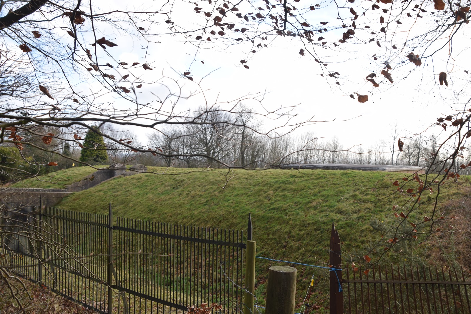
At the end of this nice open stretch of the Downs we passed by a huge water tower.  I'm guessing by the design that it was built in the 1930s - sure nothing would be built that ornate any longer.  We also passed by an old coal tax marker - I remember this being wonky when I passed by about 12 years ago.  Nothing has changed on that front!  We then had to negotiate our way around the back of some houses before our stint on the top of the Downs came to an end for this walk.

Tree Skeleton
One of the things I have always found surprising about the North Downs versus its southern equivalent is the number of houses that are built on the crest of the hill.  There are a number along this stretch of the North Downs. I guess they take advantage of the sunny aspect and the fact that they are never likely to have anything else built in the way.  For a walker though it is a little dispiriting as for quite long stretches all you get to see is back fences and parts of buildings (most of them are quite protective of their privacy as well).  

Water Tower
Having negotiated this last house we took the path down the steep slope almost to the very bottom.  We had to watch our step as it was pretty slick.  At the bottom we took a sharp left an took the parallel path along the foot of the scarp slope.  For the most part this was through woods as well and views outwards were at a premium even with all the leaves gone from the trees.  We did get the odd view up the slope and this demonstrated what a steep climb it was likely to be at the other end of the walk.

Wonky Post
At the bottom of Colley Hill we passed by the remains of Hearthstone Mine.  Hearthstone was a form of greensand that was very popular as a cleaning product back in Victorian times.  The mine was unusual in that it also had a processing works on site as well although you would be very hard pressed to find much evidence of it now other than a few earthworks.  Some of the buildings were destroyed by a V1 Doodlebug bomb in World War II.  The mine limped on after the war for a time but succumbed to the inevitable closure in 1961.  The mine entrance was then filled in by explosion.

Hearthstone Mine
Our onward route was pretty mucky in places and a couple of times we had to take avoiding action to miss the worst of the mud.  Eventually we  reached the bottom of Reigate Hill on the A217.  Just as we thought we might have to walk alongside the road an almost hidden path on the left took us up the hill away from the road.  This was definitely a sting in the tail but all the way up I think the thought of the hot drink and bacon roll from the refreshment kiosk kept us going. 

Reigate Hill
At the very top of the hill we were reunited with the North Downs Way and retraced our steps the short distance past the old fort once again to cross the main road and find the car park.  We had an enjoyable snack and drink and savoured the view across Reigate and beyond satisfied with our first outing of the year.  This isn't a difficult walk but a perfect winter outing when energy levels are generally low.


Colley Hill

Sunday, 21 January 2018

Nyman's Woodland Walk

Nymans View
After our tour around Petworth Park using one of the National Trust walks we thought we would have a go at another since time was short.  This time we headed up to Nymans, a garden at the north end of our county.  It is one that we visit regularly but what we don't do very often is venture into the extensive woods beyond.  In fact the last time we did was many years ago when my children were small and it proved to be a real struggle for them to get around the relatively modest distance (2.5 miles).

Setting Off Into The Woods
I am a little behind with writing this up - the walk was actually completed at the height of autumn when the trees were at the zenith of their colours and this is the main reason why we thought we would give the walk a go.  The start of the walk is actually at the back of the car park and not close to the main entrance.  It disappears down a tree hollow on a slope that is deceptively steep.  We had to watch our step for the muddy season was already underway and we were concerned that we might end up sliding down on our backsides if we weren't careful.

Owls
At the bottom of the slope and still on our feet we were relieved to be able to turn left on to a more solid path with a much gentler slope.  Out of the tunnel of trees we had descended by we were also now able to enjoy the full majesty of the woodland.  Most of the trees were either beech or oak and in among them were some sculptures along the way.  Sadly we didn't manage to see them all but the first caught my daughter's eye as they were a couple of owls.  She is a massive owl fan and really enjoyed seeing them so early on in the walk.

Glimpse From The Wood
I particularly enjoyed the walk through Cow Wood.  The majesty of the trees was something else although it was fairly obvious that seasons were about to change with the arrival of the holly berries providing some different colour along the way.  At the eastern end of the wood views opened up out into surrounding Wealden countryside - I imagine that the tract of woodland that once covered this area must have been cleared at some point and not allowed to grow back.  Soils around here are pretty poor so I doubt it was for growing crops - more likely for keeping livestock.

Cow Wood
A little further on and we passed by the rather fairytale like Woodlands Cottage.  This is now a National Trust holiday home and looks like a mighty fine place to stay.  It was occupied as we went past - someone had picked their week well.  It's heritage as a woodman's cottage was plain to see as we went past for the outhouses complete with woodcutter's tools were also still present.

Woodland Cottage
Just past the cottage and our route descended still further, this time to the end of a lake that we were to get a better view of later.  We turned left again and walked up though coppice woodlands to the top of a slope.  This proved to be the most popular part of the route and we were glad of the breaks on the hill that we needed to let people past.  It was a short but testing hill and enough to get us breathing but when we got to the top we were faced with some of the worst mud we had encountered yet.  Luckily previous walkers had shown us the way by doing some work arounds from the main path and heading past some of the trees on the other side from the main path.

Crossing The Field
The onward path descended slowly and through big piles of leaves that just begged to be kicked over as we walked through.  This is surely one of the joys of an autumn walk?  Soon we were to come to a fence blocking our way ahead and we had to take a sharp right hand turn and descend to a field.  After all the woodland walking thus far it seemed strange to head out across an open field like this.  The light and airy field didn't last too long though - over the next stile and we were back in the woodland, this time at the other end of the lake we had passed earlier.

The Lake
It was worth pausing at the lake for its serenity was beautiful and for me the highlight of the whole walk.  Somehow its mood seemed to calm down passing children too - they lost their boisterousness and admired the reflections instead.  We walked along a little of its shore before turning left to head up the last stretch of the woodland back to the main house of Nymans.  The mood of this woodland was quite different from the earlier one though, principally because there are conifers on this stretch and the left hand side is overlooked by some sandstone crags.

Which Way?
We climbed up the valley side and soon came to the edge of the wood.  Our route up to the main house skirted the wood for a bit and this proved to be a much wetter route than we expected.  It looked as if there are some springs along this section of path so be warned if you attempt it during the winter months.

Finding The Edge of the Woods
The path rose slowly at first and then up a final steeper section until we were at the entrance to the house. Nymans isn't all it appears.  For one thing it isn't nearly as old as you might think.  It was built in the early 20th Century to replace an older Regency house.  It is ruined now following a disastrous fire in 1947 which gutted the main building.  Although a portion was rebuilt and was lived in for a time most of the house remains a ghostly shell.  In 1987 the garden was ravaged by the Great Storm, which felled a huge number of trees.  Yet despite these two calamities the house and garden are fascinating to visit at any time of year and we lingered in the garden for quite a time, enjoying the lingering dahlias and roses that were still trying to cling on to the long gone summer.

Remembering The Great Storm
This walk is more of a stroll than a serious expedition but it does add extra enjoyment to a visit to Nymans and is worth a look if you have plenty of time for your visit.  The whole distance is 2.5 miles and should take no more than 90 minutes to complete.

Nymans House

Friday, 29 December 2017

Petworth Park

Setting  Off

Sometimes you don't have to walk far to pack a lot of scenery and interest in and that is certainly the case for this one.  We did this walk when autumn was at its zenith and were keen on making a trip to Petworth Park so we could see both the trees in colour and the rutting deer.  Petworth Park does not appear in any of the Guidebooks we have so we decided to have a go at one of the estate walks provided by the National Trust instead.  There are many such walks to explore so they will probably be a feature of future expeditions.

Autumn Colours
It was one of those glorious autumn days where there is still a little residual warmth in the air from the sun.  We had by now had quite a lot of autumn rain though and conditions in places promised to be a bit sticky as a result.  The walk starts at the north end of Petworth Park at the car park close to the A283.  It is possible to start at one of the other car parks but you will have a different starting point and will almost inevitably have to walk further as a result.  Be warned about this car park though - it is extremely popular and you may struggle to find a space on the nicest days.

Tints
Initially the walk runs parallel with the main road heading south.  The walk is designed to highlight the most notable species of tree in the park which was landscaped by Capability Brown back in the 1750s.  I wonder what Mr Brown would make of today's planning laws?  I find it unlikely that he would have got very far with any of his landscaped parks if he were building them now and yet it is unthinkable that these most celebrated parks should not exist.

Great Oak
The first of the highlighted trees we reached were some mature specimens of English oak (Quercus robur), beech (Fagus sylvatica) and aspen (Populus tremula) in the woodland surrounding the car park. Soon the path took a route through trees on both sides. It wasn't much further on that we encountered a tree with a plaque behind it on the wall declaring it to be the Beelzebub Oak.  It derived this name because the land beyond the boundary was considered to be spiritually suspect!  The tree itself is at least 250 years old, suggesting that it may have been planted at the same time the park was laid out

Lower Pond
A little further on was the Lower Pond, a smaller and less celebrated body of water than the one immediately in font of the main house.  Some of the trees that surround the pond were already mature when the park was laid out, which gives some clue to their relative ages.  The largest oak and sweet chestnuts are reckoned to be at least 350 years old.  It seems that the pond was an attractive way to deal with the problem of flooding as this area was a swamp and was described as ‘fowle and deepe of myre’.

Climbing Up To Lawn Hill
When following a walk such as this you get a different insight into the landscape.  I have walked past dead trees many times but only fleetingly have I given much thought about their importance as a habitat.  We passed by one just the other side of the pond dam which has been cut back only to make it safe. As the guide pointed out wherever possible standing dead wood, fallen wood, twigs and leaf litter is left to support a wide variety of fungi, insects, birds and bats. Leaving the dead wood enables nature to carry out its recycling work and is credited with the difference in recovery from the 1987 Hurricane in managed and unmanaged woodlands.  Those where the dead wood was left behind largely recovered more quickly than those where the wood was removed.

Fungi
By now we became aware of barking dogs and quickly realised that we were passing a boarding kennel.  I suspect they were doing brisker business than usual on account of it being half term.  When I rechecked the guide at this point to make sure we were taking the right path I was astonished to read that a bypass was planned to come through the park here in the early 1970s.  An act of vandalism on that scale would have been unforgiveable but fortunately the plans were shelved, I imagine as one of the victims of the Oil Crisis of 1973.

Upper Pond
As we headed up the hill we passed possibly the oldest tree in the Park, one of three very old English oaks. This ancient tree is estimated to be some 940 years old, so would have been a very young tree at the time of the Norman invasion. At the top of the hill we crossed Lawn Hill to a fallen sweet chestnut which was a casualty of the 1987 storm and was a mere 265 years old at the time of its demise.

Main Track
The Upper Lake was now in view as we continued across the brow of the hill.  From here we could see the South Downs and the Greensand Ridge to the north. For my money this was the best part of the whole walk - you could really get a feel for the vision that Capability Brown had from this spot.  It would have been hard to imagine how the park looked in his day for clearly many of the trees would have been much reduced in size and the water features would still have looked rather imposed on the landscape.  We soon dropped down the hill to meet the shoreline of the lake and followed around it for a short distance.

Clouds and Tree in Harmony
Within the copse around the lake we noted the mature Swamp Cypress (Taxodium distichum), which were introduced from North America in 1638. I remember seeing these when I walked through another park in London while undertaking the LOOP many years ago.  The shoreline path follows some metal railings and these are designed to exclude most of the browsing deer and allow scrub to grow beneath the trees.  This then provides a haven for wildlife, supporting breeding birds such as chiffchaff, willow warbler, black cap and nectar for insects
View Across the Park

As the trees thinned we climbed up and away from the pond. When we came upon to a very old hollow Common Lime (Tilia x europaea), we stopped to explore it a bit.  Experts have found aging this tree rather difficult as the trunk has fragmented.  It could be is 500 to 600 years old with a girth of 7.46m. It could continue as a hollow shell for several hundred years and certainly didn't seem to be in distress.  We paused here for a period of time and had the lunch that we had brought with us.

Oak
Once refreshed we continued to the top of the hill.  Once there was a farm up here but it has now long gone. We turned right on to the main track and this followed an obvious route initially through trees before opening out to another splendid view to the north.  Below us we got the first sight of the deer which call Petworth Park their home.  It was rutting season and even at a fair distance we could hear the bellows of the stags wooing the lady deer.  No doubt this is a very important season for male deer and the racks of antlers on show were quite impressive.  Many of the female deer seemed rather uninterested - they were too busy browsing and getting enough calories inside them for the winter months ahead. In fact we were so busy watching the deer that we didn't pay attention to the route and missed the opportunity to walk to the top of Monument Hill.  Perhaps we will do that another time?  I have a hunch that this would be a tremendous walk for a summer's evening.

Parasol
After walking along the largely level track for some time and enjoying our vantage point for the deer below I suddenly became aware that we were approaching the car park once again and took a turn to the right to follow the line of trees that lead down to our car.  By now we were joined by other families out for a stroll and the half hour or so we had to ourselves was over.  Despite the lovely sun and the undoubted popularity of the park we did well to have solitude for that long.  I have no doubt we'll be back - that summer's evening is beckoning!


Rutting